Assycombe Hill

Hill, Mountain in Devon West Devon

England

Assycombe Hill

Bush Down - Bennett's Cross A wayside cross on the B3212 Moretonhampstead - Two Bridges road, believed to be carved from a prehistoric menhir. It is ca 1.7 metres tall and is a well known Dartmoor landmark. Birch Tor is on the skyline.
<span class="nowrap"><a title="www.dartmoor.gov.uk" rel="nofollow ugc noopener" href="http://www.dartmoor.gov.uk">Link</a><img style="margin-left:2px;" alt="External link" title="External link - shift click to open in new window" src="https://s1.geograph.org.uk/img/external.png" width="10" height="10"/></span>
Bush Down - Bennett's Cross Credit: Colin Smith

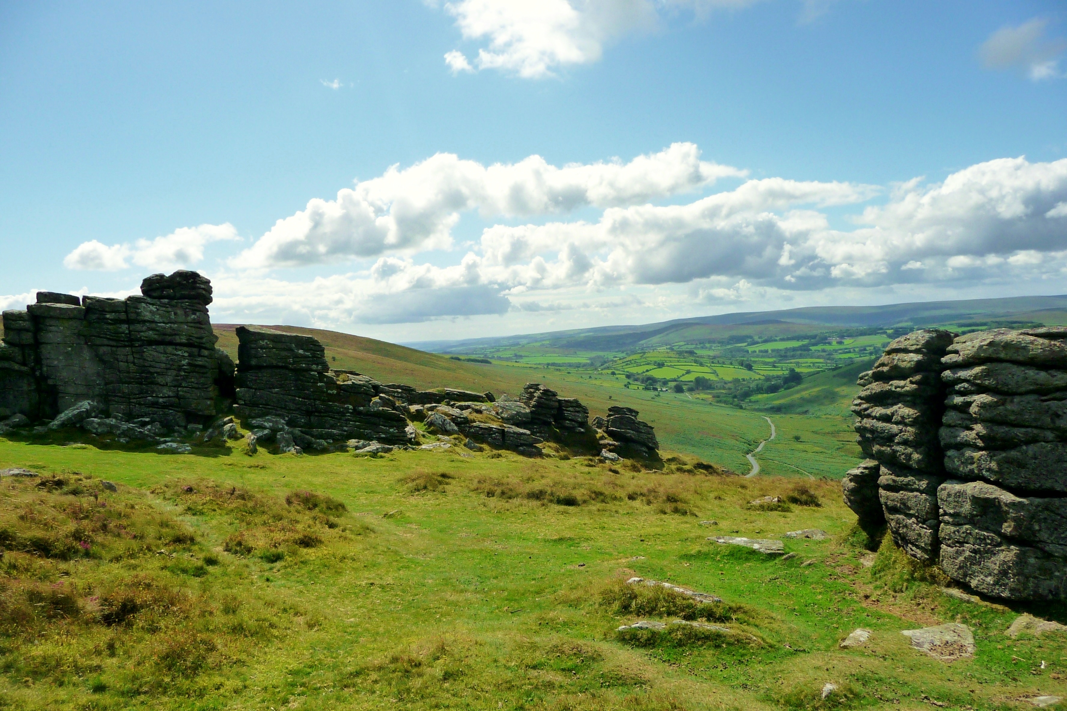
Assycombe Hill is a prominent natural landmark located in the county of Devon, England. Situated in the southern part of Dartmoor National Park, this hill stands at an elevation of approximately 380 meters (1,247 feet) above sea level. Offering breathtaking panoramic views, it is a popular destination for outdoor enthusiasts and nature lovers.

Covered in lush greenery, Assycombe Hill boasts a diverse range of flora and fauna, making it an ideal spot for wildlife observation and birdwatching. The hill is home to various species such as skylarks, buzzards, and rabbits. Additionally, it is surrounded by picturesque meadows and woodlands, creating a serene and tranquil environment.

The hill itself is characterized by its gentle slopes and rounded shape, making it easily accessible for hikers and walkers of all abilities. There are several well-marked trails that lead to the summit, allowing visitors to explore the area at their own pace. On a clear day, the breathtaking views from the top of Assycombe Hill stretch for miles, showcasing the stunning Devon countryside and distant moorlands.

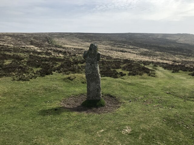
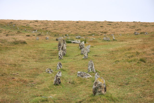
Furthermore, Assycombe Hill holds historical significance as it is believed to have served as a Bronze Age burial site. Archaeological studies have revealed the presence of ancient burial mounds and artifacts, adding to the hill's cultural value.

Overall, Assycombe Hill offers a unique blend of natural beauty, wildlife, and historical interest, making it a must-visit location for those seeking to immerse themselves in the enchanting landscapes of Devon.

If you have any feedback on the listing, please let us know in the comments section below.

Assycombe Hill Images

Images are sourced within 2km of 50.622574/-3.8894557 or Grid Reference SX6682. Thanks to Geograph Open Source API. All images are credited.

Bush Down - Bennett's Cross A wayside cross on the B3212 Moretonhampstead - Two Bridges road, believed to be carved from a prehistoric menhir. It is ca 1.7 metres tall and is a well known Dartmoor landmark. Birch Tor is on the skyline.
<span class="nowrap"><a title="www.dartmoor.gov.uk" rel="nofollow ugc noopener" href="http://www.dartmoor.gov.uk">Link</a><img style="margin-left:2px;" alt="External link" title="External link - shift click to open in new window" src="https://s1.geograph.org.uk/img/external.png" width="10" height="10"/></span>
Bush Down - Bennett's Cross
A wayside cross on the B3212 Moretonhampstead - Two Bridges road, believed to be carved from a prehistoric menhir. It is ca 1.7 metres tall and is a well known Dartmoor landmark. Birch Tor is on the skyline. LinkExternal link
Bush Down - Bennett's Cross A roadside cross, believed to have been carved from a prehistoric menhir. It is ca 1.7 metres high.
<span class="nowrap"><a title="www.dartmoor.gov.uk" rel="nofollow ugc noopener" href="http://www.dartmoor.gov.uk">Link</a><img style="margin-left:2px;" alt="External link" title="External link - shift click to open in new window" src="https://s1.geograph.org.uk/img/external.png" width="10" height="10"/></span>
Bush Down - Bennett's Cross
A roadside cross, believed to have been carved from a prehistoric menhir. It is ca 1.7 metres high. LinkExternal link
Bronze Age Reave on Assycombe Hill A reave is the name given to prehistoric field boundaries on Dartmoor.
Bronze Age Reave on Assycombe Hill
A reave is the name given to prehistoric field boundaries on Dartmoor.
Ruined farmhouse near Stannon Tor Scale 2m <span class="nowrap"><a title="https://www.heritagegateway.org.uk/Gateway/Results_Single.aspx?uid=MDV15310&resourceID=104" rel="nofollow ugc noopener" href="https://www.heritagegateway.org.uk/Gateway/Results_Single.aspx?uid=MDV15310&resourceID=104">Link</a><img style="margin-left:2px;" alt="External link" title="External link - shift click to open in new window" src="https://s1.geograph.org.uk/img/external.png" width="10" height="10"/></span>
Ruined farmhouse near Stannon Tor
Scale 2m LinkExternal link
Prehistoric Round House forming part of a settlement known as Lowton Brook East Scale 2m <span class="nowrap"><a title="https://historicengland.org.uk/listing/the-list/list-entry/1017990?section=official-list-entry" rel="nofollow ugc noopener" href="https://historicengland.org.uk/listing/the-list/list-entry/1017990?section=official-list-entry">Link</a><img style="margin-left:2px;" alt="External link" title="External link - shift click to open in new window" src="https://s1.geograph.org.uk/img/external.png" width="10" height="10"/></span>
Prehistoric Round House forming part of a settlement known as Lowton Brook East
Scale 2m LinkExternal link
Longhouse at Assycombe Farm Scale 2m <span class="nowrap"><a title="https://www.heritagegateway.org.uk/Gateway/Results_Single.aspx?uid=MDV6703&resourceID=104" rel="nofollow ugc noopener" href="https://www.heritagegateway.org.uk/Gateway/Results_Single.aspx?uid=MDV6703&resourceID=104">Link</a><img style="margin-left:2px;" alt="External link" title="External link - shift click to open in new window" src="https://s1.geograph.org.uk/img/external.png" width="10" height="10"/></span>
Longhouse at Assycombe Farm
Scale 2m LinkExternal link
Bennett's Cross
Bennett's Cross
Sandeman bridge
Sandeman bridge
Dartmoor near Statts Bridge
Datmoor near the Warren House Inn
Chagford Common
Chagford Common
Chagford Common
Chagford Common
Approaching Statts Bridge The B3212 crossing Dartmoor and approaching Statts Bridge.
Approaching Statts Bridge
The B3212 crossing Dartmoor and approaching Statts Bridge.
The B3212 crossing Dartmoor The B3212 crossing Dartmoor near Warren House Inn.
The B3212 crossing Dartmoor
The B3212 crossing Dartmoor near Warren House Inn.
Dartmoor near Warren House Inn
The B3212 near Water Hill The B3212 near Water Hill on Dartmoor.
The B3212 near Water Hill
The B3212 near Water Hill on Dartmoor.
Stone Row
Stone Row
Moors close to Fernworthy Forest
Show me another place!

Assycombe Hill is located at Grid Ref: SX6682 (Lat: 50.622574, Lng: -3.8894557)

Administrative County: Devon

District: West Devon

Police Authority: Devon and Cornwall

What 3 Words

///pronouns.flicks.amps. Near Chagford, Devon

Nearby Locations

Assycombe Hill

Related Wikis

Warren House Inn

The Warren House Inn is a remote and isolated public house in the heart of Dartmoor, Devon, England. It is the highest pub in southern England at 1,425...

Birch Tor and Vitifer mine

Birch Tor and Vitifer mine was a tin mine on Dartmoor, Devon, England. Located in the valley of the Redwater Brook, to the east of the B3212 Moretonhampstead...
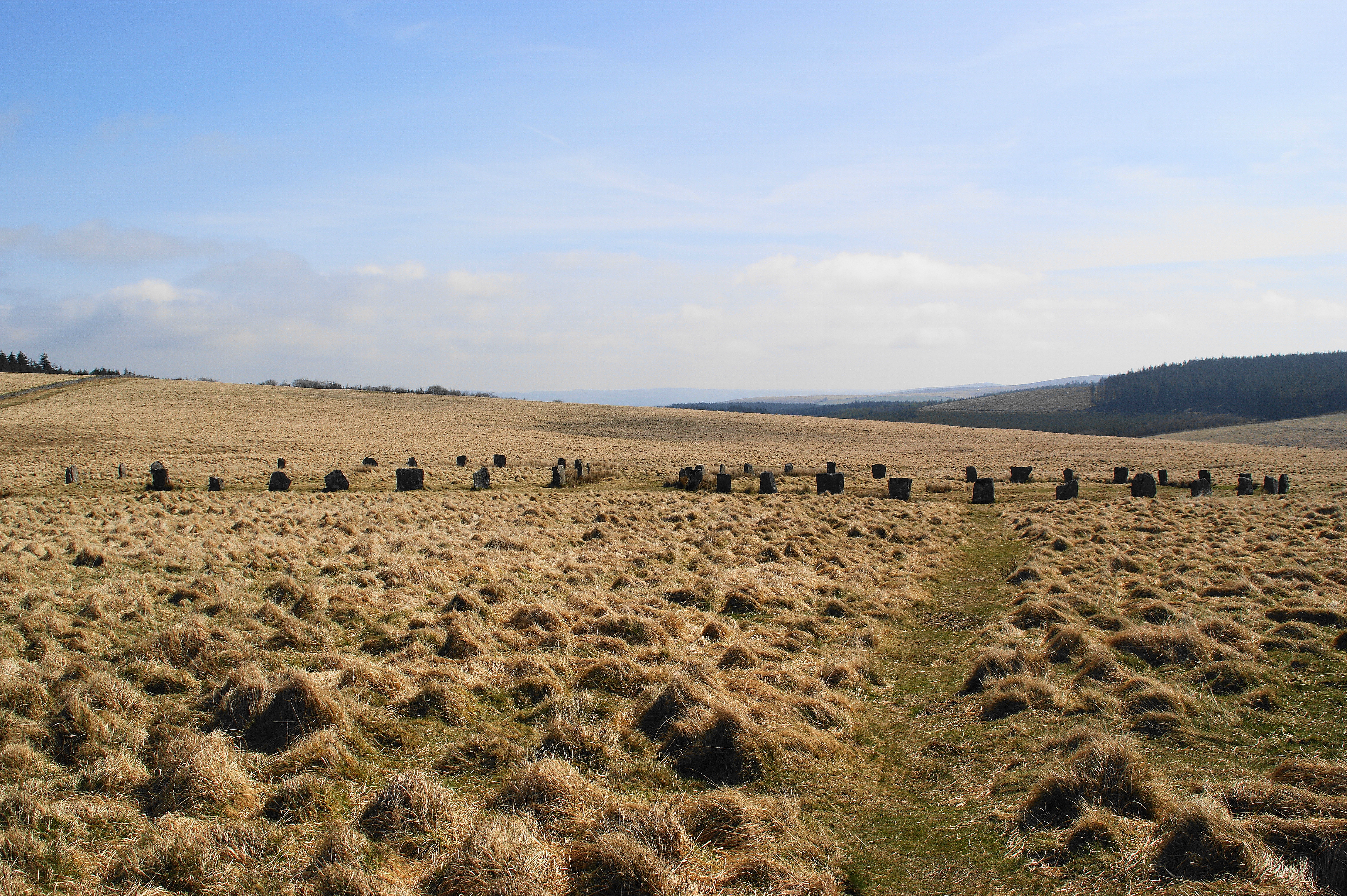
Grey Wethers

Grey Wethers consists of a pair of prehistoric stone circles, situated on grassy plateau to the north of Postbridge, Dartmoor, in the United Kingdom....

Hookney Tor

Hookney Tor is a tor, situated on Dartmoor in Devon, England. It lies on the Two Moors Way and remains of Headland Warren farm and Vitifer Mine are also...

Postbridge

Postbridge is a hamlet in the heart of Dartmoor in the English county of Devon. It lies on the B3212, roughly midway between Princetown and Moretonhampstead...

Grimspound

Grimspound is a late Bronze Age settlement, situated on Dartmoor in Devon, England. It consists of a set of 24 hut circles surrounded by a low stone wall...

Shovel Down

Shovel Down is an area of Dartmoor in Devon that is covered in megaliths including the remains of several stone rows, the Fourfold Stone Circle, and several...

Frenchbeer

Frenchbeer is a settlement in Devon, England. It is in Dartmoor national park. Fernworthy reservoir is to the south and so is the South Teign river. Chagford...

Nearby Amenities

Located within 500m of 50.622574,-3.8894557
Assycombe Hill
Created By: Potlatch 0.10f
Natural: peak
Source: NPE
Lat/Long: 50.6234981/-3.8898295
The data included in this document is from www.openstreetmap.org. The data is made available under ODbL.

Have you been to Assycombe Hill?

Leave your review of Assycombe Hill below (or comments, questions and feedback).