Cnoc Odhar
Hill, Mountain in Perthshire
Scotland
Cnoc Odhar

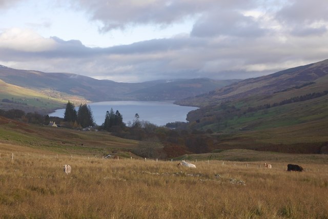
Cnoc Odhar is a prominent hill located in the county of Perthshire, Scotland. Standing at an elevation of 364 meters (1,194 feet), it is a well-known landmark in the area. The hill is situated near the village of Dunkeld, offering visitors breathtaking views of the surrounding countryside.
Cnoc Odhar is a popular destination for hikers and nature enthusiasts due to its accessibility and stunning vistas. The ascent to the summit is relatively easy, making it suitable for all skill levels. The hill is covered in heather and grass, creating a picturesque landscape that changes color with the seasons.
From the top of Cnoc Odhar, one can enjoy panoramic views of the River Tay and the surrounding Perthshire hills. On clear days, it is even possible to catch a glimpse of the Grampian Mountains in the distance. The hill also offers a peaceful and tranquil atmosphere, making it an ideal spot for picnics or simply taking in the beauty of the Scottish countryside.
Cnoc Odhar is home to a diverse range of wildlife, including birds, deer, and various species of plants and flowers. The area is protected, ensuring the preservation of its natural habitat and biodiversity. Visitors are encouraged to respect the environment and adhere to any guidelines or restrictions in place.
Overall, Cnoc Odhar is a captivating destination that showcases the natural beauty of Perthshire. With its stunning views, accessible trails, and abundant wildlife, it offers visitors a memorable experience in the heart of Scotland's countryside.
If you have any feedback on the listing, please let us know in the comments section below.
Cnoc Odhar Images
Images are sourced within 2km of 56.469523/-4.1697623 or Grid Reference NN6632. Thanks to Geograph Open Source API. All images are credited.


Cnoc Odhar is located at Grid Ref: NN6632 (Lat: 56.469523, Lng: -4.1697623)
Unitary Authority: Stirling
Police Authority: Forth Valley
What 3 Words
///shifting.savers.eyelashes. Near Comrie, Perth & Kinross
Nearby Locations
Related Wikis

Ardeonaig
Ardeonaig (Gaelic: Aird Eòdhanaig) is a hamlet on the southern shore of Loch Tay in the Stirling Council area of Scotland. It is approximately 7 miles...

Loch Tay
Loch Tay (Scottish Gaelic: Loch Tatha) is a freshwater loch in the central highlands of Scotland, in the Perth and Kinross and Stirling council areas....

Tomnadashan
Tomnadashan was a hamlet southwest of Ardtalnaig in Scotland. John Campbell, 2nd Marquess of Breadalbane tried to mine copper, gold, and sulphur there...

Lawers
Lawers is a village situated in rural Perthshire, Scotland. It lies on the banks of Loch Tay and at the foot of Ben Lawers. It was once part of a vibrant...

Ardtalnaig
Ardtalnaig (; Àird Talanaig) is a hamlet on the south shore of Loch Tay in Perth and Kinross in Scotland. It is approximately 6 miles (10 km) from Kenmore...

Rob Roy Way
The Rob Roy Way is a Scottish long distance footpath that runs from Drymen in Stirling to Pitlochry in Perth and Kinross. The path was created in 2002...
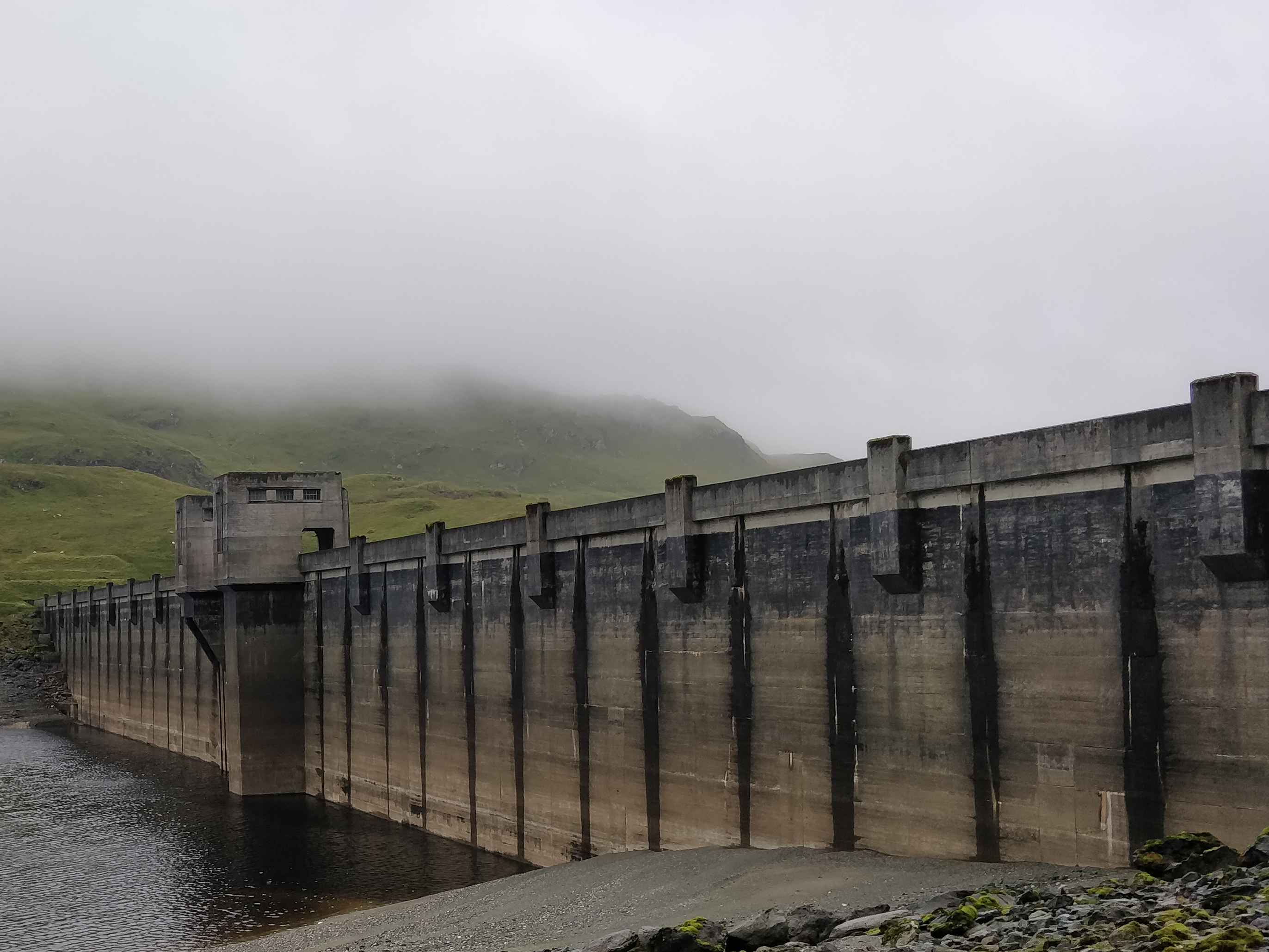
Breadalbane Hydro-Electric Scheme
The Breadalbane Hydro-Electric Scheme is a hydroelectric scheme in the Breadalbane area of Perthshire, Scotland. It comprises seven power stations which...

River Dochart
The River Dochart (Scottish Gaelic: Dochard) is in Perthshire, Scotland. Coming from Ben Lui, it flows east out of Loch Dochart and through the glen of...
Have you been to Cnoc Odhar?
Leave your review of Cnoc Odhar below (or comments, questions and feedback).