Am Bàthaich

Hill, Mountain in Inverness-shire

Scotland

Am Bàthaich

Bridge over Elrick Burn
Bridge over Elrick Burn Credit: John Ferguson

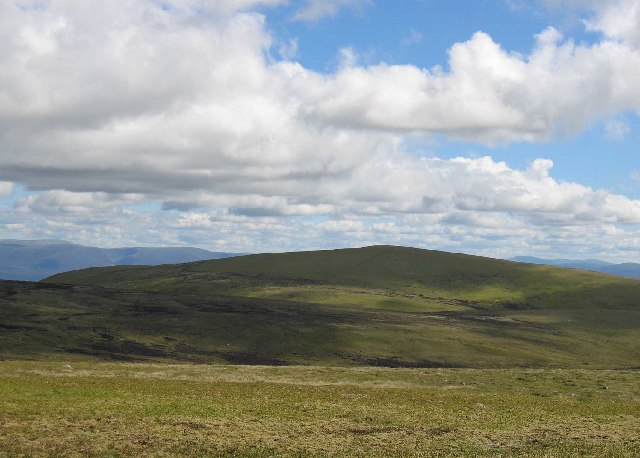
Am Bàthaich is a prominent hill located in Inverness-shire, a region in the Scottish Highlands. With an elevation of 712 meters (2,336 feet), it stands as an impressive natural feature in the area. The hill is part of the wider Monadh Liath mountain range, which stretches across the eastern part of the Highlands.

Am Bàthaich is characterized by its distinct shape and rugged appearance, with steep slopes covered in heather and rocky outcrops. Its summit offers panoramic views of the surrounding landscape, including the nearby Loch Ness and the Great Glen.

The hill is a popular destination for hikers and outdoor enthusiasts, attracting both locals and tourists alike. Several walking routes, varying in difficulty, lead to the summit, providing adventurers with the opportunity to experience the stunning scenery and wildlife of the Scottish Highlands up close.

The name "Am Bàthaich" translates to "the place of the stags" in Gaelic, reflecting the abundance of red deer that inhabit the area. These majestic creatures can often be spotted roaming the slopes of the hill, adding to the allure of the landscape.

Due to its location in Inverness-shire, Am Bàthaich is easily accessible from the nearby town of Inverness, which is approximately 25 miles away. Its proximity to Loch Ness also makes it a popular stop for visitors exploring the famous loch and its mythical resident, the Loch Ness Monster.

In summary, Am Bàthaich is a striking hill in Inverness-shire, offering breathtaking views, diverse wildlife, and a range of hiking opportunities for nature enthusiasts seeking to immerse themselves in the beauty of the Scottish Highlands.

If you have any feedback on the listing, please let us know in the comments section below.
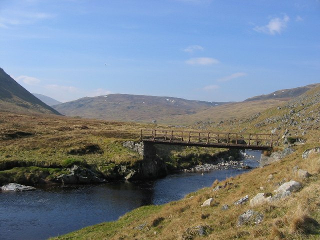
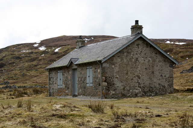
Am Bàthaich Images

Images are sourced within 2km of 57.196058/-4.2188835 or Grid Reference NH6613. Thanks to Geograph Open Source API. All images are credited.

Bridge over Elrick Burn
Estate track above Elrick Burn
Bridge, Coignafearn Estate This bridge over the Findhorn gives access to the side glen carrying the Elrick Burn, and another chunk of Monadhliath deer stalking country.
Bridge, Coignafearn Estate
This bridge over the Findhorn gives access to the side glen carrying the Elrick Burn, and another chunk of Monadhliath deer stalking country.
Strath Dearn A narrow part of the glen looking downstream from NH666141. Caimhlin Mor (660m) juts in from the right.
Strath Dearn
A narrow part of the glen looking downstream from NH666141. Caimhlin Mor (660m) juts in from the right.
Footbridge over the Findhorn River. Here near Dalbeg, the Findhorn is a young river. It can still be a thug to ford, hence the estate's footbridge.
Footbridge over the Findhorn River.
Here near Dalbeg, the Findhorn is a young river. It can still be a thug to ford, hence the estate's footbridge.
Gullery, Dalbeg At 480m above sea level the glen widens out again. The shingly island is a nesting site for gulls.
Gullery, Dalbeg
At 480m above sea level the glen widens out again. The shingly island is a nesting site for gulls.
Meltwater features. Taken when descending from the 734m top at NH640136, the hillside has been carved up by meltwater torrents from retreating glaciers. 
Looking down on the Dalbeg flatlands around the river Findhorn from NH647134
Meltwater features.
Taken when descending from the 734m top at NH640136, the hillside has been carved up by meltwater torrents from retreating glaciers. Looking down on the Dalbeg flatlands around the river Findhorn from NH647134
Bridge over River Eskin Just downstream of this bridge the Eskin meets the Abhainn Cro Chlach and becomes the Findhorn.
Bridge over River Eskin
Just downstream of this bridge the Eskin meets the Abhainn Cro Chlach and becomes the Findhorn.
Recycled Bridge This bridge was a lorry trailer in its previous life. It still has a spring, electric cables and a mud flap. It bypasses a ford on the Allt Creagach.  However the ground is so boggy on the far side that wet feet are inevitable.
Recycled Bridge
This bridge was a lorry trailer in its previous life. It still has a spring, electric cables and a mud flap. It bypasses a ford on the Allt Creagach. However the ground is so boggy on the far side that wet feet are inevitable.
Cottage, Dalbeg Refurbished and locked cottage on Coignafearn Estate.  Probably a former shepherd's house.  There is a ruined sheep fank nearby.
Cottage, Dalbeg
Refurbished and locked cottage on Coignafearn Estate. Probably a former shepherd's house. There is a ruined sheep fank nearby.
Ruined sheep fank, Dalbeg
A bend in the River Findhorn Upstream from Coignafearn Lodge.
A bend in the River Findhorn
Upstream from Coignafearn Lodge.
Track alongside River Findhorn Not far downstream from Dalbeg.
Track alongside River Findhorn
Not far downstream from Dalbeg.
Ford, Allt Creagach Near Dalbeg. A short distance up the burn a bridge can be used to bypass this ford.
Ford, Allt Creagach
Near Dalbeg. A short distance up the burn a bridge can be used to bypass this ford.
Bridge over Elrick Burn The OS map shows a vehicle track ending here and a footpath continuing along the far bank after the bridge. However the vehicle track carries on to a ford upstream then continues on the far bank.  To avoid the ford entails crossing this bridge and wading through trackless bog to rejoin the vehicle track.
Bridge over Elrick Burn
The OS map shows a vehicle track ending here and a footpath continuing along the far bank after the bridge. However the vehicle track carries on to a ford upstream then continues on the far bank. To avoid the ford entails crossing this bridge and wading through trackless bog to rejoin the vehicle track.
Moorland NW above Coignafearn Lodge Looking SE down Coachan a' Chrishinn
Moorland NW above Coignafearn Lodge
Looking SE down Coachan a' Chrishinn
Track going down to cross Caochan Chrishinn above Allt Fionnach
T Junction on Coignafearn Estate Track Beside Allt Dubh nan Searsanach
T Junction on Coignafearn Estate Track
Beside Allt Dubh nan Searsanach
Show me another place!

Am Bàthaich is located at Grid Ref: NH6613 (Lat: 57.196058, Lng: -4.2188835)

Unitary Authority: Highland

Police Authority: Highlands and Islands

What 3 Words

///smoker.blackmail.clan. Near Newtonmore, Highland

Nearby Locations

Am Bàthaich

Related Wikis

A' Chailleach (Monadhliath Mountains)

A' Chailleach (Scottish Gaelic for 'the old woman or Cailleach') is one of the Monadhliath Mountains of Scotland. It lies 7 km (4.3 mi) northwest of Newtonmore...

Have you been to Am Bàthaich?

Leave your review of Am Bàthaich below (or comments, questions and feedback).