Blackcraig Hill

Hill, Mountain in Ayrshire

Scotland

Blackcraig Hill

Large flat parking area south of Craigdarroch There have been a lot of forestry and wind turbine operations in the area;  this may have been related.
Large flat parking area south of Craigdarroch Credit: Gordon Brown

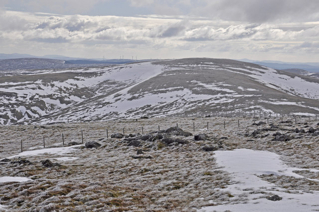
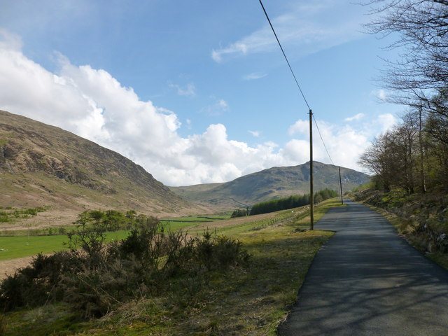
Blackcraig Hill is a prominent hill located in Ayrshire, Scotland. Situated in the Southern Uplands mountain range, it stands at an impressive height of 700 meters (2,296 feet) above sea level. The hill is part of the extensive Galloway Forest Park, which is renowned for its breathtaking natural beauty and diverse wildlife.

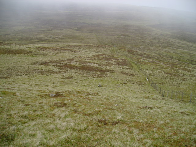
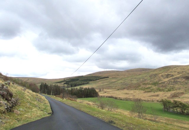
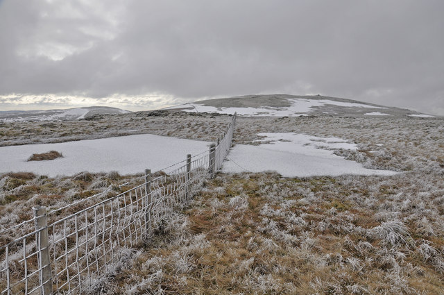
Blackcraig Hill offers stunning panoramic views of the surrounding countryside, including the neighboring hills and valleys. Its steep slopes are covered with a mixture of heather, grasses, and scattered patches of woodland, creating a picturesque landscape. The hill's rugged terrain makes it a popular destination for hikers, who can enjoy challenging yet rewarding trails to reach its summit.

The hill is also known for its rich historical significance. It is believed to have been an important site during the Bronze Age, as evidenced by the presence of ancient burial mounds and stone circles in the area. These archaeological remains contribute to the hill's cultural heritage and attract history enthusiasts.

Furthermore, Blackcraig Hill is home to a variety of wildlife, including red deer, mountain hares, and numerous bird species. The hill's remote location and undisturbed environment provide a habitat for these animals to thrive, making it an ideal spot for wildlife enthusiasts and nature lovers.

Overall, Blackcraig Hill offers a unique combination of natural beauty, historical significance, and diverse wildlife. Its breathtaking views, challenging trails, and cultural heritage make it a popular destination for outdoor enthusiasts, hikers, and those seeking to experience the tranquility of the Ayrshire countryside.

If you have any feedback on the listing, please let us know in the comments section below.

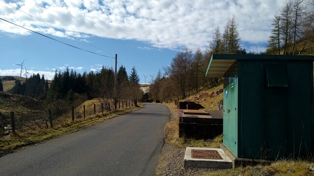
Blackcraig Hill Images

Images are sourced within 2km of 55.333441/-4.1340119 or Grid Reference NS6406. Thanks to Geograph Open Source API. All images are credited.

Large flat parking area south of Craigdarroch There have been a lot of forestry and wind turbine operations in the area;  this may have been related.
Large flat parking area south of Craigdarroch
There have been a lot of forestry and wind turbine operations in the area; this may have been related.
The road to the Afton Reservoir Although shown by the OS as a 'track' this is a well surfaced road leading to the reservoir and filter station.
The road to the Afton Reservoir
Although shown by the OS as a 'track' this is a well surfaced road leading to the reservoir and filter station.
The road to the Afton Reservoir and Filter Station The green cabinet is the Afton Regulatory Final Sample Point for the water supply.
The road to the Afton Reservoir and Filter Station
The green cabinet is the Afton Regulatory Final Sample Point for the water supply.
Rough grazing above Quintin Knowe Looking across rough grazing land from the broad northeast ridge of Blackcraig Hill towards Quintin Knowe.
Rough grazing above Quintin Knowe
Looking across rough grazing land from the broad northeast ridge of Blackcraig Hill towards Quintin Knowe.
The entrance to Craigdarroch
Craigdarroch
Craigdarroch
A track to a bridge over Afton Water The minor road, on the right, leads to Afton Filter Station.
A track to a bridge over Afton Water
The minor road, on the right, leads to Afton Filter Station.
Heading towards Afton Filter Station
Heading towards Craigdarroch in Glen Afton
A cottage in Glen Afton
Looking towards Hare Hill Wind Farm
Approaching Blackcraig Hill from the north
Summit of Blackcraig Hill
Looking south from Blackcraig Hill The next top to the south is Greenlorg Hill; the all-intrusive windmills are apparent.
Looking south from Blackcraig Hill
The next top to the south is Greenlorg Hill; the all-intrusive windmills are apparent.
The Glen Afton road The flank of Blackcraig Hill is on the left, with Craigbraneoch Hill in the distance.
The Glen Afton road
The flank of Blackcraig Hill is on the left, with Craigbraneoch Hill in the distance.
Looking into the valley of the Craig Burn The farm of Craigdarroch and the house at Craig are in the middle ground.
Looking into the valley of the Craig Burn
The farm of Craigdarroch and the house at Craig are in the middle ground.
Newly planted trees by the Afton Water Saplings in protective tubes by the edge of the burn, looking towards the valley of the Craig Burn.
Newly planted trees by the Afton Water
Saplings in protective tubes by the edge of the burn, looking towards the valley of the Craig Burn.
Craigbraneoch Rig A flat hilltop with rock outcrops south-east of the summit of Craigbraneoch Hill.
Craigbraneoch Rig
A flat hilltop with rock outcrops south-east of the summit of Craigbraneoch Hill.
Show me another place!

Blackcraig Hill is located at Grid Ref: NS6406 (Lat: 55.333441, Lng: -4.1340119)

Unitary Authority: East Ayrshire

Police Authority: Ayrshire

What 3 Words

///systems.stems.animals. Near New Cumnock, East Ayrshire

Nearby Locations

Blackcraig Hill

Related Wikis

Blackcraig Hill

Blackcraig Hill is a hill in the Carsphairn and Scaur Hills range, part of the Southern Uplands of Scotland. It lies southeast of the town of New Cumnock...

Windy Standard

Windy Standard is a hill in the Carsphairn and Scaur Hills range, part of the Southern Uplands of Scotland. It lies in Dumfries and Galloway, south of...

Knockshinnoch disaster

The Knockshinnoch disaster was a mining accident that occurred in September 1950 in the village of New Cumnock, Ayrshire, Scotland. A glaciated lake filled...

New Cumnock Town Hall

New Cumnock Town Hall is a municipal building in Castle, New Cumnock, East Ayrshire, Scotland. The structure, which is used as a community events venue...

Nearby Amenities

Located within 500m of 55.333441,-4.1340119
Blackcraig Hill
Ele: 700
Ele Ft: 2299
Natural: peak
Source: OS7
Lat/Long: 55.3334828/-4.1339957
The data included in this document is from www.openstreetmap.org. The data is made available under ODbL.

Have you been to Blackcraig Hill?

Leave your review of Blackcraig Hill below (or comments, questions and feedback).