Hog Hatch

Settlement in Surrey Waverley

England

Hog Hatch

Old Milestone, was on A287, Folly Hill, near Farnham Park Golf Club The milestone was located on Folly Hill, 170 m North of the entrance to Farnham Park golf club, on the West side of the road in the hedge. Parish of Farnham (Waverley district). Carved stone post, Odiham stone design, erected by the Odiham & Farnham turnpike trust in the 18th century. 

Inscription read:            FROM / ODIHAM / 7 / MILES / TO / FARNHAM / ½ / MILES

The milestone is now missing. The date of the image is not known but is probably before 2001.

Milestone Society National ID: SY_ODFA07
Old Milestone, was on A287, Folly Hill, near Farnham Park Golf Club Credit: Derek Renn

Hog Hatch is a small village located in the county of Surrey, England. Situated in the southeastern part of the county, it is nestled amidst picturesque countryside and offers a tranquil and idyllic setting for residents and visitors alike.

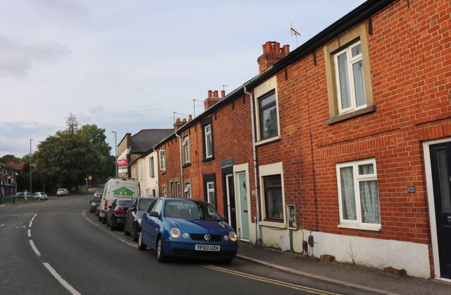
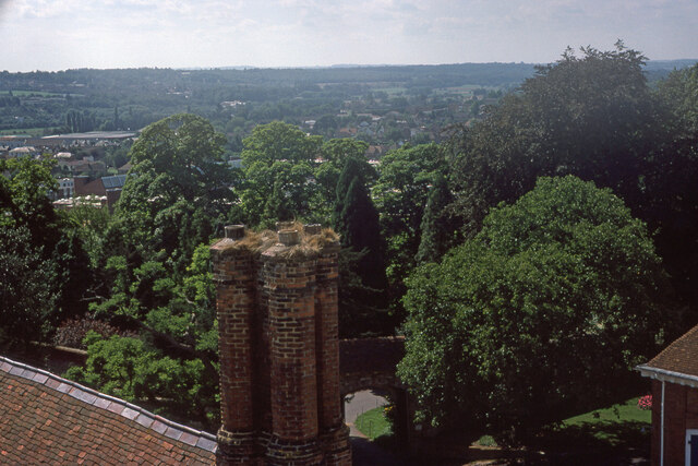
The village is known for its charming and traditional architecture, with many of the buildings dating back several centuries. The streets are lined with quaint cottages and small houses, adding to the overall charm and character of the village. The surrounding landscape is predominantly farmland, with rolling hills and green fields stretching as far as the eye can see.

Despite its small size, Hog Hatch has a strong sense of community. The villagers are friendly and welcoming, and there is a range of community activities and events that take place throughout the year. The village hall serves as a hub for these gatherings, hosting everything from art exhibitions to local fairs and celebrations.

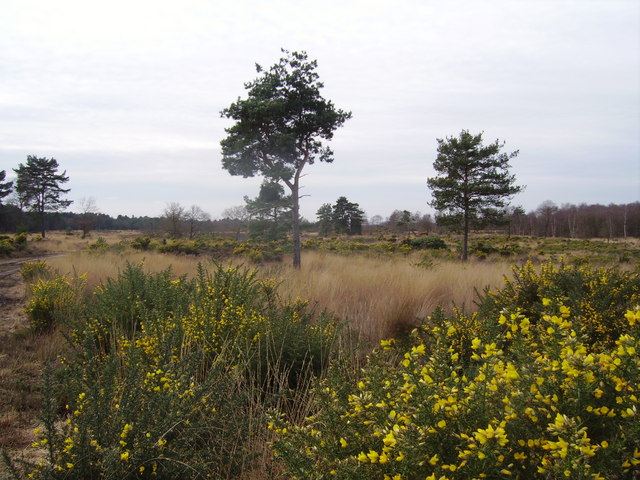
Nature enthusiasts will find plenty to explore in and around Hog Hatch. The village is surrounded by beautiful walking trails and hiking paths, allowing visitors to immerse themselves in the stunning countryside. Additionally, the nearby River Wey offers opportunities for fishing and boating.

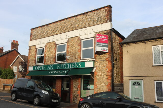
In terms of amenities, Hog Hatch is well-served by a local pub and a small convenience store, providing essential services for residents. For a wider range of shopping and entertainment options, the larger towns of Guildford and Woking are within easy reach.

Overall, Hog Hatch is a charming village that offers a peaceful and picturesque escape from the hustle and bustle of city life. Its beautiful surroundings, strong sense of community, and traditional architecture make it an attractive place to live or visit.

If you have any feedback on the listing, please let us know in the comments section below.
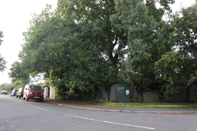
Hog Hatch Images

Images are sourced within 2km of 51.231921/-0.81046 or Grid Reference SU8348. Thanks to Geograph Open Source API. All images are credited.

Old Milestone, was on A287, Folly Hill, near Farnham Park Golf Club The milestone was located on Folly Hill, 170 m North of the entrance to Farnham Park golf club, on the West side of the road in the hedge. Parish of Farnham (Waverley district). Carved stone post, Odiham stone design, erected by the Odiham & Farnham turnpike trust in the 18th century. 

Inscription read:            FROM / ODIHAM / 7 / MILES / TO / FARNHAM / ½ / MILES

The milestone is now missing. The date of the image is not known but is probably before 2001.

Milestone Society National ID: SY_ODFA07
Old Milestone, was on A287, Folly Hill, near Farnham Park Golf Club
The milestone was located on Folly Hill, 170 m North of the entrance to Farnham Park golf club, on the West side of the road in the hedge. Parish of Farnham (Waverley district). Carved stone post, Odiham stone design, erected by the Odiham & Farnham turnpike trust in the 18th century. Inscription read: FROM / ODIHAM / 7 / MILES / TO / FARNHAM / ½ / MILES The milestone is now missing. The date of the image is not known but is probably before 2001. Milestone Society National ID: SY_ODFA07
Old Milestone, A287, Folly Hill, Upper Hale The milestone is located 50m north of the junction with Heathyfields Road on the West side of the road in the hedge. Parish of Farnham (Waverley district). Carved stone post, Odiham stone design, erected by the Odiham & Farnham turnpike trust in the 18th century.

Inscription reads:-          FROM / ODIHAM / 6 / MILES / TO / FARNHAM / 1½ / MILES

The date of the image is not known but is probably before 2001.

Milestone Society National ID: SY_ODFA06
Old Milestone, A287, Folly Hill, Upper Hale
The milestone is located 50m north of the junction with Heathyfields Road on the West side of the road in the hedge. Parish of Farnham (Waverley district). Carved stone post, Odiham stone design, erected by the Odiham & Farnham turnpike trust in the 18th century. Inscription reads:- FROM / ODIHAM / 6 / MILES / TO / FARNHAM / 1½ / MILES The date of the image is not known but is probably before 2001. Milestone Society National ID: SY_ODFA06
Lower Old Park Farmhouse -
Lower Old Park Farmhouse
-
Pasture, Farnham A footpath crosses this field at Lower Old Park having exited Pond Copse, the eastern extension of which is on the left.
Pasture, Farnham
A footpath crosses this field at Lower Old Park having exited Pond Copse, the eastern extension of which is on the left.
South Avenue at the junction of Farnborough Road
South Avenue, Hale
South Avenue, Hale
Farnborough Road, Heath End
Optiplan Kitchens on Farnborough Road, Heath End With a nice ghost sign above it.
Optiplan Kitchens on Farnborough Road, Heath End
With a nice ghost sign above it.
Looking north north-east from Farnham Castle Keep
Looking east south-east from Farnham Castle Keep
Looking south south-west from Farnham Castle Keep
Farmland, Farnham A footpath approaching Middle Old Park from the south through a crop of stubble turnips.
Farmland, Farnham
A footpath approaching Middle Old Park from the south through a crop of stubble turnips.
Pasture, Farnham Looking down from the bridleway below Upper Old Park.
Pasture, Farnham
Looking down from the bridleway below Upper Old Park.
Armsworth Way, Farnham Viewed from Reeve Drive, part of a new development on the edge of Hale.
Armsworth Way, Farnham
Viewed from Reeve Drive, part of a new development on the edge of Hale.
Farnham Baptist Church: November 2022
Cottages on Castle St, Farnham
Old Boundary Marker on Hungry Hill, Heath End War Department Boundary Marker on Hungry Hill, heathland behind The Crescent, Heath End. Farnham parish. Inscribed (arrow) / W D / 538. One of 546 numbered boundary markers marked on old OS maps around War Department land on the Hampshire/Surrey border.

Milestone Society National ID: SY_WDFARN538em
Old Boundary Marker on Hungry Hill, Heath End
War Department Boundary Marker on Hungry Hill, heathland behind The Crescent, Heath End. Farnham parish. Inscribed (arrow) / W D / 538. One of 546 numbered boundary markers marked on old OS maps around War Department land on the Hampshire/Surrey border. Milestone Society National ID: SY_WDFARN538em
Lower Road, Hale The former Hale Road, blanked off at this south end.
Lower Road, Hale
The former Hale Road, blanked off at this south end.
Show me another place!

Hog Hatch is located at Grid Ref: SU8348 (Lat: 51.231921, Lng: -0.81046)

Administrative County: Surrey

District: Waverley

Police Authority: Surrey

What 3 Words

///wreck.singing.supply. Near Hale, Surrey

Nearby Locations

Hog Hatch

Related Wikis

Upper Hale Cemetery, Farnham

Upper Hale Cemetery (also known as Hale Cemetery) is the burial ground for the district of Hale in Farnham in Surrey. Hale grew rapidly after 1854 when...

Farnham Park

Farnham Park is a 131-hectare (320-acre) Local Nature Reserve in Farnham in Surrey. It is owned and managed by Waverley Borough Council.This medieval...

Castle Bottom to Yateley and Hawley Commons

Castle Bottom to Yateley and Hawley Commons is a 922.7-hectare (2,280-acre) biological Site of Special Scientific Interest north of Fleet in Hampshire...

Caesar's Camp, Rushmoor and Waverley

Caesar's Camp is an Iron Age hill fort straddling the border of the counties of Surrey and Hampshire in southern England. The fort straddles the borough...

Nearby Amenities

Located within 500m of 51.231921,-0.81046
Crossing
Crossing: unmarked
Crossing Island: no
Kerb: lowered
Sloped Curb: yes
Tactile Paving: no
Lat/Long: 51.2310133/-0.8098601
Turning Circle
Lat/Long: 51.2348251/-0.8079906
Upper Old Park
Building: yes
Source: npe
Lat/Long: 51.2288544/-0.8150567
Lawday House
Building: yes
Source: local_knowledge
Wikidata: Q26410212
Lat/Long: 51.2350242/-0.8125632
Turning Circle
Lat/Long: 51.2347262/-0.8087124
Crossing
Button Operated: yes
Crossing: traffic_signals
Crossing Island: no
Crossing Ref: pelican
Kerb: lowered
Sloped Curb: yes
Tactile Paving: yes
Traffic Signals Sound: yes
Traffic Signals Vibration: yes
Lat/Long: 51.232231/-0.8105672
Barrier: bollard
Lat/Long: 51.2322502/-0.8080112
Barrier: bollard
Lat/Long: 51.2346761/-0.8080997
Barrier: bollard
Bollard: fixed
Lat/Long: 51.2317396/-0.8034879
Turning Circle
Lat/Long: 51.2319128/-0.8064967
Turning Circle
Lat/Long: 51.2305618/-0.8080204
Post Box
Collection Times: Mo-Fr 09:00; Sa 07:00
Drive Through: no
Operator: Royal Mail
Operator Wikidata: Q638098
Post Box Design: type_b
Post Box Type: pillar
Ref: GU9 6D
Royal Cypher: EIIR
Royal Cypher Wikidata: Q33102113
Lat/Long: 51.231001/-0.8051591
Post Box
Collection Times: Mo-Fr 09:00; Sa 07:00
Drive Through: no
Operator: Royal Mail
Operator Wikidata: Q638098
Post Box Type: pillar
Ref: GU9 45D
Royal Cypher: EIIR
Royal Cypher Wikidata: Q33102113
Source: survey
Lat/Long: 51.2319382/-0.8103986
Bus Stop
Lawday Place Lane
Bus: yes
Naptan AtcoCode: 40004411399A
Naptan Bearing: N
Naptan CommonName: Lawday Place Lane
Naptan Indicator: Opp
Naptan Landmark: Lawday Place Lane
Naptan NaptanCode: surgjmaw
Naptan PlusbusZoneRef: ALDRSHT
Naptan Street: Folly Hill
Naptan Verified: no
Public Transport: platform
Source: naptan_import
Lat/Long: 51.2340524/-0.8112052
Bus Stop
Lawday Place Lane
Bench: no
Bin: no
Bus: yes
Departures Board: timetable
Lit: yes
Naptan AtcoCode: 40004411399B
Naptan Bearing: S
Naptan CommonName: Lawday Place Lane
Naptan Indicator: Just after
Naptan Landmark: Lawday Place Lane
Naptan NaptanCode: surgjmda
Naptan PlusbusZoneRef: ALDRSHT
Naptan Street: Folly Hill
Naptan Verified: no
Public Transport: platform
Shelter: no
Source: naptan_import
Tactile Paving: no
Lat/Long: 51.2340719/-0.8110854
Bus Stop
Old Park Close / Hollybush Lane
Alt Name: Post Office
Bench: no
Bin: yes
Bus: yes
Departures Board: timetable
Lit: yes
Naptan AltCommonName: Post Office
Naptan AltStreet: Folly Hill
Naptan AtcoCode: 40004411400A
Naptan Bearing: N
Naptan CommonName: Folly Hill Post Office
Naptan Indicator: Opp
Naptan Landmark: Post Office
Naptan NaptanCode: surgjmdg
Naptan PlusbusZoneRef: ALDRSHT
Naptan Street: Folly Hill
Naptan Verified: no
Public Transport: platform
Shelter: no
Source: naptan_import
Tactile Paving: no
Lat/Long: 51.2317902/-0.8105287
Bus Stop
Drovers Way
Alt Name: Iron Duke
Bench: no
Bin: no
Bus: yes
Departures Board: timetable
Lit: yes
Naptan AltCommonName: Iron Duke
Naptan AltStreet: Folly Hill
Naptan AtcoCode: 40004411401A
Naptan Bearing: NW
Naptan CommonName: Drovers Way
Naptan Indicator: Opp
Naptan Landmark: Drovers Way
Naptan NaptanCode: surgjmdm
Naptan PlusbusZoneRef: ALDRSHT
Naptan Street: Folly Hill
Naptan Verified: no
Public Transport: platform
Shelter: no
Source: naptan_import
Tactile Paving: no
Lat/Long: 51.2299719/-0.8085847
Bus Stop
Drovers Way
Alt Name: Iron Duke
Bench: yes
Bin: no
Bus: yes
Departures Board: timetable
Lit: yes
Naptan AltCommonName: Iron Duke
Naptan AltStreet: Folly Hill
Naptan AtcoCode: 40004411401B
Naptan Bearing: SE
Naptan CommonName: Drovers Way
Naptan Indicator: adj
Naptan Landmark: Drovers Way
Naptan NaptanCode: surgjmdp
Naptan PlusbusZoneRef: ALDRSHT
Naptan Street: Folly Hill
Naptan Verified: no
Public Transport: platform
Shelter: yes
Source: naptan_import
Tactile Paving: no
Lat/Long: 51.2296895/-0.8080199
Traffic Signals
Traffic Signals Direction: forward
Lat/Long: 51.2352289/-0.8124792
Bus Stop
Folly Hill Post Office
Alt Name: Post Office
Bus: yes
Naptan AltCommonName: Post Office
Naptan AltStreet: Folly Hill
Naptan AtcoCode: 40004411400B
Naptan Bearing: S
Naptan CommonName: Folly Hill Post Office
Naptan Indicator: O/s
Naptan Landmark: Post Office
Naptan NaptanCode: surgjmdj
Naptan PlusbusZoneRef: ALDRSHT
Naptan Street: Folly Hill
Naptan Verified: no
Public Transport: platform
Source: naptan_import
Lat/Long: 51.2321587/-0.8104963
Traffic Signals
Traffic Signals: pedestrian_crossing
Traffic Signals Direction: forward
Lat/Long: 51.2322652/-0.8105695
Barrier: bollard
Lat/Long: 51.2338572/-0.8084382
Crossing
Crossing: unmarked
Kerb: lowered
Lat/Long: 51.2295187/-0.8075997
Barrier: kerb
Kerb: lowered
Tactile Paving: no
Lat/Long: 51.2309882/-0.8099218
Crossing
Crossing: unmarked
Kerb: lowered
Sloped Curb: yes
Lat/Long: 51.2304436/-0.8089954
Crossing
Crossing: unmarked
Kerb: lowered
Sloped Curb: yes
Lat/Long: 51.2298369/-0.8082684
Crossing
Crossing: unmarked
Kerb: lowered
Sloped Curb: yes
Lat/Long: 51.2335075/-0.8060159
Barrier: kerb
Kerb: lowered
Tactile Paving: no
Lat/Long: 51.231034/-0.809809
Traffic Signals
Traffic Signals Direction: backward
Lat/Long: 51.2353882/-0.8121822
Traffic Signals
Traffic Signals Direction: forward
Lat/Long: 51.2353513/-0.81259
Traffic Signals
Traffic Signals Direction: backward
Lat/Long: 51.235263/-0.8123571
Crossing
Crossing Island: yes
Kerb: lowered
Sloped Curb: yes
Lat/Long: 51.2352451/-0.8125354
Produce: eggs
Shop: farm
Lat/Long: 51.2324676/-0.8145065
Colour: green
Connection Point: primary
Man Made: street_cabinet
Operator: British Telecom
Ref: 49
Street Cabinet: telecom
Telecom: connection_point
Telecom Medium: copper
Utility: telecom
Lat/Long: 51.2340872/-0.8112383
Bench
Backrest: yes
Direction: 210
Inscription: AD 2000 PARK VIEW Residents Association
Material: brick
Seats: 4
Lat/Long: 51.2295886/-0.8076793
Note: this is a van that parks in the layby
Produce: eggs;potatoes;face masks
Shop: kiosk
Source: seen from road (see Mapillary)
Lat/Long: 51.2353746/-0.8142811
Give Way
Source: Bing
Lat/Long: 51.2357444/-0.8086545
Parkview
Operator: SSE Power Distribution
Power: substation
Ref: 3226724
Lat/Long: 51.2317356/-0.806503
Public Bookcase
Little Free Library
Brand: Little Free Library
Brand Wikidata: Q6650101
Brand Wikipedia: en:Little Free Library
Public Bookcase Type: reading_box
Lat/Long: 51.230025/-0.8082128
Gravel Pits
Building: no
Network: MoD Aldershot 11kV
Power: substation
Ref: G001408
Lat/Long: 51.2354734/-0.8142528
Charging Station
Access: yes
Capacity: 2
Fee: yes
Operator: Shell
Payment Credit Cards: yes
Lat/Long: 51.2351849/-0.8142728
Crossing
Crossing: uncontrolled
Crossing Island: yes
Kerb: lowered
Source: Mapillary
Tactile Paving: yes
Lat/Long: 51.2293311/-0.8076779
Crossing
Crossing: uncontrolled
Crossing Island: yes
Kerb: lowered
Source: Mapillary
Tactile Paving: yes
Lat/Long: 51.2293442/-0.8078615
Crossing
Crossing: uncontrolled
Crossing Island: yes
Kerb: lowered
Source: Mapillary
Tactile Paving: yes
Lat/Long: 51.2293691/-0.8079053
Crossing
Crossing: uncontrolled
Crossing Island: yes
Kerb: lowered
Source: Mapillary
Tactile Paving: yes
Lat/Long: 51.229357/-0.8076429
Crossing
Crossing: uncontrolled
Crossing Island: yes
Kerb: lowered
Source: Mapillary
Tactile Paving: yes
Lat/Long: 51.229506/-0.8078697
Crossing
Crossing: uncontrolled
Crossing Island: yes
Kerb: lowered
Source: Mapillary
Tactile Paving: yes
Lat/Long: 51.2294852/-0.8079231
Barrier: bollard
Motor Vehicle: no
Lat/Long: 51.2276826/-0.8097331
Noexit: yes
Lat/Long: 51.2276637/-0.8089809
Upper Hale Radio Tower
Communication Amateur Radio: yes
Height: 27.43 m
Man Made: tower
Material: wood
Tower Construction: lattice
Tower Type: communication
Lat/Long: 51.2349082/-0.8150227
Addr Housenumber: 36
Addr Street: Folly Hill
Lat/Long: 51.2334379/-0.8105604
Addr Housename: Pinehaven
Addr Housenumber: 1
Addr Street: Lawday Link
Lat/Long: 51.2345448/-0.8113118
Addr City: Farnham
Addr Housename: Lawday House Farm
Addr Street: Odiham Road
Lat/Long: 51.2351436/-0.8129227
Addr Housenumber: 7
Addr Street: Reeve Drive
Lat/Long: 51.2281604/-0.8100762
Addr Housenumber: 3
Addr Street: Reeve Drive
Lat/Long: 51.2284024/-0.8101804
Generator Method: photovoltaic
Generator Solar Modules: 6
Generator Source: solar
Generator Type: solar_photovoltaic_panel
Location: roof
Power: generator
Lat/Long: 51.2305035/-0.81161
Addr Housenumber: 12
Addr Street: Cardinal Way
Lat/Long: 51.2279692/-0.8094937
Addr Housenumber: 11
Addr Street: Cardinal Way
Lat/Long: 51.2277229/-0.8090015
Fire Hydrant
Emergency: fire_hydrant
Fire Hydrant Diameter: 4"
Fire Hydrant Position: lane
Fire Hydrant Type: underground
Lat/Long: 51.2306226/-0.8093469
Addr Housenumber: 7
Addr Street: Cardinal Way
Lat/Long: 51.2277289/-0.8092766
Addr Housenumber: 5
Addr Street: Reeve Drive
Lat/Long: 51.2282932/-0.8101287
Addr Housenumber: 1
Addr Street: Reeve Drive
Lat/Long: 51.2285464/-0.8101703
Addr Housenumber: 16
Addr Street: Reeve Drive
Lat/Long: 51.2287928/-0.81
Addr Housenumber: 14
Addr Street: Cardinal Way
Lat/Long: 51.2277243/-0.8096128
Addr Housenumber: 14
Addr Street: Reeve Drive
Lat/Long: 51.2288118/-0.8099168
Leisure: playground
Lat/Long: 51.2287202/-0.8092372
Addr Housenumber: 8
Addr Street: Cardinal Way
Lat/Long: 51.2281215/-0.8095207
Addr Housenumber: 11
Addr Street: Reeve Drive
Lat/Long: 51.2277879/-0.8098561
Addr Housenumber: 3
Addr Street: Cardinal Way
Lat/Long: 51.2280693/-0.8091344
Addr Housenumber: 18
Addr Street: Reeve Drive
Lat/Long: 51.228774/-0.810092
Addr Housenumber: 9
Addr Street: Reeve Drive
Lat/Long: 51.227997/-0.810005
Addr Housenumber: 5
Addr Street: Cardinal Way
Lat/Long: 51.228014/-0.8092892
Addr Housenumber: 6
Addr Street: Cardinal Way
Lat/Long: 51.2281656/-0.8094694
Addr Housenumber: 9
Addr Street: Cardinal Way
Lat/Long: 51.2277315/-0.8091332
Addr Housenumber: 1
Addr Street: Cardinal Way
Lat/Long: 51.2281217/-0.8090831
Addr Housenumber: 10
Addr Street: Cardinal Way
Lat/Long: 51.2280222/-0.8094862
Direction: 200
Generator Method: photovoltaic
Generator Output Electricity: yes
Generator Solar Modules: 8
Generator Source: solar
Generator Type: solar_photovoltaic_panel
Location: roof
Power: generator
Lat/Long: 51.235193/-0.8096494
Barrier: bollard
Motor Vehicle: no
Lat/Long: 51.2277048/-0.8099103
Noexit: yes
Lat/Long: 51.2276441/-0.8086584
Bus Stop
Old Park Close / Hollybush Lane
Bus: yes
Departures Board: timetable
Naptan NaptanCode: surgjmdj
Public Transport: platform
Shelter: yes
Lat/Long: 51.2318185/-0.8103689
Traffic Signals
Traffic Signals: pedestrian_crossing
Traffic Signals Direction: backward
Lat/Long: 51.2321921/-0.8105609
Addr Housenumber: 14
Addr Street: Armsworth Way
Lat/Long: 51.228344/-0.8086969
Addr Housenumber: 23
Addr Street: Cardwell Road
Lat/Long: 51.2287739/-0.8079769
Addr Housenumber: 8
Addr Street: Cardwell Road
Lat/Long: 51.2283257/-0.8073621
Addr Housenumber: 17
Addr Street: Cardwell Road
Lat/Long: 51.2286593/-0.8078443
Addr Housenumber: 15
Addr Street: Cardwell Road
Lat/Long: 51.22862/-0.8078154
Addr Housenumber: 19
Addr Street: Cardwell Road
Lat/Long: 51.2286963/-0.8078857
Addr Housenumber: 1
Addr Street: Cardwell Road
Lat/Long: 51.2283141/-0.8080242
Addr Housenumber: 10
Addr Street: Armsworth Way
Lat/Long: 51.2283901/-0.8088414
Addr Housenumber: 16
Addr Street: Armsworth Way
Lat/Long: 51.2283159/-0.8085472
Addr Housenumber: 11
Addr Street: Armsworth Way
Lat/Long: 51.2284193/-0.8083166
Addr Housenumber: 7
Addr Street: Armsworth Way
Lat/Long: 51.2285534/-0.8087854
Addr Housenumber: 21
Addr Street: Cardwell Road
Lat/Long: 51.2287372/-0.8079359
Addr Housenumber: 10
Addr Street: Cardwell Road
Lat/Long: 51.2281972/-0.8070878
Addr Housenumber: 5
Addr Street: Hampton Road
Lat/Long: 51.2297068/-0.8066685
Addr Housenumber: 7
Addr Street: Hampton Road
Lat/Long: 51.2297464/-0.8065915
Addr Housenumber: 9
Addr Street: Armsworth Way
Lat/Long: 51.2284653/-0.8084988
Addr Housenumber: 13
Addr Street: Armsworth Way
Lat/Long: 51.2280977/-0.8076612
Addr Housenumber: 20
Addr Street: Armsworth Way
Lat/Long: 51.2280519/-0.8079863
Addr Housenumber: 12
Addr Street: Armsworth Way
Lat/Long: 51.2283456/-0.8087408
Addr Housenumber: 15
Addr Street: Armsworth Way
Lat/Long: 51.2280601/-0.8076062
The data included in this document is from www.openstreetmap.org. The data is made available under ODbL.

Have you been to Hog Hatch?

Leave your review of Hog Hatch below (or comments, questions and feedback).