Dunbrach

Hill, Mountain in Stirlingshire

Scotland

Dunbrach

Holehead Looking over the obscured Crow Road with the radar visible on the summit. The facing hillside has been planted with trees.
Holehead Credit: Richard Webb

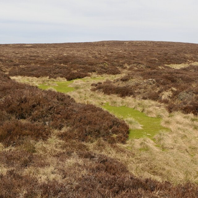
Dunbrach is a prominent hill located in Stirlingshire, Scotland. Rising to an elevation of approximately 1,580 feet (481 meters), it offers stunning panoramic views of the surrounding landscape. The hill is situated within the Loch Lomond and The Trossachs National Park, making it a popular destination for hikers, nature enthusiasts, and outdoor adventurers.

Dunbrach is characterized by its rugged terrain, with steep slopes and rocky outcrops adding to its challenging appeal. The hill is covered in a mix of grasses, heather, and shrubs, providing habitat for a variety of wildlife including birds, small mammals, and insects.

Visitors to Dunbrach can enjoy a range of outdoor activities, such as hiking, birdwatching, and photography. The hill is also a great spot for picnicking and enjoying a peaceful retreat in nature. Additionally, there are several well-marked trails leading to the summit, making it accessible to hikers of all skill levels.

Overall, Dunbrach in Stirlingshire is a stunning natural landmark that offers a rewarding outdoor experience for those looking to explore the beauty of the Scottish countryside.

If you have any feedback on the listing, please let us know in the comments section below.

Dunbrach Images

Images are sourced within 2km of 56.025048/-4.2256069 or Grid Reference NS6183. Thanks to Geograph Open Source API. All images are credited.

Holehead Looking over the obscured Crow Road with the radar visible on the summit. The facing hillside has been planted with trees.
Holehead
Looking over the obscured Crow Road with the radar visible on the summit. The facing hillside has been planted with trees.
Outer Black Hill Southern slopes of Holehead.
Outer Black Hill
Southern slopes of Holehead.
Outer Black Hill Southern slopes of Holehead, now only grazed by a few stray sheep.
Outer Black Hill
Southern slopes of Holehead, now only grazed by a few stray sheep.
Sheep, Alvain Burn The southern slopes of Holehead are partly forested and no longer formally used for livestock grazing. This lot however have got in.
Sheep, Alvain Burn
The southern slopes of Holehead are partly forested and no longer formally used for livestock grazing. This lot however have got in.
Alvain Burn Above where it forms a gorge through the Campsie scarp. West of the burn is a big area of blanket bog while the east side is grassy and better drained.
Alvain Burn
Above where it forms a gorge through the Campsie scarp. West of the burn is a big area of blanket bog while the east side is grassy and better drained.
Inner Black Hill Campsie moorland.
Inner Black Hill
Campsie moorland.
Inner Black Hill Campsie moorland
Inner Black Hill
Campsie moorland
Above the Alvain Burn There are a few sheep about, but the land here is in the care of whatever the Forestry Commission is currently calling itself and partly planted with trees with livestock supposedly excluded.
Above the Alvain Burn
There are a few sheep about, but the land here is in the care of whatever the Forestry Commission is currently calling itself and partly planted with trees with livestock supposedly excluded.
Bog on Hart Hill Much of Hart Hill is covered in deep peat with heather cover. There are scattered self seeded Sitka spruce trees.
Bog on Hart Hill
Much of Hart Hill is covered in deep peat with heather cover. There are scattered self seeded Sitka spruce trees.
Peat grough, Hart Hill Much of Hart Hill is covered in deep peat with heather cover.
Peat grough, Hart Hill
Much of Hart Hill is covered in deep peat with heather cover.
Heather on Hart Hill Much of Hart Hill is covered in deep peat with heather cover.
Heather on Hart Hill
Much of Hart Hill is covered in deep peat with heather cover.
Hart Hill Covered in heather and blanket peat bog.
Hart Hill
Covered in heather and blanket peat bog.
Bog west of Holehead Holehead is mostly grassy, but the western side is covered in deep dissected peat. Fortunately this visit was during a dry spell.
Bog west of Holehead
Holehead is mostly grassy, but the western side is covered in deep dissected peat. Fortunately this visit was during a dry spell.
Wolf Burn Leaving the Campsie plateau west of Holehead
Wolf Burn
Leaving the Campsie plateau west of Holehead
Wolf Burn, Holehead Marshy ground turning into the Wolf Burn.
Wolf Burn, Holehead
Marshy ground turning into the Wolf Burn.
Moorland north of Holehead This side of the hill is still grazed.
Moorland north of Holehead
This side of the hill is still grazed.
Fence, Holehead North of the fence land is still grazed by sheep. Much harder going southwards with young trees further down the hill. View towards the weather radar near the summit.
Fence, Holehead
North of the fence land is still grazed by sheep. Much harder going southwards with young trees further down the hill. View towards the weather radar near the summit.
Holehead Towards the summit with a weather radar. It replaces the one on Corse Hill south of Glasgow which is now a wind farm.
Holehead
Towards the summit with a weather radar. It replaces the one on Corse Hill south of Glasgow which is now a wind farm.
Show me another place!

Dunbrach is located at Grid Ref: NS6183 (Lat: 56.025048, Lng: -4.2256069)

Unitary Authority: Stirling

Police Authority: Forth Valley

What 3 Words

///loom.months.spooned. Near Lennoxtown, East Dunbartonshire

Nearby Locations

Dunbrach

Related Wikis

Campsie, East Dunbartonshire

Campsie is a civil parish in East Dunbartonshire, Scotland. The parish was formerly part of Stirlingshire. == Settlements == Auchenreoch Clachan of Campsie...
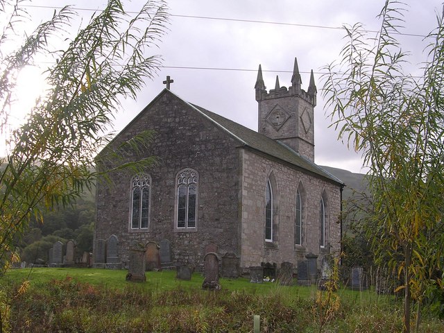
Fintry Kirk

Fintry Kirk is in the village of Fintry in Stirlingshire, Scotland. Fintry is a Church of Scotland Parish in the Presbytery of Stirling. The kirk is located...

Fintry

Fintry is a small riverside village in Stirlingshire, central Scotland. It is located 16 miles (26 km) south-west of Stirling and around 19 miles (31 km...
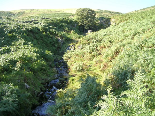
Aldessan Burn

Located in East Dunbartonshire, the Aldessan Burn (Scottish Gaelic: Allt Easain, meaning "burn of the falls"; also known as the Kirk Burn) is formed as...

Nearby Amenities

Located within 500m of 56.025048,-4.2256069
Dun Brach
Corbett: no
Donald: no
Graham: no
Munro: no
Natural: peak
Source: npe
Lat/Long: 56.0253331/-4.2255356
The data included in this document is from www.openstreetmap.org. The data is made available under ODbL.

Have you been to Dunbrach?

Leave your review of Dunbrach below (or comments, questions and feedback).