Sròn Ach' a' Bhacaidh

Hill, Mountain in Sutherland

Scotland

Sròn Ach' a' Bhacaidh

Slopes of Meall Eachainn I did not walk all the way to the top as the heather was a bit rough - maybe in the summer!
Slopes of Meall Eachainn Credit: Graeme Smith

Sròn Ach' a' Bhacaidh is a prominent hill located in the county of Sutherland, in the northern part of Scotland. It is part of the larger Scottish Highlands region and is situated in the Assynt area. The hill stands at an impressive height of approximately 741 meters (2,431 feet) above sea level.

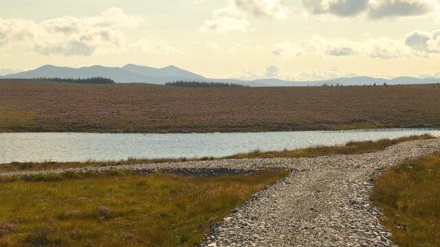
Sròn Ach' a' Bhacaidh is known for its rugged and rocky terrain, characteristic of the surrounding landscape. It is composed mainly of Torridonian sandstone, which gives it a distinct reddish-brown color. The hill's slopes are steep and covered with heather, providing a striking contrast against the clear blue skies and the nearby Loch Assynt.

The ascent to the summit of Sròn Ach' a' Bhacaidh can be challenging, as it requires a moderate level of fitness and navigation skills. However, the effort is rewarded with breathtaking panoramic views of the surrounding area. On a clear day, one can see the iconic mountains of Suilven, Canisp, and Quinag, as well as the vast expanse of Loch Assynt and the surrounding valleys.

Sròn Ach' a' Bhacaidh is a popular destination for hikers, mountaineers, and nature enthusiasts. It offers a chance to experience the raw beauty and tranquility of the Scottish Highlands. Visitors are advised to come prepared with appropriate clothing, footwear, and navigation equipment, as the weather conditions can change quickly and visibility can be limited in certain areas.

Overall, Sròn Ach' a' Bhacaidh is a remarkable hill in Sutherland, Scotland, offering a challenging yet rewarding experience for outdoor enthusiasts and a chance to connect with the stunning natural surroundings.

If you have any feedback on the listing, please let us know in the comments section below.

Sròn Ach' a' Bhacaidh Images

Images are sourced within 2km of 57.953507/-4.3444659 or Grid Reference NH6198. Thanks to Geograph Open Source API. All images are credited.

Slopes of Meall Eachainn I did not walk all the way to the top as the heather was a bit rough - maybe in the summer!
Slopes of Meall Eachainn
I did not walk all the way to the top as the heather was a bit rough - maybe in the summer!
Heather Moorland Looking across the heather towards Meall Eachainn
Heather Moorland
Looking across the heather towards Meall Eachainn
The watershed above Achinduich The first view of Loch Laro in the distance
The watershed above Achinduich
The first view of Loch Laro in the distance
Loch Laro viewed from the west The loch feels very remote despite the proximity of Lairg
Loch Laro viewed from the west
The loch feels very remote despite the proximity of Lairg
The trig point on Meall Eachainn This is a heathery summit without botanical distinction
The trig point on Meall Eachainn
This is a heathery summit without botanical distinction
The southern slopes of Meall Eachainn Loch Laro at the foot of the hill with wet heath on the opposite slopes
The southern slopes of Meall Eachainn
Loch Laro at the foot of the hill with wet heath on the opposite slopes
The eastern flank of Meall Eachainn Loch Buidhe and the extensive conifer plantations around Ben Domhnaill (347 m)  in the distance
The eastern flank of Meall Eachainn
Loch Buidhe and the extensive conifer plantations around Ben Domhnaill (347 m) in the distance
Loch Laro northern shore The aquatic flora is disappointingly poor, except for a patch of Carex rostrata at the eastern end
Loch Laro northern shore
The aquatic flora is disappointingly poor, except for a patch of Carex rostrata at the eastern end
Eastern end of Loch Laro
Lower slopes of Sron Ach' a' Bhacaidh
Remains of an old walled field enclosure at Claisnafaire
Allt Loch Laro at Claisnafaire
Trig pillar on Meall Eachainn Overlooking Loch Bhuidhe
Trig pillar on Meall Eachainn
Overlooking Loch Bhuidhe
Track towards Loch Laro, Sutherland In the hills to the south of Lairg.  The power lines on the right were recently erected to serve the new Creag Riabhach windfarm, north of Lairg.
Track towards Loch Laro, Sutherland
In the hills to the south of Lairg. The power lines on the right were recently erected to serve the new Creag Riabhach windfarm, north of Lairg.
Track Junction by Loch Laro, Sutherland View facing south.
Track Junction by Loch Laro, Sutherland
View facing south.
Ruins at Puill Fhraoich, Sutherland Low walls and a bit of improved grass land indicate that this area was once farmed.  Now abandoned.
Ruins at Puill Fhraoich, Sutherland
Low walls and a bit of improved grass land indicate that this area was once farmed. Now abandoned.
Rowing Boat on Loch Laro, Sutherland
Looking Towards Coir 'an t-Seilich Mor From the forestry Road. I bet all the Deer come out here to graze at night.
Looking Towards Coir 'an t-Seilich Mor
From the forestry Road. I bet all the Deer come out here to graze at night.
Show me another place!

Sròn Ach' a' Bhacaidh is located at Grid Ref: NH6198 (Lat: 57.953507, Lng: -4.3444659)

Unitary Authority: Highland

Police Authority: Highlands and Islands

What 3 Words

///rescue.headliner.redouble. Near Lairg, Highland

Nearby Locations

Sròn Ach' a' Bhacaidh

Related Wikis

Achinduich

Achinduich (Gaelic: Achadh an Dabhaich) is a hamlet on the east bank of the River Shin in the Scottish Highlands about 4 miles south of Lairg, Sutherland...
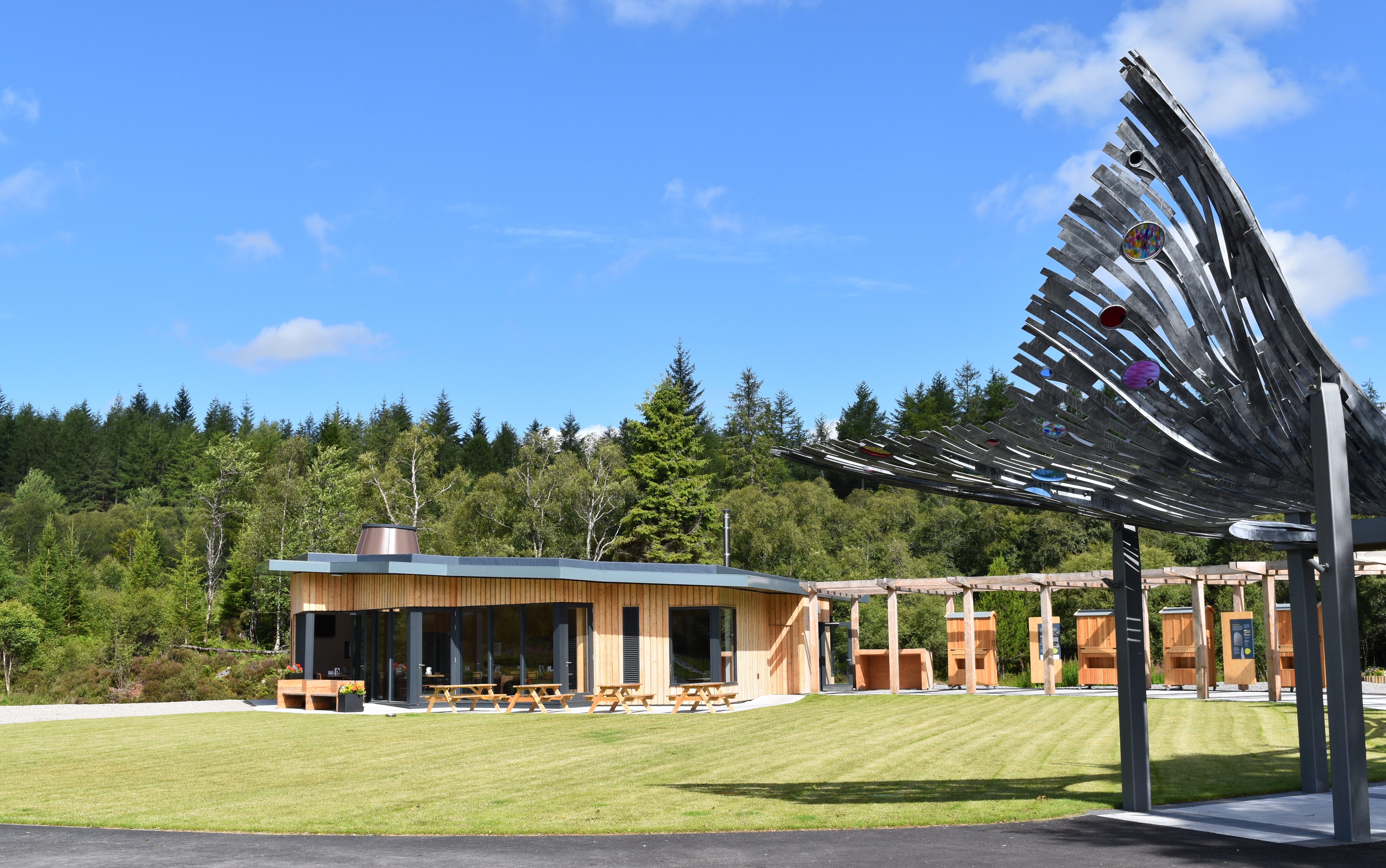
Falls of Shin

Falls of Shin is a waterfall on the River Shin, in northern Scotland, near the villages of Bonar Bridge and Lairg. Falls of Shin had a popular visitor...

Inveran

Inveran (Scottish Gaelic: Inbhirean) is a small village in the Parish of Creich located in the Sutherland region of the Highland Council area of Scotland...

River Shin

The River Shin (Scottish Gaelic: Abhainn Sin, pronounced [ˈa.ɪɲ ˈʃin]) is a river in the Scottish North West Highlands. The river flows from the southern...

Nearby Amenities

Located within 500m of 57.953507,-4.3444659
Sròn Ach' a'Bhacaidh
Ele: 282
Ele Ft: 928
Natural: peak
Source: OS7
Source Ele: OS7
Source Name: OS7
Lat/Long: 57.9533922/-4.3446961
Design: barrel
Power: tower
Lat/Long: 57.949362/-4.3420024
The data included in this document is from www.openstreetmap.org. The data is made available under ODbL.

Have you been to Sròn Ach' a' Bhacaidh?

Leave your review of Sròn Ach' a' Bhacaidh below (or comments, questions and feedback).