Hoden

Settlement in Worcestershire Wychavon

England

Hoden

Lane junction at Middle Littleton
Lane junction at Middle Littleton Credit: Row17

The requested URL returned error: 429 Too Many Requests

If you have any feedback on the listing, please let us know in the comments section below.
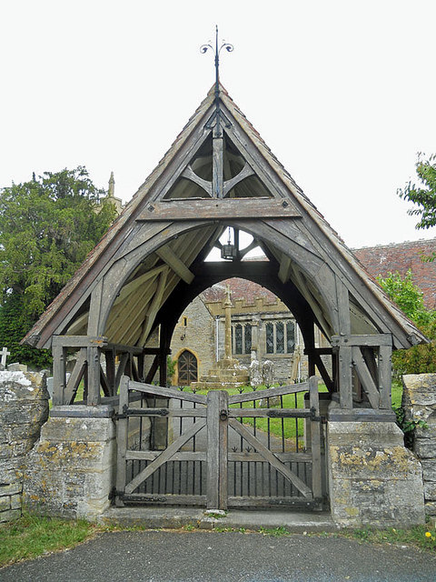
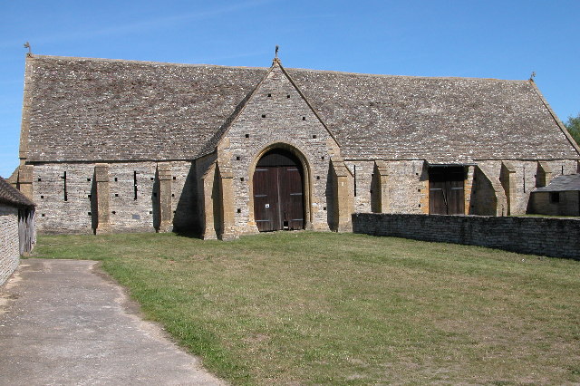
Hoden Images

Images are sourced within 2km of 52.121244/-1.8699647 or Grid Reference SP0947. Thanks to Geograph Open Source API. All images are credited.

Lane junction at Middle Littleton
Black shed under a cloudy sky
Lych gate at Middle Littleton church
Footpath through the fields
Track passing Island Barn
Houses in South Littleton This is the main road through the village which supplies accommodation for a number of people working at Long Lartin prison which is just east of the village on this road.
Houses in South Littleton
This is the main road through the village which supplies accommodation for a number of people working at Long Lartin prison which is just east of the village on this road.
Houses in South Littleton This is very close to the southern edge of the square, the grid line being just the other side of the black and white half timbered house. The road is Main St close to the junction with Long Hyde Rd.
Houses in South Littleton
This is very close to the southern edge of the square, the grid line being just the other side of the black and white half timbered house. The road is Main St close to the junction with Long Hyde Rd.
Road to Offenham This signpost is on the B4085 through South Littleton. There are sheltered accommodation houses on the left. the road straight ahead is Long Hyde Rd to Offenham with the road to Badsey on the left and to North Middleton on the right.
Road to Offenham
This signpost is on the B4085 through South Littleton. There are sheltered accommodation houses on the left. the road straight ahead is Long Hyde Rd to Offenham with the road to Badsey on the left and to North Middleton on the right.
Fields near North Littleton This is the view from Arrow Lane which runs from the village west to the B4085 road to Cleeve Prior. The houses in the village can just be seen in the distance.
Fields near North Littleton
This is the view from Arrow Lane which runs from the village west to the B4085 road to Cleeve Prior. The houses in the village can just be seen in the distance.
The Ivy Inn The village pub is located right in the centre of the village on a sizeable green
The Ivy Inn
The village pub is located right in the centre of the village on a sizeable green
Dean's Farm This is the Pebworth Poultry site and it obviously needs a fair amount of power to keep the chickes  warm and fed, judging by the power line and transformers
Dean's Farm
This is the Pebworth Poultry site and it obviously needs a fair amount of power to keep the chickes warm and fed, judging by the power line and transformers
Fields next to Long Lartin Prison Much of the area south of the road from Honeybourne to South Littleton is taken up by the prison and associated residential buildings. The prison walls can be seen on the left and the houses and living accommodation on the right.
Fields next to Long Lartin Prison
Much of the area south of the road from Honeybourne to South Littleton is taken up by the prison and associated residential buildings. The prison walls can be seen on the left and the houses and living accommodation on the right.
Bridleway to North Littleton Public bridleway from Holden Lane at Cleeve Prior to North Littleton.
Bridleway to North Littleton
Public bridleway from Holden Lane at Cleeve Prior to North Littleton.
Holden Lane, Cleeve Prior Holden Lane is a no through road from the village of Cleeve Prior to Holden Farm.  Field Barn can be seen just above the hedge on the left.
Holden Lane, Cleeve Prior
Holden Lane is a no through road from the village of Cleeve Prior to Holden Farm. Field Barn can be seen just above the hedge on the left.
Silage bales Silage bales in just inside a field off Hoden Lane.
Silage bales
Silage bales in just inside a field off Hoden Lane.
Crossroads on B4085 with B4510
St Nicholas Church, Middle Littleton
Middle Littleton Tithe Barn This 13th-century tithe barn, in the care of National Trust, is one of the largest and finest in the country
Middle Littleton Tithe Barn
This 13th-century tithe barn, in the care of National Trust, is one of the largest and finest in the country
Show me another place!

Hoden is located at Grid Ref: SP0947 (Lat: 52.121244, Lng: -1.8699647)

Administrative County: Worcestershire

District: Wychavon

Police Authority: West Mercia

What 3 Words

///rooks.lakeside.inflation. Near South Littleton, Worcestershire

Nearby Locations

Hoden

Related Wikis

Littleton F.C.

Littleton Football Club is a football club based in North and Middle Littleton, near Evesham, Worcestershire. They are members of the Midland League Division...

North and Middle Littleton

North and Middle Littleton is a civil parish located in the Wychavon district of Worcestershire, England. The parish comprises the villages of North Littleton...

Middle Littleton Tythe Barn

Middle Littleton Tythe Barn, also known as Middle Littleton Tithe Barn, is a grade I listed 13th or 14th-century tithe barn in the village of Middle Littleton...
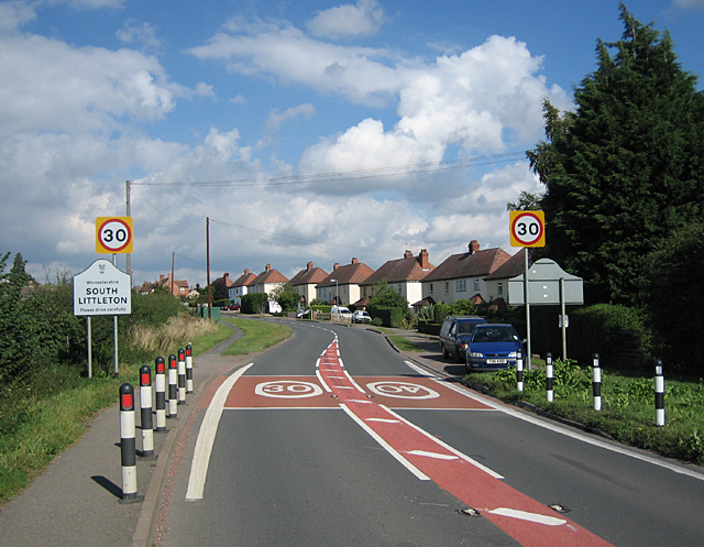
South Littleton

South Littleton is a village and civil parish located in the Wychavon district of Worcestershire, England. South Littleton is located midway between Evesham...

Nearby Amenities

Located within 500m of 52.121244,-1.8699647
Post Box
Collection Times: Mo-Fr 16:00; Sa 08:00
Operator: Royal Mail
Operator Wikidata: Q638098
Post Box Type: lamp
Ref: WR11 187
Royal Cypher: EIIR
Royal Cypher Wikidata: Q33102113
Source: survey
Lat/Long: 52.1231505/-1.8741603
Barrier: stile
Lat/Long: 52.1204487/-1.8765974
Barrier: stile
Lat/Long: 52.1199333/-1.8712498
Barrier: stile
Lat/Long: 52.1195127/-1.8666478
Barrier: stile
Lat/Long: 52.1195555/-1.864247
Generator Method: photovoltaic
Generator Output Electricity: yes
Generator Source: solar
Generator Type: solar_photovoltaic_panel
Location: roof
Power: generator
Lat/Long: 52.1235459/-1.8756875
Generator Method: photovoltaic
Generator Output Electricity: yes
Generator Source: solar
Generator Type: solar_photovoltaic_panel
Location: roof
Power: generator
Lat/Long: 52.1235591/-1.875768
Generator Method: photovoltaic
Generator Output Electricity: yes
Generator Source: solar
Generator Type: solar_photovoltaic_panel
Location: roof
Power: generator
Lat/Long: 52.1235723/-1.8758592
Generator Method: photovoltaic
Generator Output Electricity: yes
Generator Source: solar
Generator Type: solar_photovoltaic_panel
Location: roof
Power: generator
Lat/Long: 52.1235855/-1.875937
Generator Method: photovoltaic
Generator Output Electricity: yes
Generator Source: solar
Generator Type: solar_photovoltaic_panel
Location: roof
Power: generator
Lat/Long: 52.1236069/-1.8760738
Generator Method: photovoltaic
Generator Output Electricity: yes
Generator Source: solar
Generator Type: solar_photovoltaic_panel
Location: roof
Power: generator
Lat/Long: 52.1236135/-1.8761516
The data included in this document is from www.openstreetmap.org. The data is made available under ODbL.

Have you been to Hoden?

Leave your review of Hoden below (or comments, questions and feedback).