Beinn Bhreac
Hill, Mountain in Perthshire
Scotland
Beinn Bhreac

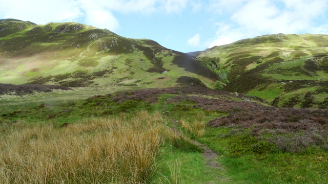
Beinn Bhreac is a prominent hill located in Perthshire, Scotland. Standing at a height of 931 meters (3054 feet), it is a popular destination for hikers and outdoor enthusiasts looking to enjoy the stunning views of the surrounding countryside.
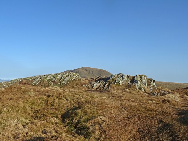
The hill is part of the Grampian Mountains range and is known for its rugged terrain, with steep slopes and rocky outcrops. Beinn Bhreac is often described as a challenging but rewarding climb, offering panoramic views of the surrounding landscape, including the nearby Loch Tay and Ben Lawers.
The summit of Beinn Bhreac is marked by a cairn, where hikers can take a well-deserved rest and soak in the breathtaking scenery. On a clear day, it is possible to see as far as the Trossachs National Park and the peaks of the Cairngorms in the distance.
Overall, Beinn Bhreac is a must-visit for those seeking a challenging hike and stunning views of the Scottish Highlands. It is a place where visitors can truly appreciate the natural beauty and rugged landscape of Perthshire.
If you have any feedback on the listing, please let us know in the comments section below.
Beinn Bhreac Images
Images are sourced within 2km of 56.29924/-4.2530359 or Grid Reference NN6014. Thanks to Geograph Open Source API. All images are credited.
![Bothan Eas An Eoin Ruin, with evidence of rig and furrow nearby. For more information see Canmore.org.uk. Bothan Eas An Eoin | Canmore. Available online at: <span class="nowrap"><a title="https://canmore.org.uk/site/82041/bothan-eas-an-eoin" rel="nofollow ugc noopener" href="https://canmore.org.uk/site/82041/bothan-eas-an-eoin">Link</a><img style="margin-left:2px;" alt="External link" title="External link - shift click to open in new window" src="https://s1.geograph.org.uk/img/external.png" width="10" height="10"/></span> [Accessed 31 May 2022].
](https://s2.geograph.org.uk/geophotos/07/18/78/7187802_fe33d58b.jpg)


Beinn Bhreac is located at Grid Ref: NN6014 (Lat: 56.29924, Lng: -4.2530359)
Unitary Authority: Stirling
Police Authority: Forth Valley
What 3 Words
///resurgent.imprints.vibrates. Near Callander, Stirling
Nearby Locations
Related Wikis

Beinn Each
Beinn Each (813 m) is a mountain in the southern Grampian Mountains of Scotland. It is located in Stirlingshire, north of the town of Callander. Rising...
Ardchullarie More
Ardchullarie More is a small hamlet in the Stirling council area, Scotland and is situated on the eastern side of Loch Lubnaig. == External links == Scottish...

Loch Lubnaig
Loch Lubnaig (Loch Lùbnaig in Gaelic) is a small freshwater loch near Callander in the Stirling council area, Scottish Highlands. It lies in the former...

Stùc a' Chroin
Stùc a' Chroin (Scottish Gaelic: Stùc a' Chrodhain, 'cloven hoof peak') (also translated as 'hill of the little sheepfold' or 'peak of danger') is a mountain...
Have you been to Beinn Bhreac?
Leave your review of Beinn Bhreac below (or comments, questions and feedback).