Belvedere Hill
Hill, Mountain in Kirkcudbrightshire
Scotland
Belvedere Hill

Belvedere Hill is a prominent geographical feature located in the region of Kirkcudbrightshire, Scotland. Situated in the southwestern part of the country, this hill stands as an impressive natural landmark with its commanding presence and panoramic views of the surrounding landscape.
Rising to an elevation of approximately 175 meters (574 feet), Belvedere Hill offers breathtaking vistas of the picturesque countryside, including the meandering River Dee and the lush green valleys that stretch out towards the horizon. The hill is characterized by its gentle slopes, making it easily accessible to visitors who wish to explore its natural beauty.
Belvedere Hill also boasts a rich historical significance. At its summit, the remains of an ancient hillfort can be found, hinting at the hill's use as a defensive structure in ancient times. These archaeological remnants provide a glimpse into the region's past and serve as a reminder of the hill's cultural importance.
Due to its scenic qualities and historical interest, Belvedere Hill has become a popular destination for outdoor enthusiasts, hikers, and nature lovers alike. Its well-maintained trails offer opportunities for leisurely walks or more challenging hikes, catering to a range of abilities and preferences.
Whether it be for the stunning views, historical intrigue, or outdoor pursuits, Belvedere Hill stands as a captivating landmark in Kirkcudbrightshire, attracting visitors from near and far to experience its natural grandeur and cultural heritage.
If you have any feedback on the listing, please let us know in the comments section below.
Belvedere Hill Images
Images are sourced within 2km of 54.866664/-4.173264 or Grid Reference NX6054. Thanks to Geograph Open Source API. All images are credited.


Belvedere Hill is located at Grid Ref: NX6054 (Lat: 54.866664, Lng: -4.173264)
Unitary Authority: Dumfries and Galloway
Police Authority: Dumfries and Galloway
What 3 Words
///lyricism.comfort.sleep. Near Kirkcudbright, Dumfries & Galloway
Nearby Locations
Related Wikis

Cally Palace
Cally Palace, formerly known as Cally House, is an 18th-century country house in the historical county of Kirkcudbrightshire in Dumfries and Galloway...

Girthon Old Parish Church
Girthon Old Parish Church is a ruined ecclesiastical building in Girthon, near Gatehouse of Fleet in Dumfries and Galloway. Built around 1620 on the foundations...

Cardoness Castle
Cardoness Castle is a well-preserved 15th-century tower house just south west of Gatehouse of Fleet, in the historical county of Kirkcudbrightshire in...

Gatehouse of Fleet Town Hall
Gatehouse of Fleet Town Hall is a former municipal building in the High Street in Gatehouse of Fleet, Dumfries and Galloway, Scotland. The structure, which...

Gatehouse of Fleet
Gatehouse of Fleet (Scots: Gatehoose o Fleet Scottish Gaelic: Taigh an Rathaid) is a town half in the civil parish of Girthon and half in the parish of...
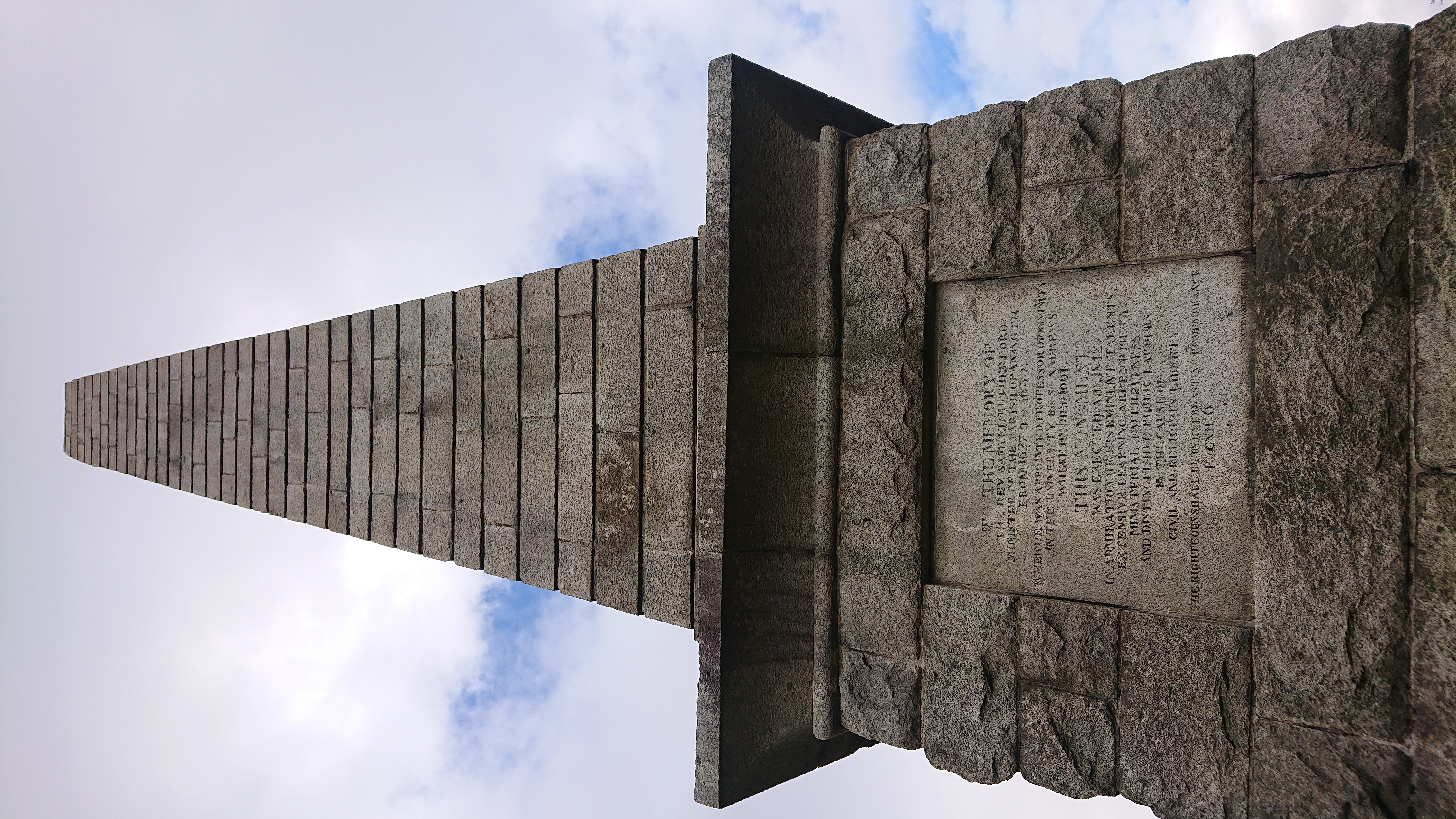
Rutherford's Monument
Rutherford's Monument is a commemorative monument between Anwoth and Gatehouse of Fleet in Dumfries and Galloway, Scotland. It is dedicated to the 17th...

Trusty's Hill
Trusty's Hill is a small vitrified hillfort about a mile to the west of the present-day town of Gatehouse of Fleet, in the parish of Anwoth in the Stewartry...

Ardwall House
Ardwall House is an eighteenth-century mansion near Gatehouse of Fleet in Dumfries and Galloway, Scotland. Built in 1762 for the McCullochs of Ardwall...
Nearby Amenities
Located within 500m of 54.866664,-4.173264Have you been to Belvedere Hill?
Leave your review of Belvedere Hill below (or comments, questions and feedback).