Mitchell Hill

Hill, Mountain in Lanarkshire

Scotland

Mitchell Hill

Cathkin Braes Trig Point Flush Bracket S3662
Cathkin Braes Trig Point Flush Bracket S3662 Credit: thejackrustles

Mitchell Hill is a prominent geographical feature located in Lanarkshire, Scotland. Rising to an elevation of approximately 304 meters (997 feet), it is considered a hill rather than a mountain.

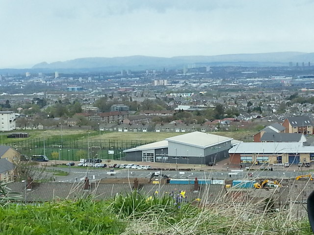
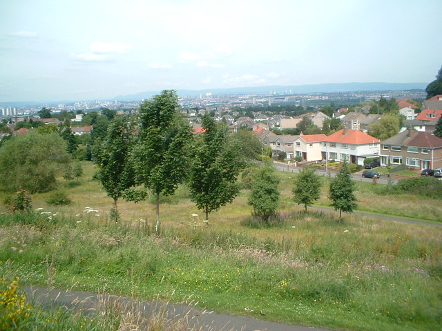
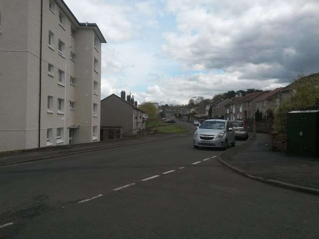
Situated in the central part of Lanarkshire, Mitchell Hill is nestled within a picturesque rural landscape. It is surrounded by rolling farmland, offering breathtaking views of the countryside. The hill is located near the small village of Muirkirk, which lies approximately 13 kilometers (8 miles) west of Cumnock.

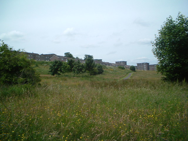
The topography of Mitchell Hill is characterized by its steep slopes and rocky terrain. It is predominantly covered with heather, grasses, and scattered shrubs, creating an attractive natural habitat for various plant and animal species. The hill is a haven for wildlife enthusiasts and nature lovers who can spot a diverse range of bird species, including peregrine falcons, kestrels, and buzzards.

Mitchell Hill also holds historical significance. It is believed to be the site of an ancient hill fort, which dates back to the Iron Age. Archaeological remains, including ditches and ramparts, have been discovered on the hill, providing valuable insights into the region's past.

The hill offers various recreational opportunities for outdoor enthusiasts. Hiking and walking trails are available, allowing visitors to explore the scenic surroundings and enjoy panoramic views from the hilltop. The area is also popular with mountain bikers and provides a challenging terrain for off-road cycling.

Overall, Mitchell Hill in Lanarkshire is a captivating natural landmark that offers a combination of natural beauty, historical interest, and outdoor recreational activities.

If you have any feedback on the listing, please let us know in the comments section below.

Mitchell Hill Images

Images are sourced within 2km of 55.800816/-4.2290193 or Grid Reference NS6058. Thanks to Geograph Open Source API. All images are credited.

Cathkin Braes Trig Point Flush Bracket S3662
Carmunnock Looking towards the junction where the road over the Cathkin Braes arrives at the village.
Carmunnock
Looking towards the junction where the road over the Cathkin Braes arrives at the village.
Footbridge in Cathkin Braes Park The footbridge is on the path into the park from Ardencraig Road. The Big Wood is behind. The bridge is seen from the other side in <a href="https://www.geograph.org.uk/photo/3241672">NS6058 : Footbridge in Cathkin Braes Country Park</a>.
Footbridge in Cathkin Braes Park
The footbridge is on the path into the park from Ardencraig Road. The Big Wood is behind. The bridge is seen from the other side in NS6058 : Footbridge in Cathkin Braes Country Park.
Castlemilk and Cathkin Braes Park The path at the bottom leads walkers from Ardencraig Road through a little bit of wood to the open part of the Cathkin Braes. Behind is the south edge of Catlemilk, with more of Glasgow and the Campsies beyond.
Castlemilk and Cathkin Braes Park
The path at the bottom leads walkers from Ardencraig Road through a little bit of wood to the open part of the Cathkin Braes. Behind is the south edge of Catlemilk, with more of Glasgow and the Campsies beyond.
Fernhill Community Centre View over Fernhill Community Centre and surroundings from the south of the estate
Fernhill Community Centre
View over Fernhill Community Centre and surroundings from the south of the estate
New Playpark, Fernhill
Fernhill 2005 View over Fernhill in 2005 prior to the refurbishment of much of the area's buildings
Fernhill 2005
View over Fernhill in 2005 prior to the refurbishment of much of the area's buildings
Boy Wonder View of Kenny Hunter statue known as King of the Castle  and Boy Wonder
Boy Wonder
View of Kenny Hunter statue known as King of the Castle and Boy Wonder
Colvend Drive 2005 View of the Colvend Drive area of Fernhill in 2005, prior to the redevelopment of the housing
Colvend Drive 2005
View of the Colvend Drive area of Fernhill in 2005, prior to the redevelopment of the housing
Fernhill gardens Attractive domestic gardens in Fernhill 2005
Fernhill gardens
Attractive domestic gardens in Fernhill 2005
Towards Neilvaig Drive View South over refurbished blocks in Neilvaig Drive, with High Burnside beyond and Clydebridge steel works in the distance
Towards Neilvaig Drive
View South over refurbished blocks in Neilvaig Drive, with High Burnside beyond and Clydebridge steel works in the distance
Gap site at Fernhill shops The site of the row of shops in Fernhill is cleared awaiting redevelopment, 2014
Gap site at Fernhill shops
The site of the row of shops in Fernhill is cleared awaiting redevelopment, 2014
To Burnside from Fernhill Park Looking northwest from the footpath in the informal parkland area between Fernhill and High Burnside. Celtic Park can be seen in the distance
To Burnside from Fernhill Park
Looking northwest from the footpath in the informal parkland area between Fernhill and High Burnside. Celtic Park can be seen in the distance
Fernhill from footpath Looking southwest towards lower Fernhill from the parkland footpath
Fernhill from footpath
Looking southwest towards lower Fernhill from the parkland footpath
Castlefern Road Castlefern Road in Fernhill, 2015
Castlefern Road
Castlefern Road in Fernhill, 2015
Felines of Fernhill Decorative murals featuring cats now adorn this enclosed parking area
Felines of Fernhill
Decorative murals featuring cats now adorn this enclosed parking area
Preparing for an excursion to Cathkin Braes Members of Glasgow Natural History Society prepare to visit Cathkin Braes on a wet afternoon, as they recreate the first excursion of the Andersonian Naturalists’ Society in August 1885. The society's object was 'to encourage the study of natural science in all its branches', which it continued to do until 1930. It then amalgamated with the Natural History Society of Glasgow and the Microscopical Society of Glasgow to form the Glasgow and Andersonian Natural History and Microscopical Society. It changed its name in 1979 to become the Glasgow Natural History Society.
Preparing for an excursion to Cathkin Braes
Members of Glasgow Natural History Society prepare to visit Cathkin Braes on a wet afternoon, as they recreate the first excursion of the Andersonian Naturalists’ Society in August 1885. The society's object was 'to encourage the study of natural science in all its branches', which it continued to do until 1930. It then amalgamated with the Natural History Society of Glasgow and the Microscopical Society of Glasgow to form the Glasgow and Andersonian Natural History and Microscopical Society. It changed its name in 1979 to become the Glasgow Natural History Society.
Castlemilk Drive The bus stops near St Bartholomew's Primary School.
Castlemilk Drive
The bus stops near St Bartholomew's Primary School.
Show me another place!

Mitchell Hill is located at Grid Ref: NS6058 (Lat: 55.800816, Lng: -4.2290193)

Unitary Authority: City of Glasgow

Police Authority: Greater Glasgow

What 3 Words

///intend.ashes.lakes. Near Carmunnock, Glasgow

Related Wikis

Castlemilk High School

Castlemilk High School is a co-educational comprehensive secondary school located in Castlemilk, Glasgow, Scotland. It was established in 1990 from a merger...

Bogany Flats

Bogany Flats was a multi-storey block of flats in Castlemilk, Glasgow. The flats were built in 1966 by George Wimpey Ltd, the last of the nine tower blocks...

Castlemilk

Castlemilk (Scottish Gaelic: Caisteal Mheilc) is a district of Glasgow, Scotland. It lies to the far south of the city centre, adjacent to the Croftfoot...

St Margaret Mary's Secondary School

St Margaret Mary's Secondary School is a co-educational, Roman Catholic, comprehensive secondary school located in Castlemilk, Glasgow, Scotland. ��2...
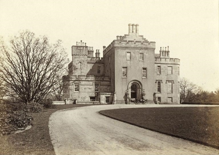
Castlemilk House

Castlemilk House was a country house located in what is now the Castlemilk district of Glasgow, Scotland. The house was the ancestral home of the Stirling...
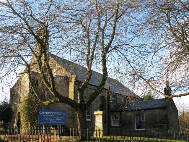
Carmunnock

Carmunnock (; Scottish Gaelic: Cathair Mhanach) is a conservation village situated within the Glasgow City council area, lying within three miles (five...

Croftfoot

Croftfoot (Scots: Croaftfuit, Scottish Gaelic: Bun a' Chroit) is a residential area on the southeastern side of the Scottish city of Glasgow. It is bordered...

Mid Lanarkshire (UK Parliament constituency)

Mid Lanarkshire was a county constituency of the House of Commons of the Parliament of the United Kingdom (Westminster) from 1885 to 1918. It elected one...

Nearby Amenities

Located within 500m of 55.800816,-4.2290193
Traffic Calming: cushion
Lat/Long: 55.7982829/-4.2340292
Traffic Calming: cushion
Lat/Long: 55.7985226/-4.2323546
Mini Roundabout
Direction: clockwise
Lat/Long: 55.7987833/-4.2314358
Kindergarten
Indigo Early Years
Addr City: Glasgow
Addr Housenumber: 29
Addr Postcode: G45 9UR
Addr Street: Dunagoil Road
Website: http://www.indigochildcaregroup.com/unit_earlyyears-29.html
Lat/Long: 55.7991202/-4.2357115
Traffic Calming: cushion
Lat/Long: 55.7982084/-4.234989
Traffic Calming: cushion
Lat/Long: 55.798668/-4.2316923
Barrier: bollard
Lat/Long: 55.8002412/-4.2323031
Traffic Calming: cushion
Lat/Long: 55.798375/-4.2332865
Traffic Calming: cushion
Lat/Long: 55.7988938/-4.2307488
Bus Stop
Castlemilk, Ardencraig Road/ Ardencraig Terrace
Naptan AtcoCode: 60903484
Naptan Bearing: W
Naptan CommonName: Ardencraig Terrace
Naptan Indicator: At
Naptan Landmark: Ardencraig Terrace
Naptan NaptanCode: 45235824
Naptan Street: Ardencraig Road
Ref: 60903484
Lat/Long: 55.80397/-4.22694
Bus Stop
Castlemilk, Ardencraig Road/ Ardencraig Terrace
Naptan AtcoCode: 60902394
Naptan Bearing: E
Naptan CommonName: Ardencraig Terrace
Naptan Indicator: Opp
Naptan Landmark: Ardencraig Terrace
Naptan NaptanCode: 45232387
Naptan Street: Ardencraig Road
Ref: 60902394
Lat/Long: 55.8041/-4.22634
Bus Stop
Castlemilk, Ardencraig Road/ Castlemilk Drive
Naptan AtcoCode: 60902376
Naptan Bearing: SW
Naptan CommonName: Castlemilk Drive
Naptan Indicator: Opp
Naptan Landmark: Castlemilk Drive
Naptan NaptanCode: 45236234
Naptan Street: Ardencraig Road
Ref: 60902376
Lat/Long: 55.799/-4.2302
Bus Stop
Castlemilk, Ardencraig Road/ Castlemilk Drive
Naptan AtcoCode: 60902377
Naptan Bearing: NE
Naptan CommonName: Castlemilk Drive
Naptan Indicator: after
Naptan Landmark: Castlemilk Drive
Naptan NaptanCode: 45237374
Naptan Street: Ardencraig Road
Ref: 60902377
Lat/Long: 55.79926/-4.22966
Bus Stop
Castlemilk, Ardencraig Road/ Crichton Court
Naptan AtcoCode: 60902379
Naptan Bearing: SW
Naptan CommonName: Mitchell Hill Road
Naptan Indicator: after
Naptan Landmark: Crichton Court
Naptan NaptanCode: 45236897
Naptan Street: Ardencraig Road
Ref: 60902379
Lat/Long: 55.80073/-4.22562
Bus Stop
Castlemilk, Ardencraig Road/ Dunagoil Street
Naptan AtcoCode: 60902374
Naptan Bearing: W
Naptan CommonName: Dunagoil Street
Naptan Indicator: opp
Naptan Landmark: Dunagoil Street
Naptan NaptanCode: 45239742
Naptan Street: Ardencraig Road
Ref: 60902374
Lat/Long: 55.7982/-4.23477
Bus Stop
Castlemilk, Ardencraig Road/ Dunagoil Street
Naptan AtcoCode: 60902375
Naptan Bearing: E
Naptan CommonName: Dunagoil Street
Naptan Indicator: before
Naptan Landmark: Dunagoil Street
Naptan NaptanCode: 45238957
Naptan Street: Ardencraig Road
Ref: 60902375
Lat/Long: 55.79833/-4.23428
Bus Stop
Castlemilk, Ardencraig Road/ Mitchell Hill Road
Naptan AtcoCode: 60902380
Naptan Bearing: NE
Naptan CommonName: Mitchell Hill Road
Naptan Indicator: opp
Naptan Landmark: Mitchell Hill Road
Naptan NaptanCode: 45232894
Naptan Street: Ardencraig Road
Ref: 60902380
Lat/Long: 55.80091/-4.22554
Bus Stop
Castlemilk, Ardencraig Road/ Mitchell Hill Road
Naptan AtcoCode: 60902381
Naptan Bearing: SW
Naptan CommonName: Mitchell Hill Road
Naptan Indicator: before
Naptan Landmark: Mitchell Hill Road
Naptan NaptanCode: 45235654
Naptan Street: Ardencraig Road
Ref: 60902381
Lat/Long: 55.80165/-4.22268
Bus Stop
Castlemilk, Ardencraig Road/ Mitchell Hill Road
Naptan AtcoCode: 60902382
Naptan Bearing: NE
Naptan CommonName: Mitchell Hill Road
Naptan Indicator: Opp
Naptan Landmark: Mitchell Hill Road
Naptan NaptanCode: 45236983
Naptan Street: Ardencraig Road
Ref: 60902382
Lat/Long: 55.80183/-4.2224
Bus Stop
Castlemilk, Castlemilk Drive/ Ardmaleish Road
Naptan AtcoCode: 60902436
Naptan Bearing: SW
Naptan CommonName: Ardmaleish Road
Naptan Indicator: Opp
Naptan Landmark: Ardmaleish Road
Naptan NaptanCode: 45232326
Naptan Street: Castlemilk Drive
Ref: 60902436
Lat/Long: 55.80207/-4.23165
Bus Stop
Castlemilk, Castlemilk Drive/ Castlemilk Terrace
Naptan AtcoCode: 60902440
Naptan Bearing: S
Naptan CommonName: Castlemilk Terrace
Naptan Indicator: opp
Naptan Landmark: Castlemilk Terrace
Naptan NaptanCode: 45237452
Naptan Street: Castlemilk Drive
Ref: 60902440
Lat/Long: 55.79901/-4.23149
Bus Stop
Castlemilk, Castlemilk Drive/ Castlemilk Terrace
Naptan AtcoCode: 60902439
Naptan Bearing: N
Naptan CommonName: Castlemilk Terrace
Naptan Indicator: at
Naptan Landmark: Castlemilk Terrace
Naptan NaptanCode: 45239285
Naptan Street: Castlemilk Drive
Ref: 60902439
Lat/Long: 55.79959/-4.23191
Bus Stop
Castlemilk, Castlemilk Drive/ Dougrie Road
Naptan AtcoCode: 60902433
Naptan Bearing: NW
Naptan CommonName: Glenwood Place
Naptan Indicator: before
Naptan Landmark: Dougrie Road
Naptan NaptanCode: 45236292
Naptan Street: Castlemilk Drive
Ref: 60902433
Lat/Long: 55.80445/-4.23013
Bus Stop
Castlemilk, Castlemilk Drive/ Glenwood Place
Naptan AtcoCode: 60902434
Naptan Bearing: S
Naptan CommonName: Ardencraig Road
Naptan Indicator: before
Naptan Landmark: Glenwood Place
Naptan NaptanCode: 45242894
Naptan Street: Castlemilk Drive
Ref: 60902434
Lat/Long: 55.80418/-4.22964
Bus Stop
Castlemilk, Castlemilk Drive/ Lenihall Drive
Naptan AtcoCode: 60902435
Naptan Bearing: NE
Naptan CommonName: Lenihall Drive
Naptan Indicator: before
Naptan Landmark: Lenihall Drive
Naptan NaptanCode: 45236972
Naptan Street: Castlemilk Drive
Ref: 60902435
Lat/Long: 55.80321/-4.23
Bus Stop
Castlemilk, Castlemilk Drive/ Stravanan Road
Naptan AtcoCode: 60902438
Naptan Bearing: N
Naptan CommonName: Stravanan Road
Naptan Indicator: before
Naptan Landmark: Stravanan Road
Naptan NaptanCode: 45235374
Naptan Street: Castlemilk Drive
Ref: 60902438
Lat/Long: 55.8005/-4.23225
Bus Stop
Castlemilk, Castlemilk Drive/ Stravanan Road
Naptan AtcoCode: 60902437
Naptan Bearing: S
Naptan CommonName: Stravanan Road
Naptan Indicator: Opp
Naptan Landmark: Stravanan Road
Naptan NaptanCode: 45242563
Naptan Street: Castlemilk Drive
Ref: 60902437
Lat/Long: 55.80075/-4.23217
Ford: yes
Lat/Long: 55.7974772/-4.228042
Barrier: cycle_barrier
Lat/Long: 55.7985267/-4.2321214
Addr Housenumber: 25
Addr Street: Dougrie Place
Entrance: staircase
Lat/Long: 55.8040548/-4.2343681
Addr Housenumber: 21
Addr Street: Dougrie Place
Entrance: staircase
Lat/Long: 55.8043058/-4.233386
Noexit: yes
Lat/Long: 55.8019288/-4.2346119
Noexit: yes
Lat/Long: 55.8030222/-4.2313631
The data included in this document is from www.openstreetmap.org. The data is made available under ODbL.

Have you been to Mitchell Hill?

Leave your review of Mitchell Hill below (or comments, questions and feedback).