Church Hill
Hill, Mountain in Ross-shire
Scotland
Church Hill

Church Hill is a prominent hill located in Ross-shire, in the Highlands region of Scotland. Rising to an elevation of approximately 350 meters (1,150 feet), it is a notable landmark in the area and offers stunning panoramic views of the surrounding countryside.
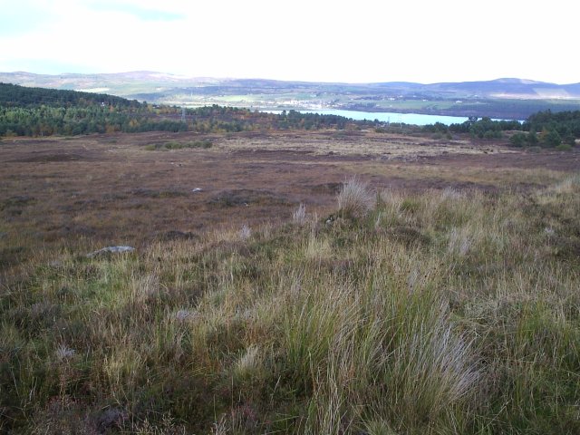
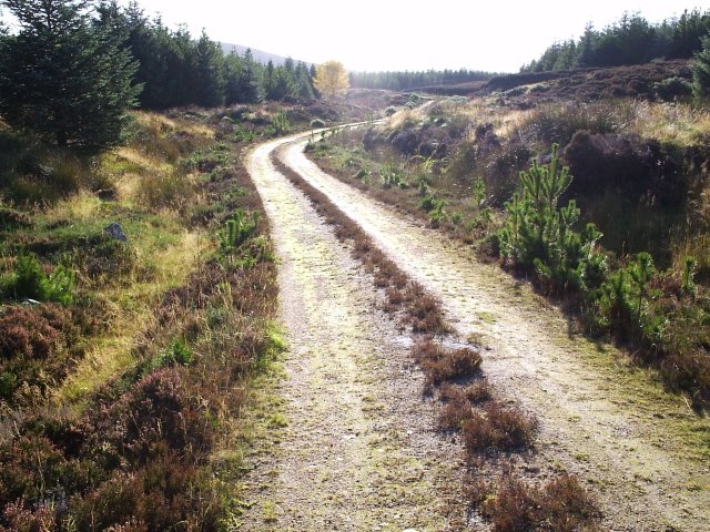
Situated near the small village of Church Hill, the hill itself is covered in heather and grass, providing a picturesque landscape. It is easily accessible to visitors, with a well-maintained footpath leading to the summit. The ascent is relatively gentle, making it suitable for hikers of all abilities.
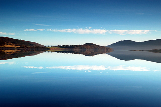
At the top of Church Hill, visitors are rewarded with breathtaking vistas overlooking the rolling hills and valleys of Ross-shire. On a clear day, the views extend as far as the Moray Firth, offering a glimpse of the nearby coast.
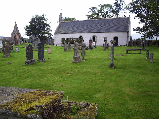
The hill takes its name from the presence of a historic church that once stood at its base. Today, only ruins remain, serving as a reminder of the area's rich history. The remnants of the church add a sense of mystique and intrigue to the hill, attracting history enthusiasts and photographers alike.
Church Hill is also home to a diverse range of wildlife, including various bird species and small mammals. Nature lovers often visit the hill to observe and photograph the local flora and fauna.
Overall, Church Hill in Ross-shire is a captivating destination for those seeking natural beauty, historical significance, and a tranquil escape from the hustle and bustle of everyday life.
If you have any feedback on the listing, please let us know in the comments section below.
Church Hill Images
Images are sourced within 2km of 57.860061/-4.3623729 or Grid Reference NH5988. Thanks to Geograph Open Source API. All images are credited.


Church Hill is located at Grid Ref: NH5988 (Lat: 57.860061, Lng: -4.3623729)
Unitary Authority: Highland
Police Authority: Highlands and Islands
What 3 Words
///tailwind.amuse.gratitude. Near Lairg, Highland
Nearby Locations
Related Wikis
Kincardine, Sutherland
Kincardine (Scottish Gaelic: Cinn Chàrdainn) is a small hamlet in Sutherland, situated on the west end of the south shore of the Dornoch Firth. The village...
Ardchronie
Ardchronie (Scottish Gaelic: Àird Chrònaidh) is a hamlet in the Highland Council area of Scotland. It lies on the south side of the Dornoch Firth, about...

Ardgay
Ardgay ard-GY (Scottish Gaelic: Àird Gaoith or Àird Ghaoithe) ["high wind"] is a small Scottish village on the south west shore of the Dornoch Firth,...
Ardgay railway station
Ardgay railway station is a railway station serving the village of Ardgay and its neighbour Bonar Bridge in the Highland council area of Scotland. The...
Have you been to Church Hill?
Leave your review of Church Hill below (or comments, questions and feedback).