Benbrack

Hill, Mountain in Kirkcudbrightshire

Scotland

Benbrack

Clearing below Tannoch Flow
Clearing below Tannoch Flow Credit: Richard Webb

Benbrack is a prominent hill located in Kirkcudbrightshire, Scotland. Standing at an elevation of 582 meters (1,909 feet), it is a popular destination for hikers and outdoor enthusiasts looking to enjoy stunning views of the surrounding countryside.

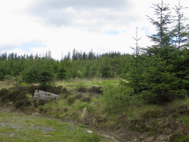
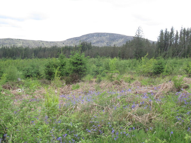
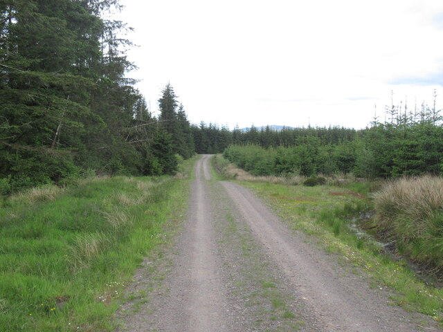
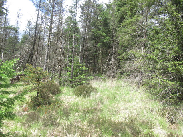
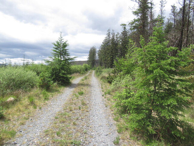
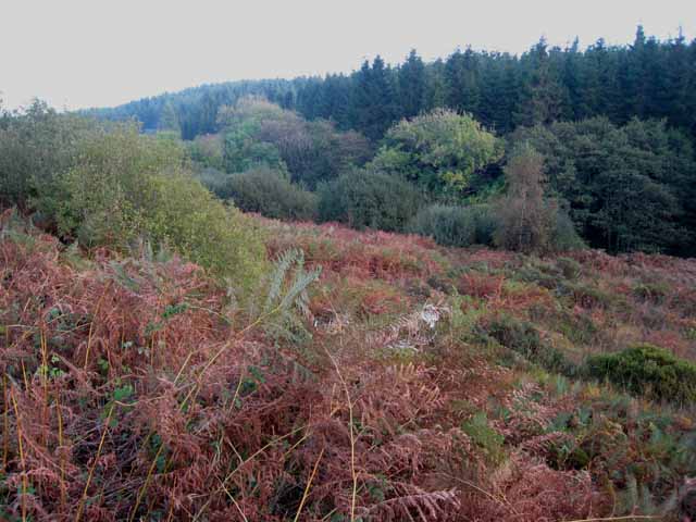
The hill is part of the Galloway Hills, which are known for their rugged beauty and diverse wildlife. Benbrack is characterized by its rolling green slopes and rocky outcrops, making it a challenging yet rewarding climb for experienced hikers.

At the summit of Benbrack, hikers are treated to panoramic views of the surrounding countryside, including the nearby Loch Skerrow and Loch Dungeon. On a clear day, it is possible to see as far as the Irish Sea and the Isle of Man.

Benbrack is a designated Site of Special Scientific Interest (SSSI) due to its unique geological features and rich biodiversity. Hikers are encouraged to respect the natural environment and wildlife while enjoying their time on the hill.

If you have any feedback on the listing, please let us know in the comments section below.

Benbrack Images

Images are sourced within 2km of 55.055677/-4.1965387 or Grid Reference NX5975. Thanks to Geograph Open Source API. All images are credited.

Clearing below Tannoch Flow
Young trees, Tannoch Flow
Roe deer Deer on a road which appears to have had little use for a while.
Roe deer
Deer on a road which appears to have had little use for a while.
Young trees, Tannoch Flow
Galloway forestry
Galloway forestry
Logging road, Tannoch Flow
Forestry east of Benbrack
Logging road, west of Cairn Edward Hill
View of Shaw Hill From a road on Tannoch Flow, west of Cairn Edward Hill.
View of Shaw Hill
From a road on Tannoch Flow, west of Cairn Edward Hill.
Galloway forestry Inside the massive plantations south of Cairnsmore of Dee.
Galloway forestry
Inside the massive plantations south of Cairnsmore of Dee.
Logging road, Galloway A spur road.
Logging road, Galloway
A spur road.
Old milestone Travelling westwards from New Galloway towards Newton Stewart this milestone is on the north side of the road about 50m from a rough lay-by on the south side of the road.   It does have a faint 27 on the front face, the distance from Dumfries.  It is a further 15 miles to Newton Stewart.
Old milestone
Travelling westwards from New Galloway towards Newton Stewart this milestone is on the north side of the road about 50m from a rough lay-by on the south side of the road. It does have a faint 27 on the front face, the distance from Dumfries. It is a further 15 miles to Newton Stewart.
Old milestone There is the milestone on the right next to a young sapling.  In April almost hidden in the dried grass.   27 miles from Dumfries.
Old milestone
There is the milestone on the right next to a young sapling. In April almost hidden in the dried grass. 27 miles from Dumfries.
Valley of the Knocknairling Burn, Clatteringshaws Forest Seen from the A712, Newton Stewart to New Galloway road.
Valley of the Knocknairling Burn, Clatteringshaws Forest
Seen from the A712, Newton Stewart to New Galloway road.
Corner of Forest Track.
Track Junction north of Tannoch Flow, Cairn Edward Forest.
Forestry Road Junction, Cairn Edward Forest.
Forest Ride, Cairn Edward Forest.
Show me another place!

Benbrack is located at Grid Ref: NX5975 (Lat: 55.055677, Lng: -4.1965387)

Unitary Authority: Dumfries and Galloway

Police Authority: Dumfries and Galloway

What 3 Words

///lunching.view.steroids. Near Castle Douglas, Dumfries & Galloway

Nearby Locations

Benbrack

Related Wikis

Water of Ken

The Water of Ken is a river in the historical county of Kirkcudbrightshire in Galloway, south-west Scotland.It rises on Blacklorg Hill, north-east of Cairnsmore...

Kenmure Castle

Kenmure Castle is a fortified house or castle in The Glenkens, 1 mile (1.6 km) south of the town of New Galloway in Kirkcudbrightshire, Galloway, south...

New Galloway Town Hall

The New Galloway Town Hall is a municipal building in Dumfries and Galloway, Scotland, situated on the town's high street. A tolbooth has existed on the...

Galloway

Galloway (Scottish Gaelic: Gall-Ghàidhealaibh [ˈkal̪ˠaɣəl̪ˠu]; Scots: Gallowa; Latin: Gallovidia) is a region in southwestern Scotland comprising the historic...

Have you been to Benbrack?

Leave your review of Benbrack below (or comments, questions and feedback).