Auchintow Hill
Hill, Mountain in Ayrshire
Scotland
Auchintow Hill
Auchintow Hill is a prominent geographical feature located in Ayrshire, Scotland. Rising to an elevation of approximately 286 meters (938 feet), it is classified as a hill rather than a mountain. Situated near the village of Ochiltree, Auchintow Hill offers scenic views of the surrounding countryside, with its summit providing an excellent vantage point for observation.
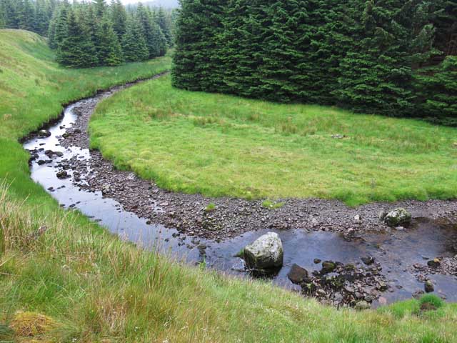
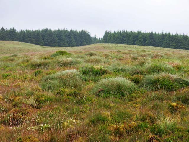
The hill is characterized by its gently sloping sides, covered in a patchwork of fields, woodlands, and hedgerows. It is predominantly composed of sedimentary rock, including sandstone and shale, which have weathered over time to form a diverse landscape.
Auchintow Hill is known for its rich biodiversity, supporting a variety of plant and animal species. The lower slopes feature grassy meadows interspersed with wildflowers, while higher up, heather and gorse dominate the landscape. The hill is home to a range of bird species, including buzzards and kestrels, which can often be seen soaring overhead.
The hill is easily accessible to walkers and hikers, with a network of paths and trails leading to the summit. It offers a popular recreational area for locals and visitors alike, with opportunities for outdoor activities such as walking, picnicking, and wildlife spotting.
Overall, Auchintow Hill is a picturesque natural landmark in Ayrshire, providing a tranquil escape from the bustle of everyday life and offering breathtaking views of the surrounding countryside.
If you have any feedback on the listing, please let us know in the comments section below.
Auchintow Hill Images
Images are sourced within 2km of 55.325946/-4.2122568 or Grid Reference NS5905. Thanks to Geograph Open Source API. All images are credited.


Auchintow Hill is located at Grid Ref: NS5905 (Lat: 55.325946, Lng: -4.2122568)
Unitary Authority: East Ayrshire
Police Authority: Ayrshire
What 3 Words
///months.rejoins.dishes. Near New Cumnock, East Ayrshire
Nearby Locations
Related Wikis

Windy Standard
Windy Standard is a hill in the Carsphairn and Scaur Hills range, part of the Southern Uplands of Scotland. It lies in Dumfries and Galloway, south of...

Blackcraig Hill
Blackcraig Hill is a hill in the Carsphairn and Scaur Hills range, part of the Southern Uplands of Scotland. It lies southeast of the town of New Cumnock...

Knockshinnoch disaster
The Knockshinnoch disaster was a mining accident that occurred in September 1950 in the village of New Cumnock, Ayrshire, Scotland. A glaciated lake filled...

Cairnsmore of Carsphairn
Cairnsmore of Carsphairn is a hill in the Carsphairn and Scaur Hills range, part of the Southern Uplands of Scotland. An alternative name, rarely used...
Have you been to Auchintow Hill?
Leave your review of Auchintow Hill below (or comments, questions and feedback).