Black Hill
Hill, Mountain in Kirkcudbrightshire
Scotland
Black Hill

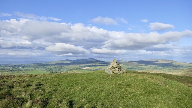
Black Hill is a prominent hill located in the region of Kirkcudbrightshire, Scotland. Situated in the scenic countryside, it stands at an elevation of approximately 295 meters (968 feet) above sea level. The hill is part of the wider Galloway Hills range, which is known for its rugged beauty and stunning vistas.
At the summit of Black Hill, visitors are treated to breathtaking panoramic views of the surrounding landscape, including the rolling hills, verdant valleys, and picturesque farmland that make up Kirkcudbrightshire. On clear days, it is even possible to catch glimpses of the sparkling waters of the Solway Firth in the distance.
The hill itself is covered in a patchwork of heather and grasses, creating a unique and colorful landscape. It is a popular destination for hikers, nature enthusiasts, and outdoor adventurers, offering various trails and paths that cater to different skill levels.
Black Hill also holds historical significance, with remnants of ancient settlements and burial cairns scattered across its slopes. These archaeological sites offer a glimpse into the area's rich past and add an additional layer of intrigue to the hill's allure.
Overall, Black Hill in Kirkcudbrightshire is a captivating natural landmark that showcases the beauty and diversity of the Scottish countryside. Its stunning views, varied flora, and historical significance make it a must-visit destination for those seeking an authentic Scottish experience.
If you have any feedback on the listing, please let us know in the comments section below.
Black Hill Images
Images are sourced within 2km of 54.937165/-4.1935211 or Grid Reference NX5962. Thanks to Geograph Open Source API. All images are credited.


Black Hill is located at Grid Ref: NX5962 (Lat: 54.937165, Lng: -4.1935211)
Unitary Authority: Dumfries and Galloway
Police Authority: Dumfries and Galloway
What 3 Words
///urge.kickers.valued. Near Kirkcudbright, Dumfries & Galloway
Nearby Locations
Related Wikis
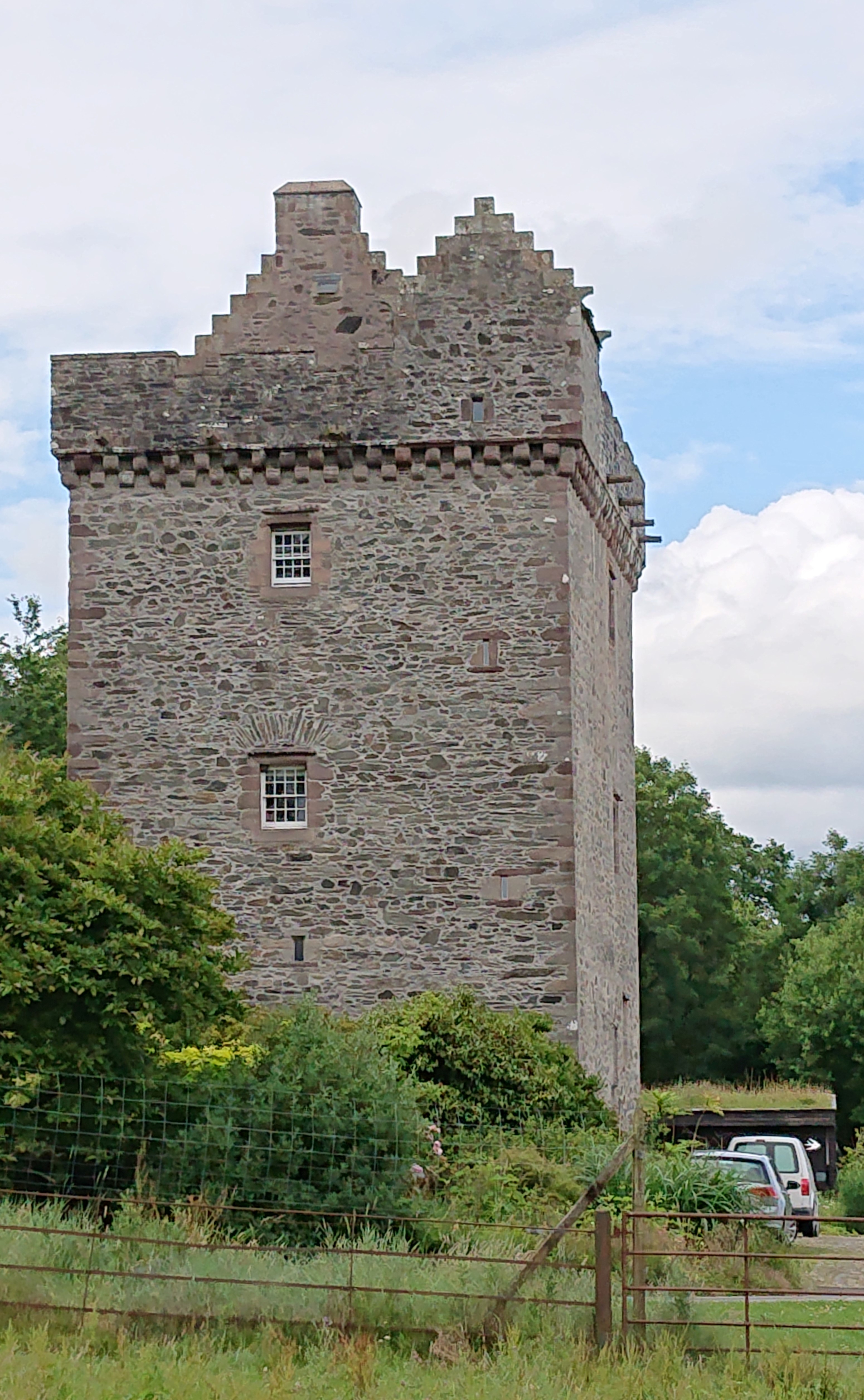
Rusco Tower
Rusco Tower, sometimes called Rusco Castle, is a tower house near Gatehouse of Fleet in Dumfries and Galloway, Scotland. Built around 1500 for Mariota...

Gatehouse of Fleet railway station
Gatehouse of Fleet railway station served the town of Gatehouse of Fleet, Dumfries and Galloway, Scotland from 1861 to 1965 on the Portpatrick and Wigtownshire...

Skerrow
Skerrow was a burgh in Dumfries and Galloway, Scotland. Loch Skerrow Halt railway station, on the Portpatrick and Wigtownshire Joint Railway, served Skerrow...
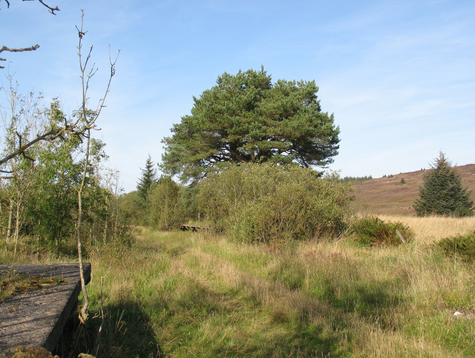
Loch Skerrow Halt railway station
Loch Skerrow Halt railway station served the burgh of Skerrow, Dumfries and Galloway, Scotland on the Portpatrick and Wigtownshire Joint Railway. ��2...

Gatehouse of Fleet
Gatehouse of Fleet (Scots: Gatehoose o Fleet Scottish Gaelic: Taigh an Rathaid) is a town half in the civil parish of Girthon and half in the parish of...

Gatehouse of Fleet Town Hall
Gatehouse of Fleet Town Hall is a former municipal building in the High Street in Gatehouse of Fleet, Dumfries and Galloway, Scotland. The structure, which...
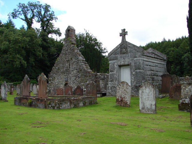
Anwoth Old Church
Anwoth Old Church is a ruined church building which was built in 1626 to serve the parish of Anwoth in Dumfries and Galloway, Scotland. It is roofless...

Trusty's Hill
Trusty's Hill is a small vitrified hillfort about a mile to the west of the present-day town of Gatehouse of Fleet, in the parish of Anwoth in the Stewartry...
Have you been to Black Hill?
Leave your review of Black Hill below (or comments, questions and feedback).