Auchenlongford Hill

Hill, Mountain in Ayrshire

Scotland

Auchenlongford Hill

Glen Garr Hill The cairn on Glen Garr hill, Wedder Hill.
This photo was taken on the 14th September 2022.
Glen Garr Hill Credit: Rab McMurdo

Auchenlongford Hill is a prominent hill located in Ayrshire, Scotland. It is part of the larger Southern Uplands range and stands at an elevation of approximately 340 meters (1,115 feet). The hill is situated near the small village of Auchenlongford, which lies to the northeast.

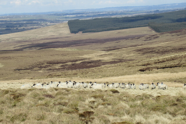
The hill is characterized by its gentle slopes and rounded peak, offering a relatively easy ascent for hikers and outdoor enthusiasts. It is primarily covered by heather and grass, providing a picturesque landscape that changes with the seasons. From the summit, visitors can enjoy panoramic views of the surrounding countryside, including the nearby Galloway Hills to the southwest and the Firth of Clyde to the west.

Auchenlongford Hill is a popular destination for outdoor activities such as walking, hiking, and birdwatching. The hill is home to a diverse range of bird species, including buzzards, kestrels, and peregrine falcons. It also provides habitat for various small mammals, such as rabbits and voles.

Access to Auchenlongford Hill is available through a network of well-maintained paths and trails that wind through the surrounding countryside. The hill is easily accessible from the village of Auchenlongford, where visitors can find parking facilities and information about the local area.

Overall, Auchenlongford Hill offers a peaceful and scenic escape for nature lovers, providing breathtaking views and opportunities for outdoor recreation.

If you have any feedback on the listing, please let us know in the comments section below.

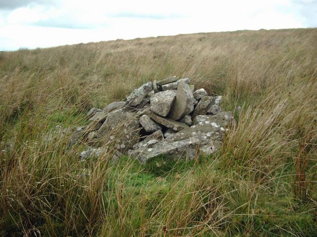
Auchenlongford Hill Images

Images are sourced within 2km of 55.540421/-4.2282841 or Grid Reference NS5929. Thanks to Geograph Open Source API. All images are credited.

Glen Garr Hill The cairn on Glen Garr hill, Wedder Hill.
This photo was taken on the 14th September 2022.
Glen Garr Hill
The cairn on Glen Garr hill, Wedder Hill. This photo was taken on the 14th September 2022.
Looking towards Powmeadow Hill from Wedder Hill A large expanse of moorland.

Some of the turbines of the vast Whitelee Wind Farm can be seen in the distance.
Looking towards Powmeadow Hill from Wedder Hill
A large expanse of moorland. Some of the turbines of the vast Whitelee Wind Farm can be seen in the distance.
Glen Garr cairn A large cairn, partly modified into a summit shelter, on the summit of Glen Garr, west of Wedder Hill.

More details can be found here: <span class="nowrap"><a title="https://canmore.org.uk/site/43718/glen-garr-hill" rel="nofollow ugc noopener" href="https://canmore.org.uk/site/43718/glen-garr-hill">Link</a><img style="margin-left:2px;" alt="External link" title="External link - shift click to open in new window" src="https://s1.geograph.org.uk/img/external.png" width="10" height="10"/></span>
Glen Garr cairn
A large cairn, partly modified into a summit shelter, on the summit of Glen Garr, west of Wedder Hill. More details can be found here: LinkExternal link
Shelter in the summit cairn, Glen Garr The cairn on the summit of this hill has been partially rearranged into a summit shelter. Details of the cairn can be found here: <span class="nowrap"><a title="https://canmore.org.uk/site/43718/glen-garr-hill" rel="nofollow ugc noopener" href="https://canmore.org.uk/site/43718/glen-garr-hill">Link</a><img style="margin-left:2px;" alt="External link" title="External link - shift click to open in new window" src="https://s1.geograph.org.uk/img/external.png" width="10" height="10"/></span>

Some of the turbines of the Whitelee Wind Farm are visible in the distance, with snow-capped hills in the southern Highlands in the far distance.
Shelter in the summit cairn, Glen Garr
The cairn on the summit of this hill has been partially rearranged into a summit shelter. Details of the cairn can be found here: LinkExternal link Some of the turbines of the Whitelee Wind Farm are visible in the distance, with snow-capped hills in the southern Highlands in the far distance.
Sheep on Wedder Hill Probably not used to many visitors to this quiet expanse of moorland.
Sheep on Wedder Hill
Probably not used to many visitors to this quiet expanse of moorland.
Cairn on the side of Little Wedder Hill
Butt above the Whitehaugh Burn Cairn Table in the distance.
Butt above the Whitehaugh Burn
Cairn Table in the distance.
Crags on Craigs Hill Quite unexpected in this rolling, tussocky terrain.  Strangely, these are marked on the 50,000 OS mapping, but not on the 25,000.
Crags on Craigs Hill
Quite unexpected in this rolling, tussocky terrain. Strangely, these are marked on the 50,000 OS mapping, but not on the 25,000.
Small cairn on the SE slopes of Wedder Hill There are lots of cairns on Wedder Hill and nearby Blacksidend.  This is one of the smaller ones.
Small cairn on the SE slopes of Wedder Hill
There are lots of cairns on Wedder Hill and nearby Blacksidend. This is one of the smaller ones.
The massive cairn on Wedder Hill The Darvel TV transmitter can be seen in the distance to the left of the cairn.
The massive cairn on Wedder Hill
The Darvel TV transmitter can be seen in the distance to the left of the cairn.
Tributary of the Burn O' Need
Wood Burn south of Craigs Hill
Grouse Butts on southern slopes of Craigs Hill
Cairn on Craigs Hill
Moorland & bog near Blackside A view towards Wedder Hill
Moorland & bog near Blackside
A view towards Wedder Hill
Blackside peat hags A view towards Wedder Hill
Blackside peat hags
A view towards Wedder Hill
Sheepfold by the Cleuch Burn
Sheepfold by the Cleuch Burn A view to the slopes of Mid Hill & Blacksidend
Sheepfold by the Cleuch Burn
A view to the slopes of Mid Hill & Blacksidend
Show me another place!

Auchenlongford Hill is located at Grid Ref: NS5929 (Lat: 55.540421, Lng: -4.2282841)

Unitary Authority: East Ayrshire

Police Authority: Ayrshire

What 3 Words

///reviewed.wreck.dude. Near Catrine, East Ayrshire

Related Wikis

Garpel Linn

Garpel Linn is a waterfall of Scotland. == See also == Waterfalls of Scotland == References ==

Greenock Water

Greenock Water is a river in East Ayrshire, Scotland. It flows out of the Dippal Burn, about 2 miles south of Dungavel Hill. A tributary of the River Ayr...

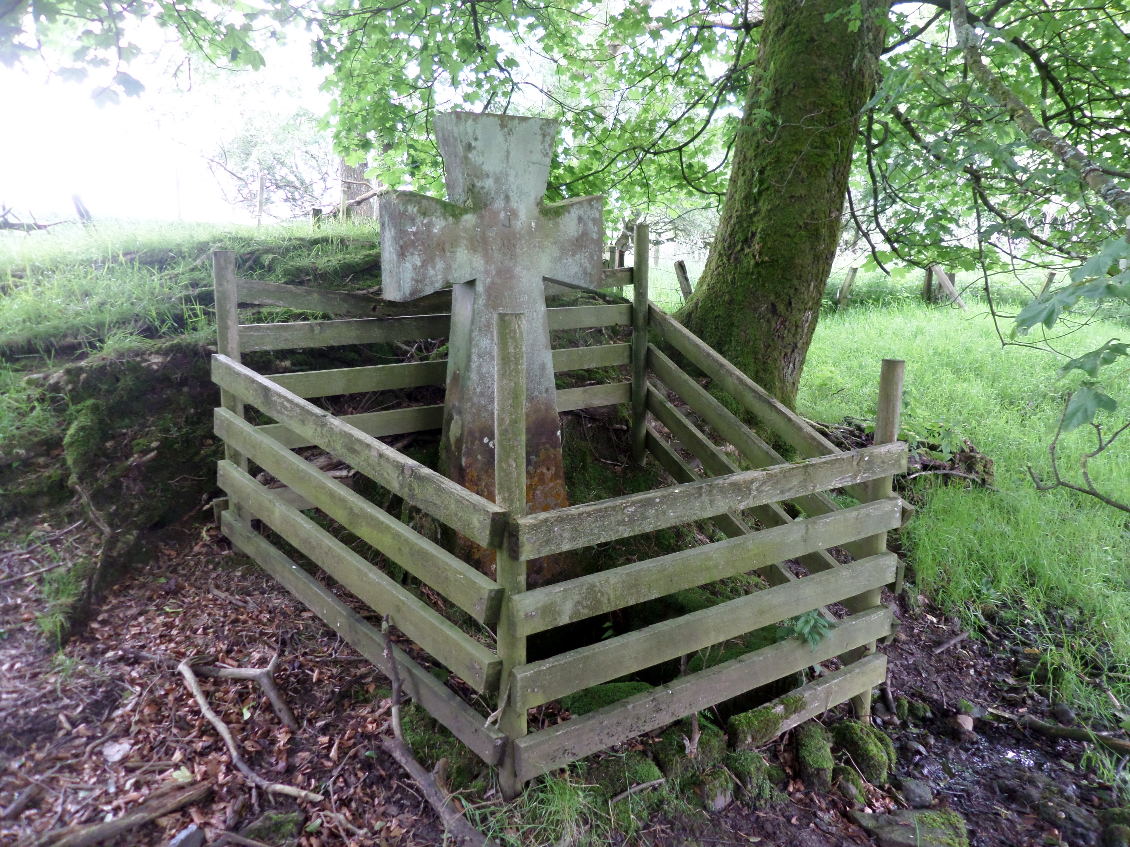
Lady's Well, Auchmannoch

The Lady's Well is a natural spring surmounted by a large cross that stands beside the Stra Burn Ford (NS254630) near Auchmannoch House in the Parish of...

Sorn, East Ayrshire

Sorn (Scottish Gaelic: Sorn, meaning a kiln) is a small village in East Ayrshire, Scotland. It is situated on the River Ayr. It has a population of roughly...

Nearby Amenities

Located within 500m of 55.540421,-4.2282841
Auchinlongford Hill
Corbett: no
Ele: 417
Ele Ft: 1369
Graham: no
Munro: no
Natural: peak
Source: OS7
Lat/Long: 55.5404362/-4.2282026
The data included in this document is from www.openstreetmap.org. The data is made available under ODbL.

Have you been to Auchenlongford Hill?

Leave your review of Auchenlongford Hill below (or comments, questions and feedback).