Shaw Hill

Hill, Mountain in Kirkcudbrightshire

Scotland

Shaw Hill

Raiders' Road Returning to within sight of the Black Water of Dee.
Raiders' Road Credit: Richard Webb

Shaw Hill is a prominent hill located in the historical county of Kirkcudbrightshire in southwest Scotland. Situated near the town of Kirkcudbright, Shaw Hill offers breathtaking panoramic views of the surrounding countryside and the nearby coast.

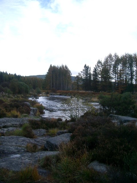
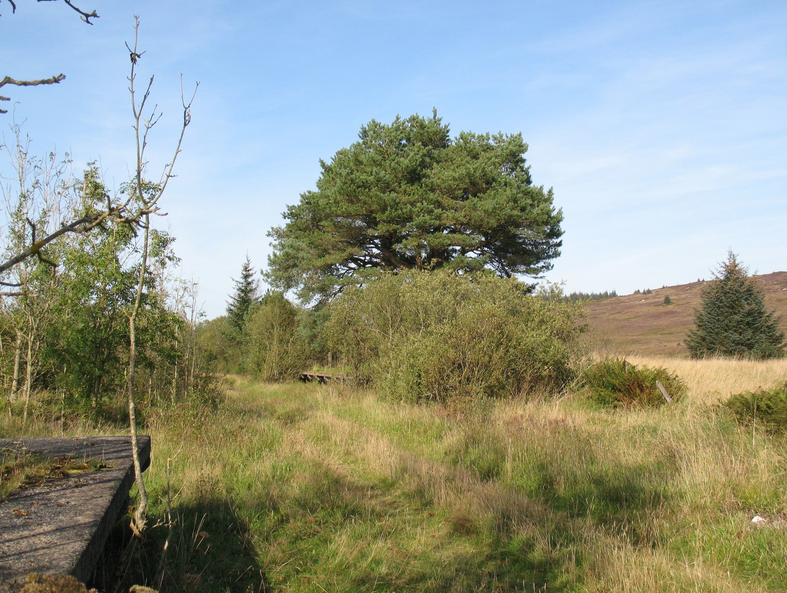
Rising to an elevation of approximately 177 meters (581 feet), Shaw Hill is known for its gentle slopes, making it accessible for both leisurely walks and more strenuous hikes. The hill is primarily composed of grassy terrain, with scattered patches of heather and bracken adding to its natural beauty.

The summit of Shaw Hill is marked by a trig point, providing a convenient reference point for visitors and walkers. From this vantage point, one can enjoy stunning vistas of the Solway Firth, with its serene waters stretching out towards the horizon. On clear days, the Cumbrian mountains of northern England can also be seen in the distance.

The area surrounding Shaw Hill is rich in biodiversity, with various species of flora and fauna thriving in this habitat. The hill serves as a natural habitat for birds, including buzzards and kestrels, which can often be spotted soaring above. Wildflowers, such as bluebells and primroses, dot the landscape in the spring, adding vibrant splashes of color to the scenery.

Shaw Hill is a popular destination for outdoor enthusiasts, offering a range of activities such as walking, hiking, and birdwatching. Its picturesque surroundings, coupled with its accessibility and stunning views, make it a must-visit location for nature lovers and those seeking a peaceful escape in Kirkcudbrightshire.

If you have any feedback on the listing, please let us know in the comments section below.

Shaw Hill Images

Images are sourced within 2km of 55.021529/-4.2065131 or Grid Reference NX5971. Thanks to Geograph Open Source API. All images are credited.

Raiders' Road Returning to within sight of the Black Water of Dee.
Raiders' Road
Returning to within sight of the Black Water of Dee.
Black Water of Dee Downstream view, deep in the forest.
Black Water of Dee
Downstream view, deep in the forest.
Black Water of Dee
Black Water of Dee
River Dee
River Dee
Robert Fergusson's Gravestone The back side of Robert Fergusson's gravestone.
Robert Fergusson's Gravestone
The back side of Robert Fergusson's gravestone.
Raiders' road
Raiders' road
Black Water of Dee
Black Water of Dee
Clearing beside the Raiders' Road
Between the Dee and Raiders' Road The publicly accessible motor road is close to the river here.
Between the Dee and Raiders' Road
The publicly accessible motor road is close to the river here.
Black Water of Dee from the Raiders Road
Rally car on forest road A rally car powering out of a junction on a forest road just south of the Black Water of Dee and Raiders Road tourist drive.
Rally car on forest road
A rally car powering out of a junction on a forest road just south of the Black Water of Dee and Raiders Road tourist drive.
Auchencloy Monument. This Covenanters Memorial is now visible from the forest road due to recent felling.  A burn has to be crossed to reach the memorial, which after heavy rain is impassable.
Auchencloy Monument.
This Covenanters Memorial is now visible from the forest road due to recent felling. A burn has to be crossed to reach the memorial, which after heavy rain is impassable.
Black Water of Dee from the Raider's Road The Black Water of Dee seen through the new growth on a larch tree.
Black Water of Dee from the Raider's Road
The Black Water of Dee seen through the new growth on a larch tree.
Dee, Trees on Shaw Hill in background taken from the Raiders Road through the Galloway Forest
Dee, Trees on Shaw Hill in background
taken from the Raiders Road through the Galloway Forest
Dee near Collin Island Taken from the picnic area at Otters Pool on the Raiders Road through the Galloway Forest.
Dee near Collin Island
Taken from the picnic area at Otters Pool on the Raiders Road through the Galloway Forest.
The Otter's Pool. This is on the bank of the River Dee (the Galloway one) just off the Raiders' Road. The Galloway Forest has many thick stands of trees along this loose and light surfaced toll road through the woods.
The Otter's Pool.
This is on the bank of the River Dee (the Galloway one) just off the Raiders' Road. The Galloway Forest has many thick stands of trees along this loose and light surfaced toll road through the woods.
The Otter Pool The Black Water of the River Dee idles its way over a granite pavement as it meanders toward Stroan Loch.
The Otter Pool
The Black Water of the River Dee idles its way over a granite pavement as it meanders toward Stroan Loch.
Northeast ridge, Fell of Fleet. Easy enough going on the ridge which is exposed to vegetation inhibiting winds, but lower down this is a very hard route, with long grass and deep holes, boulders and slabs under the vegetation - typical granite Galloway. Worth the struggle for the fine views and the relatively long walk free of the trees. Mostly heather and purple moorgrass with some self seeded spruce trees.
Northeast ridge, Fell of Fleet.
Easy enough going on the ridge which is exposed to vegetation inhibiting winds, but lower down this is a very hard route, with long grass and deep holes, boulders and slabs under the vegetation - typical granite Galloway. Worth the struggle for the fine views and the relatively long walk free of the trees. Mostly heather and purple moorgrass with some self seeded spruce trees.
Show me another place!

Shaw Hill is located at Grid Ref: NX5971 (Lat: 55.021529, Lng: -4.2065131)

Unitary Authority: Dumfries and Galloway

Police Authority: Dumfries and Galloway

What 3 Words

///proved.copes.deal. Near Newton Stewart, Dumfries & Galloway

Nearby Locations

Shaw Hill

Related Wikis

Skerrow

Skerrow was a burgh in Dumfries and Galloway, Scotland. Loch Skerrow Halt railway station, on the Portpatrick and Wigtownshire Joint Railway, served Skerrow...

Loch Skerrow Halt railway station

Loch Skerrow Halt railway station served the burgh of Skerrow, Dumfries and Galloway, Scotland on the Portpatrick and Wigtownshire Joint Railway. ��2...

Galloway

Galloway (Scottish Gaelic: Gall-Ghàidhealaibh [ˈkal̪ˠaɣəl̪ˠu]; Scots: Gallowa; Latin: Gallovidia) is a region in southwestern Scotland comprising the historic...

Water of Ken

The Water of Ken is a river in the historical county of Kirkcudbrightshire in Galloway, south-west Scotland. It rises on Blacklorg Hill, north-east of...

Kenmure Castle

Kenmure Castle is a fortified house or castle in The Glenkens, 1 mile (1.6 km) south of the town of New Galloway in Kirkcudbrightshire, Galloway, south...

Clatteringshaws Loch

Clatteringshaws Loch is a freshwater reservoir in the historical county of The Stewartry of Kirkcudbright in Dumfries and Galloway, Scotland. It was created...

New Galloway Town Hall

The New Galloway Town Hall is a municipal building in Dumfries and Galloway, Scotland, situated on the town's high street. A tolbooth has existed on the...

New Galloway

New Galloway (Scottish Gaelic: Gall-Ghàidhealaibh Nuadh) is a town in the historical county of Kirkcudbrightshire in Dumfries and Galloway. It lies on...

Nearby Amenities

Located within 500m of 55.021529,-4.2065131
Shaw Hill
Ele: 383
Natural: peak
Lat/Long: 55.0212449/-4.206196
The data included in this document is from www.openstreetmap.org. The data is made available under ODbL.

Have you been to Shaw Hill?

Leave your review of Shaw Hill below (or comments, questions and feedback).