Hobble End

Settlement in Staffordshire South Staffordshire

England

Hobble End

School Lane Just beyond the barriers seen in <a href="https://www.geograph.org.uk/photo/3687438">SK0106 : School Lane</a>, and getting more overgrown as the years go by. It's still navigable by bike, or on foot, without much problem at all.
School Lane Credit: Richard Law

Hobble End is a quaint village located in the county of Staffordshire, England. Nestled in the picturesque countryside, this idyllic settlement offers a charming and peaceful atmosphere for its residents and visitors alike. With a population of approximately 500, it is a close-knit community where neighbors know each other by name.

The village is characterized by its stunning natural surroundings, boasting rolling hills, lush green fields, and meandering streams. The landscape provides ample opportunities for outdoor activities such as hiking, cycling, and horseback riding. Visitors can explore the nearby Hobble Woods, a beautiful forested area that is home to a variety of wildlife and native flora.

Hobble End is proud of its rich history, which is evident in its well-preserved architecture. The village features several historic buildings, including the charming St. Mary's Church, dating back to the 13th century. The church is a popular spot for visitors interested in the region's heritage and offers a glimpse into the past.

Despite its small size, Hobble End offers essential amenities to its residents. The village has a local pub, The Hobble Inn, which serves as a social hub for both locals and visitors. Additionally, there is a small convenience store that caters to the daily needs of the community.

With its tranquil ambiance and scenic beauty, Hobble End is a hidden gem in the Staffordshire countryside. It provides an escape from the hustle and bustle of city life, offering residents and visitors a chance to immerse themselves in the peacefulness of rural England.

If you have any feedback on the listing, please let us know in the comments section below.

Hobble End Images

Images are sourced within 2km of 52.642741/-2.0014349 or Grid Reference SK0005. Thanks to Geograph Open Source API. All images are credited.
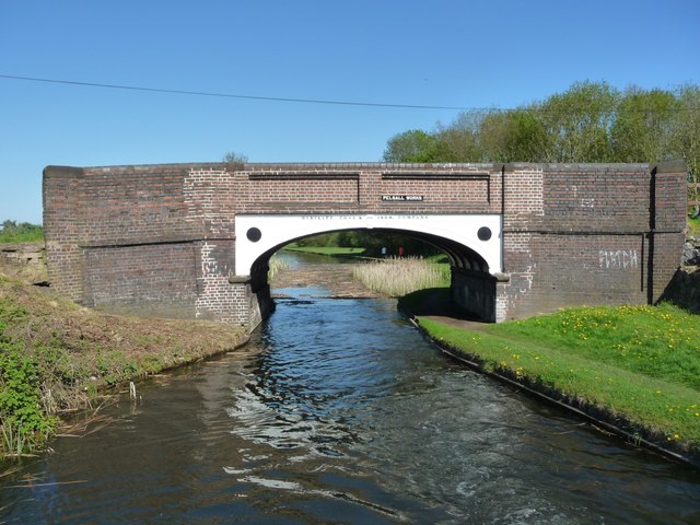
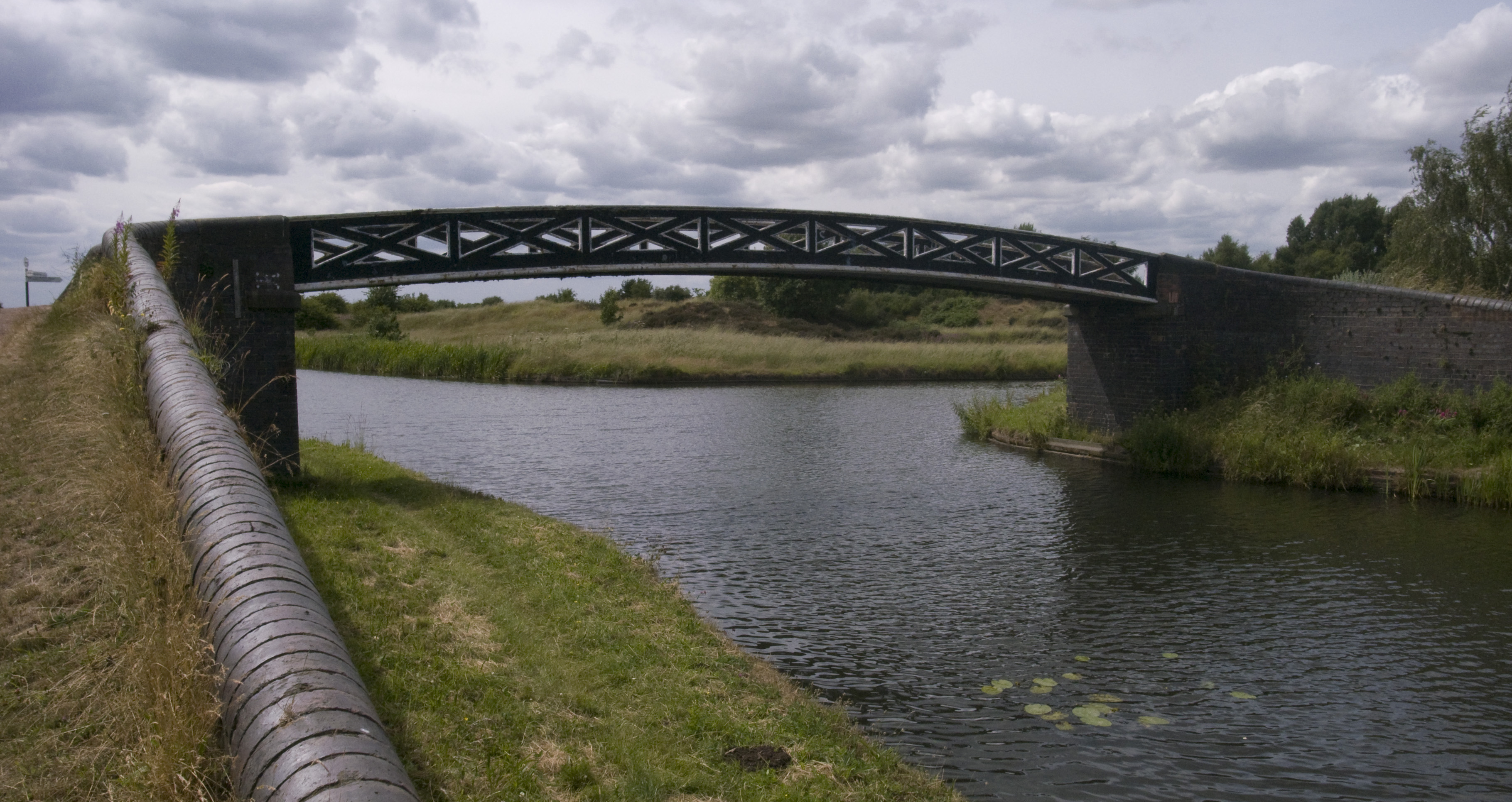
School Lane Just beyond the barriers seen in <a href="https://www.geograph.org.uk/photo/3687438">SK0106 : School Lane</a>, and getting more overgrown as the years go by. It's still navigable by bike, or on foot, without much problem at all.
School Lane
Just beyond the barriers seen in SK0106 : School Lane, and getting more overgrown as the years go by. It's still navigable by bike, or on foot, without much problem at all.
Wyrley & Essington Canal, Pelsall Wood A boat heads towards Pelsall Junction along an unusually open stretch of the canal.
Wyrley & Essington Canal, Pelsall Wood
A boat heads towards Pelsall Junction along an unusually open stretch of the canal.
Wyrley & Essington Canal at Pelsall Wood Looking eastwards from the back of a narrowboat, after the reeds have been cut.
Wyrley & Essington Canal at Pelsall Wood
Looking eastwards from the back of a narrowboat, after the reeds have been cut.
Pelsall Works Bridge, from the west Carrying a public footpath and the Forest of Mercia Trail over the Wyrley & Essington Canal.
Pelsall Works Bridge, from the west
Carrying a public footpath and the Forest of Mercia Trail over the Wyrley & Essington Canal.
Farmland northwest of Pelsall On the south bank of the Wyrley & Essington Canal.
Farmland northwest of Pelsall
On the south bank of the Wyrley & Essington Canal.
Farmland south of Freeths Bridge, Fishley On the east bank of the Wyrley & Essington Canal.
Farmland south of Freeths Bridge, Fishley
On the east bank of the Wyrley & Essington Canal.
Bare field, north of Little Bloxwich On the east bank of the Wyrley & Essington Canal. The distant houses are in Pelsall.
Bare field, north of Little Bloxwich
On the east bank of the Wyrley & Essington Canal. The distant houses are in Pelsall.
Houses in Grenfell Road, Little Bloxwich On the east bank of the Wyrley & Essington Canal.
Houses in Grenfell Road, Little Bloxwich
On the east bank of the Wyrley & Essington Canal.
Teeces [or Teece's] Bridge, from the south Carrying Stoney Lane [Bloxwich] over the Wyrley & Essington Canal.
Teeces [or Teece's] Bridge, from the south
Carrying Stoney Lane [Bloxwich] over the Wyrley & Essington Canal.
Looking south on Gains Lane
Junction of Gains Lane with Gorsey Lane
3-way junction 4 named lanes in this photo; Jacob's Hall Lane on the left, Jones's Lane in the middle, and Hazel Lane to the right, all of which are heading off in their various directions from Gorsey Lane in the foreground.
3-way junction
4 named lanes in this photo; Jacob's Hall Lane on the left, Jones's Lane in the middle, and Hazel Lane to the right, all of which are heading off in their various directions from Gorsey Lane in the foreground.
On Dark Lane A bridleway & track, which further south degrades into a footpath, and joins Jacob's Hall Lane with Fishley Lane near Pelsall Wood.
On Dark Lane
A bridleway & track, which further south degrades into a footpath, and joins Jacob's Hall Lane with Fishley Lane near Pelsall Wood.
Dark Lane, looking south A rather splendid piece of narrow bridleway along an old lane; it degrades further south into a footpath, and becomes waterlogged due to poor drainage - I reached the other end of the section referred to in <a href="https://www.geograph.org.uk/photo/2102582">SK0005 : Cadman's Lane, alternative route</a>, and can confirm that it's a running stream. Take wellies, or a horse.
Dark Lane, looking south
A rather splendid piece of narrow bridleway along an old lane; it degrades further south into a footpath, and becomes waterlogged due to poor drainage - I reached the other end of the section referred to in SK0005 : Cadman's Lane, alternative route, and can confirm that it's a running stream. Take wellies, or a horse.
Field drain near Hobble End Farm The drain joins the Wash Brook a little way to the NE of this point.
Field drain near Hobble End Farm
The drain joins the Wash Brook a little way to the NE of this point.
Looking towards Bloxwich from Wyrley Lane
Ashbourne Road, Little Bloxwich
Smallholding, Fishley Lane, Little Bloxwich
Show me another place!

Hobble End is located at Grid Ref: SK0005 (Lat: 52.642741, Lng: -2.0014349)

Administrative County: Staffordshire

District: South Staffordshire

Police Authority: Staffordshire

What 3 Words

///polite.ledge.noisy. Near Great Wyrley, Staffordshire

Nearby Locations

Hobble End

Related Wikis

Newtown, Staffordshire

Newtown is a small village in Essington parish, South Staffordshire, England. Newtown lies between the Landywood area of Great Wyrley (to the north) and...

Landywood

Landywood is a village in the South Staffordshire district of Staffordshire, England. Landywood is part of the South Staffordshire ward named "Great Wyrley...

Lower Farm Estate

Lower Farm Estate is a suburb of Bloxwich, in the Metropolitan Borough of Walsall, West Midlands, England. There are two multi-storey blocks of council...

Wednesbury Town F.C.

Wednesbury Town F.C. was the name used for three football clubs based in Wednesbury, West Midlands, England. == Original club == The Wednesbury Football...

Little Bloxwich

Little Bloxwich is a residential area of Bloxwich, West Midlands, England. It is situated in the extreme north of the Metropolitan Borough of Walsall on...

Great Wyrley

Great Wyrley is a village and civil parish in the South Staffordshire district of Staffordshire, England. It forms a built up area with nearby Cheslyn...

Turnberry Estate

Turnberry Estate is a suburb of Bloxwich in the Metropolitan Borough of Walsall in the West Midlands, England. The estate is served by the X51 National...

Pelsall Junction

Pelsall Junction (grid reference SK018044) is a canal junction at the southern limit of the Cannock Extension Canal where it meets the Wyrley and Essington...

Nearby Amenities

Located within 500m of 52.642741,-2.0014349
Power: tower
Source: BING
Lat/Long: 52.6440111/-2.0072836
Power: tower
Source: BING
Lat/Long: 52.6462114/-2.0030913
The data included in this document is from www.openstreetmap.org. The data is made available under ODbL.

Have you been to Hobble End?

Leave your review of Hobble End below (or comments, questions and feedback).