An Leacainn

Hill, Mountain in Inverness-shire

Scotland

An Leacainn

Great Glen Way and minor road, by Altourie After following the minor road for several kilometres from near Abriachan, here the Great Glen Way turns off onto a separate path.
A few metres at the end of the path are tarmac, after that it becomes compacted gravel, but still easy for walking or cycling.

A house at Wester Altourie is visible in the distance on the right.
Great Glen Way and minor road, by Altourie Credit: Craig Wallace

An Leacainn, also known as Leacan or Leachan, is a prominent hill located in Inverness-shire, Scotland. It is situated in the western part of the county, near the village of Invermoriston. An Leacainn is part of the wider Glen Moriston area, which is renowned for its picturesque landscapes and natural beauty.

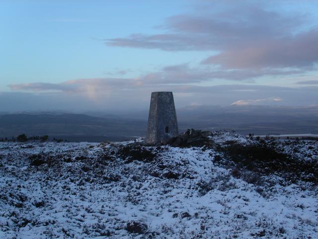
Standing at an impressive height of 773 meters (2,536 feet), An Leacainn offers stunning panoramic views of the surrounding countryside. Its summit provides breathtaking vistas of rolling hills, lush green valleys, and shimmering lochs. On clear days, it is possible to see as far as the Ben Nevis, the highest mountain in the British Isles.

The ascent to the top of An Leacainn can be challenging, with steep slopes and rugged terrain. However, it is a popular destination for outdoor enthusiasts, hikers, and hillwalkers seeking an exhilarating adventure. The hill is often included in various walking routes and trails, allowing visitors to experience its beauty while exploring the wider Glen Moriston area.

The surrounding area of An Leacainn is rich in wildlife and natural habitats. It is home to a diverse range of flora and fauna, including heather, mosses, and native bird species. The hill offers a peaceful and tranquil setting, away from the hustle and bustle of urban life.

An Leacainn is a hidden gem in Inverness-shire, offering a unique opportunity to immerse oneself in the natural wonders of the Scottish Highlands. Whether it be for a challenging hike or simply to enjoy the breathtaking scenery, this hill is a must-visit destination for nature lovers and outdoor adventurers alike.

If you have any feedback on the listing, please let us know in the comments section below.

An Leacainn Images

Images are sourced within 2km of 57.437502/-4.3721855 or Grid Reference NH5741. Thanks to Geograph Open Source API. All images are credited.

Great Glen Way and minor road, by Altourie After following the minor road for several kilometres from near Abriachan, here the Great Glen Way turns off onto a separate path.
A few metres at the end of the path are tarmac, after that it becomes compacted gravel, but still easy for walking or cycling.

A house at Wester Altourie is visible in the distance on the right.
Great Glen Way and minor road, by Altourie
After following the minor road for several kilometres from near Abriachan, here the Great Glen Way turns off onto a separate path. A few metres at the end of the path are tarmac, after that it becomes compacted gravel, but still easy for walking or cycling. A house at Wester Altourie is visible in the distance on the right.
Bleak road over moorland
Road near Altourlie, north of Abriachan
Great Glen Route This is the Great Glen route at Blackfold.
Great Glen Route
This is the Great Glen route at Blackfold.
Road and Moorland Northeast of Ladycairn.
Road and Moorland
Northeast of Ladycairn.
Open Moorland Near Altourie.
Open Moorland
Near Altourie.
Altourie From the Abriachan road.
Altourie
From the Abriachan road.
Moorland and Forest at Blackfold Blackfold is on the Great Glen Way.
Moorland and Forest at Blackfold
Blackfold is on the Great Glen Way.
An Leacainn trig point at dusk The sun's just beginning to set and is casting its last rays of the day on a snow covered Ben Wyvis in the distance.  An Leacainn is Gaelic for 'The Place of Flagstones'.
An Leacainn trig point at dusk
The sun's just beginning to set and is casting its last rays of the day on a snow covered Ben Wyvis in the distance. An Leacainn is Gaelic for 'The Place of Flagstones'.
The Great Glen Way The Great Glen Way where it crosses the forest track
The Great Glen Way
The Great Glen Way where it crosses the forest track
Cottage Cottage seen from the Great Glen Way
Cottage
Cottage seen from the Great Glen Way
Forestry Road Forestry road
Forestry Road
Forestry road
Forestry road Forestry road
Forestry road
Forestry road
Forestry road junction Forestry road junction
Forestry road junction
Forestry road junction Forestry road junction
Forestry road junction
Forestry road Over grown forestry road
Forestry road
Over grown forestry road
Forestry Road Forestry road
Forestry Road
Forestry road
Forest clearing Forest clearing
Forest clearing
Forest clearing
Show me another place!

An Leacainn is located at Grid Ref: NH5741 (Lat: 57.437502, Lng: -4.3721855)

Unitary Authority: Highland

Police Authority: Highlands and Islands

What 3 Words

///radiating.coconut.tabloid. Near Beauly, Highland

Nearby Locations

An Leacainn

Related Wikis

The Aird

The Aird (from Scottish Gaelic: An Àird (IPA: [an ˈaːɾʃt̪]) meaning "The High Place") is an area of the County of Inverness, to the west of the City of...

Blar Nam Feinne

Blàr nam Fèinne (Battlefield of the Fingalians) on Cnoc na Moine (Hill of the Peat) in The Aird, to the west of Inverness, is the site of the 11th century...

Moniack Castle

Moniack Castle is a 16th-century tower house located 7 miles (11 km) west of Inverness, and just south of Beauly in Highland, Scotland. The castle was...

Loch Dochfour

Loch Dochfour is a freshwater loch in the Scottish Highlands southwest of Inverness, part of the Great Glen. The southern end flows in through the Bona...

Nearby Amenities

Located within 500m of 57.437502,-4.3721855
Turning Circle
Lat/Long: 57.4404432/-4.3695045
The data included in this document is from www.openstreetmap.org. The data is made available under ODbL.

Have you been to An Leacainn?

Leave your review of An Leacainn below (or comments, questions and feedback).