Hitchin

Settlement in Hertfordshire North Hertfordshire

England

Hitchin

Roundabout on London Road, Gosmore At the junction of Broadmeadow Rise
Roundabout on London Road, Gosmore Credit: David Howard

Hitchin is a historic market town located in the county of Hertfordshire, in the East of England. Situated approximately 43 miles north of London, Hitchin has a population of around 34,000 people. The town is known for its picturesque architecture, charming streets, and vibrant community.

One of Hitchin's notable features is its medieval market square, which has been the heart of the town since the 14th century. The square is surrounded by beautiful half-timbered buildings, independent shops, cafes, and restaurants, creating a unique and inviting atmosphere. Every Tuesday and Saturday, the market square comes alive with a bustling market, offering a wide range of goods, from fresh local produce to clothing, antiques, and crafts.

Hitchin boasts several historic landmarks, including the stunning medieval parish church of St. Mary's, which dates back to the 14th century. The town is also home to a number of well-preserved Tudor and Georgian buildings, adding to its architectural charm.

In addition to its rich history, Hitchin offers a range of amenities and recreational facilities. The town has several parks and green spaces, providing opportunities for outdoor activities and leisurely walks. Hitchin also benefits from excellent transport links, with a train station providing regular services to London and other major cities.

Hitchin is known for its sense of community, with a variety of local events and festivals taking place throughout the year. The town has a vibrant arts scene, with numerous galleries, theaters, and music venues showcasing local talent.

Overall, Hitchin is a picturesque market town with a rich historical heritage, a strong sense of community, and a range of amenities, making it an attractive place to live or visit in Hertfordshire.

If you have any feedback on the listing, please let us know in the comments section below.
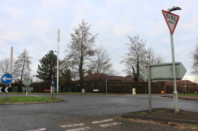
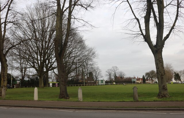
Hitchin Images

Images are sourced within 2km of 51.948502/-0.261941 or Grid Reference TL1929. Thanks to Geograph Open Source API. All images are credited.

Roundabout on London Road, Gosmore At the junction of Broadmeadow Rise
Roundabout on London Road, Gosmore
At the junction of Broadmeadow Rise
London Road, Hitchin
Priory Way from the junction of Gosmore Road
Park by Bedford Road, Hitchin Hitchin Town FC is opposite
Park by Bedford Road, Hitchin
Hitchin Town FC is opposite
Flats on Stevenage Road, Hitchin
House on Chiltern Road, Hitchin
Sevensprings Way, Hitchin The Cadent van lives here.
Sevensprings Way, Hitchin
The Cadent van lives here.
Broadmead, Hitchin
Broadmead, Hitchin
Roundabout on St Michael's Road, Hitchin
North Hertfordshire College, Hitchin
Park by the River Purwell, Hitchin The river is to the right going under the bridge.
Park by the River Purwell, Hitchin
The river is to the right going under the bridge.
The Avenue, Hitchin
The Avenue, Hitchin
Orchard Court on Nightingale Road, Hitchin
B&M on Nightingale Road, Hitchin
B&M car park on Nightingale Road, Hitchin
Advertising hoarding on Cambridge Road, Hitchin
Walsworth Road, Hitchin This view is looking towards the town centre from near the railway station along the B656. The building on the immediate left is Lyon Court, a modern apartment block.
Walsworth Road, Hitchin
This view is looking towards the town centre from near the railway station along the B656. The building on the immediate left is Lyon Court, a modern apartment block.
Show me another place!

Hitchin is located at Grid Ref: TL1929 (Lat: 51.948502, Lng: -0.261941)

Administrative County: Hertfordshire

District: North Hertfordshire

Police Authority: Hertfordshire

What 3 Words

///manliness.builds.income. Near Hitchin, Hertfordshire

Nearby Locations

Hitchin

Related Wikis

Benslow

Benslow is a district of Hitchin, Hertfordshire, England. It is located very close to the railway station. Houses in the area range from those built in...

Benslow Music Trust

Benslow Music Trust is a charitable trust established to promote music education. The trust is based in the Benslow area of Hitchin in Hertfordshire, England...

Highbury Ward

Highbury Ward is an electoral ward in Hitchin, Hertfordshire. It covers 230.174 hectares. It is a largely residential area bounded roughly to the north...

Poets Estate (Hitchin)

The Poets Estate is a residential area of Hitchin, Hertfordshire, England. It lies to the east of the town centre, based around St Michael's Road and the...

Nearby Amenities

Located within 500m of 51.948502,-0.261941
Turning Circle
Lat/Long: 51.952688/-0.2644284
Traffic Calming: cushion
Lat/Long: 51.9528812/-0.2634868
Steps
Step Count: 8
Lat/Long: 51.948064/-0.2691003
Barrier: bollard
Lat/Long: 51.9485051/-0.260027
Bus Stop
Manor Crescent
Naptan AtcoCode: 210021109380
Naptan Bearing: S
Naptan CommonName: Manor Crescent
Naptan Crossing: Wymondley Road
Naptan Indicator: opp
Naptan Landmark: Wymondley Road
Naptan NaptanCode: hrtgdwmt
Naptan PlusbusZoneRef: HITCHIN
Naptan ShortCommonName: NA
Naptan Street: Ninesprings Way
Naptan Verified: no
Source: naptan_import
Lat/Long: 51.9451782/-0.2609103
Bus Stop
Halsey Drive
Bench: no
Naptan AtcoCode: 210021109450
Naptan Bearing: NW
Naptan CommonName: Halsey Drive
Naptan Crossing: Kingsdown
Naptan Indicator: NW-bound
Naptan Landmark: Kingsdown
Naptan NaptanCode: hrtgdwpj
Naptan PlusbusZoneRef: HITCHIN
Naptan ShortCommonName: NA
Naptan Street: Halsey Drive
Naptan Verified: no
Shelter: no
Source: naptan_import
Tactile Paving: no
Lat/Long: 51.9464586/-0.2556807
Bus Stop
Gibson Close
Bench: no
Naptan AtcoCode: 210021109495
Naptan Bearing: NW
Naptan CommonName: Gibson Close
Naptan Crossing: opp Gibson Close
Naptan Indicator: opp
Naptan Landmark: opp Gibson Close
Naptan NaptanCode: hrtgdwgw
Naptan PlusbusZoneRef: HITCHIN
Naptan ShortCommonName: NA
Naptan Street: St Michaels Road
Naptan Verified: no
Shelter: no
Source: naptan_import
Tactile Paving: no
Lat/Long: 51.9492611/-0.2557913
Bus Stop
Gibson Close
Bench: no
Local Ref: NR
Naptan AtcoCode: 210021110140
Naptan Bearing: SE
Naptan CommonName: Gibson Close
Naptan Crossing: Gibson Close
Naptan Indicator: nr
Naptan Landmark: Gibson Close
Naptan NaptanCode: hrtgdtwd
Naptan PlusbusZoneRef: HITCHIN
Naptan ShortCommonName: NA
Naptan Street: St Michaels Road
Naptan Verified: no
Shelter: no
Source: naptan_import
Tactile Paving: no
Lat/Long: 51.949594/-0.2560975
Bus Stop
Wymondley Road
Naptan AtcoCode: 210021110270
Naptan Bearing: S
Naptan CommonName: Wymondley Road
Naptan Crossing: Wymondley Road
Naptan Indicator: S-bound
Naptan Landmark: Wymondley Road
Naptan NaptanCode: hrtgdtma
Naptan PlusbusZoneRef: HITCHIN
Naptan ShortCommonName: NA
Naptan Street: Halsey Drive
Naptan Verified: no
Source: naptan_import
Lat/Long: 51.9454909/-0.2571297
Bus Stop
Coleridge Close
Bench: no
Bin: no
Lit: yes
Naptan AtcoCode: 210021110785
Naptan Bearing: NW
Naptan CommonName: Coleridge Close
Naptan Indicator: NW-bound
Naptan Landmark: Unknown
Naptan NaptanCode: hrtgdpwd
Naptan PlusbusZoneRef: HITCHIN
Naptan ShortCommonName: NA
Naptan Street: St Michaels Road
Naptan Verified: no
Shelter: no
Source: naptan_import
Tactile Paving: no
Lat/Long: 51.951546/-0.2597908
Bus Stop
Coleridge Close
Bench: yes
Bin: yes
Lit: yes
Naptan AtcoCode: 210021110930
Naptan Bearing: SE
Naptan CommonName: Coleridge Close
Naptan Indicator: SE-bound
Naptan Landmark: Unknown
Naptan NaptanCode: hrtgdptd
Naptan PlusbusZoneRef: HITCHIN
Naptan ShortCommonName: NA
Naptan Street: St Michaels Road
Naptan Verified: no
Shelter: yes
Source: naptan_import
Tactile Paving: yes
Lat/Long: 51.9512967/-0.2593493
Post Box
Collection Times: Mo-Fr 09:00; Sa 07:00
Post Box Design: type_k
Post Box Type: pillar
Ref: SG4 31
Royal Cypher: EIIR
Royal Cypher Wikidata: Q33102113
Lat/Long: 51.9504159/-0.2579047
Post Box
Collection Times: Mo-Fr 09:00, Sa 07:00
Post Box Type: pillar
Ref: SG4 49
Lat/Long: 51.9504166/-0.2646776
Turning Circle
Lat/Long: 51.9477623/-0.2558428
Dentist
Hitchin Dental Practice
Addr Housenumber: 7
Addr Street: Highbury Road
Phone: +44 1462 459172
Lat/Long: 51.9493598/-0.2690714
Post Box
Collection Times: Mo-Fr 17:30; Sa 12:00
Fixme: ref is from memory; need to resurvey
Post Box Type: pillar
Ref: SG4 50
Lat/Long: 51.9485771/-0.2669525
Post Box
Brand: Royal Mail
Brand Wikidata: Q638098
Collection Times: Mo-Fr 09:00; Sa 07:00
Operator: Royal Mail
Operator Wikidata: Q638098
Post Box Type: pillar
Ref: SG4 15D
Royal Cypher: EVIIR
Royal Cypher Wikidata: Q33102324
Source: observation walking;survey
Lat/Long: 51.946342/-0.264592
Benslow
Place: suburb
Lat/Long: 51.951146/-0.2650999
Wymondley Park
Place: suburb
Lat/Long: 51.9465541/-0.257419
Hitchin
Naptan AtcoCode: 9100HITCHIN
Network: National Rail
Public Transport: stop_position
Railway: stop
Ref: 1
Ref Tiploc: HITCHIN
Train: yes
Lat/Long: 51.9517161/-0.26125
Hitchin 'A' Junction
Railway: switch
Lat/Long: 51.9494092/-0.2585604
Hill View
Place: suburb
Lat/Long: 51.9481469/-0.2557271
Source: bing
Lat/Long: 51.9440323/-0.2626891
Source: bing
Lat/Long: 51.9440468/-0.2625452
Source: bing
Lat/Long: 51.9440595/-0.2624084
Source: bing
Lat/Long: 51.9440756/-0.2626607
Source: bing
Lat/Long: 51.9440778/-0.2624818
Source: bing
Lat/Long: 51.9440843/-0.2623921
Source: bing
Lat/Long: 51.9440902/-0.2625168
Source: bing
Lat/Long: 51.9441025/-0.2624656
Source: bing
Lat/Long: 51.944109/-0.2623759
Source: bing
Lat/Long: 51.9441189/-0.2626323
Source: bing
Lat/Long: 51.9441273/-0.2624493
Source: bing
Lat/Long: 51.9441465/-0.2625387
Source: bing
Lat/Long: 51.9441761/-0.2626578
Source: bing
Lat/Long: 51.9441905/-0.2625099
Source: bing
Lat/Long: 51.9442111/-0.2623811
Source: bing
Lat/Long: 51.9442202/-0.262629
Source: bing
Lat/Long: 51.9442307/-0.2624601
Source: bing
Lat/Long: 51.9442345/-0.2624811
Source: bing
Lat/Long: 51.9442576/-0.2623506
Source: bing
Lat/Long: 51.9442642/-0.2626001
Source: bing
Lat/Long: 51.9442773/-0.2624296
Source: bing
Lat/Long: 51.9442976/-0.262505
Source: bing
Lat/Long: 51.944326/-0.262619
Source: bing
Lat/Long: 51.9443403/-0.262477
Source: bing
Lat/Long: 51.9443609/-0.2623528
Source: bing
Lat/Long: 51.9443687/-0.262591
Source: bing
Lat/Long: 51.944379/-0.2624252
Source: bing
Lat/Long: 51.944383/-0.262449
Source: bing
Lat/Long: 51.9443843/-0.2623375
Source: bing
Lat/Long: 51.9444024/-0.2624099
Source: bing
Lat/Long: 51.9444077/-0.2623221
Source: bing
Lat/Long: 51.9444114/-0.2625631
Source: bing
Lat/Long: 51.9444258/-0.2623945
Source: bing
Lat/Long: 51.9444464/-0.2624914
Source: bing
Lat/Long: 51.9444754/-0.2626078
Source: bing
Lat/Long: 51.9444924/-0.2624612
Source: bing
Lat/Long: 51.9445202/-0.2641254
Source: bing
Lat/Long: 51.9445214/-0.2625777
Source: bing
Lat/Long: 51.9445384/-0.2624311
Source: bing
Lat/Long: 51.9445488/-0.2642487
Source: bing
Lat/Long: 51.9445671/-0.2640968
Source: bing
Lat/Long: 51.9445674/-0.2625476
Source: bing
Lat/Long: 51.9445868/-0.2626017
Source: bing
Lat/Long: 51.9445957/-0.26422
Source: bing
Lat/Long: 51.9446095/-0.2626932
Source: bing
Lat/Long: 51.944614/-0.2640682
Source: bing
Lat/Long: 51.9446264/-0.2627554
Source: bing
Lat/Long: 51.9446426/-0.2641914
Source: bing
Lat/Long: 51.9446437/-0.2628298
Source: bing
Lat/Long: 51.9446471/-0.2642407
Source: bing
Lat/Long: 51.944657/-0.2640398
Source: bing
Lat/Long: 51.9446609/-0.2629041
Source: bing
Lat/Long: 51.9446628/-0.2625519
Source: bing
Lat/Long: 51.9446637/-0.2643117
Source: bing
Lat/Long: 51.9446765/-0.2629685
Source: bing
Lat/Long: 51.9446848/-0.2641599
Source: bing
Lat/Long: 51.9446856/-0.2626433
Source: bing
Lat/Long: 51.944692/-0.2642943
Source: bing
Lat/Long: 51.9446947/-0.263047
Source: bing
Lat/Long: 51.9446987/-0.2627113
Source: bing
Lat/Long: 51.9446995/-0.2642085
Source: bing
Lat/Long: 51.9447022/-0.2640122
Source: bing
Lat/Long: 51.9447072/-0.2643591
Source: bing
Lat/Long: 51.944716/-0.2627857
Source: bing
Lat/Long: 51.9447243/-0.2631746
Source: bing
Lat/Long: 51.94473/-0.2641324
Source: bing
Lat/Long: 51.9447313/-0.2643443
Source: bing
Lat/Long: 51.9447332/-0.26286
Source: bing
Lat/Long: 51.9447473/-0.2639847
Source: bing
Lat/Long: 51.9447506/-0.2629233
Source: bing
Lat/Long: 51.9447688/-0.2630018
Source: bing
Lat/Long: 51.9447752/-0.2641048
Source: bing
Lat/Long: 51.9447847/-0.26334
Source: bing
Lat/Long: 51.944785/-0.264147
Source: bing
Lat/Long: 51.9447863/-0.2639612
Source: bing
Lat/Long: 51.9447984/-0.2631294
Source: bing
Lat/Long: 51.9448025/-0.2642226
Source: bing
Lat/Long: 51.9448142/-0.2640755
Source: bing
Lat/Long: 51.9448152/-0.2634716
Source: bing
Lat/Long: 51.9448324/-0.2641181
Source: bing
Lat/Long: 51.9448325/-0.2635464
Source: bing
Lat/Long: 51.9448362/-0.2639324
Source: bing
Lat/Long: 51.9448499/-0.2641937
Source: bing
Lat/Long: 51.9448501/-0.2636129
Source: bing
Lat/Long: 51.9448623/-0.2640453
Source: bing
Lat/Long: 51.944861/-0.2632934
Source: bing
Lat/Long: 51.9448672/-0.2636869
Source: bing
Lat/Long: 51.9448852/-0.2638981
Source: bing
Lat/Long: 51.9448844/-0.263761
Source: bing
Lat/Long: 51.9448915/-0.2634251
Source: bing
Lat/Long: 51.9449114/-0.264011
Source: bing
Lat/Long: 51.9449088/-0.2634999
Source: bing
Lat/Long: 51.9449269/-0.263566
Source: bing
Lat/Long: 51.9449366/-0.2639208
Source: bing
Lat/Long: 51.9449441/-0.2636401
Source: bing
Lat/Long: 51.9449612/-0.2637141
Source: bing
Lat/Long: 51.9449708/-0.2634462
Source: bing
Lat/Long: 51.9449763/-0.2637923
Source: bing
Lat/Long: 51.9449801/-0.2634865
Source: bing
Lat/Long: 51.9449894/-0.2635268
Source: bing
Lat/Long: 51.9450069/-0.2639778
Source: bing
Lat/Long: 51.9450174/-0.2634178
Source: bing
Lat/Long: 51.9450267/-0.2634581
Source: bing
Lat/Long: 51.945036/-0.2634984
Source: bing
Lat/Long: 51.9450465/-0.2638492
School: entrance
Lat/Long: 51.9503631/-0.2656585
School: entrance
Lat/Long: 51.9504029/-0.2661863
Parking
Hitchin Station
Capacity: 306
Fee: AllDay 7.60 / 10.00-00.00 £3.30 / Evening 17.00-00.00 £2.50
Operator: APCOA
Parking: surface
Source: http://en.parkopedia.co.uk/parking/carpark/hitchin_station/sg4/hitchin/
Lat/Long: 51.9513931/-0.261352
Crossing: informal
Lat/Long: 51.9504727/-0.2581701
Childcare
Highbury Lodge Day Nursery
Addr Housenumber: 11
Addr Street: Highbury Road
Description: For children age 6 weeks - 5 years.
Phone: +44 1462 434317
Website: http://www.childbase.com
Lat/Long: 51.9490196/-0.2688388
Waste Basket
Lat/Long: 51.9479492/-0.269045
Traffic Calming: cushion
Lat/Long: 51.9526403/-0.2631096
Traffic Calming: cushion
Lat/Long: 51.9522418/-0.2624937
Generator Method: photovoltaic
Generator Output Electricity: yes
Generator Source: solar
Generator Type: solar_photovoltaic_panel
Location: roof
Power: generator
Lat/Long: 51.9491694/-0.2550513
Man Made: antenna
Lat/Long: 51.9525021/-0.2605392
Grit Bin
Access: private
Material: plastic
Lat/Long: 51.952719/-0.2627131
The data included in this document is from www.openstreetmap.org. The data is made available under ODbL.

Have you been to Hitchin?

Leave your review of Hitchin below (or comments, questions and feedback).