Hitcham

Settlement in Suffolk Babergh

England

Hitcham

Church of All Saints, Hitcham <span class="nowrap"><a title="https://historicengland.org.uk/listing/the-list/list-entry/1285593?section=official-list-entry" rel="nofollow ugc noopener" href="https://historicengland.org.uk/listing/the-list/list-entry/1285593?section=official-list-entry">Link</a><img style="margin-left:2px;" alt="External link" title="External link - shift click to open in new window" src="https://s1.geograph.org.uk/img/external.png" width="10" height="10"/></span>
Church of All Saints, Hitcham Credit: Sandy Gerrard

Hitcham is a small village located in the county of Suffolk, in eastern England. It is situated approximately 5 miles north of the town of Hadleigh and 9 miles south-west of Ipswich. The village is nestled in a rural setting, surrounded by picturesque countryside, and is known for its tranquil and idyllic atmosphere.

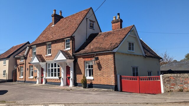
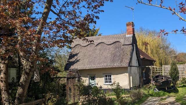
Hitcham is home to a close-knit community, with a population of around 500 residents. It boasts a charming village green, which serves as a focal point for community events and gatherings. The green is surrounded by a few traditional thatched cottages, adding to the village's quaint and historic charm.

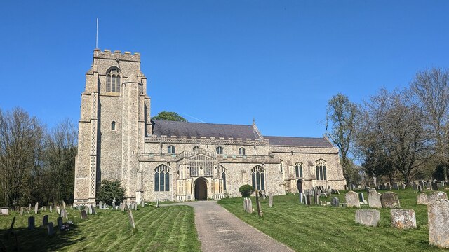
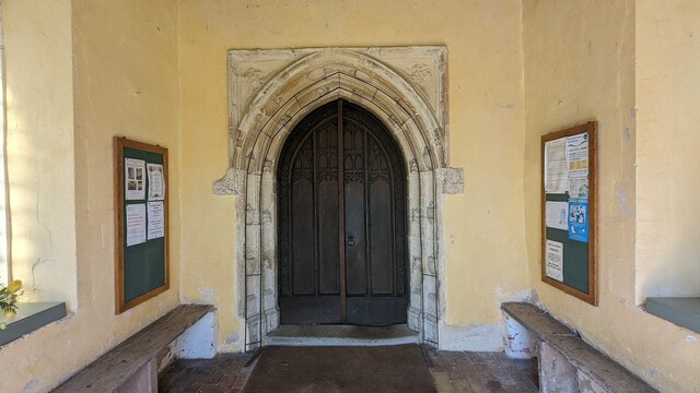
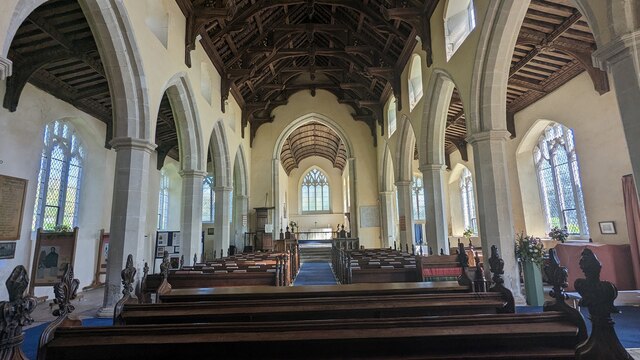
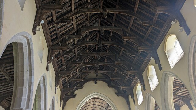
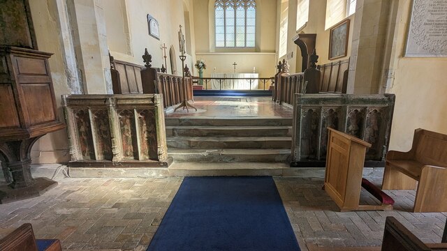
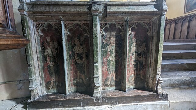
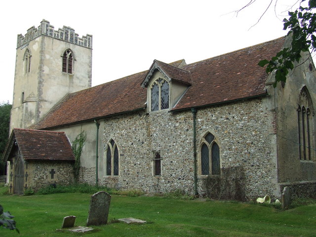
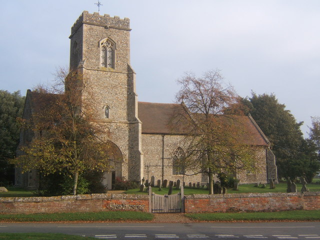
The village also features a medieval church, St. Mary's, which dates back to the 14th century. This beautiful Grade I listed building is renowned for its stunning architecture and intricate stained glass windows. It serves as a place of worship for the local community and is a popular attraction for visitors interested in historical and architectural heritage.

Hitcham is well-connected to neighboring towns and cities, with good transport links via the nearby A1071 road. The village is predominantly residential, with a few local amenities including a village hall, a primary school, and a pub, providing essential services for the residents.

Overall, Hitcham offers a peaceful and scenic retreat from the hustle and bustle of nearby urban areas. Its rich historical heritage, coupled with its natural beauty, makes it an appealing destination for those seeking a tranquil countryside experience in Suffolk.

If you have any feedback on the listing, please let us know in the comments section below.
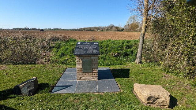
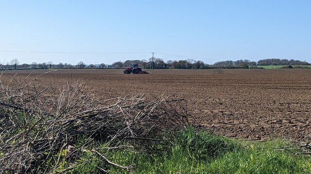
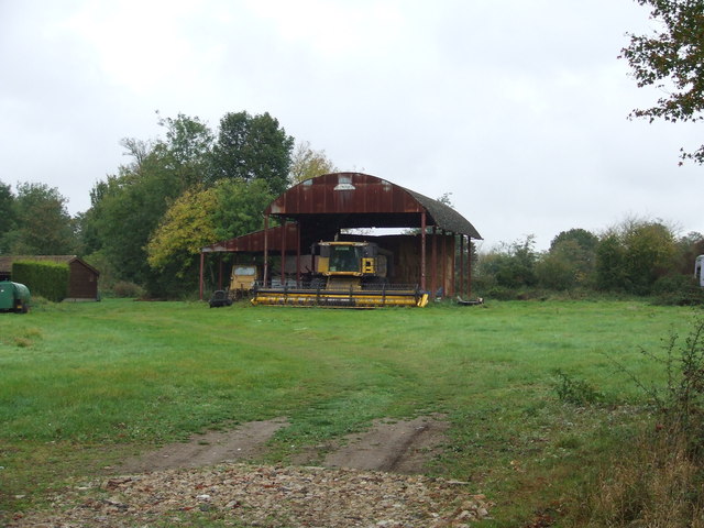
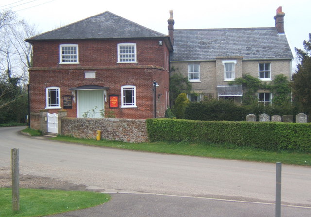
Hitcham Images

Images are sourced within 2km of 52.125472/0.898711 or Grid Reference TL9851. Thanks to Geograph Open Source API. All images are credited.

Church of All Saints, Hitcham <span class="nowrap"><a title="https://historicengland.org.uk/listing/the-list/list-entry/1285593?section=official-list-entry" rel="nofollow ugc noopener" href="https://historicengland.org.uk/listing/the-list/list-entry/1285593?section=official-list-entry">Link</a><img style="margin-left:2px;" alt="External link" title="External link - shift click to open in new window" src="https://s1.geograph.org.uk/img/external.png" width="10" height="10"/></span>
Church of All Saints, Hitcham
Doorway at Church of All Saints, Hitcham <span class="nowrap"><a title="https://historicengland.org.uk/listing/the-list/list-entry/1285593?section=official-list-entry" rel="nofollow ugc noopener" href="https://historicengland.org.uk/listing/the-list/list-entry/1285593?section=official-list-entry">Link</a><img style="margin-left:2px;" alt="External link" title="External link - shift click to open in new window" src="https://s1.geograph.org.uk/img/external.png" width="10" height="10"/></span>
Doorway at Church of All Saints, Hitcham
Interior of Church of All Saints, Hitcham <span class="nowrap"><a title="https://historicengland.org.uk/listing/the-list/list-entry/1285593?section=official-list-entry" rel="nofollow ugc noopener" href="https://historicengland.org.uk/listing/the-list/list-entry/1285593?section=official-list-entry">Link</a><img style="margin-left:2px;" alt="External link" title="External link - shift click to open in new window" src="https://s1.geograph.org.uk/img/external.png" width="10" height="10"/></span>
Interior of Church of All Saints, Hitcham
Double-hammer beam roof at Church of All Saints, Hitcham <span class="nowrap"><a title="https://historicengland.org.uk/listing/the-list/list-entry/1285593?section=official-list-entry" rel="nofollow ugc noopener" href="https://historicengland.org.uk/listing/the-list/list-entry/1285593?section=official-list-entry">Link</a><img style="margin-left:2px;" alt="External link" title="External link - shift click to open in new window" src="https://s1.geograph.org.uk/img/external.png" width="10" height="10"/></span>
Double-hammer beam roof at Church of All Saints, Hitcham
Rood Screen Dado at Church of All Saints, Hitcham <span class="nowrap"><a title="http://www.suffolkchurches.co.uk/hitcham.htm" rel="nofollow ugc noopener" href="http://www.suffolkchurches.co.uk/hitcham.htm">Link</a><img style="margin-left:2px;" alt="External link" title="External link - shift click to open in new window" src="https://s1.geograph.org.uk/img/external.png" width="10" height="10"/></span>
Rood Screen Dado at Church of All Saints, Hitcham
Closer Look at Rood Screen Dado at Church of All Saints, Hitcham <span class="nowrap"><a title="http://www.suffolkchurches.co.uk/hitcham.htm" rel="nofollow ugc noopener" href="http://www.suffolkchurches.co.uk/hitcham.htm">Link</a><img style="margin-left:2px;" alt="External link" title="External link - shift click to open in new window" src="https://s1.geograph.org.uk/img/external.png" width="10" height="10"/></span>
Closer Look at Rood Screen Dado at Church of All Saints, Hitcham
The White Horse <span class="nowrap"><a title="https://historicengland.org.uk/listing/the-list/list-entry/1194824?section=official-list-entry" rel="nofollow ugc noopener" href="https://historicengland.org.uk/listing/the-list/list-entry/1194824?section=official-list-entry">Link</a><img style="margin-left:2px;" alt="External link" title="External link - shift click to open in new window" src="https://s1.geograph.org.uk/img/external.png" width="10" height="10"/></span>
The White Horse
Brook Cottage, Hitcham <span class="nowrap"><a title="https://historicengland.org.uk/listing/the-list/list-entry/1037269?section=official-list-entry" rel="nofollow ugc noopener" href="https://historicengland.org.uk/listing/the-list/list-entry/1037269?section=official-list-entry">Link</a><img style="margin-left:2px;" alt="External link" title="External link - shift click to open in new window" src="https://s1.geograph.org.uk/img/external.png" width="10" height="10"/></span>
Brook Cottage, Hitcham
Memorial to Mid-Air Tragedy - 2nd October 1944 <span class="nowrap"><a title="https://www.iwm.org.uk/memorials/item/memorial/86682" rel="nofollow ugc noopener" href="https://www.iwm.org.uk/memorials/item/memorial/86682">Link</a><img style="margin-left:2px;" alt="External link" title="External link - shift click to open in new window" src="https://s1.geograph.org.uk/img/external.png" width="10" height="10"/></span>
Memorial to Mid-Air Tragedy - 2nd October 1944
Tractor Working in a Field
The White Horse, Hicham
I've got an old combine harvester Old combine stored for the winter at Ennals Farm near to Cross Green, Suffolk.
I've got an old combine harvester
Old combine stored for the winter at Ennals Farm near to Cross Green, Suffolk.
Footpath And Mast Footpath and a now disused mast near to Cross Green, Suffolk.
Footpath And Mast
Footpath and a now disused mast near to Cross Green, Suffolk.
Old Assembly Room Old Assembly Room at Cross Green, Suffolk.
Old Assembly Room
Old Assembly Room at Cross Green, Suffolk.
Grazing, Cross Green
B1115 towards Hitcham
Thatched cottage, Brettenham Road
Barn on Brettenham Road
Show me another place!

Hitcham is located at Grid Ref: TL9851 (Lat: 52.125472, Lng: 0.898711)

Administrative County: Suffolk

District: Babergh

Police Authority: Suffolk

What 3 Words

///speeds.bricks.airstrip. Near Bildeston, Suffolk

Nearby Locations

Hitcham

Related Wikis

Hitcham, Suffolk

Hitcham is a village and civil parish in Suffolk, England. Located on the B1115 road, between Hadleigh and Stowmarket, it is part of Babergh district....

Bildeston

Bildeston is a village and civil parish in the Babergh district of Suffolk, England. Located around 5 miles (8 km) north of Hadleigh, in 2005 it had a...

Kettlebaston

Kettlebaston is a village and a civil parish with just over 30 inhabitants in the Babergh district of Suffolk, England, located around 3 miles (5 km) east...

Wattisham Strict Baptist Chapel

Wattisham Strict Baptist Chapel is a Strict Baptist chapel in the village of Wattisham in Suffolk, England. It was built in 1825 and has been a Grade II...

Wattisham

Wattisham is a village and civil parish near to the town of Stowmarket in Suffolk, England. From the 2011 Census the population of the parish was 110,...

Cosford Hundred

Cosford was a hundred of Suffolk, consisting of 30,712 acres (124.29 km2).The hundred consisted of Hadleigh, the only town of any size, and seventeen other...

Brettenham, Suffolk

Brettenham is a village and civil parish in the Babergh district of Suffolk, England. In 2005 it had a population of 270, increasing to 353 at the 2011...

Old Buckenham Hall School

Old Buckenham Hall School (commonly known as OBH) is a day and boarding preparatory school with pre-prep for boys and girls in the village of Brettenham...

Nearby Amenities

Located within 500m of 52.125472,0.898711
Hitcham
Created By: POI Editor
Place: hamlet
Source: npe
Wikidata: Q2453307
Lat/Long: 52.1232138/0.8950481
Bus Stop
White Horse
Naptan AtcoCode: 390010487
Naptan Bearing: NE
Naptan BusStopType: CUS
Naptan CommonName: White Horse
Naptan Indicator: o/s
Naptan Landmark: White Horse
Naptan NaptanCode: sufagjwj
Naptan Street: B1115
Naptan Verified: no
Public Transport: platform
Source: naptan_import
Lat/Long: 52.1240147/0.8940472
Bus Stop
White Horse
Naptan AtcoCode: 390010488
Naptan Bearing: SW
Naptan BusStopType: CUS
Naptan CommonName: White Horse
Naptan Indicator: opp
Naptan Landmark: White Horse
Naptan NaptanCode: sufagjwm
Naptan Street: B1115
Naptan Verified: no
Public Transport: platform
Source: naptan_import
Lat/Long: 52.1239924/0.8942211
Bus Stop
Squirrels Depot
Naptan AtcoCode: 390010495
Naptan Bearing: SW
Naptan BusStopType: CUS
Naptan CommonName: Squirrels Depot
Naptan Indicator: adj
Naptan Landmark: Squirrels Depot
Naptan NaptanCode: sufagmap
Naptan Street: The Street
Naptan Verified: no
Public Transport: platform
Source: naptan_import
Lat/Long: 52.1255244/0.8988502
Bus Stop
Squirrels Depot
Naptan AtcoCode: 390010496
Naptan Bearing: NE
Naptan BusStopType: CUS
Naptan CommonName: Squirrels Depot
Naptan Indicator: opp
Naptan Landmark: Squirrels Depot
Naptan NaptanCode: sufagmat
Naptan Street: The Street
Naptan Verified: no
Public Transport: platform
Source: naptan_import
Lat/Long: 52.1256167/0.8987539
White Horse (disused)
Disused Highway: bus_stop
Naptan AtcoCode: 390010743
Naptan Bearing: E
Naptan BusStopType: CUS
Naptan CommonName: White Horse
Naptan Indicator: adj
Naptan Landmark: White Horse
Naptan NaptanCode: sufjdmwp
Naptan Street: Bury Road
Naptan Verified: no
Source: naptan_import
Lat/Long: 52.1240796/0.8935985
White Horse (disused)
Disused Highway: bus_stop
Naptan AtcoCode: 390010744
Naptan Bearing: W
Naptan BusStopType: CUS
Naptan CommonName: White Horse
Naptan Indicator: Near
Naptan Landmark: White Horse
Naptan NaptanCode: sufjdmwt
Naptan Street: Bury Road
Naptan Verified: no
Source: naptan_import
Lat/Long: 52.1240164/0.893609
Power: pole
Lat/Long: 52.1222796/0.9033465
Power: pole
Lat/Long: 52.1225102/0.9038775
Power: pole
Lat/Long: 52.1224031/0.9039043
Power: pole
Lat/Long: 52.1225669/0.9030394
Power: pole
Lat/Long: 52.122338/0.9037381
Power: pole
Lat/Long: 52.1231812/0.9021261
Power: pole
Lat/Long: 52.122576/0.9037971
Power: pole
Lat/Long: 52.1224591/0.9039634
Power: pole
Lat/Long: 52.1291601/0.9005998
Power: pole
Lat/Long: 52.1267602/0.8993581
Power: pole
Lat/Long: 52.1257752/0.8991374
Power: pole
Lat/Long: 52.1254944/0.8959201
Power: pole
Lat/Long: 52.1243298/0.9002754
Power: pole
Lat/Long: 52.1255718/0.8965732
Power: pole
Lat/Long: 52.1255286/0.8994117
Power: pole
Lat/Long: 52.1250758/0.8997362
Power: pole
Lat/Long: 52.1239222/0.8996611
Power: pole
Lat/Long: 52.1237485/0.9012115
Power: pole
Lat/Long: 52.1261317/0.8986493
Power: pole
Lat/Long: 52.1257003/0.8977266
Power: pole
Lat/Long: 52.1283496/0.9002129
Barrier: kissing_gate
Lat/Long: 52.1240965/0.8974959
Barrier: kissing_gate
Lat/Long: 52.1229816/0.8976378
The data included in this document is from www.openstreetmap.org. The data is made available under ODbL.

Have you been to Hitcham?

Leave your review of Hitcham below (or comments, questions and feedback).