Sgorrach Nuadh

Hill, Mountain in Perthshire

Scotland

Sgorrach Nuadh

Showery morning on track through Glen Kendrum A rainbow on a day that rain wasn't forecast.
Showery morning on track through Glen Kendrum Credit: Colin Park

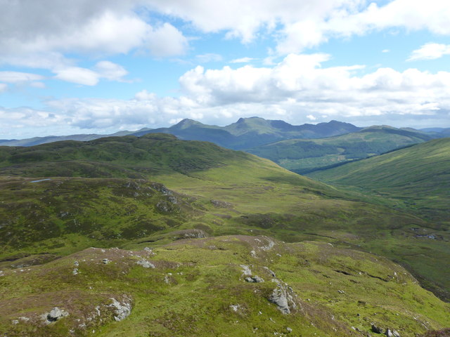
Sgorrach Nuadh is a prominent hill located in the county of Perthshire, Scotland. It is part of the larger Grampian Mountains, which stretch across the central and northeastern parts of the country. Standing at an impressive height of approximately 900 meters (2,953 feet), Sgorrach Nuadh offers breathtaking panoramic views of the surrounding landscape.

The hill is situated within the Cairngorms National Park, a protected area known for its diverse wildlife and stunning natural beauty. The terrain of Sgorrach Nuadh is characterized by rugged slopes, rocky outcrops, and heather-covered moorlands. It is a popular destination for outdoor enthusiasts, hikers, and mountaineers looking to challenge themselves and experience the beauty of the Scottish Highlands.

The ascent of Sgorrach Nuadh can be demanding, but the reward is worth the effort. From the summit, visitors are treated to sweeping vistas of the surrounding mountains, glens, and lochs. On clear days, it is even possible to catch a glimpse of the Cairngorms' highest peak, Ben Macdui, further to the northeast.

The hill is easily accessible from nearby towns and villages, such as Pitlochry and Blair Atholl, with well-marked trails leading to its summit. It is advisable to be properly prepared for the climb, as weather conditions in the area can change rapidly, and the terrain can be challenging.

Overall, Sgorrach Nuadh is a captivating natural landmark in Perthshire, offering outdoor enthusiasts a chance to immerse themselves in the stunning Scottish Highlands and take in the awe-inspiring beauty of the surrounding landscape.

If you have any feedback on the listing, please let us know in the comments section below.

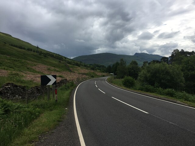
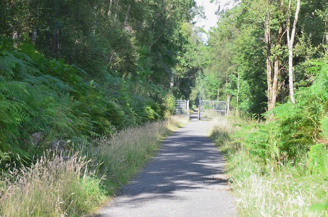
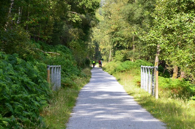
Sgorrach Nuadh Images

Images are sourced within 2km of 56.397404/-4.3197647 or Grid Reference NN5625. Thanks to Geograph Open Source API. All images are credited.

Showery morning on track through Glen Kendrum A rainbow on a day that rain wasn't forecast.
Showery morning on track through Glen Kendrum
A rainbow on a day that rain wasn't forecast.
New footbridge over Kendrum Burn, Glen Kendrum This new footbridge provides an alternative fairly direct descent from Meall an t-Seallaidh.
New footbridge over Kendrum Burn, Glen Kendrum
This new footbridge provides an alternative fairly direct descent from Meall an t-Seallaidh.
A85 in Glen Ogle
A85 in Glen Ogle
A85 in Glen Ogle
A85 in Glen Ogle
Glen Ogle Viaduct by A85 half way up Glen Ogle Twelve-arch Glen Ogle Viaduct built by John Strain, circa 1866. The viaduct, comprising twelve segmental arches with sturdy tapered piers, formerly carried the Callander and Oban Railway over open ground in the east flank of Meall Reamhar. It was 139ft long overall and 44ft high with a single track. It now carries the official footpath, Rob Roy Way. A three-arched bridge (Glen Ogle Small Viaduct) forms the southward continuation viaduct. The railway received Royal assent on 5th July 1865. The contract for this section was let to J McKay and it opened in August 1868. The line closed here in 1965 following the ‘Glen Ogle Rockfall’ not far south of the viaduct.
Glen Ogle Viaduct by A85 half way up Glen Ogle
Twelve-arch Glen Ogle Viaduct built by John Strain, circa 1866. The viaduct, comprising twelve segmental arches with sturdy tapered piers, formerly carried the Callander and Oban Railway over open ground in the east flank of Meall Reamhar. It was 139ft long overall and 44ft high with a single track. It now carries the official footpath, Rob Roy Way. A three-arched bridge (Glen Ogle Small Viaduct) forms the southward continuation viaduct. The railway received Royal assent on 5th July 1865. The contract for this section was let to J McKay and it opened in August 1868. The line closed here in 1965 following the ‘Glen Ogle Rockfall’ not far south of the viaduct.
A85 towards Lochearnhead
Glen Kendrum Approaching the ford over the Kendrum Burn on the track towards Creag Mac Rànaich.
Glen Kendrum
Approaching the ford over the Kendrum Burn on the track towards Creag Mac Rànaich.
Track approaching Creag MacRànaich After crossing the ford over the Kendrum Burn on the way from Lochearnhead, the track climbs more steeply until it reaches the bealach between Creag MacRànaich and Meall an t-Seallaidh.
Track approaching Creag MacRànaich
After crossing the ford over the Kendrum Burn on the way from Lochearnhead, the track climbs more steeply until it reaches the bealach between Creag MacRànaich and Meall an t-Seallaidh.
Meall Sgallachd Meall Sgallachd ('bald-headed lump') is a minor top north-east of Creag MacRànaich.
Meall Sgallachd
Meall Sgallachd ('bald-headed lump') is a minor top north-east of Creag MacRànaich.
Spur leading south from Meall Sgallachd On the left of the photo is the lumpy hillside of Meall Reamhar, with Glen Kendrum down below on the right.  Ben Vorlich, Stuc a' Chroin and Beinn Each form a high, knobbly ridge of the skyline.
Spur leading south from Meall Sgallachd
On the left of the photo is the lumpy hillside of Meall Reamhar, with Glen Kendrum down below on the right. Ben Vorlich, Stuc a' Chroin and Beinn Each form a high, knobbly ridge of the skyline.
Cycle path up through Glen Ogle at Glen Ogle Viaduct
Glen Ogle viaduct Looking through one of the twelve arches on the disused Category B Listed <span class="nowrap"><a title="http://portal.historic-scotland.gov.uk/hes/web/f?p=PORTAL:DESIGNATION:::::DES:LB4141" rel="nofollow ugc noopener" href="http://portal.historic-scotland.gov.uk/hes/web/f?p=PORTAL:DESIGNATION:::::DES:LB4141">Link</a><img style="margin-left:2px;" alt="External link" title="External link - shift click to open in new window" src="https://s1.geograph.org.uk/img/external.png" width="10" height="10"/></span> railway viaduct to Glen Ogle and the A85 road.
Glen Ogle viaduct
Looking through one of the twelve arches on the disused Category B Listed LinkExternal link railway viaduct to Glen Ogle and the A85 road.
Former railway through Glen Ogle The Rob Roy Way (Drymen to Pitlochry) and cyclepath now share this route climbing gently to the pass at nearly 300m.
Former railway through Glen Ogle
The Rob Roy Way (Drymen to Pitlochry) and cyclepath now share this route climbing gently to the pass at nearly 300m.
Cyclists on the Glen Ogle route On the gently climbing route using the old railway to Crianlarich with a branch to Killin.
Cyclists on the Glen Ogle route
On the gently climbing route using the old railway to Crianlarich with a branch to Killin.
Rockfall warning sign, Glen Ogle A warning of rockfalls and possibly eroded path surface on the route of the old railway through Glen Ogle, now earning its keep as the Glen Ogle Trail, Rob Roy Way and National Cycle Network route 7.
Rockfall warning sign, Glen Ogle
A warning of rockfalls and possibly eroded path surface on the route of the old railway through Glen Ogle, now earning its keep as the Glen Ogle Trail, Rob Roy Way and National Cycle Network route 7.
A85 in Glen Ogle The road south from Lix Toll to Lochearnhead seen from the Rob Roy Way on the old railway.
A85 in Glen Ogle
The road south from Lix Toll to Lochearnhead seen from the Rob Roy Way on the old railway.
Rock cutting in Glen Ogle Either a small crag or a giant boulder by the old railway which was threatened by boulders and scree on the hillside above - see <a href="https://www.geograph.org.uk/photo/773626">NN5726 : Boulder field on the west side of Glen Ogle</a>. Note the stabilising brickwork.
Rock cutting in Glen Ogle
Either a small crag or a giant boulder by the old railway which was threatened by boulders and scree on the hillside above - see NN5726 : Boulder field on the west side of Glen Ogle. Note the stabilising brickwork.
Glen Ogle Viaduct The viaduct takes the railway route across the only substantial burn from the ridge of Meall Reamhar. The A85 road can be seen R approaching the summit of the pass over to Glen Dochart.
Glen Ogle Viaduct
The viaduct takes the railway route across the only substantial burn from the ridge of Meall Reamhar. The A85 road can be seen R approaching the summit of the pass over to Glen Dochart.
Show me another place!

Sgorrach Nuadh is located at Grid Ref: NN5625 (Lat: 56.397404, Lng: -4.3197647)

Unitary Authority: Stirling

Police Authority: Forth Valley

What 3 Words

///admire.enjoys.glider. Near Callander, Stirling

Nearby Locations

Sgorrach Nuadh

Related Wikis

Glen Ogle

Glen Ogle (Scottish Gaelic: Gleann Ogail) extends 7 miles north westwards from Lochearnhead to Lix Toll, where it opens into Glen Dochart. The Ogle Burn...

Lochearnhead railway station

Lochearnhead is a former railway station in the village of Lochearnhead in Perthshire. It opened in 1904 as part of the Comrie, St Fillans & Lochearnhead...

Lochearnhead

Lochearnhead (Scottish Gaelic: Ceann Loch Èireann) is a village in Perthshire on the A84 Stirling to Crianlarich road at the foot of Glen Ogle, 14 miles...

Glenoglehead railway station

Glenoglehead was a railway station located at the head of Glen Ogle, Stirling district, Scotland. It was situated on a remote mountainside, some 3 miles...

Nearby Amenities

Located within 500m of 56.397404,-4.3197647
Ele: 658
Natural: peak
Lat/Long: 56.3974228/-4.320547
The data included in this document is from www.openstreetmap.org. The data is made available under ODbL.

Have you been to Sgorrach Nuadh?

Leave your review of Sgorrach Nuadh below (or comments, questions and feedback).