Ben Ledi

Hill, Mountain in Perthshire

Scotland

Ben Ledi

Above Bealach nan Corp On Ben Ledi's north west ridge above the pass of the dead, presumably the route of an old coffin road. The snowy hills in the distance are Stob Binnean and Ben More with Benvane just below and to their right. A lovely day to be out on the hills.
Above Bealach nan Corp Credit: Adam Ward

Ben Ledi is a prominent hill located in Perthshire, Scotland. Standing at an elevation of 879 meters (2,884 feet), it is categorized as a Corbett, a term used to describe a mountain in Scotland between 2,500 and 3,000 feet high. The hill is situated near the town of Callander and is a popular destination for outdoor enthusiasts and hikers.

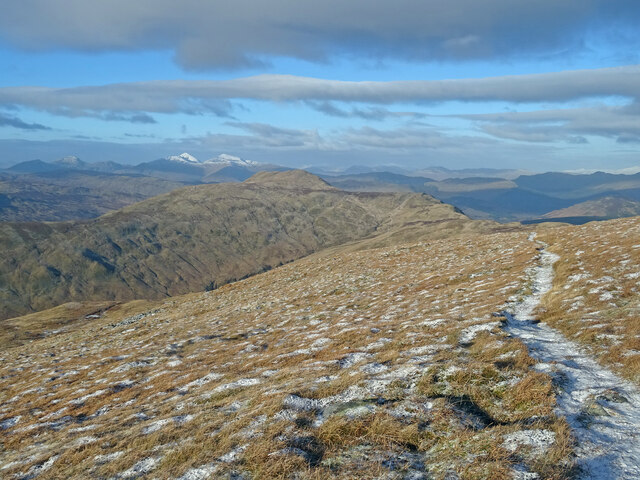
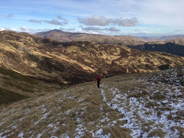
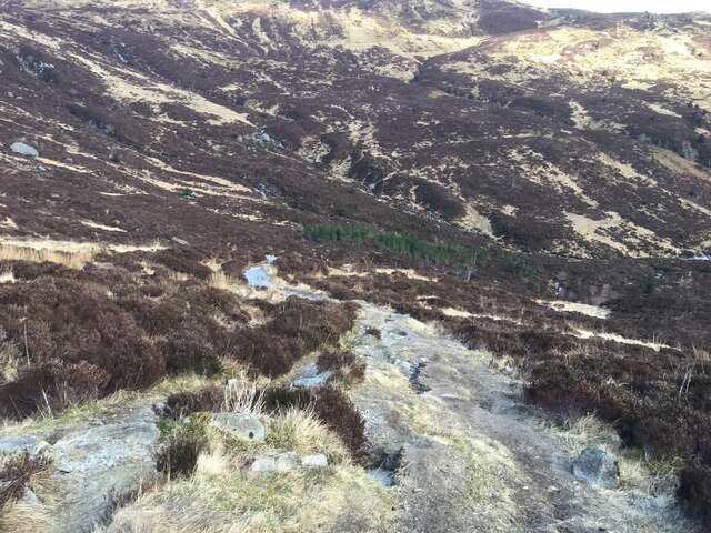
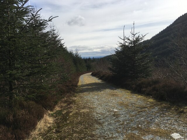
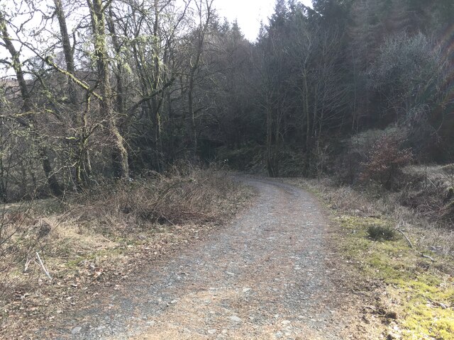
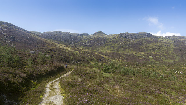
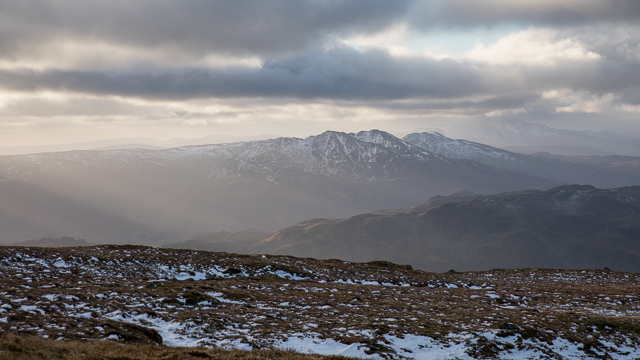
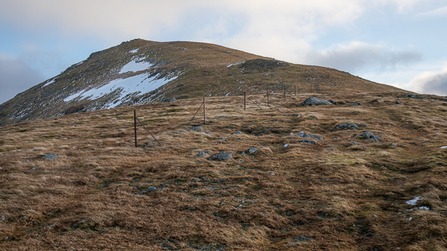
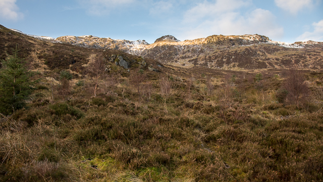
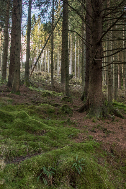
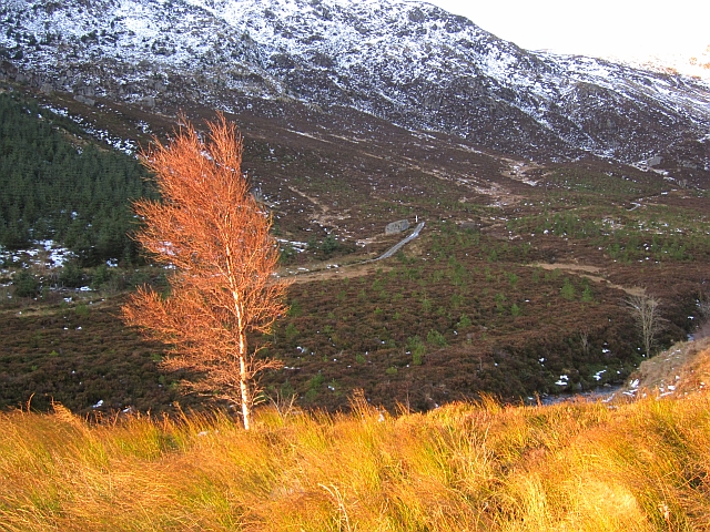
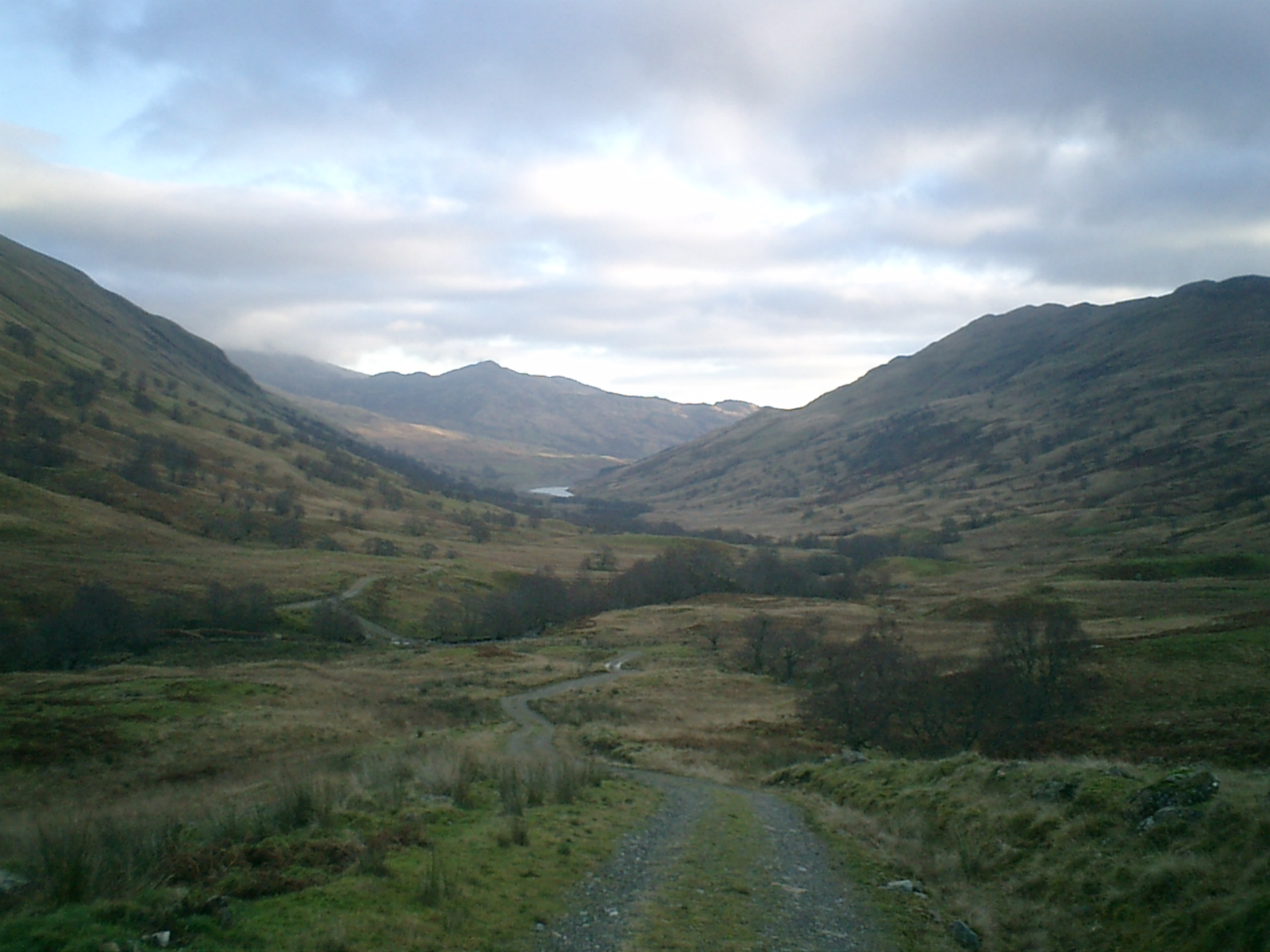
Ben Ledi offers breathtaking panoramic views of the surrounding countryside, including the Trossachs National Park and Loch Lubnaig. The ascent to the summit is a rewarding experience, with well-marked trails that cater to various levels of fitness. The most popular route starts from the car park at the foot of the hill and follows a well-maintained path through woodlands, before opening up to exposed slopes and rocky terrain closer to the summit.

The hill's diverse flora and fauna add to its allure. Hikers may encounter a variety of wildlife such as red deer, mountain hares, and a variety of bird species, including golden eagles and peregrine falcons. During the summer months, the hillside is adorned with colorful wildflowers, creating a picturesque landscape.

Due to its accessibility and proximity to major towns and cities, Ben Ledi attracts a significant number of visitors each year. Its location in the heart of the Trossachs makes it an ideal starting point for exploring the region's stunning natural beauty. Whether it be a challenging hike to the summit or a leisurely stroll along its lower slopes, Ben Ledi offers a memorable experience for nature lovers and outdoor enthusiasts alike.

If you have any feedback on the listing, please let us know in the comments section below.

Ben Ledi Images

Images are sourced within 2km of 56.258667/-4.3223884 or Grid Reference NN5609. Thanks to Geograph Open Source API. All images are credited.

Above Bealach nan Corp On Ben Ledi's north west ridge above the pass of the dead, presumably the route of an old coffin road. The snowy hills in the distance are Stob Binnean and Ben More with Benvane just below and to their right. A lovely day to be out on the hills.
Above Bealach nan Corp
On Ben Ledi's north west ridge above the pass of the dead, presumably the route of an old coffin road. The snowy hills in the distance are Stob Binnean and Ben More with Benvane just below and to their right. A lovely day to be out on the hills.
Northern slopes of Ben Ledi
Old fence line on Ben Ledi
Path towards Stank Glen
Path into Stank Glen
Forestry road in Stank Glen
Path in the Stank Glen A path crossing moorland and forestry in the Stank Glen.
Path in the Stank Glen
A path crossing moorland and forestry in the Stank Glen.
On the north ridge of Ben Ledi looking towards Ben Venue
Looking up the north ridge of Ben Ledi
Creag na h-Iolaire from the end of Stank Glen
Forest in Queen Elizabeth Forest Park
North Ridge Ben Ledi A very different scene to the one seen here from the same viewpoint:-
<a title="https://www.geograph.org.uk/photo/4052248" href="https://www.geograph.org.uk/photo/4052248">Link</a>

Still very much winter on the summits. The figure gives a sense of scale.
North Ridge Ben Ledi
A very different scene to the one seen here from the same viewpoint:- Link Still very much winter on the summits. The figure gives a sense of scale.
Gleann Casaig
Gleann Casaig
Burn on hillside below Creag Chath-bhoc
Logging road above Stank Quite icy due to compression of the snow, but progress was aided by a convoy of Killin Mountain Rescue team vehicles which broke up some of the ice.
Logging road above Stank
Quite icy due to compression of the snow, but progress was aided by a convoy of Killin Mountain Rescue team vehicles which broke up some of the ice.
Logging road, Stank Glen The floor of the upper glen has been left to grow birches or planted with Scots pine. The Sitka has been banished to the steeper slopes.
Logging road, Stank Glen
The floor of the upper glen has been left to grow birches or planted with Scots pine. The Sitka has been banished to the steeper slopes.
Birch, Stank Glen This part of the Stank Glen has been planted with Scots pines. Ben Ledi is in the background.
Birch, Stank Glen
This part of the Stank Glen has been planted with Scots pines. Ben Ledi is in the background.
Show me another place!

Ben Ledi is located at Grid Ref: NN5609 (Lat: 56.258667, Lng: -4.3223884)

Unitary Authority: Stirling

Police Authority: Forth Valley

What 3 Words

///unearthly.hurray.ombudsman. Near Callander, Stirling

Nearby Locations

Coire na Mèine Ben Ledi

Related Wikis

Ben Ledi

Ben Ledi (Beinn Leitir in Scottish Gaelic) is a mountain in Stirling, Scotland. It is 879 metres (2,884 feet) high, and is therefore classified as a Corbett...

Falls of Leny

The Falls of Leny are a series of waterfalls in the Trossachs of Scotland on the course of the Garbh Uisge, otherwise known as the River Leny, where the...

Glen Finglas

Glen Finglas (Scottish Gaelic: Gleann Fhionnghlais) is a glen in the Trossachs, in the Stirling council area of Scotland. It is an area of forest in Highlands...

Loch Lubnaig

Loch Lubnaig (Loch Lùbnaig in Gaelic) is a small freshwater loch near Callander in the Stirling council area, Scottish Highlands. It lies in the former...

Nearby Amenities

Located within 500m of 56.258667,-4.3223884
Ben Ledi
Corbett: yes
Ele: 879
Marilyn: yes
Munro: no
Natural: peak
Prominence: 528
Wikidata: Q816543
Wikipedia: en:Ben Ledi
Lat/Long: 56.258607/-4.3221237
Man Made: survey_point
Ref: 6956
Source: survey
Lat/Long: 56.258609/-4.322133
Sgt. Harry Lawrie
Historic: memorial
Inscription: In memory of Sgt. Harry Lawrie killed on duty with Killin Mountain Rescue team Ben More February 1st 1987
Memorial: cross
Lat/Long: 56.2583078/-4.3214518
Mullach Buidhe
Natural: peak
Source: OS OpenMap Local (April 2021)
Lat/Long: 56.2619488/-4.3252015
The data included in this document is from www.openstreetmap.org. The data is made available under ODbL.

Have you been to Ben Ledi?

Leave your review of Ben Ledi below (or comments, questions and feedback).