Clachertyfarlie Knowes

Hill, Mountain in Stirlingshire

Scotland

Clachertyfarlie Knowes

Summit of Dumgoyne. Such a fine peak, so someone has to leave their mark. This little piece of lamp-post widdling is a lump of alien rock hauled up by helicopter courtesy of Strathendrick Rotarians in 2000. A lot of nonsense in 2000 - must be those noughts.
Summit of Dumgoyne. Credit: Richard Webb

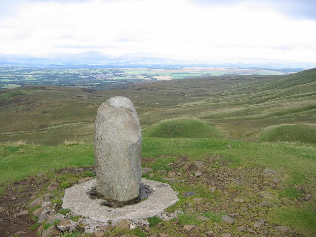
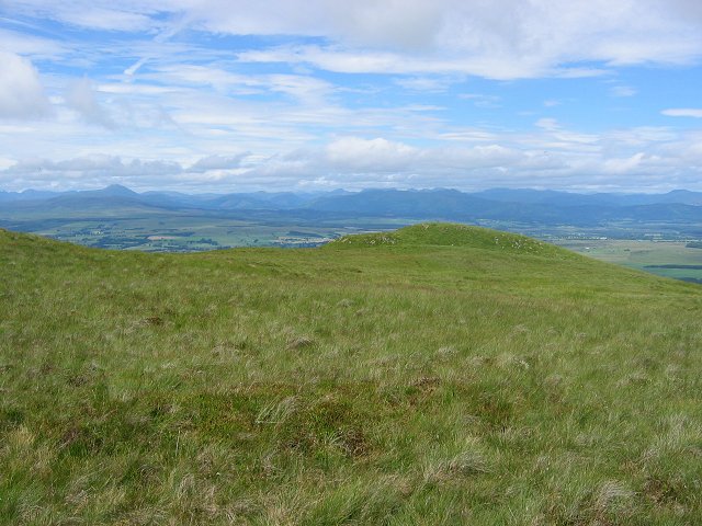
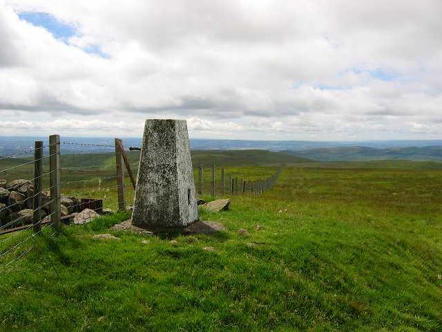
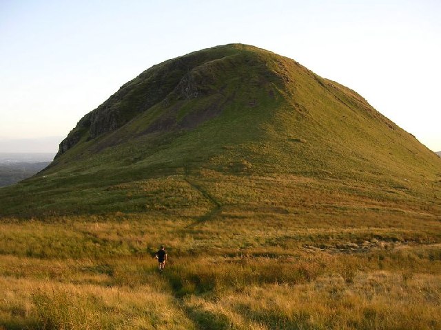
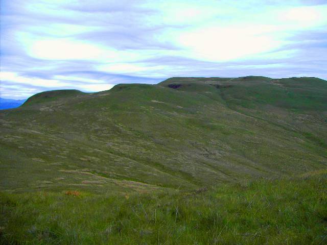
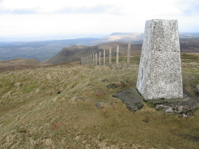
Clachertyfarlie Knowes is a prominent hill located in Stirlingshire, Scotland. Situated in the heart of the Stirling Council area, it forms part of the Campsie Fells range, which stretches across East Dunbartonshire and North Lanarkshire as well. The hill stands at an elevation of approximately 448 meters (1,470 feet) above sea level and offers breathtaking panoramic views of the surrounding countryside.

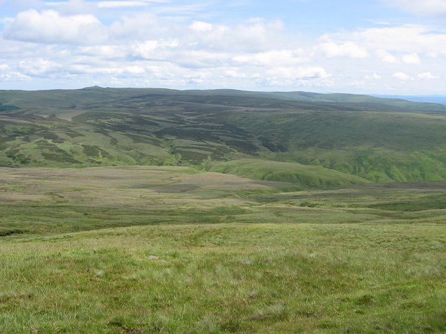
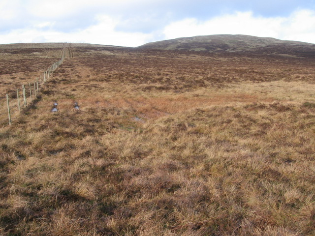
The name "Clachertyfarlie Knowes" is derived from the Scottish Gaelic language, with "Clachertyfarlie" meaning "rocky hill" and "Knowes" referring to the rounded summit. The hill is characterized by its rugged and rocky terrain, covered in heather and grasses, with scattered outcrops of exposed bedrock.

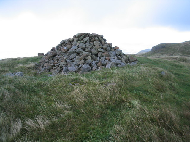
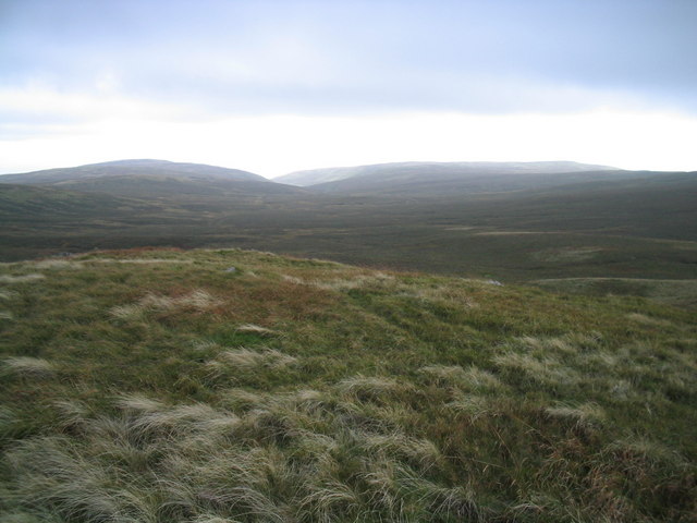
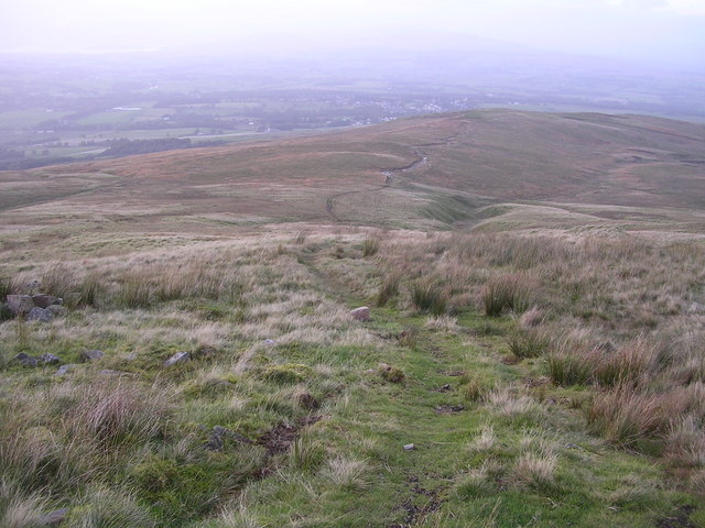
Clachertyfarlie Knowes attracts outdoor enthusiasts, hikers, and nature lovers who seek a challenging yet rewarding climb. Several well-defined paths and trails lead up the hill, providing varying levels of difficulty for walkers of different abilities. The ascent to the summit offers stunning views of the Campsie Fells, the Stirling countryside, and on clear days, even the distant peaks of the Trossachs and the Southern Highlands.

The hill is also home to a diverse range of flora and fauna, with heather and bilberry covering the slopes, and birds such as peregrine falcons, kestrels, and meadow pipits frequently spotted in the area. It is advised to be prepared for changing weather conditions when visiting Clachertyfarlie Knowes, as the exposed nature of the hill can make it susceptible to strong winds and sudden changes in temperature.

Overall, Clachertyfarlie Knowes is a picturesque and rewarding hill in Stirlingshire, offering visitors an opportunity to immerse themselves in the natural beauty and tranquility of the Scottish landscape.

If you have any feedback on the listing, please let us know in the comments section below.

Clachertyfarlie Knowes Images

Images are sourced within 2km of 56.02174/-4.3168854 or Grid Reference NS5583. Thanks to Geograph Open Source API. All images are credited.

Summit of Dumgoyne. Such a fine peak, so someone has to leave their mark. This little piece of lamp-post widdling is a lump of alien rock hauled up by helicopter courtesy of Strathendrick Rotarians in 2000. A lot of nonsense in 2000 - must be those noughts.
Summit of Dumgoyne.
Such a fine peak, so someone has to leave their mark. This little piece of lamp-post widdling is a lump of alien rock hauled up by helicopter courtesy of Strathendrick Rotarians in 2000. A lot of nonsense in 2000 - must be those noughts.
Moorland, Earl's Seat. The plateau, just below the summit of Earl's Seat, and before the plunge over the scap.
Moorland, Earl's Seat.
The plateau, just below the summit of Earl's Seat, and before the plunge over the scap.
Summit, Earl's Seat Highest point in the Campsie Fells and a fine view point overlooking Glasgow and Loch Lomond.
Summit, Earl's Seat
Highest point in the Campsie Fells and a fine view point overlooking Glasgow and Loch Lomond.
Campsie Plateau Eastward view from below the summit of Earl's seat showing the big undulating boggy plateau of the Campsie Fells.
Campsie Plateau
Eastward view from below the summit of Earl's seat showing the big undulating boggy plateau of the Campsie Fells.
Dumgoyne Eddie Dealtry running up Dumgoyne
Dumgoyne
Eddie Dealtry running up Dumgoyne
Summit of Slackdhu A fine viewpoint overlooking Strathblane
Summit of Slackdhu
A fine viewpoint overlooking Strathblane
Stonen Glen Looking up the burn into the upper reaches of Stonen Glen in the western Campsies.
Stonen Glen
Looking up the burn into the upper reaches of Stonen Glen in the western Campsies.
Lower Stonen Glen Looking down the Stonen Glen burn towards wooded Dumgoyach and the distant Kilpatrick Hills
Lower Stonen Glen
Looking down the Stonen Glen burn towards wooded Dumgoyach and the distant Kilpatrick Hills
Clachertyfarlie Knowes The oddly named Clachertyfarlie Knowes at the north west corner of the Campsies, seen from Dumfoyn.
Clachertyfarlie Knowes
The oddly named Clachertyfarlie Knowes at the north west corner of the Campsies, seen from Dumfoyn.
Garloch Hill cairn This cairn lies on the ill defined summit of Garloch Hill which is slightly lower than nearby Clachertyfarlie Knowes.
Garloch Hill cairn
This cairn lies on the ill defined summit of Garloch Hill which is slightly lower than nearby Clachertyfarlie Knowes.
Ballagan Tops cairn This cairn lies on the more westerly of the two Ballagan tops.
Ballagan Tops cairn
This cairn lies on the more westerly of the two Ballagan tops.
View from Ballagan Tops down Ballagan Burn View of the head of the valley formed by Ballagan Burn with typical tussocky moorland grass in the foreground.
View from Ballagan Tops down Ballagan Burn
View of the head of the valley formed by Ballagan Burn with typical tussocky moorland grass in the foreground.
Rough Track from Campsies to Killearn Rough track (not shown on OS maps) leading off the Campsies towards the village of Killearn
Rough Track from Campsies to Killearn
Rough track (not shown on OS maps) leading off the Campsies towards the village of Killearn
Summit of Garloch Hill Looking west towards Loch Lomond at sunset
Summit of Garloch Hill
Looking west towards Loch Lomond at sunset
Summit of Owsen Hill Lonely summit in the Campsies
Summit of Owsen Hill
Lonely summit in the Campsies
Little Earl Summit Little visited summit in the Campsies
Little Earl Summit
Little visited summit in the Campsies
Between Owsen Hill and Little Earl
Earl's Seat trig point S1622 towards Allanrowie
Show me another place!

Clachertyfarlie Knowes is located at Grid Ref: NS5583 (Lat: 56.02174, Lng: -4.3168854)

Unitary Authority: Stirling

Police Authority: Forth Valley

What 3 Words

///remedy.supposing.romance. Near Killearn, Stirling

Related Wikis

Campsie Fells

The Campsie Fells (also known as the Campsies; Scottish Gaelic: Monadh Chamaisidh) are a range of hills in central Scotland, stretching east to west from...

Earl's Seat

Earl's Seat (578 m) is the highest hill of the Campsie Fells in Central Scotland. It lies on the border of Stirlingshire and East Dunbartonshire in central...

Dumfoyn

Dumfoyn is a hill in the Campsie Fells of Scotland. It is a volcanic plug, and rises to 426 metres (1,398 ft). It sits beside another hill, Dumgoyne which...

Dumgoyne

Dumgoyne is a hill prominent on the edge of the Campsie Fells and is a well-known landmark visible from Glasgow. It is a volcanic plug and is 427 m (1...

Nearby Amenities

Located within 500m of 56.02174,-4.3168854
Garloch Hill
Corbett: no
Ele: 542
Graham: no
Munro: no
Natural: peak
Lat/Long: 56.0234453/-4.3218097
Clachertyfarlie Knowes
Corbett: no
Graham: no
Munro: no
Natural: peak
Lat/Long: 56.0211807/-4.3169888
Man Made: cairn
Lat/Long: 56.0237722/-4.3233108
The data included in this document is from www.openstreetmap.org. The data is made available under ODbL.

Have you been to Clachertyfarlie Knowes?

Leave your review of Clachertyfarlie Knowes below (or comments, questions and feedback).