Hirael

Settlement in Caernarfonshire

Wales

Hirael

Penrhyn Castle Penrhyn Castle is a country house near Bangor, in the form of a Norman castle. The present building was created between about 1822 and 1837 to designs by Thomas Hopper for George Hay Dawkins-Pennant who owned the Penrhyn Estate.
Penrhyn Castle Credit: Steve Daniels

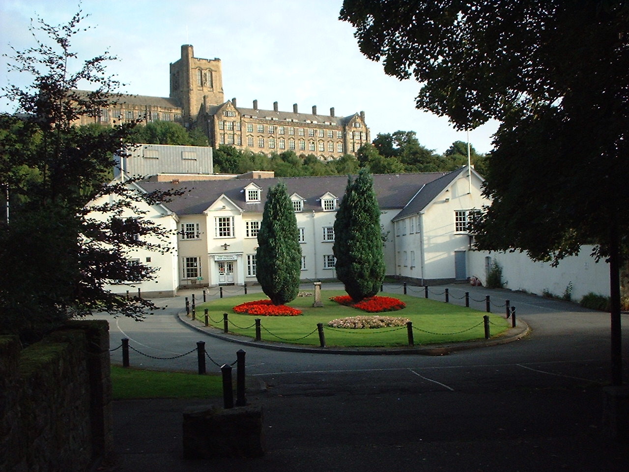
Hirael is a small area located in the historic county of Caernarfonshire, Wales. Situated just south of the town of Caernarfon, it lies on the southern bank of the Menai Strait, offering stunning views of the water and the nearby Isle of Anglesey.

Once a thriving industrial area, Hirael became known for its shipbuilding and slate quarrying activities in the 19th century. Today, it has transformed into a residential neighborhood, characterized by rows of terraced houses and a close-knit community.

Hirael enjoys a convenient location, being within walking distance of the town center of Caernarfon. This provides residents with easy access to a range of amenities, including shops, restaurants, and leisure facilities. The area also has good transport links, with regular bus services connecting it to surrounding towns and villages.

Nature enthusiasts will appreciate the proximity of Hirael to the stunning Snowdonia National Park, which is just a short drive away. This offers opportunities for outdoor activities such as hiking, mountain biking, and wildlife spotting.

Hirael is also home to several notable landmarks, including the Grade II listed St. Mary's Church, which dates back to the 14th century. The church's architecture is a blend of Gothic and Georgian styles, making it a notable attraction for history buffs and architecture enthusiasts.

Overall, Hirael provides a peaceful residential setting with a rich history and breathtaking natural surroundings. Its proximity to Caernarfon and the Menai Strait make it an attractive place to live for those seeking a balance between urban convenience and natural beauty.

If you have any feedback on the listing, please let us know in the comments section below.
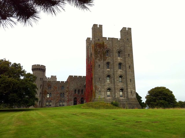
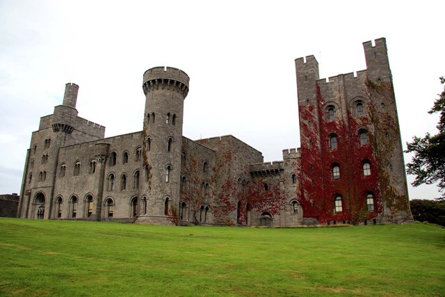
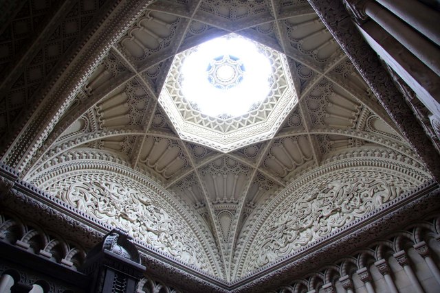
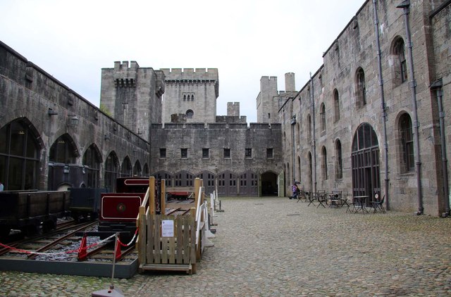
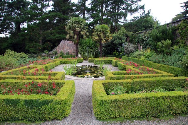
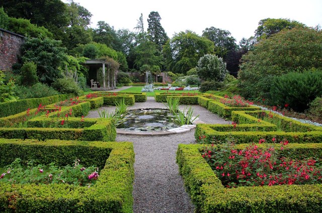
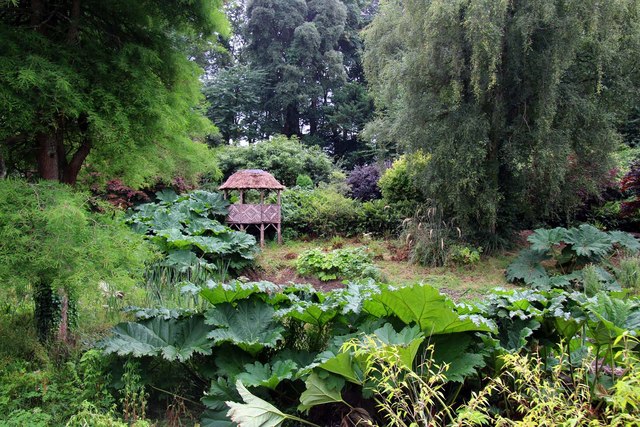
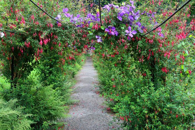
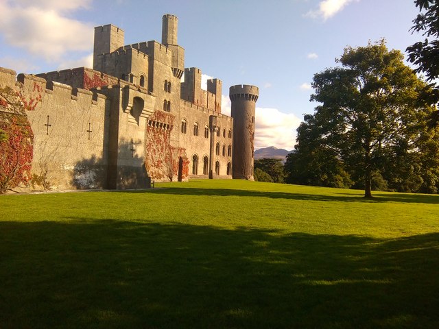
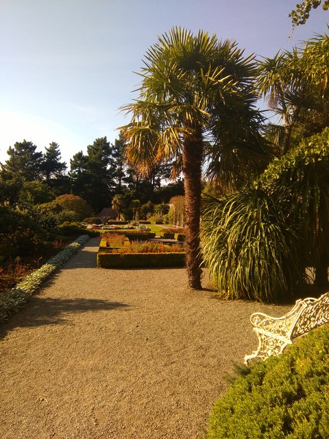
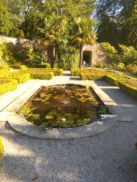
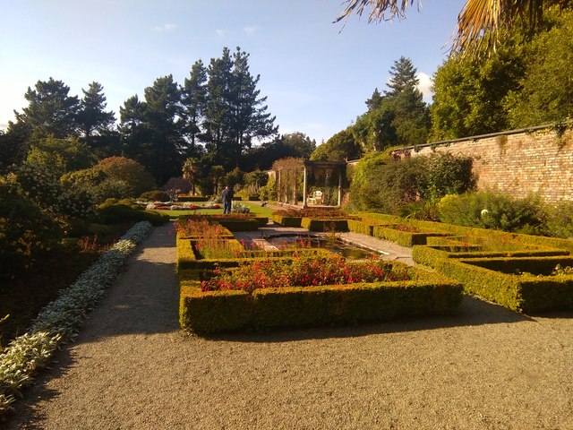
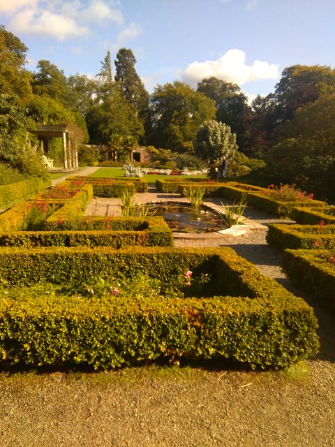
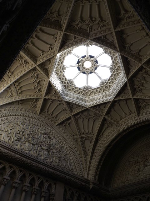
Hirael Images

Images are sourced within 2km of 53.232227/-4.122192 or Grid Reference SH5872. Thanks to Geograph Open Source API. All images are credited.

Penrhyn Castle Penrhyn Castle is a country house near Bangor, in the form of a Norman castle. The present building was created between about 1822 and 1837 to designs by Thomas Hopper for George Hay Dawkins-Pennant who owned the Penrhyn Estate.
Penrhyn Castle
Penrhyn Castle is a country house near Bangor, in the form of a Norman castle. The present building was created between about 1822 and 1837 to designs by Thomas Hopper for George Hay Dawkins-Pennant who owned the Penrhyn Estate.
The ceiling in the library at Penrhyn Castle The ceiling is decorated with Italian plaster mouldings.
The ceiling in the library at Penrhyn Castle
The ceiling is decorated with Italian plaster mouldings.
The Grand Staircase in Penrhyn Castle A stone staircase built in a Norman style.
The Grand Staircase in Penrhyn Castle
A stone staircase built in a Norman style.
The ceiling above the Grand Staircase in Penrhyn Castle Penrhyn Castle is a country house near Bangor, in the form of a Norman castle. The present building was created between about 1822 and 1837 to designs by Thomas Hopper for George Hay Dawkins-Pennant who owned the Penrhyn Estate.
The ceiling above the Grand Staircase in Penrhyn Castle
Penrhyn Castle is a country house near Bangor, in the form of a Norman castle. The present building was created between about 1822 and 1837 to designs by Thomas Hopper for George Hay Dawkins-Pennant who owned the Penrhyn Estate.
The State Bedroom in Penrhyn Castle Penrhyn Castle is a country house near Bangor, in the form of a Norman castle. The present building was created between about 1822 and 1837 to designs by Thomas Hopper for George Hay Dawkins-Pennant who owned the Penrhyn Estate. 
Queen Victoria is reported to have slept in this bed.
The State Bedroom in Penrhyn Castle
Penrhyn Castle is a country house near Bangor, in the form of a Norman castle. The present building was created between about 1822 and 1837 to designs by Thomas Hopper for George Hay Dawkins-Pennant who owned the Penrhyn Estate. Queen Victoria is reported to have slept in this bed.
The Railway Museum in Penrhyn Castle Penrhyn Castle is a country house near Bangor, in the form of a Norman castle. The present building was created between about 1822 and 1837 to designs by Thomas Hopper for George Hay Dawkins-Pennant who owned the Penrhyn Estate.
The Railway Museum in Penrhyn Castle
Penrhyn Castle is a country house near Bangor, in the form of a Norman castle. The present building was created between about 1822 and 1837 to designs by Thomas Hopper for George Hay Dawkins-Pennant who owned the Penrhyn Estate.
The Walled Garden at Penrhyn Castle Penrhyn Castle is a National Trust property.
The Walled Garden at Penrhyn Castle
Penrhyn Castle is a National Trust property.
The Walled Garden at Penrhyn Castle Penrhyn Castle is a National Trust property.
The Walled Garden at Penrhyn Castle
Penrhyn Castle is a National Trust property.
The Bog Garden at Penrhyn Castle Penrhyn Castle is a National Trust property.
The Bog Garden at Penrhyn Castle
Penrhyn Castle is a National Trust property.
Floral archway in the Walled Garden Penrhyn Castle is a National Trust property.
Floral archway in the Walled Garden
Penrhyn Castle is a National Trust property.
Penrhyn Castle Towards Snowdonia, in the late afternoon towards the end of summer.
Penrhyn Castle
Towards Snowdonia, in the late afternoon towards the end of summer.
Walled Garden at Penrhyn Castle On a glorious late summers evening.
Walled Garden at Penrhyn Castle
On a glorious late summers evening.
Ornamental pond Within the confines of the Walled Garden.
Ornamental pond
Within the confines of the Walled Garden.
Walled Garden at Penrhyn Castle On a glorious late summers evening.
Walled Garden at Penrhyn Castle
On a glorious late summers evening.
The Walled Garden at Penrhyn Castle On a glorious late summers evening.
The Walled Garden at Penrhyn Castle
On a glorious late summers evening.
Ceiling above Grand Staircase Built between 1822 and 1837 for George Hay Dawkins-Pennant who had inherited the estate, including the previous much smaller castle on the site, on the death of his second cousin, Richard Pennant, whose fortune had been made from Jamaican sugar plantations and local slate quarries.  It was designed by Thomas Hopper in mock Norman form, with solid walls and rounded windows and doorways.

In 1951 it was passed to the Treasury in lieu of death duties, which in turn passed it to the National Trust.

Grade I listed - see <span class="nowrap"><a title="http://cadwpublic-api.azurewebsites.net/reports/listedbuilding/FullReport?lang=en&id=3659" rel="nofollow ugc noopener" href="http://cadwpublic-api.azurewebsites.net/reports/listedbuilding/FullReport?lang=en&id=3659">Link</a><img style="margin-left:2px;" alt="External link" title="External link - shift click to open in new window" src="https://s1.geograph.org.uk/img/external.png" width="10" height="10"/></span>
Ceiling above Grand Staircase
Built between 1822 and 1837 for George Hay Dawkins-Pennant who had inherited the estate, including the previous much smaller castle on the site, on the death of his second cousin, Richard Pennant, whose fortune had been made from Jamaican sugar plantations and local slate quarries. It was designed by Thomas Hopper in mock Norman form, with solid walls and rounded windows and doorways. In 1951 it was passed to the Treasury in lieu of death duties, which in turn passed it to the National Trust. Grade I listed - see LinkExternal link
The Keep at Penrhyn Castle Built between 1822 and 1837 for George Hay Dawkins-Pennant who had inherited the estate, including the previous much smaller castle on the site, on the death of his second cousin, Richard Pennant, whose fortune had been made from Jamaican sugar plantations and local slate quarries.  It was designed by Thomas Hopper in mock Norman form, with solid walls and rounded windows and doorways.

In 1951 it was passed to the Treasury in lieu of death duties, which in turn passed it to the National Trust.

Grade I listed - see <span class="nowrap"><a title="http://cadwpublic-api.azurewebsites.net/reports/listedbuilding/FullReport?lang=en&id=3659" rel="nofollow ugc noopener" href="http://cadwpublic-api.azurewebsites.net/reports/listedbuilding/FullReport?lang=en&id=3659">Link</a><img style="margin-left:2px;" alt="External link" title="External link - shift click to open in new window" src="https://s1.geograph.org.uk/img/external.png" width="10" height="10"/></span>
The Keep at Penrhyn Castle
Built between 1822 and 1837 for George Hay Dawkins-Pennant who had inherited the estate, including the previous much smaller castle on the site, on the death of his second cousin, Richard Pennant, whose fortune had been made from Jamaican sugar plantations and local slate quarries. It was designed by Thomas Hopper in mock Norman form, with solid walls and rounded windows and doorways. In 1951 it was passed to the Treasury in lieu of death duties, which in turn passed it to the National Trust. Grade I listed - see LinkExternal link
Show me another place!

Hirael is located at Grid Ref: SH5872 (Lat: 53.232227, Lng: -4.122192)

Unitary Authority: Gwynedd

Police Authority: North Wales

What 3 Words

///fantastic.elated.shifts. Near Bangor, Gwynedd

Related Wikis

Bangor Mountain

Bangor Mountain (Welsh: Mynydd Bangor) is a scarp face of a hill below which the city of Bangor in Gwynedd, Wales, sits.Though not a mountain in the true...

Bangor, Gwynedd

Bangor (English: ; Welsh: [ˈbaŋɡɔr] ) is a cathedral city and community in Gwynedd, North Wales. It is the oldest city in Wales. Historically part of Caernarfonshire...

Bangor University

Bangor University (Welsh: Prifysgol Bangor) is a public university in Bangor, Wales. It received its Royal Charter in 1885 and was one of the founding...

Bangor Normal College

The Normal College, Bangor (Welsh: Y Coleg Normal) was an independent teacher training college, founded in 1858. It was created through the efforts of...

Bangor Town Hall

Bangor Town Hall (Welsh: Neuadd y Dref Bangor), formerly The Bishop's Palace (Welsh: Plas yr Esgob), is a municipal building on Ffordd Deiniol, in Bangor...

Garth Pier

Garth Pier (Welsh: Pier y Garth; also known as Bangor Pier) is a Grade II listed structure in Bangor, Wales. At 1,500 feet (460 m) in length, it is the...

Bangor Cathedral

Bangor Cathedral (Welsh: Eglwys Gadeiriol Bangor) is the cathedral church of Bangor, Gwynedd, Wales. It is dedicated to its founder, Saint Deiniol. The...

Afon Cegin

The Afon Cegin (River Cegin in English) is a small river draining parts of North Wales and discharging to the Menai Strait at Porth Penrhyn. Its name means...

Nearby Amenities

Located within 500m of 53.232227,-4.122192
Source: PGS
Lat/Long: 53.2314519/-4.1153099
Source: PGS
Lat/Long: 53.2318084/-4.1159865
Source: PGS
Lat/Long: 53.2324646/-4.1174056
Source: PGS
Lat/Long: 53.2326491/-4.1174862
Source: PGS
Lat/Long: 53.2327358/-4.1174536
Source: PGS
Lat/Long: 53.2333554/-4.1179558
Source: PGS
Lat/Long: 53.2337597/-4.1185257
Source: PGS
Lat/Long: 53.2341637/-4.1191613
Source: PGS
Lat/Long: 53.2347759/-4.118725
Source: PGS
Lat/Long: 53.2349587/-4.1183532
Source: PGS
Lat/Long: 53.2346955/-4.1205441
Source: PGS
Lat/Long: 53.2349281/-4.1197321
Source: PGS
Lat/Long: 53.2353843/-4.1201895
Source: PGS
Lat/Long: 53.235191/-4.1209758
Source: PGS
Lat/Long: 53.2362842/-4.1211167
Source: PGS
Lat/Long: 53.2367035/-4.1217962
Source: PGS
Lat/Long: 53.2364578/-4.124456
Source: PGS
Lat/Long: 53.2359128/-4.1261876
Traffic Signals
Traffic Signals Direction: forward
Lat/Long: 53.2339322/-4.1212
Mini Roundabout
Direction: clockwise
Lat/Long: 53.2290055/-4.1264365
Roman Camp (hill fort)
Historic: archaeological_site
Wheelchair: no
Lat/Long: 53.2325854/-4.1275894
Man Made: mast
Lat/Long: 53.2329278/-4.1278689
Mapillary: 1018748932335753
Ref: LL57 116
Removed Amenity: post_box
Royal Cypher: GR
Survey Date: 2022-06-13
Lat/Long: 53.2285201/-4.1230568
Mini Roundabout
Lat/Long: 53.2337924/-4.1207533
Pub
The Skerries
Addr City: Bangor
Addr Housenumber: 374
Addr Postcode: LL57 1YE
Addr Street: Stryd Fawr
Fhrs Id: 1215309
Fhrs Local Authority Id: 27335
Wikidata: Q80857599
Lat/Long: 53.2292645/-4.120566
Pub
Y Vaults
Addr City: Bangor
Addr Housenumber: 334
Addr Postcode: LL57 1YA
Addr Street: Stryd Fawr
Fhrs Id: 330821
Fhrs Local Authority Id: 1359
Lat/Long: 53.2287116/-4.1221826
Turning Circle
Lat/Long: 53.2305484/-4.1187804
Post Box
Collection Times: Mo-Fr 09:00; Sa 07:00
Operator: Royal Mail
Operator Wikidata: Q638098
Post Box Type: pillar
Ref: LL57 207
Royal Cypher: GR
Royal Cypher Wikidata: Q33102273
Lat/Long: 53.2318009/-4.1171123
Bus Stop
Bus: yes
Naptan AtcoCode: 5400AWF80422
Naptan NaptanCode: gwnajwp
Public Transport: platform
Shelter: no
Lat/Long: 53.2304823/-4.1163451
Traffic Signals
Crossing: traffic_signals
Crossing Ref: puffin
Kerb: lowered
Lat/Long: 53.2324442/-4.1181627
Recycling
Location: overground
Recycling Type: container
Lat/Long: 53.2322709/-4.1171207
Pub
Ship Launch
Lat/Long: 53.2359552/-4.1220966
Bus Stop
Bench: no
Bin: no
Bus: yes
Public Transport: platform
Shelter: no
Lat/Long: 53.2334922/-4.1232218
Noexit: yes
Lat/Long: 53.2344132/-4.1231605
Barrier: yes
Lat/Long: 53.2349513/-4.1236232
Post Box
Collection Times: Mo-Fr 09:00; Sa 07:00
Operator: Royal Mail
Operator Wikidata: Q638098
Post Box Type: pillar
Ref: LL57 86
Royal Cypher: EIIR
Royal Cypher Wikidata: Q33102113
Lat/Long: 53.2346431/-4.1224706
Bus Stop
Bay: yes
Bench: no
Bin: no
Bus: yes
Naptan AtcoCode: 5400AWF80921
Naptan NaptanCode: gwngawg
Public Transport: platform
Shelter: yes
Time: y
Lat/Long: 53.2334129/-4.1230534
Traffic Calming: hump
Lat/Long: 53.228908/-4.125498
Pharmacy
Rowlands Pharmacy
Brand: Rowlands Pharmacy
Brand Wikidata: Q62663235
Healthcare: pharmacy
Website: https://rowlandspharmacy.co.uk/find-local-pharmacy#!/l/bangor/glynne-road,-bron-derw/1013
Lat/Long: 53.2300484/-4.1218189
Bus Stop
Bus: yes
Public Transport: platform
Shelter: yes
Lat/Long: 53.2337227/-4.1204525
Bus Stop
Bench: yes
Bus: yes
Naptan AtcoCode: 5400AWF80425
Naptan NaptanCode: gwnajtj
Public Transport: platform
Shelter: yes
Lat/Long: 53.2321814/-4.1174285
Bus Stop
Bench: yes
Bus: yes
Public Transport: platform
Shelter: yes
Lat/Long: 53.2316857/-4.1167331
Bus Stop
Bus: yes
Public Transport: platform
Lat/Long: 53.2337039/-4.120743
Fast Food
Lat/Long: 53.2321142/-4.1178292
Information: board
Tourism: information
Lat/Long: 53.2325084/-4.1181637
Pub
The Mostyn Arms
Addr City: Bangor
Addr Housenumber: 27
Addr Postcode: LL57 1BH
Addr Street: Stryd Ambrose
Fhrs Id: 801051
Fhrs Local Authority Id: 17199
Wikidata: Q80583239
Lat/Long: 53.2311856/-4.1191385
Addr City: Bangor
Addr Housenumber: 286
Addr Postcode: LL57 1UL
Addr Street: Stryd Fawr
Addr Street En: High Street
Disused Shop: yes
Level: 0
Lat/Long: 53.2278945/-4.1236668
Cafe
Costa
Addr City: Bangor
Addr Housenumber: 284
Addr Postcode: LL57 1UL
Addr Street: Stryd Fawr
Addr Street En: High Street
Brand: Costa
Brand Wikidata: Q608845
Brand Wikipedia: en:Costa Coffee
Cuisine: coffee_shop
Diet Vegetarian: yes
Fhrs Id: 69697
Fhrs Local Authority Id: 15718
Indoor Seating: yes
Level: 0
Outdoor Seating: no
Takeaway: yes
Lat/Long: 53.22784/-4.1237519
Fast Food
Lat/Long: 53.2292463/-4.1206771
Fast Food
Jade Chinese Takeaway
Lat/Long: 53.2292336/-4.1208295
Source: Bing
Lat/Long: 53.2329255/-4.1230351
Crossing
Crossing: unmarked
Crossing Island: yes
Crossing Markings: no
Kerb: flush
Tactile Paving: yes
Lat/Long: 53.2338078/-4.1229247
Source: Bing
Lat/Long: 53.233293/-4.1226065
Source: Bing
Lat/Long: 53.233171/-4.1223225
Source: PGS
Lat/Long: 53.2348297/-4.1205738
Source: PGS
Lat/Long: 53.2351154/-4.1200004
Give Way
Direction: forward
Lat/Long: 53.2315532/-4.1236605
Telephone
Booth: KX100
Covered: booth
Lat/Long: 53.2327996/-4.119174
Source: Bing
Lat/Long: 53.2352862/-4.1226176
Source: Bing
Lat/Long: 53.2353911/-4.1226174
Source: Bing
Lat/Long: 53.2352859/-4.1223212
Source: Bing
Lat/Long: 53.235337/-4.1223211
Source: Bing
Lat/Long: 53.2353371/-4.1223705
Source: Bing
Lat/Long: 53.2353951/-4.1223704
Source: Bing
Lat/Long: 53.2353951/-4.1224152
Source: Bing
Lat/Long: 53.2353484/-4.1224153
Source: Bing
Lat/Long: 53.2353484/-4.122455
Source: Bing
Lat/Long: 53.2353914/-4.1224549
Source: Bing
Lat/Long: 53.2353914/-4.1225012
Source: Bing
Lat/Long: 53.2353446/-4.1225014
Source: Bing
Lat/Long: 53.2353446/-4.1225459
Source: Bing
Lat/Long: 53.235391/-4.1225457
Source: Bing
Lat/Long: 53.2352861/-4.122498
Source: Bing
Lat/Long: 53.2329111/-4.1230523
Source: Bing
Lat/Long: 53.2327931/-4.1227777
Source: Bing
Lat/Long: 53.2329674/-4.1231326
Source: Bing
Lat/Long: 53.2331031/-4.1228344
Source: Bing
Lat/Long: 53.2334302/-4.1220769
Source: Bing
Lat/Long: 53.2333434/-4.1221819
Source: Bing
Lat/Long: 53.2332713/-4.1220154
Source: Bing
Lat/Long: 53.2329998/-4.1225279
Source: Bing
Lat/Long: 53.2329357/-4.1223786
Source: Bing
Lat/Long: 53.2334961/-4.121935
Source: Bing
Lat/Long: 53.23363/-4.1220785
Source: Bing
Lat/Long: 53.2336813/-4.122197
Source: Bing
Lat/Long: 53.2336573/-4.1222261
Source: Bing
Lat/Long: 53.2337016/-4.1223283
Source: Bing
Lat/Long: 53.233595/-4.1224572
Source: Bing
Lat/Long: 53.23351/-4.1217268
Source: Bing
Lat/Long: 53.2334984/-4.1217
Source: Bing
Lat/Long: 53.2335641/-4.1216205
Source: Bing
Lat/Long: 53.233645/-4.1218073
Source: Bing
Lat/Long: 53.233577/-4.1218896
Source: Bing
Lat/Long: 53.2335621/-4.1218552
Source: Bing
Lat/Long: 53.2353282/-4.1227347
Source: Bing
Lat/Long: 53.2353645/-4.1228327
Source: Bing
Lat/Long: 53.2355143/-4.1226782
Source: Bing
Lat/Long: 53.235478/-4.1225801
Source: Bing
Lat/Long: 53.2347538/-4.1226975
Source: Bing
Lat/Long: 53.2348301/-4.1226483
Source: Bing
Lat/Long: 53.2346996/-4.1224631
Source: Bing
Lat/Long: 53.2348051/-4.1225402
Mini Roundabout
Lat/Long: 53.2289609/-4.1257363
Man Made: surveillance
Surveillance: public
Lat/Long: 53.2287779/-4.1264553
University
University of Bangor, College Road Site
Lat/Long: 53.2310651/-4.1271415
Barrier: lift_gate
Bicycle: yes
Foot: yes
Horse: no
Motorcar: yes
Motorcycle: yes
Lat/Long: 53.2302067/-4.1265884
Bus Stop
Bench: no
Bin: no
Bus: yes
Public Transport: platform
Shelter: no
Lat/Long: 53.2312789/-4.1251542
Barrier: bollard
Lat/Long: 53.2291762/-4.1235259
Man Made: surveillance
Surveillance: public
Lat/Long: 53.2291304/-4.1227471
Source: Bing
Lat/Long: 53.2340712/-4.1210268
Source: Bing
Lat/Long: 53.234066/-4.120961
Source: Bing
Lat/Long: 53.2340009/-4.1209754
Source: Bing
Lat/Long: 53.2340143/-4.1211453
Source: Bing
Lat/Long: 53.2340791/-4.121131
Source: Bing
Lat/Long: 53.234165/-4.1210062
Source: Bing
Lat/Long: 53.2340845/-4.1211994
Source: Bing
Lat/Long: 53.2341786/-4.1211787
Source: Bing
Lat/Long: 53.2341746/-4.1211289
Source: Bing
Lat/Long: 53.2342504/-4.121126
Source: Bing
Lat/Long: 53.23404/-4.1207975
Source: Bing
Lat/Long: 53.23404/-4.1207117
Source: Bing
Lat/Long: 53.2340575/-4.1206696
Source: Bing
Lat/Long: 53.2340972/-4.1206632
Source: Bing
Lat/Long: 53.2340972/-4.1206389
Source: Bing
Lat/Long: 53.2341728/-4.1206259
Source: Bing
Lat/Long: 53.2341728/-4.1205919
Source: Bing
Lat/Long: 53.2341902/-4.1205774
Source: Bing
Lat/Long: 53.2342561/-4.1205774
Source: Bing
Lat/Long: 53.2342629/-4.1206065
Source: Bing
Lat/Long: 53.2342448/-4.1208387
Source: Bing
Lat/Long: 53.234164/-4.1208431
Barrier: lift_gate
Lat/Long: 53.2342281/-4.1200756
Source: Bing
Lat/Long: 53.2343133/-4.1206
Source: Bing
Lat/Long: 53.2343152/-4.120757
Source: Bing
Lat/Long: 53.2340368/-4.1197489
Source: Bing
Lat/Long: 53.2339969/-4.1196949
Source: Bing
Lat/Long: 53.2340093/-4.1196693
Source: Bing
Lat/Long: 53.2339747/-4.1196226
Source: Bing
Lat/Long: 53.23392/-4.1197354
Source: Bing
Lat/Long: 53.233954/-4.1197812
Source: Bing
Lat/Long: 53.2339731/-4.1197512
Source: Bing
Lat/Long: 53.2340075/-4.1198093
Source: PGS
Lat/Long: 53.2352039/-4.1186887
Source: PGS
Lat/Long: 53.2351521/-4.119429
Source: PGS
Lat/Long: 53.234923/-4.1184096
Source: Bing
Lat/Long: 53.2337112/-4.1212737
Source: Bing
Lat/Long: 53.2337017/-4.1212518
Source: Bing
Lat/Long: 53.23344/-4.1209674
Source: Bing
Lat/Long: 53.2333326/-4.1206467
Source: Bing
Lat/Long: 53.2333896/-4.1202569
Source: Bing
Lat/Long: 53.2333271/-4.1203321
Source: Bing
Lat/Long: 53.2333558/-4.1203987
Source: Bing
Lat/Long: 53.2334183/-4.1203236
Source: Bing
Lat/Long: 53.2334998/-4.1204307
Source: Bing
Lat/Long: 53.2336424/-4.1207243
Source: Bing
Lat/Long: 53.2337796/-4.1212015
Source: Bing
Lat/Long: 53.2337479/-4.1212304
Source: Bing
Lat/Long: 53.2337707/-4.1211709
Source: Bing
Lat/Long: 53.233739/-4.1211998
Source: Bing
Lat/Long: 53.2337393/-4.1212364
Source: Bing
Lat/Long: 53.2337298/-4.1212145
Source: Bing
Lat/Long: 53.2340454/-4.1211384
Source: Bing
Lat/Long: 53.2340333/-4.1209682
Atm
Lat/Long: 53.2341418/-4.1209139
Garth
Is In: Bangor
Is In Country: United Kingdom
Is In County: Gwynedd
Place: suburb
Lat/Long: 53.2354765/-4.122497
Give Way
Direction: forward
Traffic Sign: GB:1003B
Lat/Long: 53.2330117/-4.122129
Barrier: kerb
Kerb: lowered
Tactile Paving: no
Lat/Long: 53.2316353/-4.1238858
Crossing
Bicycle: discouraged
Crossing: unmarked
Crossing Island: no
Crossing Markings: no
Kerb: lowered
Segregated: no
Tactile Paving: no
Traffic Calming: choker
Lat/Long: 53.2316182/-4.1239209
Crossing
Bicycle: yes
Crossing: traffic_signals
Crossing Ref: toucan
Kerb: lowered
Segregated: no
Tactile Paving: yes
Lat/Long: 53.2339258/-4.121149
Source: Bing
Lat/Long: 53.2335267/-4.1220055
Source: Bing
Lat/Long: 53.2307345/-4.1276461
Source: Bing
Lat/Long: 53.2306452/-4.128062
Source: Bing
Lat/Long: 53.2307356/-4.127751
Source: Bing
Lat/Long: 53.2305968/-4.1276811
Source: Bing
Lat/Long: 53.2306849/-4.1281348
Source: Bing
Lat/Long: 53.2306328/-4.1277528
Source: Bing
Lat/Long: 53.230618/-4.1277735
Source: Bing
Lat/Long: 53.2307159/-4.1279547
Source: Bing
Lat/Long: 53.2307681/-4.1278157
Source: Bing
Lat/Long: 53.230758/-4.1280238
Source: Bing
Lat/Long: 53.2306599/-4.1278569
Source: Bing
Lat/Long: 53.2308173/-4.1277468
Source: Bing
Lat/Long: 53.2311147/-4.128114
Source: Bing
Lat/Long: 53.2311582/-4.1269729
Source: Bing
Lat/Long: 53.2308388/-4.1272299
Source: Bing
Lat/Long: 53.2312863/-4.1285176
Source: Bing
Lat/Long: 53.2312521/-4.1283668
Source: Bing
Lat/Long: 53.2312214/-4.1283989
Source: Bing
Lat/Long: 53.2311892/-4.1270825
Source: Bing
Lat/Long: 53.2310526/-4.1281788
Source: Bing
Lat/Long: 53.231373/-4.1287492
Source: Bing
Lat/Long: 53.2313023/-4.1285009
Source: Bing
Lat/Long: 53.2312963/-4.1288294
Pub
Oscars
Lat/Long: 53.2284673/-4.1226587
Source: Bing
Lat/Long: 53.2314487/-4.1264305
Source: Bing
Lat/Long: 53.2318057/-4.1262939
Source: Bing
Lat/Long: 53.2310911/-4.1267012
Source: Bing
Lat/Long: 53.2315103/-4.1266802
Source: Bing
Lat/Long: 53.231475/-4.12653
Source: Bing
Lat/Long: 53.2315436/-4.1268117
Source: Bing
Lat/Long: 53.2310708/-4.1266282
Source: Bing
Lat/Long: 53.2318378/-4.1264281
Source: Bing
Lat/Long: 53.2307401/-4.1268866
Source: Bing
Lat/Long: 53.2305577/-4.1277108
Source: Bing
Lat/Long: 53.2304533/-4.1274934
Source: Bing
Lat/Long: 53.2304665/-4.1272507
Source: Bing
Lat/Long: 53.230473/-4.12782
Source: Bing
Lat/Long: 53.2305315/-4.1273854
Vending Machine
School of Electronic Engineering
Name Cy: Ysgol Peirianneg Electronig
Operator: Bangor University
Phone: +44 1248 382686
Vending: sweets;crisps
Website: http://www.eng.bangor.ac.uk/
Lat/Long: 53.2297352/-4.1238695
Vending Machine
School of Computer Science
Name Cy: Ysgol Gwyddorau Cyfrifiadurol
Operator: Bangor University
Phone: +44 1248 382686
Vending: drinks
Website: http://www.cs.bangor.ac.uk/
Lat/Long: 53.2297112/-4.1238373
IBMM (Institute of Bioelectronic and Molecular Microsystems)
Name Cy: Sefydliad Bioelectronig a Microsystem Molecwlar
Operator: Bangor University
Phone: +44 1248 382010
Website: http://www.eng.bangor.ac.uk/Business/ibmm
Lat/Long: 53.2296191/-4.1236374
ICON (Industrial and Commercial Optoelectronics)
Name Cy: Canolfan Optoelectroneg Diwydiannola Masnachol
Operator: Bangor University
Phone: +44 1248 382686
Website: http://www.eng.bangor.ac.uk/Business/icon
Lat/Long: 53.2295993/-4.1236018
IDB (Industrial Development Bangor) Ltd
Name Cy: Datblygiad Diwydiannol Bangor Cyf
Operator: Bangor University
Phone: +44 1248 382749
Website: http://www.eng.bangor.ac.uk/Business/idb
Lat/Long: 53.2295673/-4.1235638
IT Wales
Name Cy: IT Wales
Operator: Bangor University
Phone: +44 1248 388245
Website: http://www.eng.bangor.ac.uk/Business/itwales
Lat/Long: 53.2295352/-4.1235316
UK LMC (UK Laser Micromachining Centre)
Name Cy: UK LMC
Operator: Bangor University
Phone: +44 1248 383662
Website: http://www.eng.bangor.ac.uk/Business/uklmc
Lat/Long: 53.2295128/-4.1235021
CHEME Research Centre
Name Cy: Canolfan Ymchwil CHEME
Operator: Bangor University
Phone: +44 1248 388314
Website: https://www.bangor.ac.uk/imscar/healtheconomics/
Lat/Long: 53.2296536/-4.1243158
Software Alliance Wales
Name Cy: Cynghrair Meddalwedd Cymru
Operator: Bangor University
Lat/Long: 53.2294935/-4.1234836
Noexit: yes
Lat/Long: 53.2305142/-4.1236108
Barrier: kissing_gate
Lat/Long: 53.2327378/-4.1234421
Informatics
Building: yes
Lat/Long: 53.2297564/-4.1238171
Source: Bing
Lat/Long: 53.2328977/-4.1224241
Source: Bing
Lat/Long: 53.2329571/-4.1225624
Source: Bing
Lat/Long: 53.2330652/-4.1229432
Source: Bing
Lat/Long: 53.2330856/-4.1229908
Source: Bing
Lat/Long: 53.233121/-4.1228762
Source: Bing
Lat/Long: 53.2335829/-4.1221354
Give Way
Direction: forward
Lat/Long: 53.2340599/-4.1226559
Source: PGS
Lat/Long: 53.2348346/-4.1185866
Source: Bing
Lat/Long: 53.2307848/-4.1196179
Source: Bing
Lat/Long: 53.2307978/-4.1221237
Source: Bing
Lat/Long: 53.2308231/-4.1197069
Source: Bing
Lat/Long: 53.2308478/-4.1200434
Source: Bing
Lat/Long: 53.2308386/-4.1196519
Source: Bing
Lat/Long: 53.2308468/-4.1196705
Source: Bing
Lat/Long: 53.2308538/-4.122294
Source: Bing
Lat/Long: 53.2308575/-4.1196292
Source: Bing
Lat/Long: 53.2308648/-4.1220622
Source: Bing
Lat/Long: 53.2308803/-4.1194924
Source: Bing
Lat/Long: 53.2308822/-4.119664
Source: Bing
Lat/Long: 53.2308967/-4.1201106
Source: Bing
Lat/Long: 53.2308914/-4.1196146
Source: Bing
Lat/Long: 53.2309064/-4.1200895
Source: Bing
Lat/Long: 53.2309088/-4.1199721
Source: Bing
Lat/Long: 53.2309107/-4.1207567
Source: Bing
Lat/Long: 53.2308987/-4.1194843
Source: Bing
Lat/Long: 53.2309166/-4.119994
Source: Bing
Lat/Long: 53.2309142/-4.1194883
Source: Bing
Lat/Long: 53.2309287/-4.1199818
Source: Bing
Lat/Long: 53.2309208/-4.1222325
Source: Bing
Lat/Long: 53.2309216/-4.1223668
Source: Bing
Lat/Long: 53.2309551/-4.1208496
Source: Bing
Lat/Long: 53.2309613/-4.1215825
Source: Bing
Lat/Long: 53.2309756/-4.1222714
Source: Bing
Lat/Long: 53.2310038/-4.1201543
Source: Bing
Lat/Long: 53.2309986/-4.1216955
Source: Bing
Lat/Long: 53.2310044/-4.1224975
Source: Bing
Lat/Long: 53.2310217/-4.1201341
Source: Bing
Lat/Long: 53.2310202/-4.1225316
Source: Bing
Lat/Long: 53.2310584/-4.1224021
Source: Bing
Lat/Long: 53.2310781/-4.1205337
Source: Bing
Lat/Long: 53.2310734/-4.1224357
Source: Bing
Lat/Long: 53.2310896/-4.1203397
Source: Bing
Lat/Long: 53.2311041/-4.1203162
Source: Bing
Lat/Long: 53.2310968/-4.1226504
Source: Bing
Lat/Long: 53.2311225/-4.1206265
Source: Bing
Lat/Long: 53.231112/-4.1226798
Source: Bing
Lat/Long: 53.2311395/-4.1206125
Source: Bing
Lat/Long: 53.2311497/-4.120483
Source: Bing
Lat/Long: 53.23115/-4.1225545
Source: Bing
Lat/Long: 53.2311721/-4.122594
Source: Bing
Lat/Long: 53.2311891/-4.1228308
Source: Bing
Lat/Long: 53.231217/-4.1204247
Source: Bing
Lat/Long: 53.2312218/-4.1228829
Source: Bing
Lat/Long: 53.2312403/-4.120504
Source: Bing
Lat/Long: 53.2312273/-4.1227021
Source: Bing
Lat/Long: 53.2312657/-4.1226474
Source: Bing
Lat/Long: 53.2312722/-4.1228056
Source: Bing
Lat/Long: 53.2312876/-4.1226903
Source: Bing
Lat/Long: 53.231302/-4.1219074
Source: Bing
Lat/Long: 53.2312975/-4.1230208
Source: Bing
Lat/Long: 53.231311/-4.1281056
Source: Bing
Lat/Long: 53.2313172/-4.1230551
Source: Bing
Lat/Long: 53.2313377/-4.1205181
Source: Bing
Lat/Long: 53.231348/-4.1229435
Source: Bing
Lat/Long: 53.2313658/-4.1279728
Source: Bing
Lat/Long: 53.2313693/-4.128275
Source: Bing
Lat/Long: 53.2313576/-4.1205651
Source: Bing
Lat/Long: 53.2313699/-4.127888
Source: Bing
Lat/Long: 53.231368/-4.122978
Source: Bing
Lat/Long: 53.2313871/-4.1280289
Source: Bing
Lat/Long: 53.2313818/-4.1203748
Source: Bing
Lat/Long: 53.2313947/-4.1231976
Source: Bing
Lat/Long: 53.231416/-4.1222611
Source: Bing
Lat/Long: 53.2314308/-4.1202833
Source: Bing
Lat/Long: 53.2314455/-4.1231205
Source: Bing
Lat/Long: 53.2314482/-4.1203408
Source: Bing
Lat/Long: 53.2314661/-4.1217598
Source: Bing
Lat/Long: 53.2314714/-4.1279785
Source: Bing
Lat/Long: 53.2314885/-4.1279693
Source: Bing
Lat/Long: 53.2314904/-4.1204218
Source: Bing
Lat/Long: 53.2314904/-4.1210893
Source: Bing
Lat/Long: 53.2315097/-4.128038
Source: Bing
Lat/Long: 53.2315078/-4.1233723
Source: Bing
Lat/Long: 53.2315221/-4.1281433
Source: Bing
Lat/Long: 53.2315264/-4.1212107
Source: Bing
Lat/Long: 53.2315611/-4.1277415
Source: Bing
Lat/Long: 53.2315623/-4.123446
Source: Bing
Lat/Long: 53.231568/-4.1277678
Source: Bing
Lat/Long: 53.2315677/-4.1219423
Source: Bing
Lat/Long: 53.2315783/-4.1277415
Source: Bing
Lat/Long: 53.2315801/-4.1221135
Source: Bing
Lat/Long: 53.2315824/-4.1277586
Source: Bing
Lat/Long: 53.2315821/-4.121545
Source: Bing
Lat/Long: 53.2316071/-4.1279315
Source: Bing
Lat/Long: 53.2316034/-4.1220488
Source: Bing
Lat/Long: 53.2316139/-4.127951
Source: Bing
Lat/Long: 53.2316385/-4.1205372
Source: Bing
Lat/Long: 53.2316585/-4.1276785
Source: Bing
Lat/Long: 53.2316589/-4.1214729
Source: Bing
Lat/Long: 53.2316671/-4.1219892
Source: Bing
Lat/Long: 53.2316808/-4.1218392
Source: Bing
Lat/Long: 53.231675/-4.1206457
Source: Bing
Lat/Long: 53.2317071/-4.1278422
Source: Bing
Lat/Long: 53.2317017/-4.1215462
Source: Bing
Lat/Long: 53.2317118/-4.122951
Source: Bing
Lat/Long: 53.2317137/-4.1221449
Source: Bing
Lat/Long: 53.2317347/-4.1228962
Source: Bing
Lat/Long: 53.2317301/-4.1220018
Source: Bing
Lat/Long: 53.231761/-4.1221014
Source: Bing
Lat/Long: 53.2317663/-4.1230247
Source: Bing
Lat/Long: 53.2317947/-4.1229463
Source: Bing
Lat/Long: 53.2318053/-4.1283719
Source: Bing
Lat/Long: 53.2318069/-4.1219343
Source: Bing
Lat/Long: 53.2318387/-4.1217735
Source: Bing
Lat/Long: 53.2318627/-4.1282012
Source: Bing
Lat/Long: 53.2318799/-4.1224107
Source: Bing
Lat/Long: 53.2318878/-4.1223867
Source: Bing
Lat/Long: 53.2318769/-4.1284391
Source: Bing
Lat/Long: 53.2318931/-4.1219441
Source: Bing
Lat/Long: 53.2319006/-4.1217183
Source: Bing
Lat/Long: 53.2319409/-4.1220282
Source: Bing
Lat/Long: 53.2319399/-4.1224608
Source: Bing
Lat/Long: 53.2319343/-4.1282684
Source: Bing
Lat/Long: 53.2319529/-4.1224136
Source: Bing
Lat/Long: 53.2319551/-4.1218889
Source: Bing
Lat/Long: 53.232006/-4.1220552
Source: Bing
Lat/Long: 53.2320018/-4.1284836
Source: Bing
Lat/Long: 53.2320064/-4.1283543
Source: Bing
Lat/Long: 53.2320722/-4.1198526
Source: Bing
Lat/Long: 53.2320948/-4.1284927
Source: Bing
Lat/Long: 53.2320993/-4.1283634
Source: Bing
Lat/Long: 53.2321047/-4.1200996
Source: Bing
Lat/Long: 53.2321095/-4.120113
Source: Bing
Lat/Long: 53.2321181/-4.1199522
Source: Bing
Lat/Long: 53.2321495/-4.1283495
Source: Bing
Lat/Long: 53.2321528/-4.1282119
Source: Bing
Lat/Long: 53.2321421/-4.1202118
Source: Bing
Lat/Long: 53.2322039/-4.1289281
Source: Bing
Lat/Long: 53.2322186/-4.1287728
Source: Bing
Lat/Long: 53.2322368/-4.1283553
Source: Bing
Lat/Long: 53.2322401/-4.1282177
Source: Bing
Lat/Long: 53.2322343/-4.1204168
Source: Bing
Lat/Long: 53.23227/-4.1205253
Source: Bing
Lat/Long: 53.2322723/-4.1197736
Source: Bing
Lat/Long: 53.2322939/-4.1282866
Source: Bing
Lat/Long: 53.2323032/-4.1281492
Source: Bing
Lat/Long: 53.2323191/-4.1288542
Source: Bing
Lat/Long: 53.2323242/-4.1288006
Source: Bing
Lat/Long: 53.2323509/-4.1207252
Source: Bing
Lat/Long: 53.2323793/-4.1283027
Source: Bing
Lat/Long: 53.2323799/-4.1289744
Source: Bing
Lat/Long: 53.2323886/-4.1281652
Source: Bing
Lat/Long: 53.2323769/-4.1207019
Source: Bing
Lat/Long: 53.2323894/-4.1288727
Source: Bing
Lat/Long: 53.232401/-4.1207773
Source: Bing
Lat/Long: 53.2324087/-4.1209059
Source: Bing
Lat/Long: 53.2324265/-4.1283588
Source: Bing
Lat/Long: 53.2324438/-4.1282114
Source: Bing
Lat/Long: 53.2324572/-4.1287558
Source: Bing
Lat/Long: 53.2324441/-4.119386
Source: Bing
Lat/Long: 53.2324712/-4.1296713
Source: Bing
Lat/Long: 53.2324927/-4.1288807
Source: Bing
Lat/Long: 53.2324885/-4.1193521
Source: Bing
Lat/Long: 53.2324843/-4.1194776
Source: Bing
Lat/Long: 53.2324957/-4.1194769
Source: Bing
Lat/Long: 53.2325191/-4.128389
Source: Bing
Lat/Long: 53.2325173/-4.1296001
Source: Bing
Lat/Long: 53.232521/-4.1194462
Source: Bing
Lat/Long: 53.2325363/-4.1282416
Source: Bing
Lat/Long: 53.2325448/-4.1286864
Source: Bing
Lat/Long: 53.2325334/-4.1206592
Source: Bing
Lat/Long: 53.2325356/-4.1197208
Source: Bing
Lat/Long: 53.2325671/-4.1207646
Source: Bing
Lat/Long: 53.2325803/-4.1288113
Source: Bing
Lat/Long: 53.2325682/-4.1198196
Source: Bing
Lat/Long: 53.2325877/-4.1206659
Source: Bing
Lat/Long: 53.2326097/-4.1286457
Source: Bing
Lat/Long: 53.2326147/-4.1207481
Source: Bing
Lat/Long: 53.2326336/-4.1191767
Source: Bing
Lat/Long: 53.2326564/-4.1287637
Source: Bing
Lat/Long: 53.232657/-4.1295393
Source: Bing
Lat/Long: 53.232668/-4.1191224
Source: Bing
Lat/Long: 53.2326847/-4.1285629
Source: Bing
Lat/Long: 53.2326969/-4.1294999
Source: Bing
Lat/Long: 53.2327202/-4.129632
Source: Bing
Lat/Long: 53.2327239/-4.1284495
Source: Bing
Lat/Long: 53.2327314/-4.128681
Source: Bing
Lat/Long: 53.2327315/-4.1193204
Source: Bing
Lat/Long: 53.2327417/-4.119287
Source: Bing
Lat/Long: 53.2327362/-4.1209287
Source: Bing
Lat/Long: 53.2327614/-4.1210056
Source: Bing
Lat/Long: 53.2327761/-4.1285547
Source: Bing
Lat/Long: 53.2327833/-4.1294574
Source: Bing
Lat/Long: 53.2327918/-4.1283554
Source: Bing
Lat/Long: 53.2327949/-4.1192173
Source: Bing
Lat/Long: 53.2328066/-4.1295896
Source: Bing
Lat/Long: 53.2328174/-4.1294446
Source: Bing
Lat/Long: 53.2328395/-4.1295498
Source: Bing
Lat/Long: 53.232844/-4.1284606
Source: Bing
Lat/Long: 53.2328168/-4.1198837
Source: Bing
Lat/Long: 53.2328771/-4.1195872
Source: Bing
Lat/Long: 53.2328886/-4.1295209
Source: Bing
Lat/Long: 53.2328946/-4.1295494
Source: Bing
Lat/Long: 53.2329085/-4.1293912
Source: Bing
Lat/Long: 53.2328505/-4.1199875
Source: Bing
Lat/Long: 53.2329366/-4.1295248
Source: Bing
Lat/Long: 53.2329454/-4.1293799
Source: Bing
Lat/Long: 53.2329516/-4.1195135
Source: Bing
Lat/Long: 53.2329639/-4.1294666
Source: Bing
Lat/Long: 53.232951/-4.1196982
Source: Bing
Lat/Long: 53.2330179/-4.1294344
Source: Bing
Lat/Long: 53.233016/-4.1196384
Source: Bing
Lat/Long: 53.2330306/-4.1294938
Source: Bing
Lat/Long: 53.2330354/-4.1293263
Source: Bing
Lat/Long: 53.2330666/-4.1294724
Source: Bing
Lat/Long: 53.233067/-4.1202206
Source: Bing
Lat/Long: 53.2330954/-4.1203073
Source: Bing
Lat/Long: 53.2331039/-4.1199521
Source: Bing
Lat/Long: 53.2331241/-4.1199851
Source: Bing
Lat/Long: 53.2331543/-4.1198668
Source: Bing
Lat/Long: 53.2332108/-4.1293486
Source: Bing
Lat/Long: 53.2331866/-4.1198912
Source: Bing
Lat/Long: 53.2332278/-4.1291977
Source: Bing
Lat/Long: 53.2332283/-4.120472
Source: Bing
Lat/Long: 53.2332302/-4.1201544
Source: Bing
Lat/Long: 53.2332527/-4.1205494
Source: Bing
Lat/Long: 53.2332893/-4.1200556
Source: Bing
Lat/Long: 53.2333374/-4.1293884
Source: Bing
Lat/Long: 53.2333544/-4.1292375
Source: Bing
Lat/Long: 53.2340812/-4.1229229
Source: Bing
Lat/Long: 53.2341644/-4.1233024
Source: Bing
Lat/Long: 53.2341849/-4.122991
Source: Bing
Lat/Long: 53.2342167/-4.1231361
Source: Bing
Lat/Long: 53.2342303/-4.1231278
Source: Bing
Lat/Long: 53.2342563/-4.1232462
Source: Bing
Lat/Long: 53.2343133/-4.122781
Source: Bing
Lat/Long: 53.2343387/-4.1228969
Source: Bing
Lat/Long: 53.2348534/-4.1223638
Source: Bing
Lat/Long: 53.2348826/-4.1224902
Source: Bing
Lat/Long: 53.2354351/-4.1213535
Source: Bing
Lat/Long: 53.2355262/-4.1212936
Source: Bing
Lat/Long: 53.2355614/-4.1218903
Source: Bing
Lat/Long: 53.2355694/-4.1225661
Source: Bing
Lat/Long: 53.2355718/-4.1224533
Source: Bing
Lat/Long: 53.2356034/-4.1225681
Source: Bing
Lat/Long: 53.2356058/-4.1224553
Source: Bing
Lat/Long: 53.2356339/-4.1225075
Source: Bing
Lat/Long: 53.235634/-4.1224293
Source: Bing
Lat/Long: 53.2356492/-4.1218874
Source: Bing
Lat/Long: 53.2356634/-4.1225076
Source: Bing
Lat/Long: 53.2356635/-4.1224294
Source: Bing
Lat/Long: 53.2356652/-4.123
Source: Bing
Lat/Long: 53.23567/-4.1225161
Source: Bing
Lat/Long: 53.2356719/-4.1224337
Source: Bing
Lat/Long: 53.2356813/-4.1230701
Source: Bing
Lat/Long: 53.2356962/-4.1225178
Source: Bing
Lat/Long: 53.2356981/-4.1224354
Source: Bing
Lat/Long: 53.2357175/-4.1229665
Source: Bing
Lat/Long: 53.2357336/-4.1230366
Hirael
Place: locality
Lat/Long: 53.231474/-4.119768
Pub
Lord Nelson
Real Ale: yes
Wikidata: Q80857564
Lat/Long: 53.2319183/-4.1173518
Traffic Signals
Crossing: traffic_signals
Crossing Ref: puffin
Kerb: flush
Tactile Paving: yes
Lat/Long: 53.229265/-4.1262227
Bus Stop
Bench: no
Bin: no
Bus: yes
Public Transport: platform
Shelter: no
Timetable: yes
Lat/Long: 53.2315346/-4.1247282
Betfred
Addr City: Bangor
Addr Street: Stryd Fawr
Addr Street En: High Street
Brand: Betfred
Brand Wikidata: Q4897425
Brand Wikipedia: en:Betfred
Shop: bookmaker
Lat/Long: 53.2279231/-4.1236255
Siop Y Bara Da
Shop: bakery
Lat/Long: 53.2280345/-4.1238407
CoolTrader
Brand: CoolTrader
Brand Wikidata: Q99642268
Disused Shop: food
Start Date: 2011-10
Lat/Long: 53.228088/-4.1238042
davidormerod Hearing Centres
Shop: hearing_aids
Lat/Long: 53.2280466/-4.123808
Old Phone: +44 1248 362341
Operator: BT plc
Removed Amenity: telephone
Lat/Long: 53.2363709/-4.1219038
Bangor Bus Station
Bus: yes
Local Ref: F
Public Transport: stop_position
Lat/Long: 53.2285249/-4.1264157
Post Box
Operator: Royal Mail
Operator Wikidata: Q638098
Lat/Long: 53.2308837/-4.1215932
Crossing
Crossing: marked
Crossing Island: no
Crossing Markings: yes
Tactile Paving: yes
Lat/Long: 53.2300942/-4.1215226
Source: Bing
Lat/Long: 53.2316677/-4.1214429
Roman Camp
Fixme: location approximate
Information: board
Source: survey
Tourism: information
Lat/Long: 53.2321152/-4.1265314
Addr City: Bangor
Addr Housenumber: 43
Addr Postcode: LL57 2SS
Addr Street: Upper Garth Road
Source: survey
Lat/Long: 53.2348797/-4.1235993
Noexit: yes
Lat/Long: 53.2355775/-4.121287
Addr Housenumber: 29
Source: survey
Lat/Long: 53.235178/-4.1231711
Addr Housenumber: 3
Addr Postcode: LL57 2SR
Addr Street: Upper Garth Road
Source: survey
Lat/Long: 53.23606/-4.1224043
Addr Housenumber: 41
Source: survey
Lat/Long: 53.2349886/-4.123539
Addr Housenumber: 5
Addr Postcode: LL57 2SR
Addr Street: Upper Garth Road
Source: survey
Lat/Long: 53.2360223/-4.122411
Addr Housename: Glenshire
Addr Housenumber: 18
Source: survey
Lat/Long: 53.2353865/-4.1232814
Addr Housenumber: 25
Source: survey
Lat/Long: 53.2353609/-4.1227718
Addr Housenumber: 11
Source: survey
Lat/Long: 53.2358681/-4.1224137
Addr Housenumber: 12
Source: survey
Lat/Long: 53.2355825/-4.1230158
Addr Housenumber: 33
Source: survey
Lat/Long: 53.2351008/-4.1233214
Addr Housenumber: 15
Source: survey
Lat/Long: 53.2357823/-4.1224298
Addr Housenumber: 17
Addr Postcode: LL57 2SR
Source: survey
Lat/Long: 53.2357558/-4.1224419
Addr Housenumber: 19
Source: survey
Lat/Long: 53.2354845/-4.1226537
Addr Housenumber: 23
Source: survey
Lat/Long: 53.2353978/-4.1227396
Addr Housename: Woodlands
Addr Housenumber: 20
Source: survey
Lat/Long: 53.2353143/-4.1234343
Addr Housenumber: 21
Source: survey
Lat/Long: 53.2354348/-4.1227074
Addr Housenumber: 6
Addr Postcode: LL57 2SR
Addr Street: Upper Garth Road
Source: survey
Lat/Long: 53.2358425/-4.1228361
Addr Housenumber: 8
Addr Postcode: LL57 2SR
Source: survey
Lat/Long: 53.2357188/-4.1228469
Addr Housenumber: 39
Source: survey
Lat/Long: 53.2350286/-4.1234826
Addr Housenumber: 16
Source: survey
Lat/Long: 53.2354332/-4.1231929
Addr Housenumber: 10
Source: survey
Lat/Long: 53.2356675/-4.1228844
Addr Housenumber: 35
Source: survey
Lat/Long: 53.2350752/-4.123386
Addr Housenumber: 13
Source: survey
Lat/Long: 53.2358224/-4.1224204
Addr Housename: Glyncoed
Addr Housenumber: 14
Source: survey
Lat/Long: 53.2355182/-4.1230802
Addr Housenumber: 7
Source: survey
Lat/Long: 53.235983/-4.122407
Addr Housenumber: 1
Addr Postcode: LL57 2SR
Source: survey
Lat/Long: 53.2361017/-4.1224096
Addr Housenumber: 4
Addr Postcode: LL57 2SR
Addr Street: Upper Garth Road
Source: survey
Lat/Long: 53.2359018/-4.1228227
Addr Housenumber: 37
Source: survey
Lat/Long: 53.2350528/-4.1234343
Addr Housenumber: 31
Source: survey
Lat/Long: 53.2351449/-4.1232489
Addr Housenumber: 9
Source: survey
Lat/Long: 53.2359339/-4.1224084
Addr Housename: Uplands
Addr Housenumber: 22
Source: survey
Lat/Long: 53.235279/-4.123504
Addr Housenumber: 27
Source: survey
Lat/Long: 53.2352291/-4.1230133
Addr City: Bangor
Addr Housenumber: 47
Addr Postcode: LL57 2SS
Addr Street: Upper Garth Road
Source: survey
Lat/Long: 53.2348136/-4.1237105
Addr Housenumber: 71
Addr Postcode: LL57 2SS
Addr Street: Upper Garth Road
Source: survey
Lat/Long: 53.2330459/-4.1247563
Addr Housenumber: 61
Addr Postcode: LL57 2SS
Addr Street: Upper Garth Road
Source: survey
Lat/Long: 53.2334778/-4.1244211
Addr Housenumber: 67
Addr Postcode: LL57 2SS
Addr Street: Upper Garth Road
Source: survey
Lat/Long: 53.2332386/-4.1245874
Addr Housenumber: 75
Addr Postcode: LL57 2SS
Addr Street: Upper Garth Road
Source: survey
Lat/Long: 53.2329063/-4.1250004
Addr Housenumber: 65
Addr Postcode: LL57 2SS
Addr Street: Upper Garth Road
Source: survey
Lat/Long: 53.2332916/-4.1245364
Addr Housenumber: 73
Addr Postcode: LL57 2SS
Addr Street: Upper Garth Road
Source: survey
Lat/Long: 53.232948/-4.124936
Addr Housename: Teg Annedd
Addr Housenumber: 63
Addr Postcode: LL57 2SS
Addr Street: Upper Garth Road
Source: survey
Lat/Long: 53.2334072/-4.1244452
Addr Housenumber: 32
Source: survey
Lat/Long: 53.2347172/-4.124236
Addr City: Bangor
Addr Housenumber: 45
Addr Postcode: LL57 2SS
Addr Street: Upper Garth Road
Source: survey
Lat/Long: 53.2348553/-4.1236998
Addr Housenumber: 91
Addr Postcode: LL57 2SS
Addr Street: Upper Garth Road
Source: survey
Lat/Long: 53.2323443/-4.1259203
Addr Housenumber: 83
Addr Postcode: LL57 2SS
Addr Street: Upper Garth Road
Source: survey
Lat/Long: 53.2326413/-4.1254537
Addr Housenumber: 77
Addr Postcode: LL57 2SS
Addr Street: Upper Garth Road
Source: survey
Lat/Long: 53.2328132/-4.1251587
Addr Housenumber: 81
Addr Postcode: LL57 2SS
Addr Street: Upper Garth Road
Source: survey
Lat/Long: 53.2326799/-4.1253893
Addr Housenumber: 85
Addr Postcode: LL57 2SS
Addr Street: Upper Garth Road
Source: survey
Lat/Long: 53.2325772/-4.1255919
Addr Housenumber: 87
Addr Postcode: LL57 2SS
Addr Street: Upper Garth Road
Source: survey
Lat/Long: 53.2325074/-4.1256978
Addr Housenumber: 89
Addr Postcode: LL57 2SS
Addr Street: Upper Garth Road
Source: survey
Lat/Long: 53.232435/-4.1258051
Addr Housenumber: 69
Addr Postcode: LL57 2SS
Addr Street: Upper Garth Road
Source: survey
Lat/Long: 53.2330989/-4.1247027
Addr Housenumber: 79
Addr Postcode: LL57 2SS
Addr Street: Upper Garth Road
Source: survey
Lat/Long: 53.2327618/-4.1252311
Source: PGS
Lat/Long: 53.2349428/-4.1181217
Source: PGS
Lat/Long: 53.2346981/-4.1183985
Source: PGS
Lat/Long: 53.234874/-4.1180983
Addr Housenumber: 78
Addr Postcode: LL57 2SS
Addr Street: Upper Garth Road
Source: survey
Lat/Long: 53.2326929/-4.1265525
Addr Housenumber: 64
Addr Postcode: LL57 2SS
Addr Street: Upper Garth Road
Source: survey
Lat/Long: 53.2334809/-4.1260493
Post Box
Collection Times: Mo-Fr 17:00; Sa 11:30
Fixme: collection times probably out of data
Operator: Royal Mail
Operator Wikidata: Q638098
Post Box Type: wall
Ref: LL57 3
Source: survey
Lat/Long: 53.2321244/-4.1265585
Leisure: pitch
Sport: skateboard
Lat/Long: 53.2328452/-4.1181282
Source: survey
Traffic Calming: hump
Lat/Long: 53.2311902/-4.1278599
Bench
Backrest: yes
Material: metal
Lat/Long: 53.2346847/-4.1277332
Bench
Backrest: yes
Material: metal
Lat/Long: 53.2346036/-4.1278857
Tourism: viewpoint
Lat/Long: 53.2346464/-4.1277955
Bench
Lat/Long: 53.2337243/-4.1283453
Power: substation
Lat/Long: 53.234232/-4.123464
Power: substation
Lat/Long: 53.229413/-4.119471
Power: substation
Lat/Long: 53.228892/-4.121096
Power: substation
Lat/Long: 53.231644/-4.118757
Power: substation
Lat/Long: 53.231454/-4.12261
Marsden's Barbers
Addr Housenumber: 4
Addr Postcode: LL57 1UP
Addr Street: Stryd Y Deon
Shop: hairdresser
Lat/Long: 53.2285615/-4.1230335
Power: transformer
Lat/Long: 53.2315061/-4.12252
Bollard: yes
Lat/Long: 53.2281117/-4.1236737
Addr City: Bangor
Addr Street: Stryd Fawr
Addr Street En: High Street
Disused Shop: yes
Level: 0
Lat/Long: 53.2280678/-4.1234551
Barnardo's
Addr City: Bangor
Addr Street: Stryd Fawr
Addr Street En: High Street
Check Date: 2024-03-01
Disused Shop: charity
Level: 0
Lat/Long: 53.228083/-4.1234243
Addr City: Bangor
Addr Housenumber: 302
Addr Street: Stryd Fawr
Addr Street En: High Street
Disused Shop: yes
Level: 0
Lat/Long: 53.2281473/-4.1232969
Addr City: Bangor
Addr Housenumber: 304
Addr Street: Stryd Fawr
Addr Street En: High Street
Disused Shop: yes
Level: 0
Lat/Long: 53.2281832/-4.1232211
Tŷ Gobaith
Addr City: Bangor
Addr Housenumber: 306
Addr Street: Stryd Fawr
Addr Street En: High Street
Check Date: 2024-03-01
Level: 0
Shop: charity
Lat/Long: 53.2282191/-4.1231453
Zam Zam
Addr City: Bangor
Addr Housenumber: 308
Addr Postcode: LL57 1UL
Addr Street: Stryd Fawr
Addr Street En: High Street
Alt Name: Zamzam
Contact Phone: +44 1248 353816
Cuisine: african;middle_eastern;polish;turkish
Fhrs Id: 330911
Fhrs Local Authority Id: 21851
Level: 0
Operator: Zamzam Bangor Ltd
Shop: convenience
Lat/Long: 53.2282396/-4.1230777
Mrs M W Williams
Addr City: Bangor
Addr Housenumber: 310
Addr Street: Stryd Fawr
Addr Street En: High Street
Contact Phone: +44 1248 354949
Healthcare: optometrist
Level: 0
Shop: optician
Lat/Long: 53.228291/-4.1229938
Ambiwlans Awyr Cymru
Addr City: Bangor
Addr Housenumber: 305
Addr Street: Stryd Fawr
Addr Street En: High Street
Contact Phone: +44 844 85 84 999
Contact Website: https://www.walesairambulance.com/
Level: 0
Name En: Wales Air Ambulance
Shop: charity
Lat/Long: 53.2282618/-4.1234107
Henry's
Addr City: Bangor
Addr Housenumber: 303
Addr Street: Stryd Fawr
Addr Street En: High Street
Contact Phone: +44 1248 209662
Level: 0
Shop: yes
Lat/Long: 53.2282274/-4.1234832
Oxfam
Addr City: Bangor
Addr Housenumber: 301
Addr Postcode: LL57 1UL
Addr Street: Stryd Fawr
Addr Street En: High Street
Brand: Oxfam
Brand Wikidata: Q267941
Brand Wikipedia: en:Oxfam
Contact Website: https://www.oxfam.org.uk/shops/oxfam-shop-bangor/
Fhrs Id: 996204
Fhrs Local Authority Id: 15232
Level: 0
Shop: charity
Lat/Long: 53.2281929/-4.1235557
Age Cymru
Addr City: Bangor
Addr Street: Stryd Fawr
Addr Street En: High Street
Branch: Bangor
Contact Website: https://www.agecymru.org.uk/
Level: 0
Shop: charity
Lat/Long: 53.2281585/-4.1236281
Cafe
Miracle Café
Addr City: Bangor
Addr Housenumber: 307-309
Addr Postcode: LL57 1UL
Addr Street: Stryd Fawr
Addr Street En: High Street
Branch: Bangor
Changing Table: yes
Changing Table Location: unisex_toilet
Contact Phone: +44 1248 352155
Diet Gluten Free: yes
Diet Vegan: yes
Diet Vegetarian: yes
Fhrs Id: 1424900
Fhrs Local Authority Id: 771041
Internet Access: wlan
Level: 0;-1
Old Name: Viridian
Opening Hours: Mo off;Tu-Sa 10:00-17:00;Su off
Outdoor Seating: yes
Toilets: yes
Toilets Access: customers
Website: https://miracle.cafe/bangor/
Lat/Long: 53.2283014/-4.1233274
Homme Menswear & Barbers
Addr City: Bangor
Addr Housenumber: 311
Addr Street: Stryd Fawr
Addr Street En: High Street
Level: 0
Shop: clothes
Lat/Long: 53.2283503/-4.1232244
Stop
Direction: backward
Lat/Long: 53.2284/-4.1229798
Haf Jones & Pegler
Contact Phone: +44 1248 364422
Level: 0
Office: estate_agent
Lat/Long: 53.2284893/-4.1229147
Williams & Goodwin
Addr City: Bangor
Addr Street: Stryd Fawr
Addr Street En: High Street
Contact Phone: +44 1248 355333
Level: 0
Office: estate_agent
Lat/Long: 53.2283929/-4.1231346
Direction: forward
Traffic Sign: GB:618.3B
Lat/Long: 53.2283653/-4.1229861
Barrier: bollard
Bicycle: no
Bollard: removable
Disabled: yes @ (00:00-10:00,16:30-24:00)
Foot: yes
Motor Vehicle: no
Motor Vehicle Conditional: loading @ (00:00-10:00,16:30-24:00)
Lat/Long: 53.2283606/-4.1229952
Stop
Direction: forward
Lat/Long: 53.2283662/-4.1229324
Restaurant
Voltaire
Addr City: Bangor
Addr Housenumber: 25
Addr Postcode: LL57 2SE
Addr Street: Ffordd Garth
Addr Street En: Garth Road
Check Date: 2024-03-01
Diet Vegan: only
Diet Vegetarian: yes
Fhrs Id: 878095
Fhrs Local Authority Id: 24805
Level: 0
Lat/Long: 53.2347697/-4.1224825
Description: Cyclists dismount
Description Cy: Beicwyr dewch oddi ar eich beic
Traffic Sign: GB:966
Lat/Long: 53.231582/-4.1239753
Description: Cyclists dismount
Description Cy: Beicwyr dewch oddi ar eich beic
Traffic Sign: GB:966
Lat/Long: 53.2316536/-4.1238474
Barrier: bollard
Bicycle: yes
Bollard: fixed
Foot: yes
Lat/Long: 53.2316382/-4.1238796
Barrier: bollard
Bicycle: yes
Bollard: fixed
Foot: yes
Lat/Long: 53.231597/-4.1239601
Barrier: kerb
Kerb: lowered
Tactile Paving: no
Lat/Long: 53.231601/-4.1239559
Defibrillator
Emergency: defibrillator
Lat/Long: 53.2334507/-4.1217984
Barrier: bollard
Bicycle: yes
Foot: yes
Lat/Long: 53.2338505/-4.1211808
Barrier: kerb
Kerb: lowered
Tactile Paving: yes
Lat/Long: 53.2339533/-4.1208997
Barrier: kerb
Kerb: lowered
Tactile Paving: yes
Lat/Long: 53.2338783/-4.1211694
Barrier: kerb
Kerb: lowered
Tactile Paving: yes
Lat/Long: 53.2339722/-4.121129
Traffic Signals
Traffic Signals Direction: backward
Lat/Long: 53.2339146/-4.1210993
Bench
Lat/Long: 53.2365825/-4.1225923
Waste Basket
Lat/Long: 53.2366724/-4.1223128
Bench
Lat/Long: 53.236687/-4.1224074
Bench
Lat/Long: 53.2366187/-4.1226689
Bench
Lat/Long: 53.23658/-4.1228031
Bench
Lat/Long: 53.2365976/-4.1227406
Bench
Lat/Long: 53.2365595/-4.1222815
Bench
Lat/Long: 53.2364617/-4.1222331
Bench
Lat/Long: 53.2364559/-4.1228097
Bench
Backrest: yes
Lat/Long: 53.2365549/-4.1219342
Tourism: viewpoint
Lat/Long: 53.2366529/-4.1219348
Source: PGS
Lat/Long: 53.2362842/-4.1211167
Source: PGS
Lat/Long: 53.2362744/-4.1211922
Revolution Launderette
Laundry Service: no
Payment Card: yes
Payment Cash: no
Payment Contactless: yes
Self Service: yes
Shop: laundry
Lat/Long: 53.2342288/-4.1213174
Source: PGS
Lat/Long: 53.2349342/-4.1184534
Source: PGS
Lat/Long: 53.23497/-4.1184387
Source: PGS
Lat/Long: 53.2351702/-4.1187429
Source: PGS
Lat/Long: 53.2353416/-4.1188243
Source: Bing
Lat/Long: 53.2327052/-4.1193353
Direction: 145
Generator Method: photovoltaic
Generator Output Electricity: yes
Generator Solar Modules: 14
Generator Source: solar
Generator Type: solar_photovoltaic_panel
Location: roof
Power: generator
Lat/Long: 53.229886/-4.1187761
Fast Food
Zizza Pizza
Addr City: Bangor
Addr Housenumber: 319
Addr Postcode: LL57 1YA
Addr Street: Stryd Fawr
Fhrs Id: 1486759
Source Addr: FHRS Open Data
Lat/Long: 53.2286199/-4.1227017
Barrier: bollard
Lat/Long: 53.2286016/-4.1266138
Barrier: bollard
Lat/Long: 53.2285797/-4.1265701
Barrier: bollard
Lat/Long: 53.228588/-4.1265832
Barrier: bollard
Lat/Long: 53.2285945/-4.1265955
Barrier: bollard
Lat/Long: 53.2286056/-4.1266309
Barrier: bollard
Lat/Long: 53.2286097/-4.1266479
Barrier: bollard
Lat/Long: 53.2318016/-4.1200675
Direction: SE
Generator Method: photovoltaic
Generator Output Electricity: yes
Generator Solar Modules: 15
Generator Source: solar
Generator Type: solar_photovoltaic_panel
Location: roof
Power: generator
Lat/Long: 53.2307664/-4.1228715
Direction: 210
Generator Method: photovoltaic
Generator Output Electricity: yes
Generator Solar Modules: 39
Generator Source: solar
Generator Type: solar_photovoltaic_panel
Location: roof
Power: generator
Lat/Long: 53.2313794/-4.1220863
Direction: 215
Generator Method: photovoltaic
Generator Output Electricity: yes
Generator Solar Modules: 6
Generator Source: solar
Generator Type: solar_photovoltaic_panel
Location: roof
Power: generator
Lat/Long: 53.2350249/-4.1240016
Direction: 35
Generator Method: photovoltaic
Generator Output Electricity: yes
Generator Solar Modules: 4
Generator Source: solar
Generator Type: solar_photovoltaic_panel
Location: roof
Power: generator
Lat/Long: 53.2350566/-4.1239715
Direction: 125
Generator Method: photovoltaic
Generator Output Electricity: yes
Generator Solar Modules: 6
Generator Source: solar
Generator Type: solar_photovoltaic_panel
Location: roof
Power: generator
Lat/Long: 53.2350895/-4.1240291
Direction: 100
Generator Method: photovoltaic
Generator Output Electricity: yes
Generator Solar Modules: 10
Generator Source: solar
Generator Type: solar_photovoltaic_panel
Location: roof
Power: generator
Lat/Long: 53.2317004/-4.1257833
Direction: 235
Generator Method: photovoltaic
Generator Output Electricity: yes
Generator Solar Modules: 6
Generator Source: solar
Generator Type: solar_photovoltaic_panel
Location: roof
Power: generator
Lat/Long: 53.2300564/-4.1193916
Direction: 195
Generator Method: photovoltaic
Generator Output Electricity: yes
Generator Solar Modules: 4
Generator Source: solar
Generator Type: solar_photovoltaic_panel
Location: roof
Power: generator
Lat/Long: 53.2330193/-4.1294589
Direction: 105
Generator Method: photovoltaic
Generator Output Electricity: yes
Generator Solar Modules: 8
Generator Source: solar
Generator Type: solar_photovoltaic_panel
Location: roof
Power: generator
Lat/Long: 53.2329818/-4.1293667
Atm
Lat/Long: 53.228997/-4.1216733
Bench
Backrest: yes
Material: wood
Lat/Long: 53.2318968/-4.1167235
Defibrillator
Defibrillator Location: Inside Jobcentre Plus.
Emergency: defibrillator
Indoor: yes
Lat/Long: 53.2285768/-4.1224291
Benchmark: yes
Direction: 330
Historic: milestone
Inscription: Holyhead 25 Mona 12 C. Curig 14M-3F
Man Made: survey_point
Mapillary: 1450691285383707
Survey Date: 2022-06-13
Survey Point Structure: cut
Lat/Long: 53.2297416/-4.1187726
Kwiksave
Addr City: Bangor
Addr Housenumber: 346 - 350
Addr Postcode: LL57 1YA
Addr Street: Stryd Fawr
Brand Wikipedia: en:Kwik Save
Fhrs Id: 591909
Shop: convenience
Source Addr: FHRS Open Data
Lat/Long: 53.2290291/-4.1215097
Information: map
Tourism: information
Lat/Long: 53.2340489/-4.1204668
Benchmark: yes
Direction: 110
Man Made: survey_point
Mapillary: 496698625559090
Survey Date: 2022-06-13
Survey Point Structure: cut
Lat/Long: 53.2342914/-4.1227944
Benchmark: yes
Direction: 290
Historic: yes
Man Made: survey_point
Mapillary: 1061186787834471
Survey Point Purpose: both
Survey Point Structure: cut
Lat/Long: 53.2305719/-4.1252742
Tourism: information
Lat/Long: 53.234018/-4.1193087
Street Lamp
Lat/Long: 53.2291387/-4.127464
Bench
Material: wood
Lat/Long: 53.232995/-4.1178817
Historic: memorial
Inscription: Péiriannydd H. Iorys Hughes 1902-1977 Engineer
Memorial: plaque
Lat/Long: 53.2335006/-4.123354
Bench
Material: wood
Lat/Long: 53.2334274/-4.1182276
Bench
Material: wood
Lat/Long: 53.2336393/-4.1185497
Kimberley Nails
Shop: beauty
Lat/Long: 53.2286375/-4.1223279
Benchmark: yes
Historic: yes
Man Made: survey_point
Survey Date: 2022-06-13
Survey Point Purpose: both
Survey Point Structure: cut
Lat/Long: 53.2323202/-4.1240526
Bench
Material: stone
Lat/Long: 53.2333133/-4.1181217
Addr City: Bangor
Information: qr_code
Mapillary: 733161084666541
Title En: Novelist's former home
Tourism: information
Website: https://historypoints.org/
Lat/Long: 53.2332118/-4.1234306
Waste Basket
Lat/Long: 53.2304342/-4.1254744
Waste Basket
Lat/Long: 53.2335865/-4.118359
Jobcentre Plus
Addr City: Bangor
Brand: Jobcentre Plus
Brand Wikidata: Q6206793
Office: employment_agency
Lat/Long: 53.2285786/-4.1223989
Information: route_marker
Tourism: information
Lat/Long: 53.2342194/-4.1200655
Information: route_marker
Tourism: information
Lat/Long: 53.2341737/-4.1205141
Poundland
Addr City: Bangor
Addr Housename: Canolfan Menai
Addr Postcode: LL57 1DN
Addr Street: Ffordd Garth
Addr Unit: Unit 13
Brand: Poundland
Brand Wikidata: Q1434528
Fhrs Id: 446838
Shop: variety_store
Source Addr: FHRS Open Data
Lat/Long: 53.2283366/-4.1258539
Bench
Lat/Long: 53.2364584/-4.1218945
Binoculars
Fee: yes
Lat/Long: 53.2366802/-4.121945
Bench
Backrest: yes
Lat/Long: 53.2367036/-4.1219902
Parking Entrance
Access: customers
Parking: underground
Lat/Long: 53.2287341/-4.1257011
Barrier: kerb
Kerb: lowered
Tactile Paving: no
Lat/Long: 53.2287659/-4.1251077
Bench
Backrest: yes
Material: wood
Lat/Long: 53.2292776/-4.1248097
Barrier: kerb
Kerb: lowered
Tactile Paving: no
Lat/Long: 53.2287604/-4.125158
Bus Stop
The Play Centre
Bus: yes
Network: Arriva
Network Wikidata: Q680991
Operator: Arriva
Public Transport: platform
Lat/Long: 53.2293628/-4.1205633
Noexit: yes
Lat/Long: 53.2342592/-4.1233794
Barrier: kerb
Lat/Long: 53.2340334/-4.1228063
Noexit: yes
Lat/Long: 53.2342114/-4.123657
Crossing
Crossing: unmarked
Crossing Island: no
Crossing Markings: no
Kerb: lowered
Tactile Paving: yes
Lat/Long: 53.2318096/-4.1243245
Give Way
Direction: forward
Lat/Long: 53.2318591/-4.1244272
Crossing
Crossing: unmarked
Crossing Island: no
Crossing Markings: no
Kerb: lowered
Tactile Paving: yes
Lat/Long: 53.2315684/-4.1236334
Crossing
Crossing: unmarked
Crossing Island: no
Crossing Markings: no
Kerb: lowered
Tactile Paving: yes
Lat/Long: 53.231438/-4.1235387
Crossing
Crossing: unmarked
Crossing Island: no
Crossing Markings: no
Kerb: lowered
Tactile Paving: yes
Lat/Long: 53.2314702/-4.123778
Give Way
Direction: backward
Lat/Long: 53.2314857/-4.1237608
Crossing
Crossing: unmarked
Crossing Island: no
Crossing Markings: no
Lat/Long: 53.2320571/-4.1220759
Source: Bing
Lat/Long: 53.2305732/-4.1276535
Pier Roman Camp
Ele: 60
Natural: peak
Lat/Long: 53.2335341/-4.1273639
Addr Postcode: LL57 2RT
Addr Street: Garth Road
Email: contact@ygarth.co.uk
Phone: 01248362277
Tourism: guest_house
Website: https://www.ygarth.co.uk/
Lat/Long: 53.2328423/-4.1239243
The data included in this document is from www.openstreetmap.org. The data is made available under ODbL.

Have you been to Hirael?

Leave your review of Hirael below (or comments, questions and feedback).