Cefn Du
Hill, Mountain in Caernarfonshire
Wales
Cefn Du
Cefn Du is a hill located in the county of Caernarfonshire in North Wales. It is situated near the town of Caernarfon and forms part of the Snowdonia National Park. With an elevation of approximately 450 meters (1,480 feet), Cefn Du is considered a mountainous terrain.
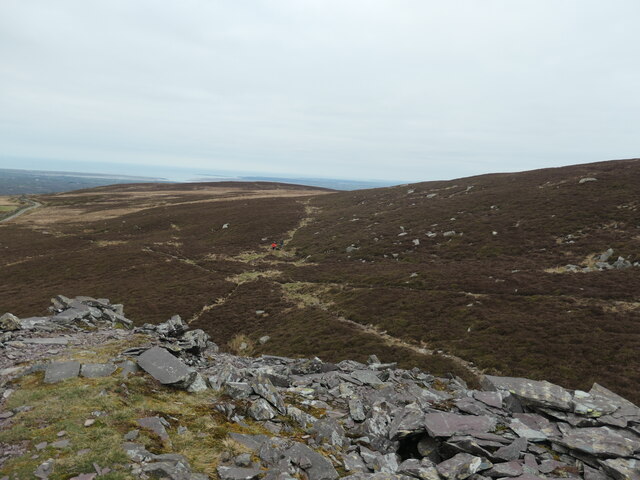
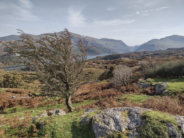
The hill is known for its rugged and rocky landscape, typical of the Snowdonia region. It offers breathtaking panoramic views of the surrounding mountains, valleys, and the nearby Menai Strait. On clear days, it is possible to see as far as the Isle of Anglesey and the Irish Sea.
Cefn Du is a popular destination for hikers and walkers, offering various trails and paths to explore. One of the most well-known routes is the Cefn Du Circular Walk, which takes visitors around the hill and provides opportunities to admire the stunning scenery and diverse wildlife. The hill is home to a variety of plant and animal species, including heather, bilberry, and several types of birds.
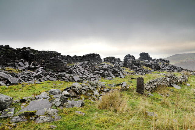
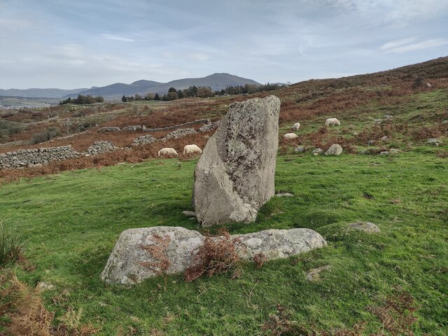
Additionally, Cefn Du has historical significance, as it is believed to have been a site of Iron Age settlement. Archaeological remains and artifacts have been discovered in the area, indicating human presence dating back thousands of years.
Overall, Cefn Du is a picturesque and fascinating hill/mountain that attracts nature enthusiasts, hikers, and history lovers alike, offering a chance to immerse oneself in the natural beauty and rich heritage of Caernarfonshire.
If you have any feedback on the listing, please let us know in the comments section below.
Cefn Du Images
Images are sourced within 2km of 53.120551/-4.1692247 or Grid Reference SH5460. Thanks to Geograph Open Source API. All images are credited.
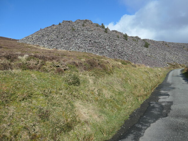
![Hen dramffordd ddiwydiannol / former industrial tramway One of the tongues of slate on the south side of Cefn Du. Waste slate from Chwarel Fawr [Cefn Du] was dumped here off the end of each tip. The tramway on this particular tip was not mapped by the OS in 1888, but was mapped in 1899. It had disappeared by 1913, but the tip itself still remains.](https://s1.geograph.org.uk/geophotos/07/42/84/7428429_34505e68.jpg)
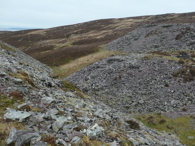
![Gwastraff llechi / Slate waste, Cefn Du [1] From a small quarry that was described as 'old' in 1899.](https://s0.geograph.org.uk/geophotos/07/42/84/7428432_72b169b6.jpg)
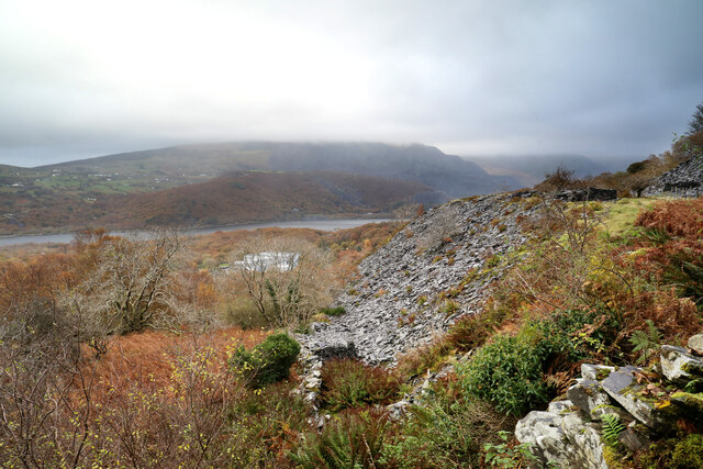
![Diwedd y domen lechi / the end of the slate tip The tipping point on one of the slate tips on the south side of Cefn Du. Waste slate from Chwarel Fawr [Cefn Du] was dumped here off the end of each tip. The tramway on this particular tip was not mapped by the OS in 1888, but was mapped in 1899. It had disappeared by 1913, but the tip itself still remains.](https://s1.geograph.org.uk/geophotos/07/42/84/7428437_e533fc93.jpg)
![Y man gollwng ar y domen lechi / The slate tip's tipping point [1] Built up so the wagon can tip up. Waste slate from Chwarel Fawr [Cefn Du] was dumped here off the end of each tip. The tramway on this particular tip was not mapped by the OS in 1888, but was mapped in 1899. It had disappeared by 1913, but the tip itself still remains.](https://s2.geograph.org.uk/geophotos/07/42/84/7428442_da1d5d5e.jpg)
![Gwastraff llechi / Slate waste, Cefn Du [2] Nature is very slowly colonising the slate tips.](https://s3.geograph.org.uk/geophotos/07/42/84/7428443_754c6fb3.jpg)
![Coeden ar y domen lechi / Tree on the slate tip It's common enough to see small conifers growing on the Chwarel Fawr [Cefn Du] slate tips, but very unusual to see a deciduous tree.](https://s3.geograph.org.uk/geophotos/07/42/86/7428627_c55f6f6a.jpg)
![Coeden binwydd ar y domen lechi / Pine tree on the slate tip Small conifers are beginning to colonise the slate tips of Chwarel Fawr [Cefn Du].](https://s2.geograph.org.uk/geophotos/07/42/86/7428634_03daf28f.jpg)
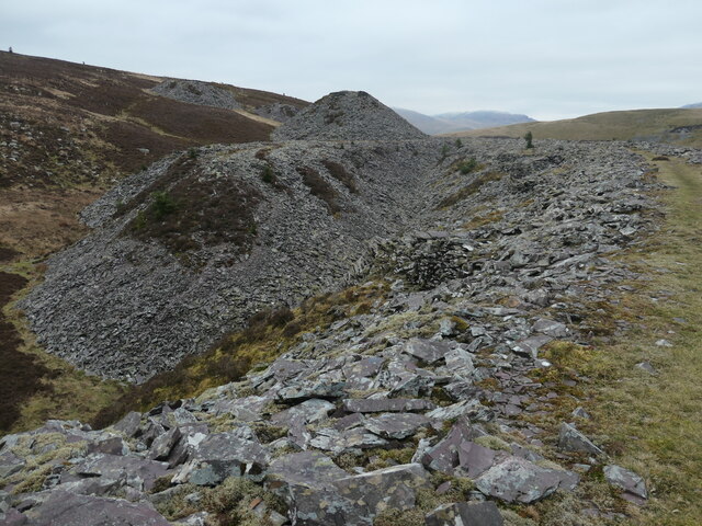
![Diwedd y domen llechen hir / The end of the long slate tip Built up so the wagon can tip up. Waste slate from Chwarel Fawr [Cefn Du] was dumped here off the end of each tip. The tramway on this particular tip was mapped by the OS in 1888 and 1899. It had disappeared by 1913, but the tip itself still remains.](https://s1.geograph.org.uk/geophotos/07/42/86/7428637_16f9bd34.jpg)
Cefn Du is located at Grid Ref: SH5460 (Lat: 53.120551, Lng: -4.1692247)
Unitary Authority: Gwynedd
Police Authority: North Wales
What 3 Words
///windows.pulps.amuses. Near Llanberis, Gwynedd
Nearby Locations
Related Wikis

Glynrhonwy quarries
The Glynrhonwy quarries (also known as the Glyn-Rhonwy quarries) were two adjacent quarries in the Glynrhonwy area, north-west of Llanberis, in Carnarvonshire...
Cwm-y-Glo railway station
Cwm-y-Glo railway station served the village of Cwm-y-glo, Gwynedd, Wales, at the north-west end of Llyn Padarn. The station was closed for regular passenger...

Cwm-y-glo
Cwm-y-glo is a small village in Wales, 4+1⁄2 miles (7 km) east of Caernarfon, between Llanberis and Llanrug. It is in the Arfon Parliamentary constituency...

Bryn Bras Castle
Bryn Bras Castle is a Grade II* listed country house located on the old road between Llanrug and Llanberis in Caernarfon, Gwynedd. The house, which remains...
Nearby Amenities
Located within 500m of 53.120551,-4.1692247Have you been to Cefn Du?
Leave your review of Cefn Du below (or comments, questions and feedback).