Bedminnie Hill

Hill, Mountain in Ayrshire

Scotland

Bedminnie Hill

Old opencast site near Skares
Old opencast site near Skares Credit: Steven Brown

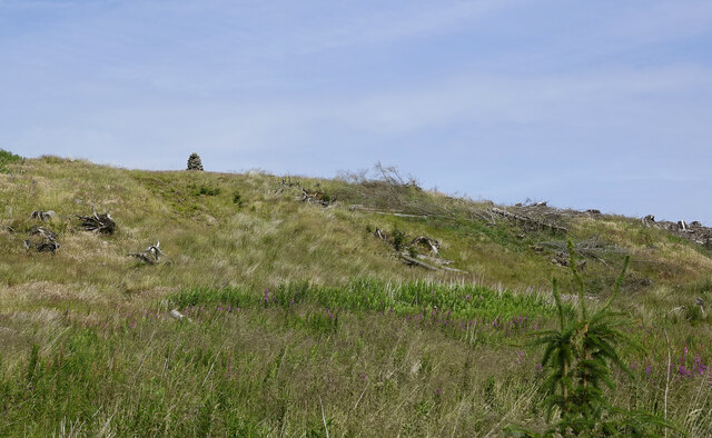
Bedminnie Hill is a prominent hill located in the region of Ayrshire, Scotland. It stands at an impressive height of 380 meters (1,250 feet) above sea level, making it a notable landmark in the area. Situated within the Southern Uplands, Bedminnie Hill is part of a range of hills known for their picturesque landscapes and scenic beauty.

The hill is characterized by its rounded shape and gentle slopes, making it accessible for hikers and nature enthusiasts. Its summit offers breathtaking panoramic views of the surrounding countryside, including the nearby Glen Afton, which adds to its allure. The vegetation on Bedminnie Hill is primarily comprised of grasses, heather, and scattered shrubs, creating an enchanting natural environment.

The hill is a popular destination for outdoor activities such as hillwalking, cycling, and birdwatching. Its diverse terrain provides opportunities for different levels of hiking, from leisurely walks to more challenging climbs. The surrounding area is home to various wildlife species, including red deer, foxes, and a variety of bird species, making it a haven for nature lovers.

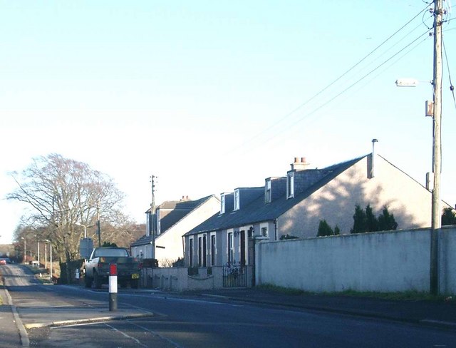
Bedminnie Hill's location in Ayrshire makes it easily accessible for both locals and visitors alike. The nearby town of New Cumnock provides amenities and accommodation options for those looking to explore the area further.

Overall, Bedminnie Hill is a captivating natural landmark in Ayrshire, offering stunning views, diverse flora and fauna, and a range of outdoor activities for all to enjoy.

If you have any feedback on the listing, please let us know in the comments section below.

Bedminnie Hill Images

Images are sourced within 2km of 55.393878/-4.3098686 or Grid Reference NS5313. Thanks to Geograph Open Source API. All images are credited.

Old opencast site near Skares
Forestry road near Skares
A new track around Carsgailoch Hill This new track gives access to the forested areas, crossing land that was altered by open-cast mining.
A new track around Carsgailoch Hill
This new track gives access to the forested areas, crossing land that was altered by open-cast mining.
Heading for Black Hill The higher-level forested ground was untouched by the open-cast mining operations that changed so much of this area. Therefore, it’s still easy to follow the maps here.
Heading for Black Hill
The higher-level forested ground was untouched by the open-cast mining operations that changed so much of this area. Therefore, it’s still easy to follow the maps here.
Approaching Linn Burn This part of the track existed before the open-cast mining operations changed the landscape. It’s still easy to follow the maps in the forested land. Viewed on the edge of the square. The ruin beside the track lies in the next square. See <a href="https://www.geograph.org.uk/photo/7236144">NS5413 : A ruin in the forest</a>
Approaching Linn Burn
This part of the track existed before the open-cast mining operations changed the landscape. It’s still easy to follow the maps in the forested land. Viewed on the edge of the square. The ruin beside the track lies in the next square. See NS5413 : A ruin in the forest
A ruin in the forest This appears to be an old building called The Linn, probably a shepherd’s cottage. It would have been abandoned when the forest was planted in the mid-20th century.  <a href="https://www.geograph.org.uk/photo/7236136">NS5513 : Approaching Linn Burn</a> shows the location.
A ruin in the forest
This appears to be an old building called The Linn, probably a shepherd’s cottage. It would have been abandoned when the forest was planted in the mid-20th century. NS5513 : Approaching Linn Burn shows the location.
Onion weathering Technically known as exfoliation, this rock is being broken down by peeling off in layers, similar to the layers of an onion. There were lots of examples in the area.
Onion weathering
Technically known as exfoliation, this rock is being broken down by peeling off in layers, similar to the layers of an onion. There were lots of examples in the area.
Linn Burn The upper part of Linn Burn was in an unplanted part of the forest.
Linn Burn
The upper part of Linn Burn was in an unplanted part of the forest.
Former open-cast site near Dalgig This enormous hole in the ground is not visible from the valley floor. It illustrates the extent of the coal extraction that took place here around the turn of the 20th century. Letting it fill with water is about the only way of restoring the site to any sort of landscape. It will look really bare for a very long time while weathering and re-growth of vegetation take place. The nearby House of Water site is still used by Hargreaves Mining. The old landscape, including the farm buildings at Dalgig, no longer exists.
Former open-cast site near Dalgig
This enormous hole in the ground is not visible from the valley floor. It illustrates the extent of the coal extraction that took place here around the turn of the 20th century. Letting it fill with water is about the only way of restoring the site to any sort of landscape. It will look really bare for a very long time while weathering and re-growth of vegetation take place. The nearby House of Water site is still used by Hargreaves Mining. The old landscape, including the farm buildings at Dalgig, no longer exists.
Black Hill view Looking down from the cairn with the old open-cast workings visible in the background. Viewed in disappointing mid-July light.
Black Hill view
Looking down from the cairn with the old open-cast workings visible in the background. Viewed in disappointing mid-July light.
Cairn on Black Hill Not quite on the summit and accessible again since the trees have been felled.
Cairn on Black Hill
Not quite on the summit and accessible again since the trees have been felled.
Opencast mining in Nithsdale In the upper reaches of the River Nith, about 7 km west of New Cumnock.
Opencast mining in Nithsdale
In the upper reaches of the River Nith, about 7 km west of New Cumnock.
Opencast mining in Nithsdale One of many areas of opencast mining in East Ayrshire, now presumably inactive as a result of the financial difficulties of Scottish Coal, which is in administration, with questions as to who will pay for the restoration of the landscape.
Opencast mining in Nithsdale
One of many areas of opencast mining in East Ayrshire, now presumably inactive as a result of the financial difficulties of Scottish Coal, which is in administration, with questions as to who will pay for the restoration of the landscape.
Opencast at Waterhead The remains of opencast mining in amongst the forestry; there is a lot in this area but since the demise of Scottish Coal its future, and any restoration, is in the balance.
Opencast at Waterhead
The remains of opencast mining in amongst the forestry; there is a lot in this area but since the demise of Scottish Coal its future, and any restoration, is in the balance.
The road to House of Water farm The road to House of Water farm now demolished.
The road to House of Water farm
The road to House of Water farm now demolished.
Black Hill Wood. View of woodland and fields near to Dalgig Farm. This area is famous for its association with the Covenanters.
Black Hill Wood.
View of woodland and fields near to Dalgig Farm. This area is famous for its association with the Covenanters.
Craigman Opencast Mine The road has a gate across it at this point. I'm unsure whether this mine is abandoned or awaiting restoration but there was no apparent activity on the site.
Craigman Opencast Mine
The road has a gate across it at this point. I'm unsure whether this mine is abandoned or awaiting restoration but there was no apparent activity on the site.
Forest Fire Break Forest fire break look out onto Loch Rig.
Forest Fire Break
Forest fire break look out onto Loch Rig.
Show me another place!

Bedminnie Hill is located at Grid Ref: NS5313 (Lat: 55.393878, Lng: -4.3098686)

Unitary Authority: East Ayrshire

Police Authority: Ayrshire

What 3 Words

///hears.remove.fabric. Near Cumnock, East Ayrshire

Related Wikis

Skares

Skares is a village in East Ayrshire, Scotland. Skares is located some 3 miles (5 km) southwest of Cumnock. It used to have a football team called Skares...

Skares railway station

Skares railway station was a railway station serving the former mining village of Skares, East Ayrshire, Scotland. The station was originally part of the...

Dumfries House railway station

Dumfries House railway station was a railway station near Dumfries House, East Ayrshire, Scotland. The station was originally part of the Annbank to Cronberry...

Black Loch (New Cumnock)

Black Loch (NS 59057 161720) is a freshwater loch, named from its dark waters, situated in the East Ayrshire Council Area, between Cumnock and New Cumnock...

Creoch Loch

Creoch Loch (NS 59259 15615), previously known as Little Creoch Loch, is a freshwater loch in the Parish of New Cumnock in the East Ayrshire Council Area...

Ochiltree railway station

Ochiltree railway station was a railway station serving the village of Ochiltree, East Ayrshire, Scotland. The station was originally part of the Annbank...

Lands of Borland, Barony of Cumnock

The Lands of Borland or Boreland (NS 5864 1742) formed a castle and land holdings within the old Barony of Cumnock, East Ayrshire, Parish of Old Cumnock...

Loch o' th' Lowes (New Cumnock)

Loch o' th' Lowes (NS 60183 14581), Lochside or Meikle Creoch Loch is a freshwater loch in the Parish of New Cumnock in the East Ayrshire Council Area...

Have you been to Bedminnie Hill?

Leave your review of Bedminnie Hill below (or comments, questions and feedback).