Bennan Hill

Hill, Mountain in Kirkcudbrightshire

Scotland

Bennan Hill

Loch Minnoch View of the loch with Scabbed Craigs behind.
Loch Minnoch Credit: Iain Russell

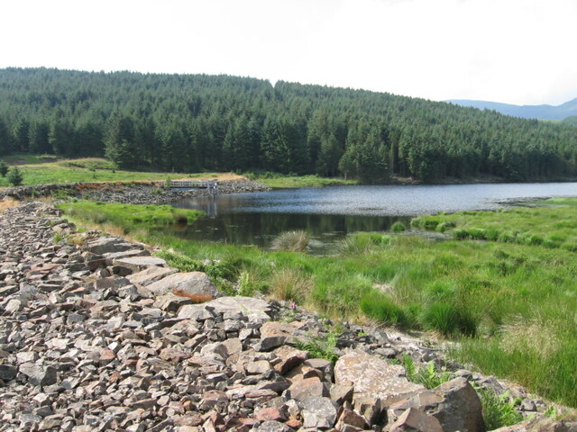
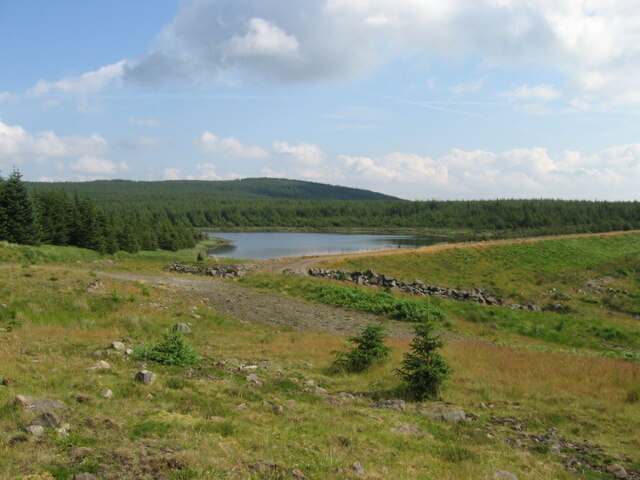
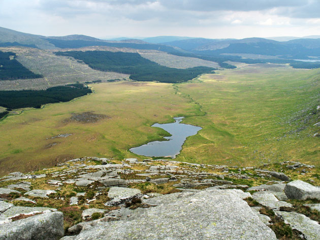
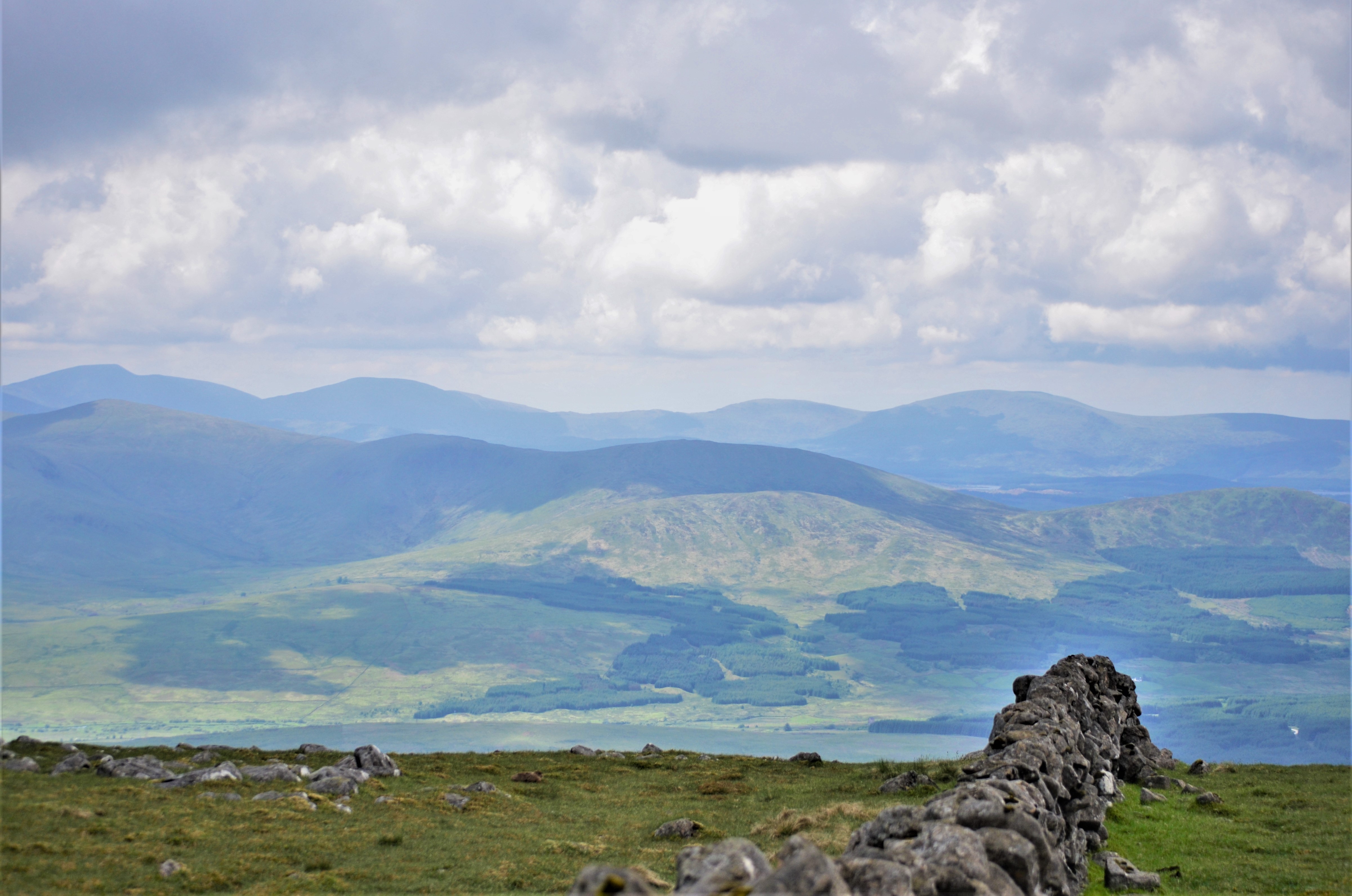
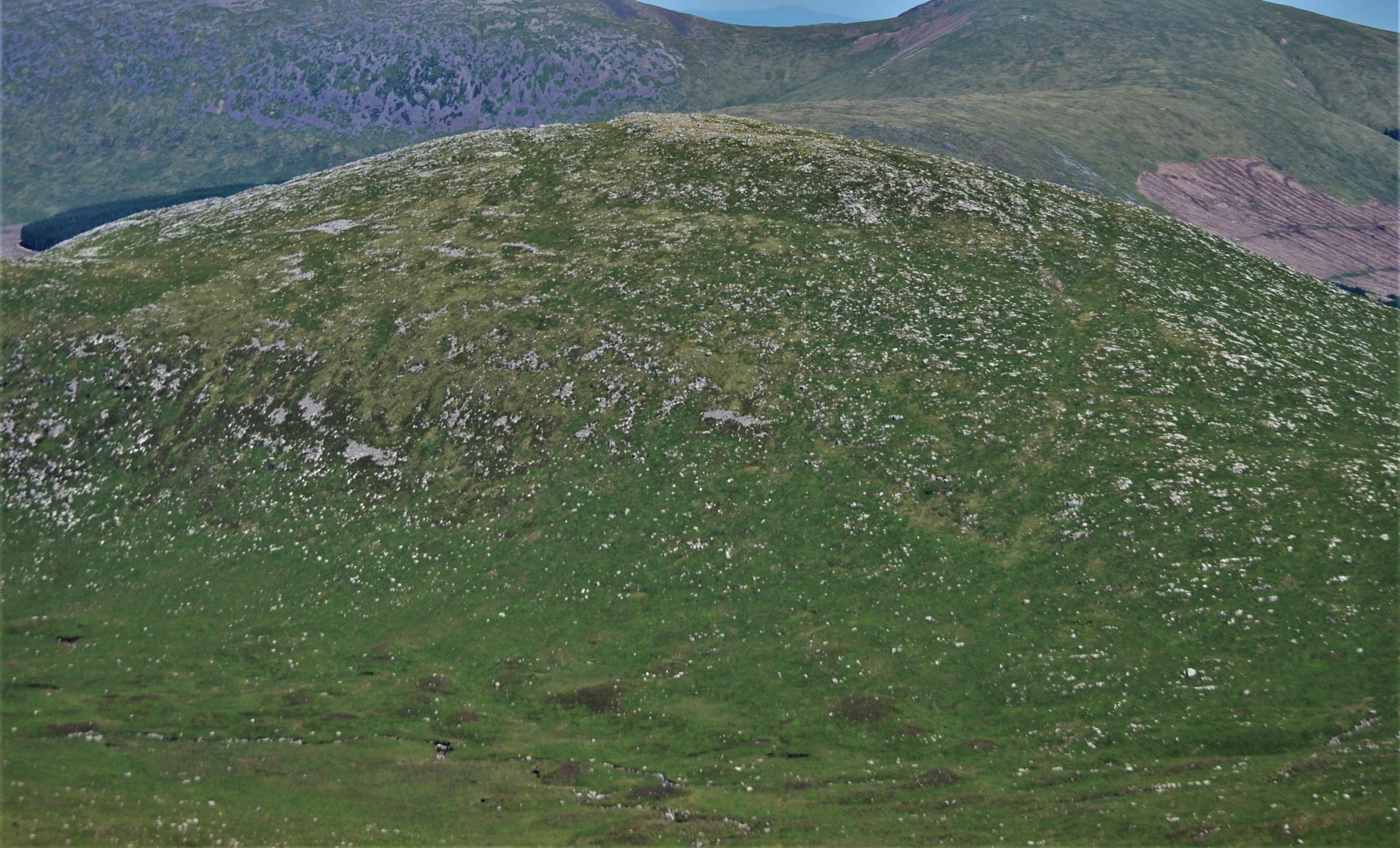
Bennan Hill, located in Kirkcudbrightshire, is a prominent hill and mountain that offers breathtaking panoramic views of the surrounding countryside. Situated in the southern part of Scotland, it is part of the wider Galloway Hills range. With an elevation of 479 meters (1572 feet), Bennan Hill stands tall and dominates the landscape.

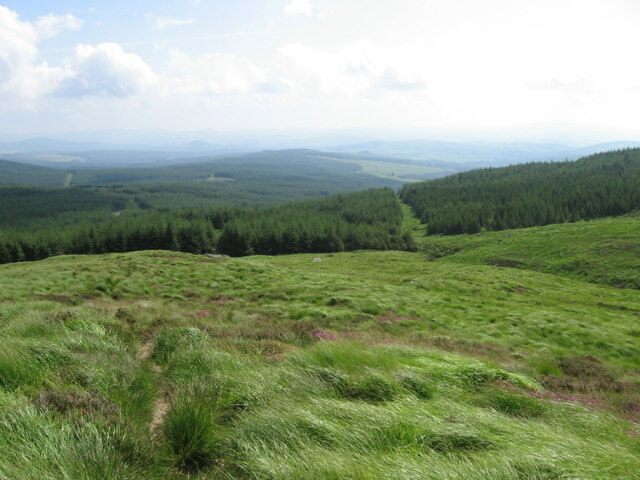
The hill is a popular destination for hikers and nature enthusiasts due to its accessibility and stunning vistas. It is easily reachable via a well-maintained footpath that winds its way up the hillside. As visitors ascend, they are treated to ever-expanding views of the rolling hills, lush valleys, and vast forests that make up the Kirkcudbrightshire region.

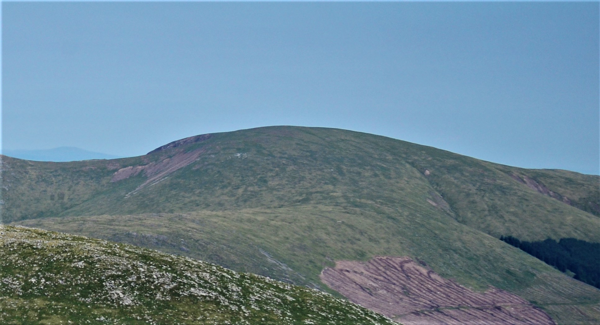
Bennan Hill's terrain comprises a mixture of heather-covered moorland, rocky outcrops, and grassy slopes, adding to its scenic appeal. Its summit is marked by a cairn, which serves as a great spot for hikers to rest and take in the picturesque surroundings. On a clear day, one can see as far as the Solway Firth and even catch a glimpse of the distant Lake District mountains in England.

Aside from its natural beauty, Bennan Hill also holds historical significance. The area has evidence of ancient settlements, including standing stones and burial cairns, which provide insight into the region's past.

Overall, Bennan Hill in Kirkcudbrightshire offers a rewarding outdoor experience for those seeking stunning views, peaceful walks, and a connection to the rich history of the area.

If you have any feedback on the listing, please let us know in the comments section below.

Bennan Hill Images

Images are sourced within 2km of 55.149221/-4.3015431 or Grid Reference NX5386. Thanks to Geograph Open Source API. All images are credited.

Loch Minnoch View of the loch with Scabbed Craigs behind.
Loch Minnoch
View of the loch with Scabbed Craigs behind.
Loch Dungeon Loch Dungeon is the largest of several small lochs to the east of the Rhinns of Kells hill range.
Loch Dungeon
Loch Dungeon is the largest of several small lochs to the east of the Rhinns of Kells hill range.
The History of a figurehead at Fred Olsen's house This figurehead was borne by the passenger liner, the first "BLACK WATCH", which entered service for Fred Olsen lines between Newcastle and Oslo early in 1939.
With the outbreak of WWII in September 1939 the "BLACK WATCH" was laid up in a Norwegian fjord only to be commandeered by the German Navy on Germany's invasion of Norway.
The vessel then served as a communication centre and supply ship until May 5th, 1945, two days before the end of hostilities, when she was bombed and sunk in 150 feet of water at Kilbotn near Harstad, Norway by the Fleet Air Arm.
No more was heard of the "Black Watch" until 1963 when a salvage firm began operations to recover the hull for scrap and the first thing they brought up after nearly 20 years under water was this figurehead, which was returned to its owner, Fred Olsen, who has restored it and placed it at the entrance to his Galloway estate.
The History of a figurehead at Fred Olsen's house
This figurehead was borne by the passenger liner, the first "BLACK WATCH", which entered service for Fred Olsen lines between Newcastle and Oslo early in 1939. With the outbreak of WWII in September 1939 the "BLACK WATCH" was laid up in a Norwegian fjord only to be commandeered by the German Navy on Germany's invasion of Norway. The vessel then served as a communication centre and supply ship until May 5th, 1945, two days before the end of hostilities, when she was bombed and sunk in 150 feet of water at Kilbotn near Harstad, Norway by the Fleet Air Arm. No more was heard of the "Black Watch" until 1963 when a salvage firm began operations to recover the hull for scrap and the first thing they brought up after nearly 20 years under water was this figurehead, which was returned to its owner, Fred Olsen, who has restored it and placed it at the entrance to his Galloway estate.
Mid Burn near Burnhead A changed view from <a href="https://www.geograph.org.uk/photo/1145642">NX5485 : The Mid Burn near Burnhead</a> now that the trees have been felled and the burn is down to a trickle after many weeks of dry weather.
Mid Burn near Burnhead
A changed view from NX5485 : The Mid Burn near Burnhead now that the trees have been felled and the burn is down to a trickle after many weeks of dry weather.
Professor Hans Heiberg Road A forestry road in the Forrest Estate named after a famous Norwegian.
Professor Hans Heiberg Road
A forestry road in the Forrest Estate named after a famous Norwegian.
Road and Burnhead Bridge Looking westward.
Road and Burnhead Bridge
Looking westward.
Forestry road near Burnhead Fork on the Professor Hans Heiberg road.
Forestry road near Burnhead
Fork on the Professor Hans Heiberg road.
The drive to Forrest Lodge Showing the "Black Watch" figurehead.
The drive to Forrest Lodge
Showing the "Black Watch" figurehead.
Forrest Estate "Black Watch" plaque
The Robert McLellan Watson memorial stone Near the car park at Forrest Lodge.
The Robert McLellan Watson memorial stone
Near the car park at Forrest Lodge.
The track to Fore Bush
Loch Dungeon & Loch Minnoch from below the summit of Meikle Millyea
Forrest Lodge car park Forrest Lodge car parking.
Forrest Lodge car park
Forrest Lodge car parking.
Farm buildings at Burnhead One of the former hill farms which has found itself largely surrounded by forestry plantations in the Galloway Forest Park.
Farm buildings at Burnhead
One of the former hill farms which has found itself largely surrounded by forestry plantations in the Galloway Forest Park.
Path to Loch Harrow Dam
Loch Harrow Dam
Loch Harrow Dam
Loch Mannoch
Loch Mannoch
Lower slopes of Corserine near Folk Burn
Show me another place!

Bennan Hill is located at Grid Ref: NX5386 (Lat: 55.149221, Lng: -4.3015431)

Unitary Authority: Dumfries and Galloway

Police Authority: Dumfries and Galloway

What 3 Words

///tallest.promotes.vacancies. Near Bellsbank, East Ayrshire

Nearby Locations

Bennan Hill

Related Wikis

Rhinns of Kells

The Rhinns of Kells are a range of hills in the Galloway Hills range, part of the Southern Uplands of Scotland. The most easterly of three parallel ridges...

Corserine

Corserine is a hill in the Rhinns of Kells, a sub-range of the Galloway Hills range, part of the Southern Uplands of Scotland. The highest point of the...

Waukers Linn

Waukers Linn is a waterfall on Polharrow Burn in Dumfries and Galloway, Scotland. == See also == Waterfalls of Scotland == References ==

Carsphairn

Carsphairn (Scottish Gaelic: An Còrsa Feàrna) is a village in the historic county of Kirkcudbrightshire in Dumfries and Galloway, Scotland. It is located...

Polharrow Burn

Polharrow Burn is a small watercourse in Dumfries and Galloway, Scotland, in the historic county of Kirkcudbrightshire. It rises in Loch Harrow and flows...

Silver Flowe

Silver Flowe is an area of patterned blanket mire in the Galloway Hills, in Dumfries and Galloway, Scotland. Located around 16 km north northeast of Newton...

Galloway Hills

The Galloway Hills are part of the Southern Uplands of Scotland, and form the northern boundary of western Galloway. They lie within the bounds of the...

Mullwharchar

Mullwharchar is a hill in the Dungeon Hills, a sub-range of the Galloway Hills range, part of the Southern Uplands of Scotland. Mullwarchar is situated...

Have you been to Bennan Hill?

Leave your review of Bennan Hill below (or comments, questions and feedback).