Banc y Moelfre

Hill, Mountain in Cardiganshire

Wales

Banc y Moelfre

Main road through Cribyn The B4337 Temple Bar to Llanybydder road.
Main road through Cribyn Credit: Eirian Evans

Banc y Moelfre is a prominent hill located in Cardiganshire, Wales. Standing at an elevation of 317 meters (1,040 ft), it offers stunning panoramic views of the surrounding countryside. The hill is situated approximately 5 kilometers northeast of the small village of Llanilar and 12 kilometers southeast of the town of Aberystwyth.

Banc y Moelfre is characterized by its distinctive conical shape and lush green slopes, which are covered in grasses and heather. The hill is composed mainly of sedimentary rocks, including sandstone and shale, which have been shaped over millions of years by natural erosion processes.

The summit of Banc y Moelfre is easily accessible by foot, with several well-marked paths leading to the top. Hikers and nature enthusiasts are drawn to the hill for its scenic beauty and the diverse range of flora and fauna that can be found along its slopes. From the summit, visitors are rewarded with breathtaking views of the Cambrian Mountains to the east and the Cardigan Bay coastline to the west.

Banc y Moelfre is also steeped in history, with evidence of prehistoric settlements and ancient burial mounds discovered in the surrounding area. The hill has been a place of human activity for centuries, and its rich cultural heritage adds to its allure.

Overall, Banc y Moelfre is a remarkable natural landmark in Cardiganshire, offering visitors a chance to immerse themselves in the beauty of the Welsh countryside while exploring its fascinating history.

If you have any feedback on the listing, please let us know in the comments section below.

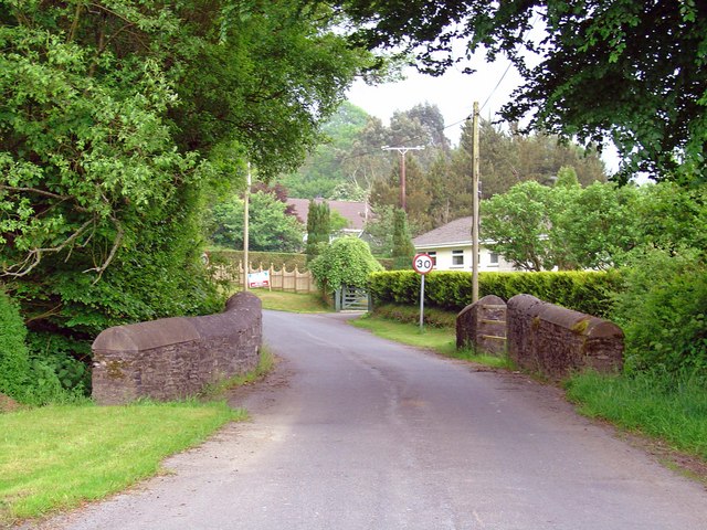
Banc y Moelfre Images

Images are sourced within 2km of 52.124457/-4.1439668 or Grid Reference SN5349. Thanks to Geograph Open Source API. All images are credited.

Main road through Cribyn The B4337 Temple Bar to Llanybydder road.
Main road through Cribyn
The B4337 Temple Bar to Llanybydder road.
Semi-detached houses at Cribyn
Former Fish & Anchor is now a Private Dwelling In the early 1980's this was a wonderful place for a pub meal.
Former Fish & Anchor is now a Private Dwelling
In the early 1980's this was a wonderful place for a pub meal.
Ordnance Survey Cut Mark This OS cut mark can be found on the outbuilding of the Fish & Anchor PH. It marks a point 133.457m above mean sea level.
Ordnance Survey Cut Mark
This OS cut mark can be found on the outbuilding of the Fish & Anchor PH. It marks a point 133.457m above mean sea level.
Churn Stand
Churn Stand
Barn on a sharp bend
Old Milepost by the B4337, Cribyn, Llanfihangel Ystrad parish Flat top casting by the B4337, Cribyn, in parish of Llanfihangel Ystrad (Ceredigion District).

Inscription reads:-
: TEMPLE BAR / 3 / MILES : : LLANYBYTHER / 5 / MILES :
Maker:-
: Eagle Foundry, Aberystwyth. :

Grade II listed by Cadw.
Reference Number: 17437 <span class="nowrap"><a title="https://cadwpublic-api.azurewebsites.net/reports/listedbuilding/FullReport?lang=&id=17437" rel="nofollow ugc noopener" href="https://cadwpublic-api.azurewebsites.net/reports/listedbuilding/FullReport?lang=&id=17437">Link</a><img style="margin-left:2px;" alt="External link" title="External link - shift click to open in new window" src="https://s1.geograph.org.uk/img/external.png" width="10" height="10"/></span>

Surveyed

Milestone Society National ID: CRD_TBLY03
Old Milepost by the B4337, Cribyn, Llanfihangel Ystrad parish
Flat top casting by the B4337, Cribyn, in parish of Llanfihangel Ystrad (Ceredigion District). Inscription reads:- : TEMPLE BAR / 3 / MILES : : LLANYBYTHER / 5 / MILES : Maker:- : Eagle Foundry, Aberystwyth. : Grade II listed by Cadw. Reference Number: 17437 LinkExternal link Surveyed Milestone Society National ID: CRD_TBLY03
Capel Undodaidd, Cribyn Cribyn Welsh Unitarian Chapel.  
Cribyn Unitarian Chapel was built in 1790 and rebuilt in 1851. The present chapel, dated 1851, is built in the Simple Round-Headed style of the gable entry type.
Capel Undodaidd, Cribyn
Cribyn Welsh Unitarian Chapel. Cribyn Unitarian Chapel was built in 1790 and rebuilt in 1851. The present chapel, dated 1851, is built in the Simple Round-Headed style of the gable entry type.
Three Horse Shoes, Cribyn Formerly a pub but now a private residence.  Note the three horse shoes above the front door.
Three Horse Shoes, Cribyn
Formerly a pub but now a private residence. Note the three horse shoes above the front door.
Cribyn Post Office See the sign set into the wall on the corner of the property.
Cribyn Post Office
See the sign set into the wall on the corner of the property.
Ordnance Survey Cut Mark This OS cut mark can be found on the gatepost south side of the road junction. It marks a point 176.671m above mean sea level.
Ordnance Survey Cut Mark
This OS cut mark can be found on the gatepost south side of the road junction. It marks a point 176.671m above mean sea level.
Sheep pasture from the footpath above Pentre-Shon View across the Nant-y-Gwrgedd valley towards Cwmhendryd, from the Road Used as a Public Path above Pentre-Shon, showing open sheep pasture typical of the grid square.
Sheep pasture from the footpath above Pentre-Shon
View across the Nant-y-Gwrgedd valley towards Cwmhendryd, from the Road Used as a Public Path above Pentre-Shon, showing open sheep pasture typical of the grid square.
Capel-y-Groes
Capel-y-Groes
Road junction at Capel-y-Groes
Bridge over the Afon Grannell, Capel-y-Groes
The bridleway above Neuadd-fawr This bend, at the Northernmost tip of the Road Used as a Public Path, only just protrudes into this grid square.
The bridleway above Neuadd-fawr
This bend, at the Northernmost tip of the Road Used as a Public Path, only just protrudes into this grid square.
Afon Grannell, Capel-y-Groes Taken from the B4337 bridge, this stream is flowing fast following heavy rain in the previous few days. It was still raining when this photograph was taken.
Afon Grannell, Capel-y-Groes
Taken from the B4337 bridge, this stream is flowing fast following heavy rain in the previous few days. It was still raining when this photograph was taken.
Lane east of Capel-y-Groes The Moelfre sign stands opposite the track leading to the farm.
Lane east of Capel-y-Groes
The Moelfre sign stands opposite the track leading to the farm.
Show me another place!

Banc y Moelfre is located at Grid Ref: SN5349 (Lat: 52.124457, Lng: -4.1439668)

Unitary Authority: Ceredigion

Police Authority: Dyfed Powys

What 3 Words

///bombshell.earmarked.nametag. Near Lampeter, Ceredigion

Nearby Locations

Banc y Moelfre

Related Wikis

Neudd-fawr

Neudd-fawr (also spelt Neuadd Fawr) is a small village in the community of Llanwnnen, Ceredigion, Wales, which is 59.9 miles (96.4 km) from Cardiff and...

Cribyn

Cribyn is a small village in Ceredigion, Wales, about 7 miles (11 km) north of Lampeter and with the villages of Troed y Rhiw, Mydroilyn and Dihewyd to...

Maestir

Maestir is a hamlet in the community of Llanwnnen, Ceredigion, Wales, which is 59.9 miles (96.3 km) from Cardiff and 175.5 miles (282.4 km) from London...

Llanwnnen

Llanwnnen is a village, parish and community located in the county of Ceredigion, Wales. The population of the community taken at the 2011 census was 490...

Falcondale

Falcondale (Welsh: Glyn Hebog) is a hamlet in the community of Lampeter, Ceredigion, Wales, and occupies a low bluff overlooking the Nant Creuddyn north...

Pentre-bach, Ceredigion

Pentre-bach is a small village in the community of Lampeter, Ceredigion, Wales. Pentre-bach is represented in the Senedd by Elin Jones (Plaid Cymru) and...
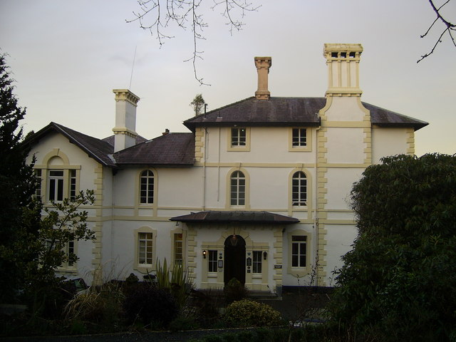
Falcondale House

Falcondale House is a Grade II listed former country house, now the Falcondale Mansion Hotel, which is situated some 1 mile north-west of Lampeter, Ceredigion...

Falcondale Lake

Falcondale Lake is a man-made lake in the hamlet of Falcondale near Lampeter in Ceredigion It was created as part of the landscaping for Falcondale House...

Nearby Amenities

Located within 500m of 52.124457,-4.1439668
Generator Method: wind_turbine
Generator Source: wind
Power: generator
Lat/Long: 52.1235061/-4.1435427
The data included in this document is from www.openstreetmap.org. The data is made available under ODbL.

Have you been to Banc y Moelfre?

Leave your review of Banc y Moelfre below (or comments, questions and feedback).