Creag an Tulabhain

Hill, Mountain in Perthshire

Scotland

Creag an Tulabhain

Path leading up the southern ridge leading to Beinn nan Oighreag Surprisingly I came across this unmarked path which led up the southern ridge towards Beinn nan Oighreag.
Path leading up the southern ridge leading to Beinn nan Oighreag Credit: Colin Park

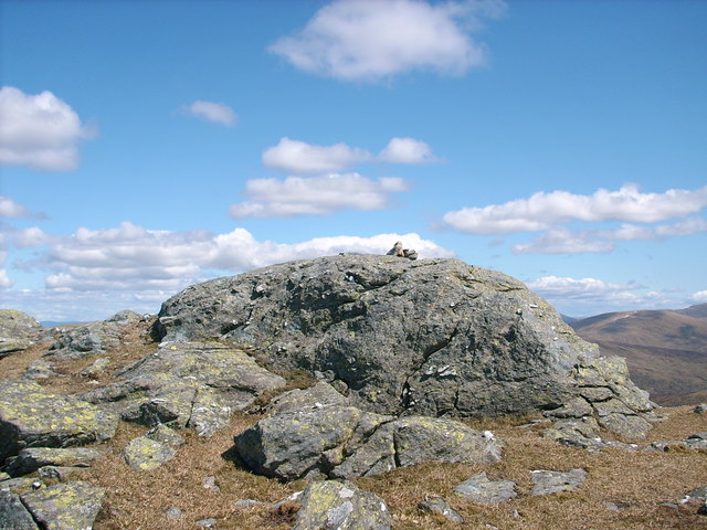
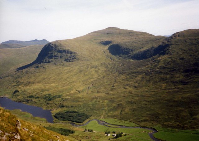
Creag an Tulabhain is a prominent hill located in the county of Perthshire, Scotland. Situated in the southern part of the Cairngorms National Park, it stands at an impressive height of 714 meters (2,343 feet). The hill is a popular destination for hikers and nature enthusiasts due to its stunning views and diverse wildlife.

The ascent to Creag an Tulabhain is relatively challenging, with steep and rugged terrain. However, the reward at the summit is well worth the effort, as it offers breathtaking panoramic vistas of the surrounding landscape. On clear days, one can see the vast expanse of the Cairngorms, the rolling hills of Perthshire, and even the distant peaks of the Grampians.

The hill is covered in a mixture of heather moorland and scattered woodland, providing a rich habitat for a variety of flora and fauna. Visitors may encounter species such as red deer, mountain hares, and golden eagles during their trek. In the summer months, the hillside bursts into a vibrant display of wildflowers, including purple heather and yellow gorse.

Access to Creag an Tulabhain is facilitated by a network of well-marked trails, ensuring a safe and enjoyable experience for walkers. The hill is approximately a two-hour drive from the city of Perth, making it easily accessible for day trips or longer stays in the region.

Overall, Creag an Tulabhain is a captivating natural feature within Perthshire, offering stunning vistas, diverse wildlife, and a challenging yet rewarding hiking experience for nature enthusiasts.

If you have any feedback on the listing, please let us know in the comments section below.

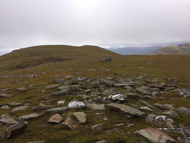
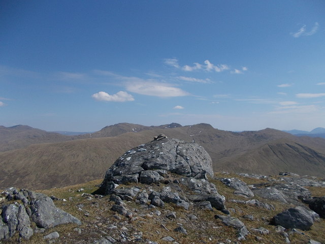
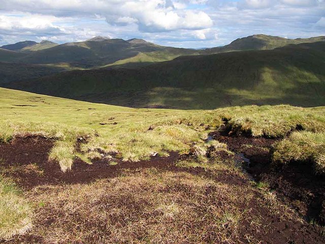
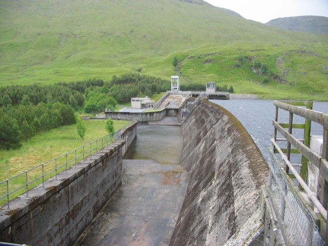
Creag an Tulabhain Images

Images are sourced within 2km of 56.543751/-4.4003881 or Grid Reference NN5241. Thanks to Geograph Open Source API. All images are credited.

Path leading up the southern ridge leading to Beinn nan Oighreag Surprisingly I came across this unmarked path which led up the southern ridge towards Beinn nan Oighreag.
Path leading up the southern ridge leading to Beinn nan Oighreag
Surprisingly I came across this unmarked path which led up the southern ridge towards Beinn nan Oighreag.
On the summit of Beinn nan Oighreag with view towards Meall Ghaordie
Stronuich Reservoir Dam
Cashlie Power Station
East side of Beinn nan Oighreag Looking down on a boggy, untracked pass between Glen Lochay and Glen Lyon.
East side of Beinn nan Oighreag
Looking down on a boggy, untracked pass between Glen Lochay and Glen Lyon.
Beinn nan Oighreag Looking along the ridge to the 909m summit.  Beinn nan Oighreag has at least twice set off a frenzy of activity amongst those believing it to be above 3000'.  It has now been accurately surveyed.
Beinn nan Oighreag
Looking along the ridge to the 909m summit. Beinn nan Oighreag has at least twice set off a frenzy of activity amongst those believing it to be above 3000'. It has now been accurately surveyed.
Cairn, Beinn nan Oighreag Not the summit, a little lower and to the north of the high point. Beinn nan Oighreag is not the most distinctive of hills and it has a very vague summit area.  View towards Meall Ghaordaidh.
Cairn, Beinn nan Oighreag
Not the summit, a little lower and to the north of the high point. Beinn nan Oighreag is not the most distinctive of hills and it has a very vague summit area. View towards Meall Ghaordaidh.
Beinn nan Oighreag from north top Older photos on Geograph of this top show a large cairn.  It has been completely destroyed probably as folk thought that it was the summit which actually lies at the 909 spot height.
Beinn nan Oighreag from north top
Older photos on Geograph of this top show a large cairn. It has been completely destroyed probably as folk thought that it was the summit which actually lies at the 909 spot height.
Summit of Beinn nan Oighreag Rock outcrop topped by a micro cairn marks the summit of the Corbett. The Tarmachan hills are in the distance.
Summit of Beinn nan Oighreag
Rock outcrop topped by a micro cairn marks the summit of the Corbett. The Tarmachan hills are in the distance.
Boggy ground near Beinn nan Oighreag summit Looking towards the Ben Lawers group
Boggy ground near Beinn nan Oighreag summit
Looking towards the Ben Lawers group
Looking down to Lairig Luaidhe Viewed from the W slope of Beinn nan Oighreag
Looking down to Lairig Luaidhe
Viewed from the W slope of Beinn nan Oighreag
Stronuich Reservoir The water here will end up at Lochay Power Station via 9km of pipeline.
Stronuich Reservoir
The water here will end up at Lochay Power Station via 9km of pipeline.
Stronuich Dam The channel at the bottom of the picture carries the outfall from Cashlie Power Station and will end up at Lochay Power Station.
Stronuich Dam
The channel at the bottom of the picture carries the outfall from Cashlie Power Station and will end up at Lochay Power Station.
Across Coire Loaghain
River Lyon Under Creag Tulabhan, one of the northern spurs of Meall Ghaordaidh.
River Lyon
Under Creag Tulabhan, one of the northern spurs of Meall Ghaordaidh.
River Lyon Downstream view towards Beinn nan Oighreag.
River Lyon
Downstream view towards Beinn nan Oighreag.
Ath an t-Sluaigh Ruins beside the River Lyon with Beinn nan Oighreag on the opposite side of the glen.
Ath an t-Sluaigh
Ruins beside the River Lyon with Beinn nan Oighreag on the opposite side of the glen.
Show me another place!

Creag an Tulabhain is located at Grid Ref: NN5241 (Lat: 56.543751, Lng: -4.4003881)

Unitary Authority: Perth and Kinross

Police Authority: Tayside

What 3 Words

///mops.handrail.archduke. Near Pubil, Perth & Kinross

Nearby Locations

Creag an Tulabhain

Related Wikis

Beinn nan Oighreag

Beinn nan Oighreag (910 m) is a mountain in the Grampian Mountains of Scotland. It lies between Glen Lyon and Glen Lochay, on the border of Perthshire...

Meall Ghaordaidh

Meall Ghaordaidh is a mountain in the Southern Highlands of Scotland, approximately 10 km north-west of Killin. The mountain can be ascended via Glen Lochay...

Meggernie Castle

Meggernie Castle is a castle in the heart of Perth and Kinross, in central Scotland. It is located halfway up Glenlyon, where the river Lyon flows through...

Stuchd an Lochain

Stuchd an Lochain (Scottish Gaelic: Stùc an Lochain, 'peak of the little lake') is a mountain in the Breadalbane region of the southern Scottish Highlands...

Nearby Amenities

Located within 500m of 56.543751,-4.4003881
Creag an Tulabhain
Ele: 809
Natural: peak
Lat/Long: 56.5434959/-4.3999412
The data included in this document is from www.openstreetmap.org. The data is made available under ODbL.

Have you been to Creag an Tulabhain?

Leave your review of Creag an Tulabhain below (or comments, questions and feedback).