Boulters Tor

Hill, Mountain in Devon West Devon

England

Boulters Tor

Line of stones beside a track on Smeardon Down
Line of stones beside a track on Smeardon Down Credit: Sandy Gerrard

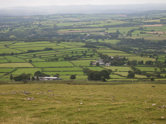
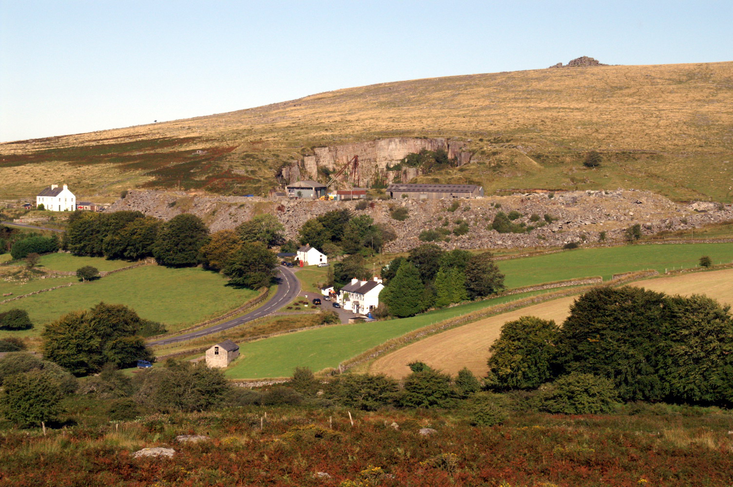
Boulters Tor is a prominent hill located in Devon, England. Situated near the village of South Brent, it forms part of the scenic landscape of Dartmoor National Park. Rising to an elevation of approximately 340 meters (1,115 feet), Boulters Tor offers breathtaking panoramic views of the surrounding countryside and is a popular destination for hikers, nature enthusiasts, and photographers.

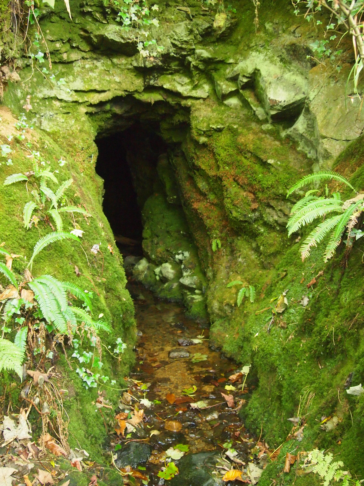
The tor is characterized by its rugged and rocky terrain, typical of the tors found in Dartmoor. It features granite outcrops and boulders, some of which are weathered into unique shapes, adding to the tor's charm and appeal. Its distinctive profile stands out against the rolling hills and moorland, making it a recognizable landmark in the area.

The tor is accessible via a network of footpaths and trails, making it easily reachable for visitors of varying fitness levels. It provides an opportunity for outdoor activities such as walking, hiking, and rock climbing. The hill is also home to a diverse range of flora and fauna, with heathland and grassy slopes hosting a variety of wildflowers, including Devon violets and heather.

Boulters Tor holds historical significance as well, with evidence of Bronze Age settlements and stone circles in the vicinity. The tor's location within Dartmoor National Park ensures its preservation and protection, allowing visitors to appreciate its natural beauty and historical importance. Whether it's for a leisurely stroll, a challenging hike, or simply to take in the stunning views, Boulters Tor offers a memorable experience for all who visit.

If you have any feedback on the listing, please let us know in the comments section below.

Boulters Tor Images

Images are sourced within 2km of 50.583687/-4.0848061 or Grid Reference SX5278. Thanks to Geograph Open Source API. All images are credited.

Line of stones beside a track on Smeardon Down
Stephen's Grave The hill behind the grave is known locally by the name Whittor rather than the White Tor shown on Ordnance Survey Maps <span class="nowrap"><a title="https://www.legendarydartmoor.co.uk/steve_grave.htm" rel="nofollow ugc noopener" href="https://www.legendarydartmoor.co.uk/steve_grave.htm">Link</a><img style="margin-left:2px;" alt="External link" title="External link - shift click to open in new window" src="https://s1.geograph.org.uk/img/external.png" width="10" height="10"/></span>
Stephen's Grave
The hill behind the grave is known locally by the name Whittor rather than the White Tor shown on Ordnance Survey Maps LinkExternal link
Interior of the Neolithic Hilltop Enclosure at White Tor <span class="nowrap"><a title="https://www.megalithic.co.uk/article.php?sid=17506" rel="nofollow ugc noopener" href="https://www.megalithic.co.uk/article.php?sid=17506">Link</a><img style="margin-left:2px;" alt="External link" title="External link - shift click to open in new window" src="https://s1.geograph.org.uk/img/external.png" width="10" height="10"/></span>
Interior of the Neolithic Hilltop Enclosure at White Tor
Old Guide Stone near Horndon Bridge, Peter Tavy parish Granite guidestone post by the UC road, in parish of Peter Tavy (West Devon District), North of Cudlipptown, Southeast of Horndon Bridge, at fork of old road to Horndon, high on grass bank.

Inscription reads:-
: HORN / DON / ½ / MILE : : TAVI / STOCK / 5 / MILES : : WAPS / WORTHY / 1 / MILE : 

Grade II listed.
List Entry Number: 1171007 <span class="nowrap"><a title="https://historicengland.org.uk/listing/the-list/list-entry/1171007" rel="nofollow ugc noopener" href="https://historicengland.org.uk/listing/the-list/list-entry/1171007">Link</a><img style="margin-left:2px;" alt="External link" title="External link - shift click to open in new window" src="https://s1.geograph.org.uk/img/external.png" width="10" height="10"/></span>

Surveyed

Milestone Society National ID: DV_XPTAV01
Old Guide Stone near Horndon Bridge, Peter Tavy parish
Granite guidestone post by the UC road, in parish of Peter Tavy (West Devon District), North of Cudlipptown, Southeast of Horndon Bridge, at fork of old road to Horndon, high on grass bank. Inscription reads:- : HORN / DON / ½ / MILE : : TAVI / STOCK / 5 / MILES : : WAPS / WORTHY / 1 / MILE : Grade II listed. List Entry Number: 1171007 LinkExternal link Surveyed Milestone Society National ID: DV_XPTAV01
The Edge of the Moor Looking East from Cox Tor.
The Edge of the Moor
Looking East from Cox Tor.
Cairn, Cox Tor
Cairn, Cox Tor
Peter Tavy Inn, Peter Tavy A very old public house that was apparently used by the masons constructing the nearby church. It remains a pleasant public house with decent food.
Peter Tavy Inn, Peter Tavy
A very old public house that was apparently used by the masons constructing the nearby church. It remains a pleasant public house with decent food.
Ordnance Survey 1GL Bolt This OS Bolt can be found on the NW angle of St Mary's Church. It marks a point 172.413m above mean sea level.
Ordnance Survey 1GL Bolt
This OS Bolt can be found on the NW angle of St Mary's Church. It marks a point 172.413m above mean sea level.
Ordnance Survey Cut Mark This OS cut mark can be found on the SW angle of St Peter's Church. It marks a point 172.364m above mean sea level.
Ordnance Survey Cut Mark
This OS cut mark can be found on the SW angle of St Peter's Church. It marks a point 172.364m above mean sea level.
Ordnance Survey Cut Mark This OS cut mark can be found on the east angle of the barn. It marks a point 165.040m above mean sea level.
Ordnance Survey Cut Mark
This OS cut mark can be found on the east angle of the barn. It marks a point 165.040m above mean sea level.
Ordnance Survey Cut Mark This OS cut mark can be found on the garden gatepost on the west side of the road. It marks a point 162.434m above mean sea level.
Ordnance Survey Cut Mark
This OS cut mark can be found on the garden gatepost on the west side of the road. It marks a point 162.434m above mean sea level.
Trig pillar on Cox Tor
Farmyard, Peter Tavy
St Peter's Church, Peter Tavy
Cider Press, Mary Tavy
Mary Tavy Community Composting Scheme
Adit, Devon United Mine
Remains OF A Turbine, Devon United Mine
Show me another place!

Boulters Tor is located at Grid Ref: SX5278 (Lat: 50.583687, Lng: -4.0848061)

Administrative County: Devon

District: West Devon

Police Authority: Devon and Cornwall

What 3 Words

///twinkling.graphic.cube. Near Tavistock, Devon

Related Wikis

Cudlipptown

Cudlipptown or Cudliptown is a small village located near the western edge of Dartmoor National Park, northeast of Tavistock, and approximately one mile...

Peter Tavy

Peter Tavy () is a village 3 miles (4.8 km) along the A386, North-East of Tavistock, Devon, England; it is named after the River Tavy. St Peter's Parish...

Devon United Mine

Devon United Mine (grid reference SX521795) is a 1.0 hectare geological Site of Special Scientific Interest in Devon, England, notified in 1987. ��2�...

Collybrooke

The Collybrooke or Colly Brook is a brook on Dartmoor in Devon, England. It is a tributary of the River Tavy. == Bibliography == The Painted Stream, Robin...

Mary Tavy

Mary Tavy () is a village with a population of around 600, located four miles north of Tavistock in Devon in south-west England; it is named after the...

Wilminstone

Wilminstone is a village in the civil parish of Mary Tavy in the West Devon district of Devon, England. Its nearest town is Tavistock, which lies approximately...

River Burn, Devon

The Burn is a river on Dartmoor, Devon, England. It is a tributary of the River Tavy. == References == Armstrong, Robin (1985). The Painted Stream. London...

Merrivale, Devon

Merrivale (formerly also Merivale) is a locality in western Dartmoor, in the West Devon district of Devon, England. It is best known for the nearby series...

Nearby Amenities

Located within 500m of 50.583687,-4.0848061
Boulters Tor
Ele: 336
Natural: peak
Source: NPE
Lat/Long: 50.5835983/-4.0849402
"Twist" (Ruined Farmhouse)
Historic: ruins
Lat/Long: 50.5849737/-4.0812278
Lower Godsworthy
Addr City: Tavistock
Addr Country: GB
Addr County: Devon
Addr Housename: Lower Godsworthy Farm
Addr Place: Peter Tavy
Addr Postcode: PL19 9NY
Place: farm
Lat/Long: 50.5799087/-4.0816999
The data included in this document is from www.openstreetmap.org. The data is made available under ODbL.

Have you been to Boulters Tor?

Leave your review of Boulters Tor below (or comments, questions and feedback).