Cnoc an t-Sìthean

Hill, Mountain in Inverness-shire

Scotland

Cnoc an t-Sìthean

Log stacks, Boblainy Forest Stacks of timber alongside the track, on a grey evening.
Log stacks, Boblainy Forest Credit: Craig Wallace

Cnoc an t-Sìthean is a hill located in Inverness-shire, Scotland. It stands at an elevation of 358 meters (1175 feet) above sea level and offers stunning panoramic views of the surrounding countryside. The hill is situated near the village of Farr, approximately 17 miles south of Inverness.

Cnoc an t-Sìthean is a popular destination for hikers and outdoor enthusiasts, with a well-defined path leading to the summit. The terrain is mostly grassy and rocky, making it a moderate to challenging hike depending on the weather conditions.

The hill is steeped in folklore and legend, with its name translating to "Fairy Hill" in Gaelic. It is said to be home to supernatural beings such as fairies and spirits, adding to its mystique and allure.

Visitors to Cnoc an t-Sìthean can enjoy a peaceful and serene environment, away from the hustle and bustle of city life. The hill is also a great spot for birdwatching, with a variety of species to be spotted in the area.

Overall, Cnoc an t-Sìthean is a beautiful and enchanting location that offers a memorable hiking experience for those who venture to its summit.

If you have any feedback on the listing, please let us know in the comments section below.

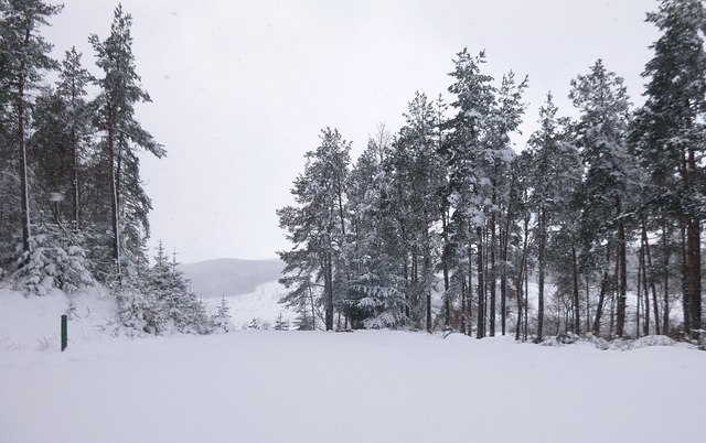
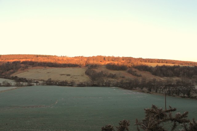
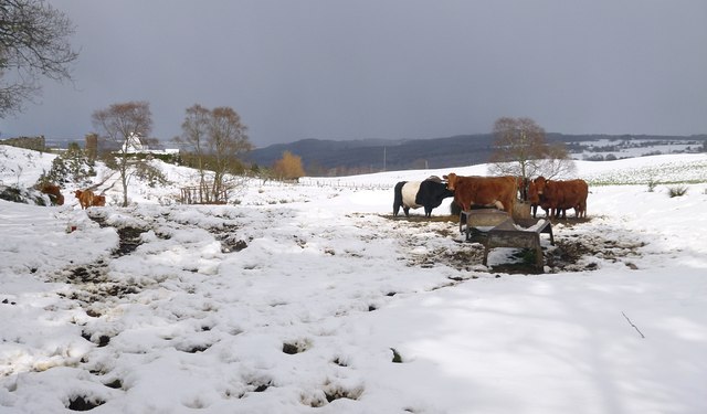
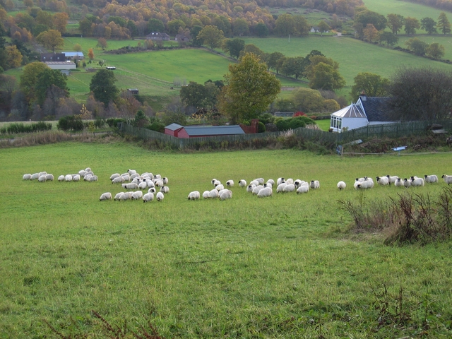
Cnoc an t-Sìthean Images

Images are sourced within 2km of 57.404485/-4.4768648 or Grid Reference NH5137. Thanks to Geograph Open Source API. All images are credited.

Log stacks, Boblainy Forest Stacks of timber alongside the track, on a grey evening.
Log stacks, Boblainy Forest
Stacks of timber alongside the track, on a grey evening.
Minor track, Boblainy Forest Much of the surrounding area has been felled recently, but the smaller trees alongside the track have been left.
Minor track, Boblainy Forest
Much of the surrounding area has been felled recently, but the smaller trees alongside the track have been left.
Bench with a view, Boblainy Forest A view north towards Ben Wyvis. The cleared area in the foreground is now getting covered by bracken and gorse.

A similar view last year. <a href="https://www.geograph.org.uk/photo/6419555">NH4937 : Bench with a view, Boblainy Forest</a>
Bench with a view, Boblainy Forest
A view north towards Ben Wyvis. The cleared area in the foreground is now getting covered by bracken and gorse. A similar view last year. NH4937 : Bench with a view, Boblainy Forest
Valley of the Bruiach Burn Much of the forest on the slopes either side of the burn was felled a few years ago. It looks like not much has been replanted - instead the area is becoming covered with bushes, heather, and a few small trees.
Valley of the Bruiach Burn
Much of the forest on the slopes either side of the burn was felled a few years ago. It looks like not much has been replanted - instead the area is becoming covered with bushes, heather, and a few small trees.
Track junction in the snow The main track through Boblainy Forest - between Ardendrain and Culburnie - is on the left of the photo. This route is marked by a red Forestry Commission marker post. Another track branches off to the right.
Track junction in the snow
The main track through Boblainy Forest - between Ardendrain and Culburnie - is on the left of the photo. This route is marked by a red Forestry Commission marker post. Another track branches off to the right.
Road down to Whitebridge
Glen Convinth
Glen Convinth
Minor road by Ruifour This road goes along past a few houses and small farms.
Minor road by Ruifour
This road goes along past a few houses and small farms.
Forest track into Battan
Lone Tree A lone tree in a field by Cnoc an t-Sithean.
Lone Tree
A lone tree in a field by Cnoc an t-Sithean.
Convinth Cemetery The abandoned church and old graveyard by White Bridge, Convinth.
Convinth Cemetery
The abandoned church and old graveyard by White Bridge, Convinth.
Glen Convinth Tree lined fields in Glen Convinth.
Glen Convinth
Tree lined fields in Glen Convinth.
Wooded Layby An improvised layby by woodland in Glen Convith.
Wooded Layby
An improvised layby by woodland in Glen Convith.
Field by Fanblair Fields near Fanblair and Boblainy Forest on the hilltop behind.
Field by Fanblair
Fields near Fanblair and Boblainy Forest on the hilltop behind.
Cattle in the snow, by Achnacloich A group of cattle gathered around a feeder.
The track along the side of the field is often rather muddy, today it is also covered by snow. The house and farm buildings at Achnacloich are in the distance on the left of the photo.
Cattle in the snow, by Achnacloich
A group of cattle gathered around a feeder. The track along the side of the field is often rather muddy, today it is also covered by snow. The house and farm buildings at Achnacloich are in the distance on the left of the photo.
Moorland beside Boblainy Forest Looking across moorland above Glen Convinth.
The fence on the right of the photo is the boundary of Boblainy Forest. There once was a track alongside the fence, but it now seems to be rather overgrown with bushes. It is probably largely redundant since the road to the water treatment works was built.
The water treatment works is in the distance in the centre of the photo - it is painted brown, so barely visible against the moorland.
Moorland beside Boblainy Forest
Looking across moorland above Glen Convinth. The fence on the right of the photo is the boundary of Boblainy Forest. There once was a track alongside the fence, but it now seems to be rather overgrown with bushes. It is probably largely redundant since the road to the water treatment works was built. The water treatment works is in the distance in the centre of the photo - it is painted brown, so barely visible against the moorland.
Glenconvinth Cemetery This was once the site of St Lawrence's Church, the parish church for Convinth. Some of the ruins are visible, next to the trees to the left of the photo.
The cemetery is still in use, with a number of more recent graves at the opposite end, near the entrance gate.
The burial ground is a Category C(S) listed building. See the Highland Council Historic Environment Record: <span class="nowrap"><a title="http://her.highland.gov.uk/SingleResult.aspx?uid=MHG31357" rel="nofollow ugc noopener" href="http://her.highland.gov.uk/SingleResult.aspx?uid=MHG31357">Link</a><img style="margin-left:2px;" alt="External link" title="External link - shift click to open in new window" src="https://s1.geograph.org.uk/img/external.png" width="10" height="10"/></span>
Glenconvinth Cemetery
This was once the site of St Lawrence's Church, the parish church for Convinth. Some of the ruins are visible, next to the trees to the left of the photo. The cemetery is still in use, with a number of more recent graves at the opposite end, near the entrance gate. The burial ground is a Category C(S) listed building. See the Highland Council Historic Environment Record: LinkExternal link
Anemometer mast, Blairmore This rather tall mast has anemometers at a number of different heights. It is for measuring wind speed for the proposed Druim Bà wind farm.
There is a digger and tipper truck parked near the base of the mast.
Anemometer mast, Blairmore
This rather tall mast has anemometers at a number of different heights. It is for measuring wind speed for the proposed Druim Bà wind farm. There is a digger and tipper truck parked near the base of the mast.
Show me another place!

Cnoc an t-Sìthean is located at Grid Ref: NH5137 (Lat: 57.404485, Lng: -4.4768648)

Unitary Authority: Highland

Police Authority: Highlands and Islands

What 3 Words

///bronze.divisible.biked. Near Drumnadrochit, Highland

Nearby Locations

Cnoc an t-Sìthean

Related Wikis

Ardendrain

Ardendrain (Scottish Gaelic: Àirde an Droigheann, meaning "Height of the Blackthorn) is a scattered hamlet in the Highland council area of Scotland. It...

Foxhole, Scotland

Foxhole (Scottish Gaelic: A 'Bhog solla) is a small hamlet in the Highland council area of Scotland. It is 2 miles (3.2 km) south of the village of Kiltarlity...

Moniack Mhor

Moniack Mhor is a creative writing centre in Scotland. Based in the Scottish Highlands, Moniack Mhor is fourteen miles from Inverness. The centre is a...

Culnaskiach Falls

Culnaskiach Falls is a waterfall in Boblainy Forest, to the south of the village of Kiltarlity, in the Highland council area of Scotland. It is on a small...

Nearby Amenities

Located within 500m of 57.404485,-4.4768648
Bus Stop
Convinth Junction
Naptan AtcoCode: 6700712524
Naptan Bearing: SW
Naptan CommonName: Convinth Junction
Naptan Indicator: at White Bridge
Naptan Landmark: White Bridge
Naptan NaptanCode: 45327892
Naptan Street: Foxhole Road
Naptan Verified: no
Physically Present: no
Shelter: no
Source: naptan_import
Lat/Long: 57.4044665/-4.4766498
Bus Stop
Convinth Junction
Naptan AtcoCode: 6700712524A
Naptan Bearing: NE
Naptan CommonName: Convinth Junction
Naptan Indicator: at White Bridge
Naptan Landmark: White Bridge
Naptan NaptanCode: 45329393
Naptan Street: Foxhole Road
Naptan Verified: no
Physically Present: no
Shelter: no
Source: naptan_import
Lat/Long: 57.404509/-4.4767692
Bench
Backrest: yes
Material: wood
Lat/Long: 57.4034372/-4.4777653
Power: pole
Lat/Long: 57.4044239/-4.4794965
Power: pole
Lat/Long: 57.4052846/-4.4789772
Power: pole
Lat/Long: 57.4059179/-4.4788402
Power: pole
Lat/Long: 57.4064047/-4.4787474
Power: pole
Lat/Long: 57.407357/-4.4787562
Power: pole
Lat/Long: 57.4082795/-4.4787717
Power: pole
Lat/Long: 57.4051977/-4.4784491
Power: pole
Lat/Long: 57.405869/-4.4784712
Power: pole
Lat/Long: 57.4078724/-4.4785198
Power: pole
Lat/Long: 57.4085532/-4.4785441
Power: pole
Lat/Long: 57.4056714/-4.4843414
Power: pole
Lat/Long: 57.4057113/-4.4830642
Power: pole
Lat/Long: 57.4057619/-4.481682
Power: pole
Lat/Long: 57.4057929/-4.4807892
Power: pole
Lat/Long: 57.405825/-4.4797352
Power: pole
Lat/Long: 57.4059119/-4.4771542
Power: pole
Lat/Long: 57.4059559/-4.4767608
Power: pole
Lat/Long: 57.4060637/-4.4759222
Power: pole
Lat/Long: 57.400848/-4.4800284
Power: pole
Lat/Long: 57.4017788/-4.4797798
Power: pole
Lat/Long: 57.4027177/-4.4795373
Power: pole
Lat/Long: 57.4036702/-4.4792918
The data included in this document is from www.openstreetmap.org. The data is made available under ODbL.

Have you been to Cnoc an t-Sìthean?

Leave your review of Cnoc an t-Sìthean below (or comments, questions and feedback).