Sròn Bealach Beithe

Hill, Mountain in Inverness-shire

Scotland

Sròn Bealach Beithe

Ben Alder skyline from the Fara ridge Taken from the top shown in  <a href="https://www.geograph.org.uk/photo/7244097">NN5882 : Unnamed top on the Fara ridge</a>, Ben Alder is about 8 miles to the south.  The skyline features L to R are Beinn Bheoil, Bealach Beithe, Ben Alder, Bealach Dubh, Lancet Edge (Sgor Iutharn), Carn Dearg (front), Aonach Beag (behind Carn Dearg), An Lairig, Beinn a' Clachair, Geal Charn.
Ben Alder skyline from the Fara ridge Credit: AlastairG

Sròn Bealach Beithe is a prominent hill located in the Inverness-shire region of Scotland. Standing at an elevation of 1,001 meters (3,284 feet), it is classified as a Corbett, which is a Scottish hill between 2,500 and 3,000 feet in height.

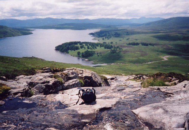
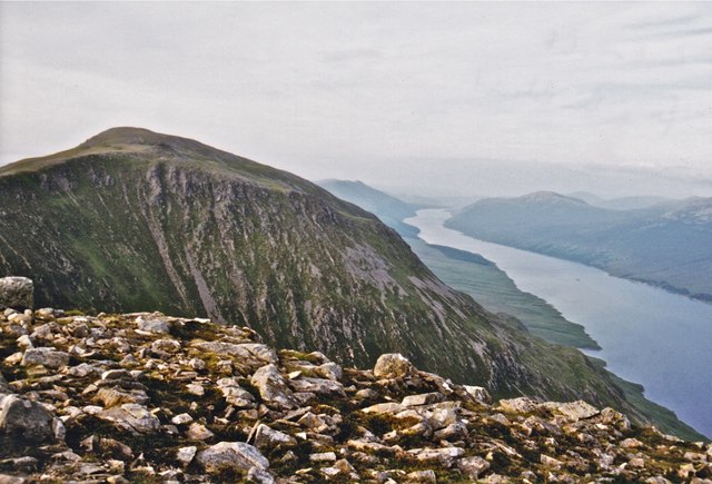
The hill is situated near the village of Glenmoriston, offering stunning views of the surrounding countryside and nearby Loch Ness. It is a popular destination for hikers and outdoor enthusiasts, with a well-defined path leading to the summit.

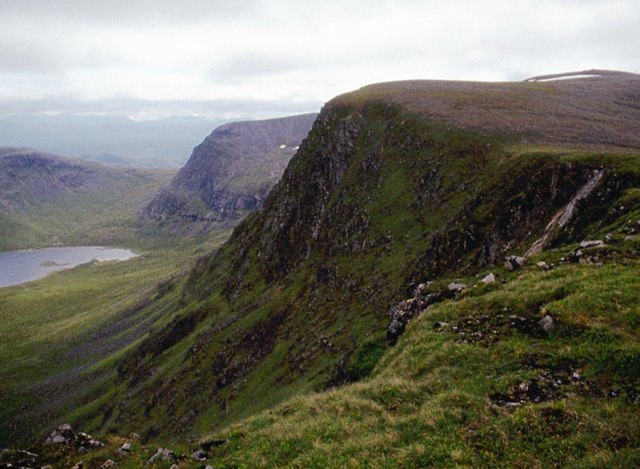
The name Sròn Bealach Beithe translates to "Nose of the Birch Pass" in Gaelic, referencing the distinctive shape of the hill and the presence of birch trees in the area. The terrain is rugged and challenging, with steep slopes and rocky outcrops to navigate.

Wildlife is abundant on Sròn Bealach Beithe, with birdwatchers often spotting golden eagles, peregrine falcons, and other bird species in the area. Red deer and other mammals can also be seen roaming the hillside.

Overall, Sròn Bealach Beithe offers a rewarding outdoor experience for those looking to explore the natural beauty of the Scottish Highlands.

If you have any feedback on the listing, please let us know in the comments section below.

Sròn Bealach Beithe Images

Images are sourced within 2km of 56.804398/-4.4597691 or Grid Reference NN4970. Thanks to Geograph Open Source API. All images are credited.

Ben Alder skyline from the Fara ridge Taken from the top shown in  <a href="https://www.geograph.org.uk/photo/7244097">NN5882 : Unnamed top on the Fara ridge</a>, Ben Alder is about 8 miles to the south.  The skyline features L to R are Beinn Bheoil, Bealach Beithe, Ben Alder, Bealach Dubh, Lancet Edge (Sgor Iutharn), Carn Dearg (front), Aonach Beag (behind Carn Dearg), An Lairig, Beinn a' Clachair, Geal Charn.
Ben Alder skyline from the Fara ridge
Taken from the top shown in NN5882 : Unnamed top on the Fara ridge, Ben Alder is about 8 miles to the south. The skyline features L to R are Beinn Bheoil, Bealach Beithe, Ben Alder, Bealach Dubh, Lancet Edge (Sgor Iutharn), Carn Dearg (front), Aonach Beag (behind Carn Dearg), An Lairig, Beinn a' Clachair, Geal Charn.
The burn running up behind Benalder Cottage with Loch Ericht A wonderful spot to paddle and relax on a perfect day.
The burn running up behind Benalder Cottage with Loch Ericht
A wonderful spot to paddle and relax on a perfect day.
Ben Alder's summit plateau Last of the snow
Ben Alder's summit plateau
Last of the snow
Allt a' Gharbh Choire Looking from Ben Alder summit down onto a small burn.
Allt a' Gharbh Choire
Looking from Ben Alder summit down onto a small burn.
Lochan a' Gharbh Choire Ice and snow still evident in june.
Lochan a' Gharbh Choire
Ice and snow still evident in june.
Ben Alder summit ridge Almost there!  After a very enjoyable scramble up the Long Leachas, tempted by the SMC guide's promise of "..better situations...", one steep pull and then you're on to the last long slope to the summit. What a great hill for stravaiging over the plateau!
Ben Alder summit ridge
Almost there! After a very enjoyable scramble up the Long Leachas, tempted by the SMC guide's promise of "..better situations...", one steep pull and then you're on to the last long slope to the summit. What a great hill for stravaiging over the plateau!
Beinn Bheoil and Loch Ericht Taken from the same location as geograph <a href="https://www.geograph.org.uk/photo/46912">NN5170 : Beinn Bheòil and Loch Ericht</a> but four years earlier - not much changed! The walk over Beinn Bheoil followed on from Ben Alder and made for a spectacular day out. It was (almost) downhill all the way back to Dalwhinnie on the bike!
Beinn Bheoil and Loch Ericht
Taken from the same location as geograph NN5170 : Beinn Bheòil and Loch Ericht but four years earlier - not much changed! The walk over Beinn Bheoil followed on from Ben Alder and made for a spectacular day out. It was (almost) downhill all the way back to Dalwhinnie on the bike!
Ben Alder -Beinn Bheoil bealach The Bealach Breabag gives a route from Ben Alder cottage to Culra bothy between these two fine hills. On the down side, I've never seen so many ticks crawling over the heather as at this bealach!
Ben Alder -Beinn Bheoil bealach
The Bealach Breabag gives a route from Ben Alder cottage to Culra bothy between these two fine hills. On the down side, I've never seen so many ticks crawling over the heather as at this bealach!
Garbh-Choire Beag, Ben Alder
Summit trig point , Ben Alder
The cliffs of Ben Alder
Bealach Breabag with Loch a Bhealaich Beithe A quiet spot, even in July.
Bealach Breabag with Loch a Bhealaich Beithe
A quiet spot, even in July.
Sròn Bealach Beithe
Sròn Bealach Beithe
East flank of Beinn Bheoil and Loch Ericht
Beinn Bheòil summit looking across to Sròn Coire na h-Iolaire South end of Loch Ericht lies below.
Beinn Bheòil summit looking across to Sròn Coire na h-Iolaire
South end of Loch Ericht lies below.
Ben Alder summit camp
Looking SW at dawn from near the summit of Ben Alder Taken during a weekend ski tour, and an early rise for photographs after a summit camp.
Looking SW at dawn from near the summit of Ben Alder
Taken during a weekend ski tour, and an early rise for photographs after a summit camp.
View ENE from near Ben Alder summit at dawn Taken during a weekend ski tour and summit camp
View ENE from near Ben Alder summit at dawn
Taken during a weekend ski tour and summit camp
Show me another place!

Sròn Bealach Beithe is located at Grid Ref: NN4970 (Lat: 56.804398, Lng: -4.4597691)

Unitary Authority: Highland

Police Authority: Highlands and Islands

What 3 Words

///argue.brownish.dream. Near Pubil, Perth & Kinross

Nearby Locations

Sròn Bealach Beithe

Related Wikis

Lochan a' Garbh Coire

Lochan a' Garbh Coire is a small freshwater loch located below the summit of Ben Alder in the Highlands of Scotland. At over 1,120 m (3,670 ft) above sea...

Ben Alder

Ben Alder (Scottish Gaelic: Beinn Eallair) is the highest mountain in the remote area of the Scottish Highlands between Loch Ericht and Glen Spean. It...

Beinn Bheoil

Beinn Bheoil (1,019 m) is a mountain in the Grampian Mountains of Scotland, located on the western shore of Loch Ericht in Highland. Taking the form of...

Stob an Aonaich Mhòir

Stob an Aonaich Mhoir (855 m) is a remote mountain in the Grampian Mountains of Scotland. It lies in Perthshire, on the eastern shore of Loch Ericht. Due...

Nearby Amenities

Located within 500m of 56.804398,-4.4597691
Garbh Choire
Place: locality
Lat/Long: 56.8084323/-4.4575739
The data included in this document is from www.openstreetmap.org. The data is made available under ODbL.

Have you been to Sròn Bealach Beithe?

Leave your review of Sròn Bealach Beithe below (or comments, questions and feedback).