Braehead

Hill, Mountain in Ayrshire

Scotland

Braehead

Auchinleck Castle A wee alcove, or shelf, cut in the solid rock inside Auchinleck Castle.
This photo was taken on the 25th June 2022.
Auchinleck Castle Credit: Rab McMurdo

Braehead is a prominent hill located in Ayrshire, Scotland. With an elevation of approximately 310 meters (1,017 feet) above sea level, it offers breathtaking panoramic views of the surrounding countryside. Situated near the town of Ayr, Braehead is a popular destination for outdoor enthusiasts, hikers, and nature lovers.

The hill is characterized by its gentle slopes and dense vegetation, primarily consisting of heather, grasses, and scattered trees. The terrain is relatively easy to navigate, making it accessible to individuals of varying fitness levels. Several well-marked trails crisscross the hill, allowing visitors to explore its diverse flora and fauna.

Braehead is home to a rich variety of wildlife, including birds such as buzzards, kestrels, and pheasants. The hill's diverse ecosystem also supports a range of small mammals, such as rabbits, foxes, and squirrels. Nature enthusiasts may also encounter various species of butterflies and wildflowers during their visit.

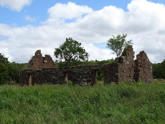
Aside from its natural beauty, Braehead has historical significance as well. At the summit, there are remnants of an ancient hill fort, believed to date back to the Iron Age. This archaeological site provides a glimpse into the area's past and offers visitors an opportunity to learn about its cultural heritage.

Furthermore, Braehead's close proximity to Ayr makes it easily accessible for day trips or longer excursions. Its tranquil and picturesque setting makes it an ideal destination for those seeking a peaceful retreat in nature.

If you have any feedback on the listing, please let us know in the comments section below.

Braehead Images

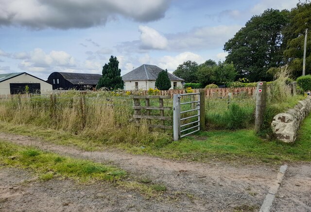
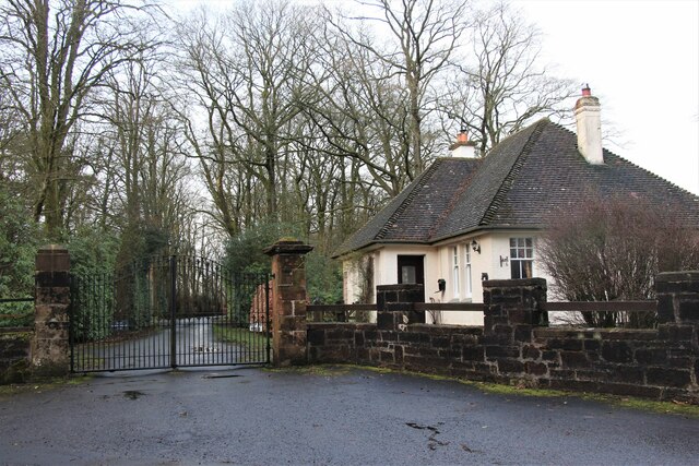
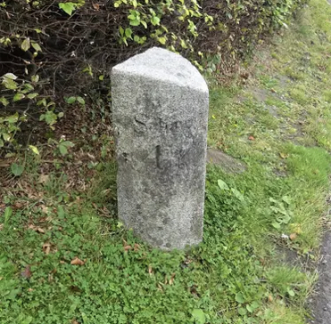
Images are sourced within 2km of 55.490493/-4.3828972 or Grid Reference NS4924. Thanks to Geograph Open Source API. All images are credited.

Auchinleck Castle A wee alcove, or shelf, cut in the solid rock inside Auchinleck Castle.
This photo was taken on the 25th June 2022.
Auchinleck Castle
A wee alcove, or shelf, cut in the solid rock inside Auchinleck Castle. This photo was taken on the 25th June 2022.
Wallace's Cave Inside Wallace's Cave.
This photo was taken on the 25th June 2022.
Wallace's Cave
Inside Wallace's Cave. This photo was taken on the 25th June 2022.
River Ayr Walk near Mauchline River Ayr Walk near Mauchline.
River Ayr Walk near Mauchline
River Ayr Walk near Mauchline.
North East Lodge at Barskimming
Snowdrop Walk Snowdrop Walk between the two Auchinleck castles.
Snowdrop Walk
Snowdrop Walk between the two Auchinleck castles.
Old Milestone by Barskimming Road, Mauchline Parish Ayr granite by the UC road, in parish of Mauchline (Kyle District), South of cemetery, outside Bentfield.

Inscription reads:- : Schaw / 4¾ : : Mauchline / 1 :

Surveyed

Milestone Society National ID: AYE_MCSW01
Old Milestone by Barskimming Road, Mauchline Parish
Ayr granite by the UC road, in parish of Mauchline (Kyle District), South of cemetery, outside Bentfield. Inscription reads:- : Schaw / 4¾ : : Mauchline / 1 : Surveyed Milestone Society National ID: AYE_MCSW01
Auchinleck Mains These ruins are all that's left of Auchinleck Mains farm.
This photo was taken on the 25th June 2022.
Auchinleck Mains
These ruins are all that's left of Auchinleck Mains farm. This photo was taken on the 25th June 2022.
Auchinleck Estate An old bridge over the Dippol Burn.
This photo was taken on the 25th June 2022.
Auchinleck Estate
An old bridge over the Dippol Burn. This photo was taken on the 25th June 2022.
Sandstone cliffs on the River Ayr Sandstone cliffs on the River Ayr near Haugh Farm.
Sandstone cliffs on the River Ayr
Sandstone cliffs on the River Ayr near Haugh Farm.
Doocot at Holm Farm near Ochiltree A doocot at Holm Farm near Ochiltree.
Doocot at Holm Farm near Ochiltree
A doocot at Holm Farm near Ochiltree.
Auchinleck House, Ayrshire Built in the late 1750's for Alexander Boswell, Lord Auchinleck, a Scottish judge and father of James Boswell, the biographer of Dr Samuel Johnson.
See <span class="nowrap"><a title="http://canmore.rcahms.gov.uk/en/site/43613/details/auchinleck+house/" rel="nofollow ugc noopener" href="http://canmore.rcahms.gov.uk/en/site/43613/details/auchinleck+house/">Link</a><img style="margin-left:2px;" alt="External link" title="External link - shift click to open in new window" src="https://s1.geograph.org.uk/img/external.png" width="10" height="10"/></span>
Auchinleck House, Ayrshire
Built in the late 1750's for Alexander Boswell, Lord Auchinleck, a Scottish judge and father of James Boswell, the biographer of Dr Samuel Johnson. See LinkExternal link
Cup and ring markings near Mauchline The Cup and Ring markings consist of over 200 markings some of which are unique to the area. The carvings have been dated between the Neolithic and early Bronze age and reckoned to have been made over a period of about 1000 years. The marking would have eroded long ago if they had not been made on this unusual face of "hard sandstone". Despite graffiti from the 19th century, the markings lay unnoticed again until 1986 when a local man walking his dog spotted them. The site is among the top 10 most important "Cup and Ring" sites in Britain.
Cup and ring markings near Mauchline
The Cup and Ring markings consist of over 200 markings some of which are unique to the area. The carvings have been dated between the Neolithic and early Bronze age and reckoned to have been made over a period of about 1000 years. The marking would have eroded long ago if they had not been made on this unusual face of "hard sandstone". Despite graffiti from the 19th century, the markings lay unnoticed again until 1986 when a local man walking his dog spotted them. The site is among the top 10 most important "Cup and Ring" sites in Britain.
Ballochmyle Viaduct over the river Ayr Ballochmyle Viaduct was one of the greatest engineering achievements of its time - the world's largest masonry span arch. Work started on March 1846.  It still claims to be the UK's highest railway viaduct.  The bridge became a star in the film Mission Impossible when the famous scene on the top of the train was filmed while the train crossed over the viaduct.  The town of Catrine was apparently clearly visible in the background.
Ballochmyle Viaduct over the river Ayr
Ballochmyle Viaduct was one of the greatest engineering achievements of its time - the world's largest masonry span arch. Work started on March 1846. It still claims to be the UK's highest railway viaduct. The bridge became a star in the film Mission Impossible when the famous scene on the top of the train was filmed while the train crossed over the viaduct. The town of Catrine was apparently clearly visible in the background.
Ballochmyle Viaduct The greatest stone arch in the world when it was built between 1846 and 1848.  And still in regular use!
Ballochmyle Viaduct
The greatest stone arch in the world when it was built between 1846 and 1848. And still in regular use!
Junction of road to Kingencleugh House and A76(T) Grassmillees Cottage lies on the edge of the A76(T) road from Kilmarnock to Dumfries. The farm of Grassmillees can just be seen behind the trees and bushes on the hilltop.
Junction of road to Kingencleugh House and A76(T)
Grassmillees Cottage lies on the edge of the A76(T) road from Kilmarnock to Dumfries. The farm of Grassmillees can just be seen behind the trees and bushes on the hilltop.
Auchinleck House
Auchinleck House
Cattle Cattle grazing on farmland near Syke farm
Cattle
Cattle grazing on farmland near Syke farm
Cattle grazing
Cattle grazing
Show me another place!

Braehead is located at Grid Ref: NS4924 (Lat: 55.490493, Lng: -4.3828972)

Unitary Authority: East Ayrshire

Police Authority: Ayrshire

What 3 Words

///blown.remarried.surreal. Near Mauchline, East Ayrshire

Nearby Locations

Braehead Newlands Wood

Related Wikis

Lugar Water

The Lugar Water, or River Lugar, is created by the confluence of the Bellow Water and the Glenmuir Water, just north of Lugar, both of which flow from...

Haugh, East Ayrshire

Haugh or The Haugh is a small village or hamlet in East Ayrshire, Parish of Mauchline, Scotland. The habitation is situated about two and a half miles...

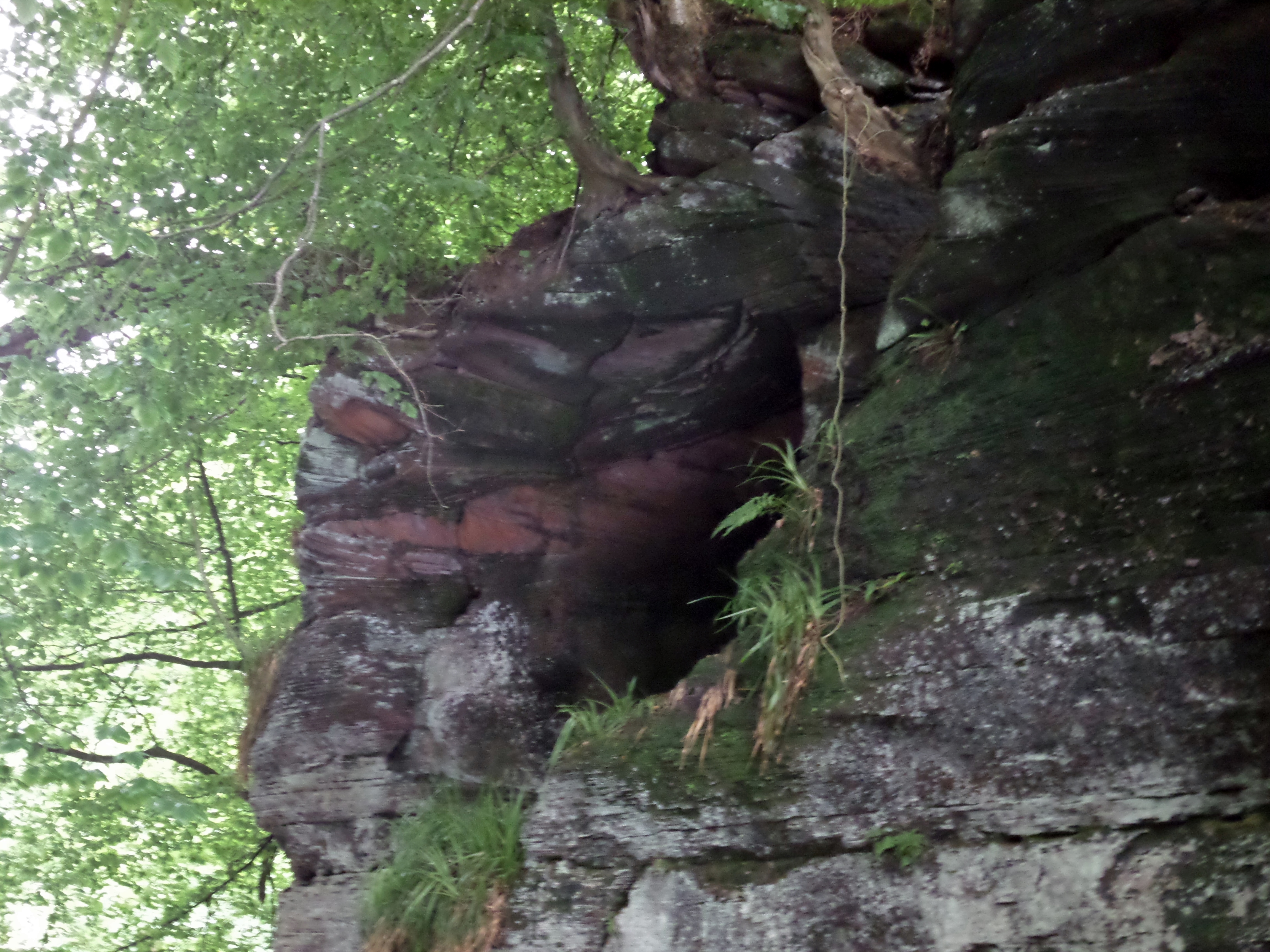
Peden's Cave (Auchinbay)

Peden's Cave is at least partly artificial and is set into a craggy outcrop of red sandstone rocks overlooking the River Lugar just below the farm of Auchinbay...

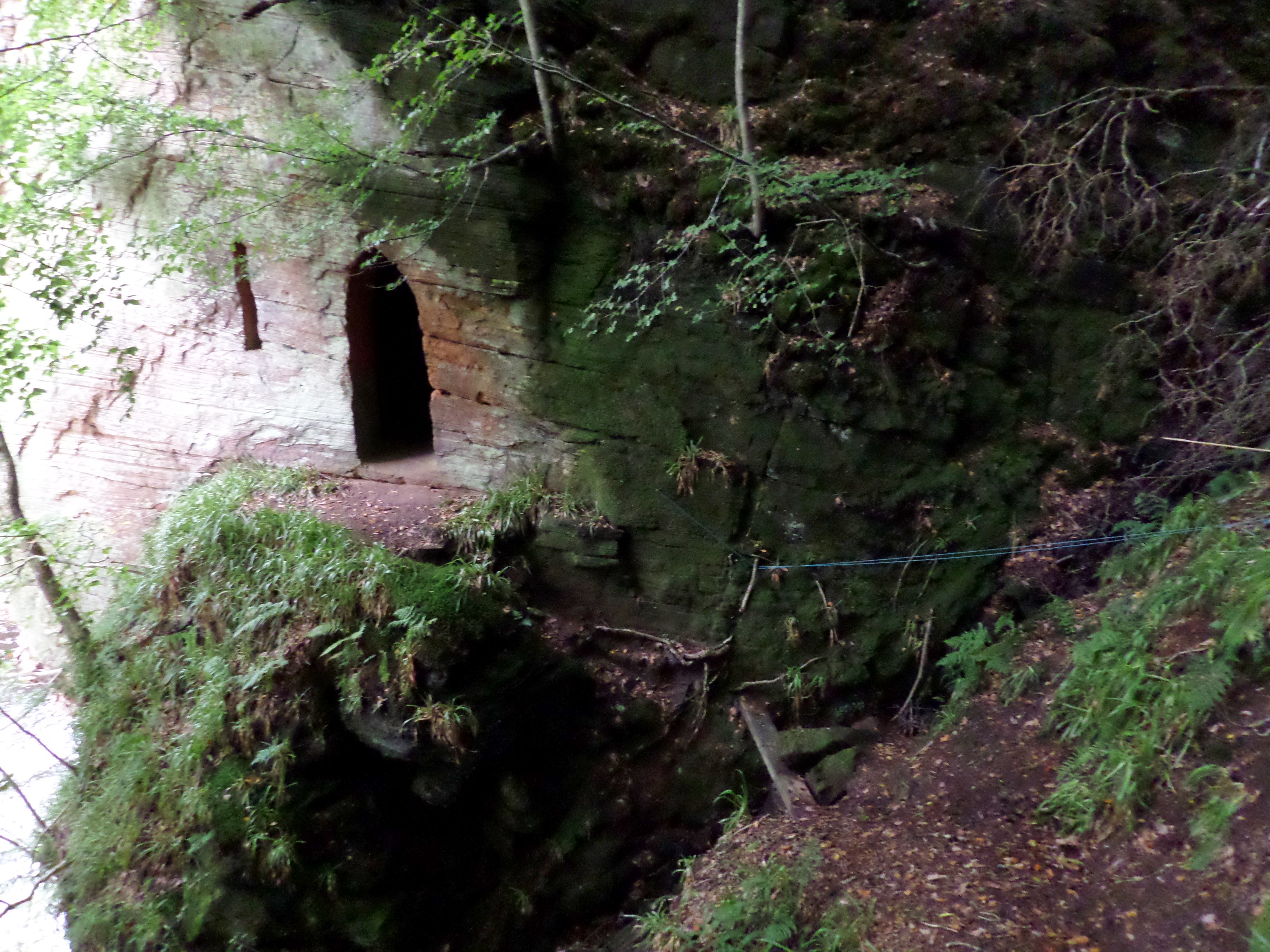
Wallace's Cave, Auchinleck

Wallace's Cave in the Lugar Gorge at Auchinleck in the Parish of Auchinleck is an 18th-century grotto contemporary with Dr Johnson's Summerhouse, also...

Nearby Amenities

Located within 500m of 55.490493,-4.3828972
Power: pole
Lat/Long: 55.4871035/-4.3868615
Power: pole
Lat/Long: 55.4879136/-4.3865089
Power: pole
Lat/Long: 55.4886787/-4.3861877
Power: pole
Lat/Long: 55.4894105/-4.3858778
Power: pole
Lat/Long: 55.4901974/-4.3855453
Power: pole
Lat/Long: 55.4909432/-4.3852219
Power: pole
Lat/Long: 55.4917224/-4.3848984
Power: pole
Lat/Long: 55.4924938/-4.3845908
Power: pole
Lat/Long: 55.4931384/-4.3843284
Power: pole
Lat/Long: 55.4941546/-4.3838963
Power: pole
Lat/Long: 55.494225/-4.3838692
Power: pole
Lat/Long: 55.494908/-4.3832901
Power: pole
Lat/Long: 55.4871267/-4.3853508
Power: pole
Lat/Long: 55.4871536/-4.3838511
Power: pole
Lat/Long: 55.4871805/-4.3824758
Power: pole
Lat/Long: 55.4871972/-4.3810281
Power: pole
Lat/Long: 55.4872305/-4.3794311
Power: pole
Lat/Long: 55.4872459/-4.3779993
The data included in this document is from www.openstreetmap.org. The data is made available under ODbL.

Have you been to Braehead?

Leave your review of Braehead below (or comments, questions and feedback).