Dod Hill

Hill, Mountain in Renfrewshire

Scotland

Dod Hill

White Loch B769 on the left.
White Loch Credit: wfmillar

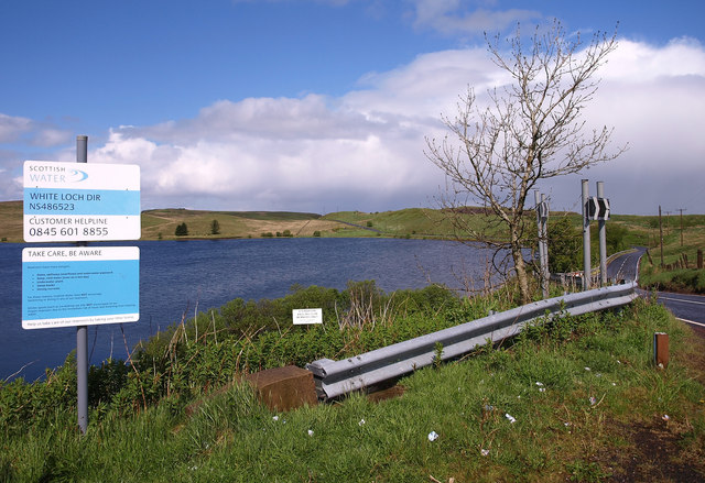
Dod Hill is a prominent hill located in Renfrewshire, Scotland. Standing at an elevation of 451 meters (1,480 feet), it is a popular destination for hikers and outdoor enthusiasts looking to enjoy stunning views of the surrounding landscape.

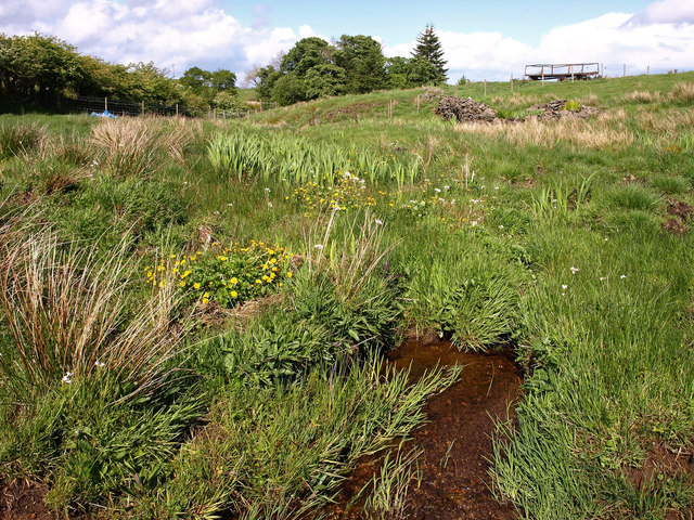
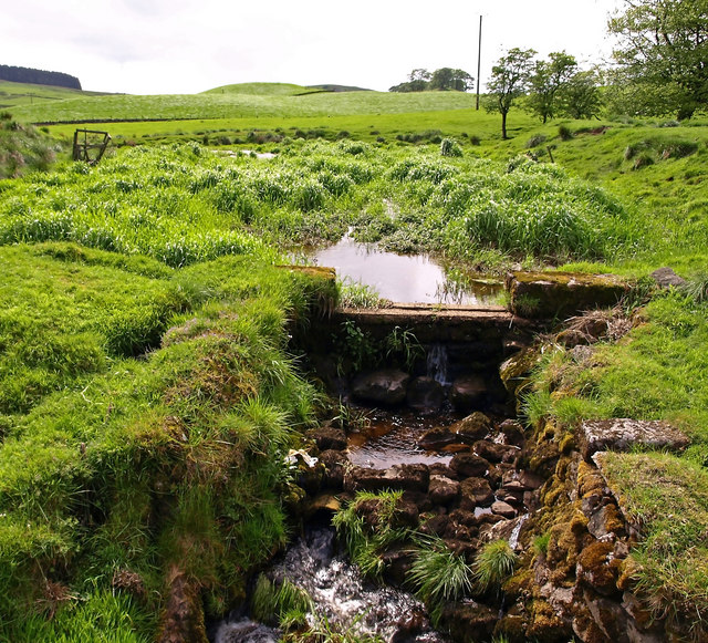
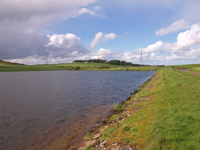
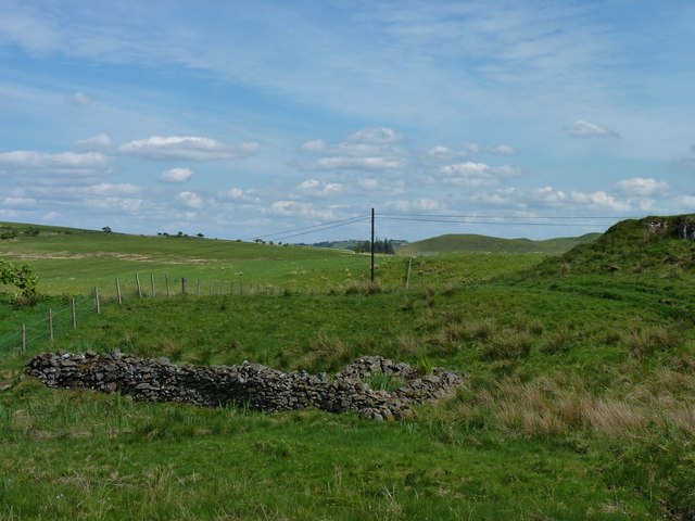
The hill is part of the Renfrewshire Hills, a range of hills located in the southern part of Scotland. Dod Hill is known for its rugged terrain and steep slopes, making it a challenging hike for those looking for a more strenuous outdoor adventure.

At the summit of Dod Hill, hikers are rewarded with panoramic views of the Renfrewshire countryside, including rolling hills, lush forests, and distant mountains. On a clear day, it is possible to see as far as the Firth of Clyde and the Isle of Arran.

The area surrounding Dod Hill is rich in wildlife, with a variety of bird species, deer, and other animals calling the hill home. The hill is also steeped in history, with ancient ruins and burial mounds scattered throughout the landscape, adding to its charm and intrigue for visitors.

If you have any feedback on the listing, please let us know in the comments section below.

Dod Hill Images

Images are sourced within 2km of 55.751062/-4.4015708 or Grid Reference NS4953. Thanks to Geograph Open Source API. All images are credited.

White Loch B769 on the left.
White Loch
B769 on the left.
White Loch The north end of the loch.
White Loch
The north end of the loch.
Small Burn Near Mearns Law.
Small Burn
Near Mearns Law.
Old Dam, South Craigton The Walton Burn was used to create this small disused reservoir.
Old Dam, South Craigton
The Walton Burn was used to create this small disused reservoir.
Walton Dam Near Neilston.
Walton Dam
Near Neilston.
Neilston countryside This view looks east from the top of Neilston Pad over several of the farms in the area, towards Newton Mearns in the distance. Snypes Dam (<a href="https://www.geograph.org.uk/photo/1519619">NS4855 : Neilston Trout Fishery from above</a>) is in the foreground, and Walton Dam (e.g. <a href="https://www.geograph.org.uk/photo/245407">NS4955 : Walton Dam</a>) beyond.
Neilston countryside
This view looks east from the top of Neilston Pad over several of the farms in the area, towards Newton Mearns in the distance. Snypes Dam (NS4855 : Neilston Trout Fishery from above) is in the foreground, and Walton Dam (e.g. NS4955 : Walton Dam) beyond.
Bushy cluster Small copse near Driffenbeg farm.
Bushy cluster
Small copse near Driffenbeg farm.
Passing White Loch The B769 near the shore of White Loch.
Passing White Loch
The B769 near the shore of White Loch.
Remains of a wall Near Dodside.
Remains of a wall
Near Dodside.
Walton Dam This wee reservoir lies south of Barrhead and is popular with local anglers.
Walton Dam
This wee reservoir lies south of Barrhead and is popular with local anglers.
Walton Dam outflow Water flows out of Walton Dam through this channel.
Walton Dam outflow
Water flows out of Walton Dam through this channel.
North Walton farm road A minor public road loops off Springhill Road at Walton Dam. Here it turns sharp right, at the start of the road to North Walton farm.
North Walton farm road
A minor public road loops off Springhill Road at Walton Dam. Here it turns sharp right, at the start of the road to North Walton farm.
Countryside around Walton Dam The picture looks roughly north across the countryside near Walton Dam, part of which is visible just left of centre. The prominent wee hill of Duncarnock is at the right. Greater Glasgow lies beyond.
Countryside around Walton Dam
The picture looks roughly north across the countryside near Walton Dam, part of which is visible just left of centre. The prominent wee hill of Duncarnock is at the right. Greater Glasgow lies beyond.
Craigton Farm Looking across Walton Burn from Craigton Road.
Craigton Farm
Looking across Walton Burn from Craigton Road.
Black Loch The picture is taken from the minor road as it approaches Black Loch from the east.
Black Loch
The picture is taken from the minor road as it approaches Black Loch from the east.
Spume near the Black Loch outflow Froth has accumulated at the edge of Black Loch, near the outflow at its northeast corner.
Spume near the Black Loch outflow
Froth has accumulated at the edge of Black Loch, near the outflow at its northeast corner.
North end of Black Loch
Black Loch spume detail Undisturbed by strong winds, the froth at the edge of Black Loch near its outflow has formed regular patterns, here broken up around a couple of rocks.
Black Loch spume detail
Undisturbed by strong winds, the froth at the edge of Black Loch near its outflow has formed regular patterns, here broken up around a couple of rocks.
Show me another place!

Dod Hill is located at Grid Ref: NS4953 (Lat: 55.751062, Lng: -4.4015708)

Unitary Authority: East Renfrewshire

Police Authority: Greater Glasgow

What 3 Words

///line.saving.smooth. Near Neilston, East Renfrewshire

Nearby Locations

Dod Hill

Related Wikis

Neilston Pad

Neilston Pad, referred to locally as The Pad, is a distinctive hill in East Renfrewshire, situated a mile (1.5 km) south of the village of Neilston. Its...

Craighall Reservoir

Craighall Reservoir, known locally as Craighall Dam, is one of a number of small reservoirs, situated around Neilston in East Renfrewshire, Scotland. The...

Netherplace

Netherplace is a hamlet in East Renfrewshire. It is to the west of Newton Mearns, and adjacent to the M77 motorway. The settlement is almost entirely along...

Netherton Goods station

Netherton Goods station or Netherton Depot was a railway public freight facility located between Neilston railway station and Patterton railway station...

Nearby Amenities

Located within 500m of 55.751062,-4.4015708
Generator Method: wind_turbine
Generator Output Electricity: 2.0 MW
Generator Source: wind
Generator Type: horizontal_axis
Manufacturer: Gamesa
Model: G80
Power: generator
Source: survey
Lat/Long: 55.7513534/-4.4040512
Dod Hill
Ele: 275
Natural: peak
Lat/Long: 55.7514306/-4.3998298
Power: pole
Lat/Long: 55.7478431/-4.3960036
Power: pole
Lat/Long: 55.7485713/-4.3955883
Power: pole
Lat/Long: 55.7492913/-4.3951897
Power: pole
Lat/Long: 55.7500206/-4.3947682
Power: pole
Lat/Long: 55.750501/-4.3944906
Power: pole
Lat/Long: 55.7509391/-4.3942319
Power: pole
Lat/Long: 55.7515956/-4.3938562
Power: pole
Lat/Long: 55.7525091/-4.3941407
The data included in this document is from www.openstreetmap.org. The data is made available under ODbL.

Have you been to Dod Hill?

Leave your review of Dod Hill below (or comments, questions and feedback).