Drumbeg

Hill, Mountain in Stirlingshire

Scotland

Drumbeg

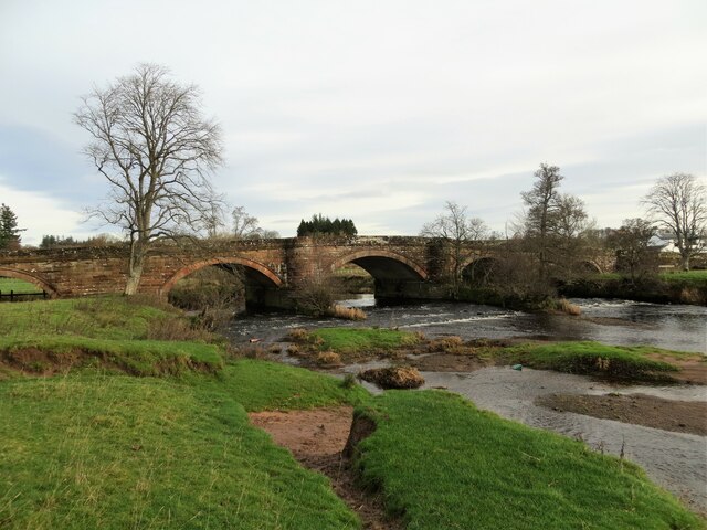
Gartness Bridge
Gartness Bridge Credit: Peter Ward

The requested URL returned error: 429 Too Many Requests

If you have any feedback on the listing, please let us know in the comments section below.

Drumbeg Images

Images are sourced within 2km of 56.060145/-4.4352968 or Grid Reference NS4887. Thanks to Geograph Open Source API. All images are credited.
Gartness Bridge
Gartness Bridge
Weir on River Endrick River in Spate
Weir on River Endrick
River in Spate
Weir from Gartness Bridge
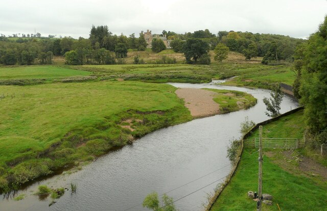
The Endrick Water Seen from the Endrick Viaduct. Dalnair House is in the distance.
The Endrick Water
Seen from the Endrick Viaduct. Dalnair House is in the distance.
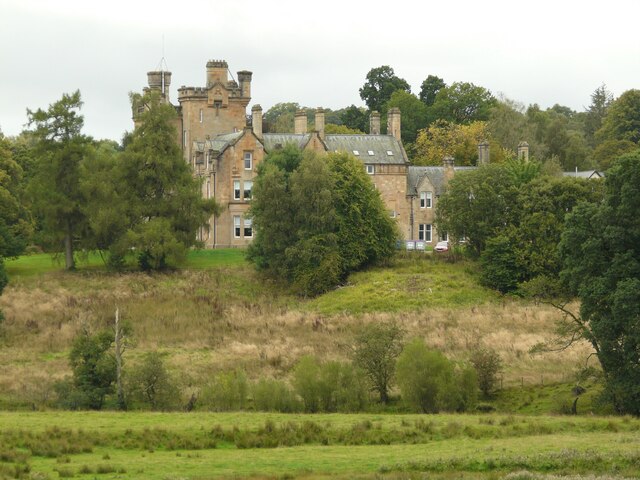
Dalnair House Seen from the Endrick Viaduct. A Category B listed baronial mansion <span class="nowrap"><a title="http://portal.historicenvironment.scot/designation/LB49000" rel="nofollow ugc noopener" href="http://portal.historicenvironment.scot/designation/LB49000">Link</a><img style="margin-left:2px;" alt="External link" title="External link - shift click to open in new window" src="https://s1.geograph.org.uk/img/external.png" width="10" height="10"/></span> dating from 1884. It is also known as Dalnair Castle. It has recently been extensively renovated as a residential development of 10 luxury apartments.
Dalnair House
Seen from the Endrick Viaduct. A Category B listed baronial mansion LinkExternal link dating from 1884. It is also known as Dalnair Castle. It has recently been extensively renovated as a residential development of 10 luxury apartments.
Galls Silk button galls formed by Neuroterus numismalis, a cynipid wasp; and common spangle galls formed by another cynipid wasp, Neuroterus quercusbaccarum on an oak leak.
Galls
Silk button galls formed by Neuroterus numismalis, a cynipid wasp; and common spangle galls formed by another cynipid wasp, Neuroterus quercusbaccarum on an oak leak.
Grazing ponies Beside Spittal.
Grazing ponies
Beside Spittal.
Confined space The padlocked door gives access to some steps down into some kind of chamber - presumably relating to water supply. The sign on the door warns of a 'confined space' and no unauthorised entry.
Confined space
The padlocked door gives access to some steps down into some kind of chamber - presumably relating to water supply. The sign on the door warns of a 'confined space' and no unauthorised entry.
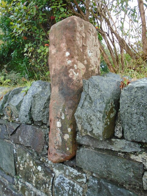
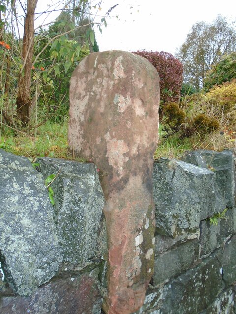
Old milestone This shows the left side of the red sandstone milestone in the wall opposite the Buchanan Arms in Drymen.  A very worn 22 can just be made out which is the mileage to Stirling.  It is marked on the 1776 Taylor & Skinner map 1776 and is on the route of the Old Military Road built by Major William Caufeild 1765-97
Old milestone
This shows the left side of the red sandstone milestone in the wall opposite the Buchanan Arms in Drymen. A very worn 22 can just be made out which is the mileage to Stirling. It is marked on the 1776 Taylor & Skinner map 1776 and is on the route of the Old Military Road built by Major William Caufeild 1765-97
Old milestone This shows the right face of the red sandstone milestone in the wall opposite the Buchanan Arms in Drymen. A faint 12 can be made out which is the distance to Dumbarton.  There is a similar stone on the A811 in West Dunbartonshire at <a href="https://www.geograph.org.uk/gridref/NS+4148+8525">NS 4148 8525</a>.
Old milestone
This shows the right face of the red sandstone milestone in the wall opposite the Buchanan Arms in Drymen. A faint 12 can be made out which is the distance to Dumbarton. There is a similar stone on the A811 in West Dunbartonshire at NS 4148 8525.
Drymen Bridge over Endrick Water
Drumbeg trig pillar hiding amongst the gorse
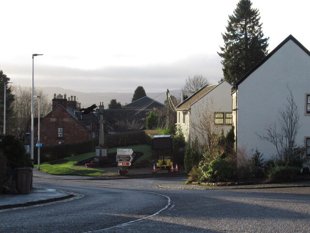
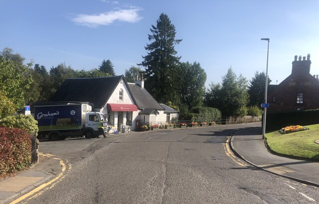
Drymen View south towards the Balmaha turning where there is a big variable message sign with a couple of the usual parkspeak hectoring messages referring to parking responsibly and generally not trashing the place.
Drymen
View south towards the Balmaha turning where there is a big variable message sign with a couple of the usual parkspeak hectoring messages referring to parking responsibly and generally not trashing the place.
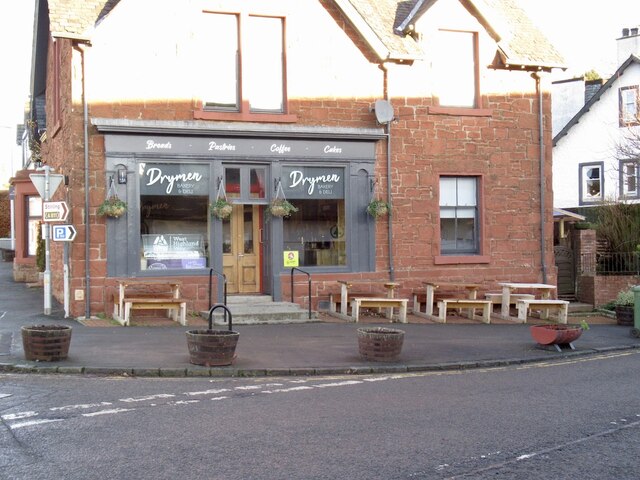
Cafe, Drymen Once a bike shop.
Cafe, Drymen
Once a bike shop.
The Village Hub, Drymen Village shop selling local produce and zero-waste products
The Village Hub, Drymen
Village shop selling local produce and zero-waste products
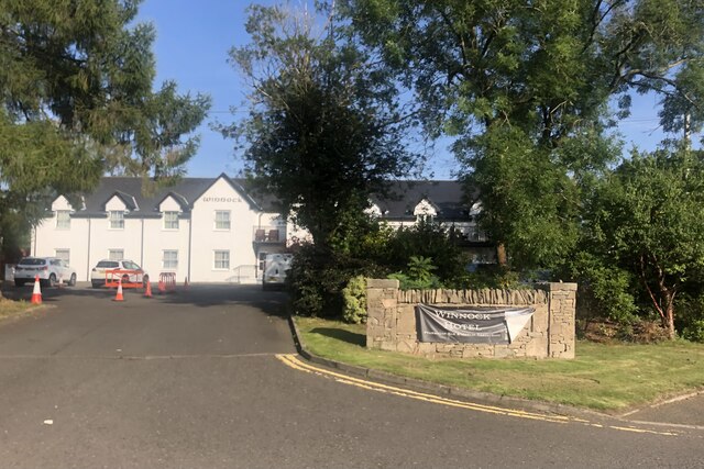
The Winnock Hotel, Drymen
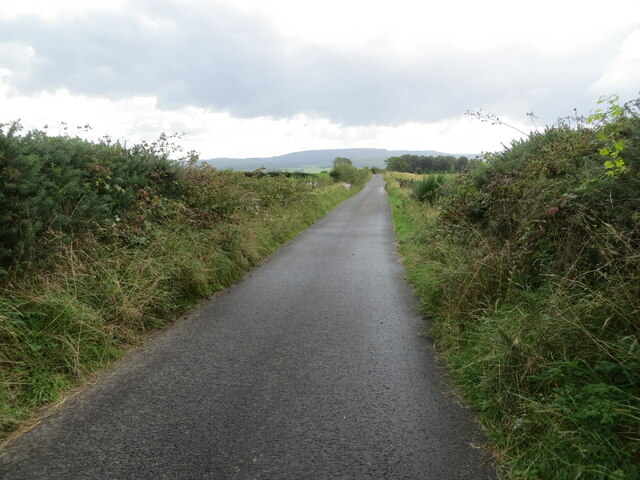
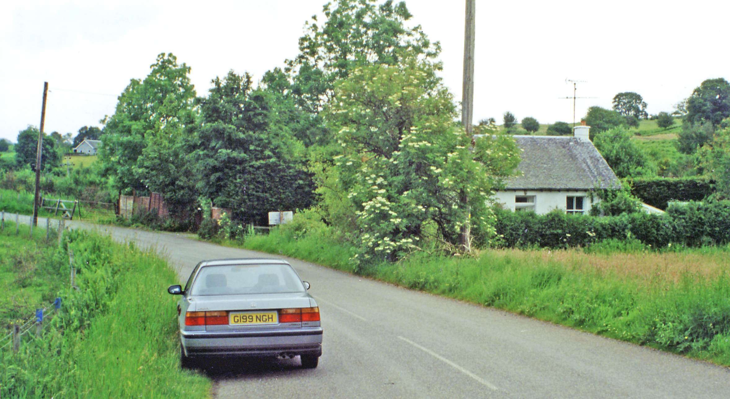
Gartness Road near Gateside House Looking north-westward. This section or road is used by the West Highland Way Path.
Gartness Road near Gateside House
Looking north-westward. This section or road is used by the West Highland Way Path.
Gartness Road at the hedge hidden Dumbeg Triangulation Pillar Looking southward. This section of road is used by the West Highland Way Path.
Gartness Road at the hedge hidden Dumbeg Triangulation Pillar
Looking southward. This section of road is used by the West Highland Way Path.
Show me another place!

Drumbeg is located at Grid Ref: NS4887 (Lat: 56.060145, Lng: -4.4352968)

Unitary Authority: Stirling

Police Authority: Forth Valley

What 3 Words

///reset.transfers.acoustics. Near Killearn, Stirling

Nearby Locations

Drumbeg

Related Wikis

Drumquhassle

Drumquhassle was a Roman fort associated with the Gask Ridge in Scotland. It was found from aerial photography in the late 1970s. The name selected for...

Drymen

Drymen (; from Scottish Gaelic: Druiminn [ˈt̪ɾɯmɪɲ]) is a village in the Stirling district of central Scotland. Once a popular stopping place for cattle...

Drymen railway station

Drymen railway station served the village of Croftamie, Stirling, Scotland, from 1856 to 1934 on the Forth and Clyde Junction Railway. == History == The...

Gartness railway station

Gartness railway station served the hamlet of Gartness, Stirling, Scotland, from 1856 to 1934 on the Forth and Clyde Junction Railway. == History == The...

Nearby Amenities

Located within 500m of 56.060145,-4.4352968
Gateside
Place: hamlet
Lat/Long: 56.0639145/-4.434185
Power: pole
Lat/Long: 56.0626369/-4.429541
Power: pole
Lat/Long: 56.0620647/-4.4304154
Power: pole
Lat/Long: 56.0614936/-4.4311119
Power: pole
Lat/Long: 56.0609681/-4.4317792
Power: pole
Lat/Long: 56.0603561/-4.4316558
Power: pole
Lat/Long: 56.059381/-4.4309069
Power: pole
Lat/Long: 56.0587585/-4.4304216
Power: pole
Lat/Long: 56.0582282/-4.4300263
Power: pole
Lat/Long: 56.0573056/-4.430384
Power: pole
Lat/Long: 56.0579514/-4.4295829
Power: pole
Lat/Long: 56.0585202/-4.4299573
Power: pole
Lat/Long: 56.0582609/-4.4284659
Power: pole
Lat/Long: 56.0628109/-4.4408082
Power: pole
Lat/Long: 56.0628751/-4.4396849
Power: pole
Lat/Long: 56.0629405/-4.4385365
Power: pole
Lat/Long: 56.0630129/-4.4372815
Power: pole
Lat/Long: 56.0578066/-4.4415382
Power: pole
Lat/Long: 56.0581068/-4.4406157
Power: pole
Lat/Long: 56.0583836/-4.4397121
Power: pole
Lat/Long: 56.0586288/-4.4390678
Power: pole
Lat/Long: 56.0610697/-4.4346543
Power: pole
Lat/Long: 56.0609074/-4.4331189
Power: pole
Lat/Long: 56.060759/-4.4316986
Power: pole
Lat/Long: 56.0614434/-4.4308808
Power: pole
Lat/Long: 56.0619794/-4.4302198
Power: pole
Lat/Long: 56.0625622/-4.4293413
Power: pole
Lat/Long: 56.0609552/-4.4346898
Power: pole
Lat/Long: 56.0608022/-4.4331587
Power: pole
Lat/Long: 56.0606166/-4.4313619
Power: pole
Lat/Long: 56.0595853/-4.4306758
The data included in this document is from www.openstreetmap.org. The data is made available under ODbL.

Have you been to Drumbeg?

Leave your review of Drumbeg below (or comments, questions and feedback).