Craigivairn

Hill, Mountain in Stirlingshire

Scotland

Craigivairn
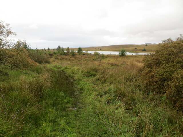
Path giving access to Muir Park Reservoir Looking westward.
Path giving access to Muir Park Reservoir Credit: Peter Wood

The requested URL returned error: 429 Too Many Requests

If you have any feedback on the listing, please let us know in the comments section below.

Craigivairn Images

Images are sourced within 2km of 56.088844/-4.4443105 or Grid Reference NS4891. Thanks to Geograph Open Source API. All images are credited.

Path giving access to Muir Park Reservoir Looking westward.
Path giving access to Muir Park Reservoir
Looking westward.
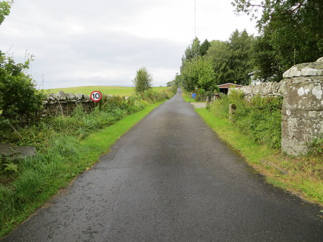
Minor road linking Drymen and Gartmore Looking northward towards Bàt a' Charchel.
Minor road linking Drymen and Gartmore
Looking northward towards Bàt a' Charchel.
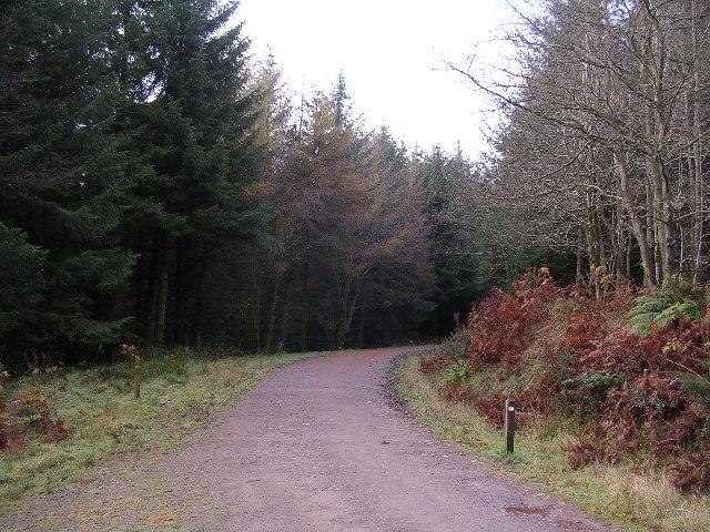
Track through Garadhban Forest Looking north-westward, This section of track is used by the West Highland Way Path.
Track through Garadhban Forest
Looking north-westward, This section of track is used by the West Highland Way Path.
Forest track through High Wood Looking south-eastward. This section of track is used by the West Highland Way Path.
Forest track through High Wood
Looking south-eastward. This section of track is used by the West Highland Way Path.
Minor road near Drymen
Minor road towards Gartmore
Track giving access to Coldrach Looking north-westward.
Track giving access to Coldrach
Looking north-westward.
Garadbhan Forestry Commission Access point into Queen Elizabeth Forest Park above Drymen
Garadbhan Forestry Commission
Access point into Queen Elizabeth Forest Park above Drymen
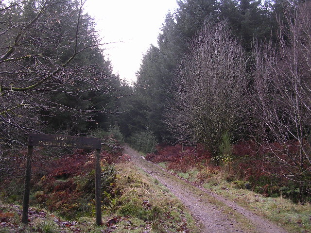
Warning. Maximum load 8 tonnes That's what the sign says. There's a small bridge across a burn here.
Warning. Maximum load 8 tonnes
That's what the sign says. There's a small bridge across a burn here.
West Highland Way in Garadhban Forest
Forest Felling Near Drymen Forest felling beside the West Highland Way near Drymen
Forest Felling Near Drymen
Forest felling beside the West Highland Way near Drymen
National Cycle Route No. 7 The back road to Drymen from Gartmore.
National Cycle Route No. 7
The back road to Drymen from Gartmore.
Muir Park Reservoir Looking north across the water onto Moor Park
Muir Park Reservoir
Looking north across the water onto Moor Park
Rough moorland Close up of the tussocks on Moor Park
Rough moorland
Close up of the tussocks on Moor Park
Sheep grazing Sheep grazing on Moor Park
Sheep grazing
Sheep grazing on Moor Park
The West Highland Way passing through Garadhban Forest
A glimpse of gorse through the trees A view from Garadhban Forest which is part of the Queen Elizabeth Forest Park.  (Although the Forestry Commission sign says Garadbhan, I've been assured that Garadh bàn would be good Gaelic for "fair den", which would suggest that the spelling on the OS map is correct.)
A glimpse of gorse through the trees
A view from Garadhban Forest which is part of the Queen Elizabeth Forest Park. (Although the Forestry Commission sign says Garadbhan, I've been assured that Garadh bàn would be good Gaelic for "fair den", which would suggest that the spelling on the OS map is correct.)
Show me another place!

Craigivairn is located at Grid Ref: NS4891 (Lat: 56.088844, Lng: -4.4443105)

Unitary Authority: Stirling

Police Authority: Forth Valley

What 3 Words

///connector.enclosing.prune. Near Killearn, Stirling

Nearby Locations

Craigivairn

Related Wikis

Buchanan Smithy

Buchanan Smithy is a hamlet in Buchanan in the far west of Stirling, Scotland. The current settlement was mostly purpose-built in the 18th century for...

Drymen

Drymen (; from Scottish Gaelic: Druiminn [ˈt̪ɾɯmɪɲ]) is a village in the Stirling district of central Scotland. Once a popular stopping place for cattle...

Buchanan Castle

Buchanan Castle is a ruined castle in Stirlingshire, Scotland, located 1 mile (1.6 km) west of the village of Drymen. The house was commissioned by The...

Buchanan Auld House

Buchanan Auld House (or Buchanan Old House) is a ruined house in Stirlingshire, Scotland, located 1.5 miles (2.4 km) west of the village of Drymen. Historic...

Nearby Amenities

Located within 500m of 56.088844,-4.4443105
Parking
Lat/Long: 56.08449/-4.4449738
Bicycle: yes
Hiking: yes
Information: map
Map Type: scheme
Tourism: information
Lat/Long: 56.0844866/-4.445523
The data included in this document is from www.openstreetmap.org. The data is made available under ODbL.

Have you been to Craigivairn?

Leave your review of Craigivairn below (or comments, questions and feedback).