Bac na Craoibhe

Hill, Mountain in Perthshire

Scotland

Bac na Craoibhe

The Alder Burn The glen behind Alder Bay and Ben Alder Cottage with Beinn Eibhinn beyond. Ben Alder was holding back cloud from the northeast.
The Alder Burn Credit: Richard Webb

The requested URL returned error: 429 Too Many Requests

If you have any feedback on the listing, please let us know in the comments section below.

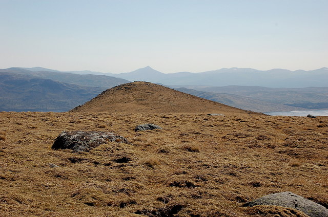
Bac na Craoibhe Images

Images are sourced within 2km of 56.784275/-4.4978108 or Grid Reference NN4768. Thanks to Geograph Open Source API. All images are credited.

The Alder Burn The glen behind Alder Bay and Ben Alder Cottage with Beinn Eibhinn beyond. Ben Alder was holding back cloud from the northeast.
The Alder Burn
The glen behind Alder Bay and Ben Alder Cottage with Beinn Eibhinn beyond. Ben Alder was holding back cloud from the northeast.
View over Loch Ericht A view from Sron a' Chlaonaidh over Loch Ericht towards the Alder Burn and surrounding hills, including Beinn a' Chumhainn and Meall a' Bhealaich. For reverse view, see Geograph image <a href="https://www.geograph.org.uk/photo/2394484">NN4770 : The Alder Burn</a>.
View over Loch Ericht
A view from Sron a' Chlaonaidh over Loch Ericht towards the Alder Burn and surrounding hills, including Beinn a' Chumhainn and Meall a' Bhealaich. For reverse view, see Geograph image NN4770 : The Alder Burn.
Cascade on Allt Tom a Chogaidh Just about the only feature of interest in the glen.
Cascade on Allt Tom a Chogaidh
Just about the only feature of interest in the glen.
The lower slopes of Meall a Bhealaich Rough heather slopes of Meall a Bhealaich. Loch Ericht can be seen in the distance
The lower slopes of Meall a Bhealaich
Rough heather slopes of Meall a Bhealaich. Loch Ericht can be seen in the distance
Track South East of Ben Alder
The Shoulder of Ben Alder and Loch Ericht Taken during an epic Moutainbike ride, there is a good path right around the mountain.  The path can be made out to the right of the image, contouring down the hillside.  At the foot of the track is one of several bothies in the area that provides shelter in foul weather.  The water is Loch Ericht - 10th largest loch in Scotland, and dammed to provide Hydro power.
The Shoulder of Ben Alder and Loch Ericht
Taken during an epic Moutainbike ride, there is a good path right around the mountain. The path can be made out to the right of the image, contouring down the hillside. At the foot of the track is one of several bothies in the area that provides shelter in foul weather. The water is Loch Ericht - 10th largest loch in Scotland, and dammed to provide Hydro power.
Schiehallion from Meall a' Bhealaich Schiehallion's shapely profile is in line here with the 852m subsidiary top.
Schiehallion from Meall a' Bhealaich
Schiehallion's shapely profile is in line here with the 852m subsidiary top.
Boulders on the Alder Burn
Show me another place!

Bac na Craoibhe is located at Grid Ref: NN4768 (Lat: 56.784275, Lng: -4.4978108)

Unitary Authority: Perth and Kinross

Police Authority: Tayside

What 3 Words

///submits.tell.prancing. Near Pubil, Perth & Kinross

Nearby Locations

Bac na Craoibhe

Related Wikis

Sgor Gaibhre

Sgor Gaibhre (955 m) is a mountain in the Grampian Mountains of Scotland. It lies on the border of Highland and Perth and Kinross, near Loch Ossian. A...

Lochan a' Garbh Coire

Lochan a' Garbh Coire is a small freshwater loch located below the summit of Ben Alder in the Highlands of Scotland. At over 1,120 m (3,670 ft) above sea...

Ben Alder

Ben Alder (Scottish Gaelic: Beinn Eallair) is the highest mountain in the remote area of the Scottish Highlands between Loch Ericht and Glen Spean. It...

Beinn Bheoil

Beinn Bheoil (1,019 m) is a mountain in the Grampian Mountains of Scotland, located on the western shore of Loch Ericht in Highland. Taking the form of...

Nearby Amenities

Located within 500m of 56.784275,-4.4978108
Bac na Craoibhe
Alt Name: Bac nan Craobh
Ele: 635
Natural: peak
Lat/Long: 56.7822652/-4.4925398
The data included in this document is from www.openstreetmap.org. The data is made available under ODbL.

Have you been to Bac na Craoibhe?

Leave your review of Bac na Craoibhe below (or comments, questions and feedback).