Balnamoon

Settlement in Aberdeenshire

Scotland

Balnamoon

New Pitsligo telephone exchange The telephone exchange in New Pitsligo stands by a grassy slope in the centre of the village. There's even a bench you can sit on to admire the building.
New Pitsligo telephone exchange Credit: Haworth Hodgkinson

Balnamoon is a small village located in Aberdeenshire, Scotland. Situated approximately 7 miles south of Huntly, it is nestled in the picturesque countryside of the region. The village is known for its tranquil setting and stunning natural beauty.

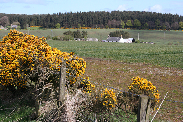
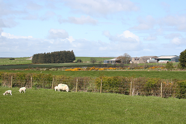
Balnamoon offers a peaceful escape from the hustle and bustle of city life, with its rolling green hills, lush landscapes, and charming rural atmosphere. The area is dotted with traditional stone cottages and farmhouses, giving it a quaint and rustic feel.

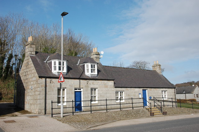
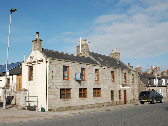
Despite its small size, Balnamoon has a strong sense of community, with friendly and welcoming locals. The village is home to a handful of local amenities, including a small shop, a post office, and a village hall that hosts various community events throughout the year.

Outdoor enthusiasts will find plenty to do in and around Balnamoon. The surrounding countryside offers numerous walking and hiking trails, providing stunning views of the nearby mountains and valleys. The River Deveron, which runs through the village, is a popular spot for fishing, attracting anglers from far and wide.

For those interested in history, Balnamoon is also home to Balnamoon House, a grand Georgian mansion that dates back to the 18th century. The house, surrounded by well-manicured gardens, is a testament to the area's rich heritage and architectural beauty.

Overall, Balnamoon is a hidden gem in Aberdeenshire, offering a tranquil retreat for nature lovers and those seeking a slower pace of life.

If you have any feedback on the listing, please let us know in the comments section below.

Balnamoon Images

Images are sourced within 2km of 57.58493/-2.1689009 or Grid Reference NJ9055. Thanks to Geograph Open Source API. All images are credited.

New Pitsligo telephone exchange The telephone exchange in New Pitsligo stands by a grassy slope in the centre of the village. There's even a bench you can sit on to admire the building.
New Pitsligo telephone exchange
The telephone exchange in New Pitsligo stands by a grassy slope in the centre of the village. There's even a bench you can sit on to admire the building.
Road approaching New Pitsligo
Crossroads near New Pitsligo
Minor road near Cairnhigh
B9093 near New Pitsligo
Electricity Sub-station Beside the road just south of New Pitsligo.
Electricity Sub-station
Beside the road just south of New Pitsligo.
Woods near Sprottineuk Sunshine filtered through the new leaves beside <a href="https://www.geograph.org.uk/photo/821287">NJ8854 : Avenue of trees</a>.
Woods near Sprottineuk
Sunshine filtered through the new leaves beside NJ8854 : Avenue of trees.
Leechesburn Fields turning green south of New Pitsligo. The digger was working in a ditch at the field boundary.
Leechesburn
Fields turning green south of New Pitsligo. The digger was working in a ditch at the field boundary.
Name Unknown The name of this farm is not on the maps, so if someone can tell me what it is called, I'll be very grateful.
Name Unknown
The name of this farm is not on the maps, so if someone can tell me what it is called, I'll be very grateful.
Pastoral Scene Sheep grazing beside a new hedge inside a double fence. The nearer farm is not named on the maps, but the next one is curiously named Mormond Prop.
Pastoral Scene
Sheep grazing beside a new hedge inside a double fence. The nearer farm is not named on the maps, but the next one is curiously named Mormond Prop.
West Brownhill West Brownhill is towards the left, and there is a glimpse of North Brownhill on the right.
West Brownhill
West Brownhill is towards the left, and there is a glimpse of North Brownhill on the right.
High Street The south end of the long High Street is Lined with mostly traditional stone houses.
High Street
The south end of the long High Street is Lined with mostly traditional stone houses.
New Pitsligo Library Probably originally the librarian's house to the left.
New Pitsligo Library
Probably originally the librarian's house to the left.
New Pitsligo millennium monument New Pitsligo was established as a planned village in 1787 in the aftermath of the turbulence of the 'Forty-five.
New Pitsligo millennium monument
New Pitsligo was established as a planned village in 1787 in the aftermath of the turbulence of the 'Forty-five.
New Pitsligo park Public green space opposite the market place.  New Pitsligo was built on quite a steep hillside, so everything slopes...
New Pitsligo park
Public green space opposite the market place. New Pitsligo was built on quite a steep hillside, so everything slopes...
Commercial Hotel, New Pitsligo Dating from ca. 1820 and originally serving thirsty and hungry travellers on the turnpike to Fraserburgh.
Commercial Hotel, New Pitsligo
Dating from ca. 1820 and originally serving thirsty and hungry travellers on the turnpike to Fraserburgh.
New Pitsligo Public Hall Dating from ca. 1895 in 'miniaturized free Baroque' style, according to The Buildings of Scotland guide.
New Pitsligo Public Hall
Dating from ca. 1895 in 'miniaturized free Baroque' style, according to The Buildings of Scotland guide.
St John the Evangelist Episcopal Church, New Pitsligo An Early English revival church built on an extremely awkward site on the side of what is almost a ravine and now in danger of being suffocated by out of control vegetation.  A-listed: <span class="nowrap"><a title="http://www.britishlistedbuildings.co.uk/sc-16440-episcopal-church-of-st-john-the-evangelis#.Vx56zaT2amQ" rel="nofollow ugc noopener" href="http://www.britishlistedbuildings.co.uk/sc-16440-episcopal-church-of-st-john-the-evangelis#.Vx56zaT2amQ">Link</a><img style="margin-left:2px;" alt="External link" title="External link - shift click to open in new window" src="https://s1.geograph.org.uk/img/external.png" width="10" height="10"/></span> .
St John the Evangelist Episcopal Church, New Pitsligo
An Early English revival church built on an extremely awkward site on the side of what is almost a ravine and now in danger of being suffocated by out of control vegetation. A-listed: LinkExternal link .
Show me another place!

Balnamoon is located at Grid Ref: NJ9055 (Lat: 57.58493, Lng: -2.1689009)

Unitary Authority: Aberdeenshire

Police Authority: North East

What 3 Words

///highbrow.booklet.blazing. Near New Pitsligo, Aberdeenshire

Nearby Locations

Balnamoon

Related Wikis

Willows Animal Sanctuary

Willows Animal Sanctuary is an animal sanctuary in Fraserburgh, Aberdeenshire, Scotland. == History == Willows Animal Sanctuary was founded, on a 54-acre...

New Pitsligo

New Pitsligo (Scots: Pitsligae), also known as Cavoch (locally Cyaak), is a village in Aberdeenshire, Scotland, quite near Fraserburgh. == Overview... ==
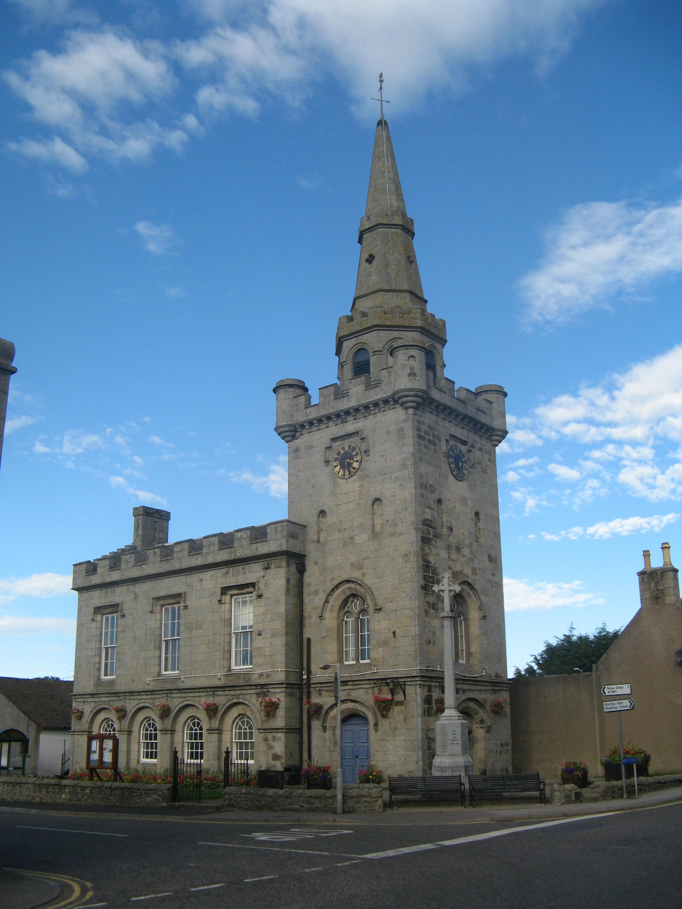
Strichen Town House

Strichen Town House is a municipal structure in High Street, Strichen, Aberdeenshire, Scotland. The building, which was the meeting place of Strichen Parish...

Strichen

Strichen is a village in Aberdeenshire, Scotland. It sits on the A981, connecting it to New Deer 7.2 miles (12 km) to the southwest and Fraserburgh 8 miles...

Nearby Amenities

Located within 500m of 57.58493,-2.1689009
Power: pole
Lat/Long: 57.585748/-2.1633008
Power: pole
Lat/Long: 57.5858084/-2.1642798
Power: pole
Lat/Long: 57.5858572/-2.1653742
Power: pole
Lat/Long: 57.5859321/-2.16643
Power: pole
Lat/Long: 57.5860873/-2.1700278
Power: pole
Lat/Long: 57.5860283/-2.1687672
Power: pole
Lat/Long: 57.5861534/-2.1711919
Power: pole
Lat/Long: 57.5863978/-2.1718946
Power: pole
Lat/Long: 57.5866624/-2.1725652
Power: pole
Lat/Long: 57.5866552/-2.173681
Power: pole
Lat/Long: 57.5866423/-2.1747699
Power: pole
Lat/Long: 57.5866221/-2.1758992
Power: pole
Lat/Long: 57.5885731/-2.1648216
Power: pole
Lat/Long: 57.5856437/-2.1607178
Power: pole
Lat/Long: 57.5857126/-2.1620786
Power: pole
Lat/Long: 57.585983/-2.1675555
Power: pole
Lat/Long: 57.5882465/-2.165983
Power: pole
Lat/Long: 57.5879984/-2.1660641
Power: pole
Lat/Long: 57.5873358/-2.1661749
Power: pole
Lat/Long: 57.5866414/-2.1663114
Power: pole
Lat/Long: 57.5849238/-2.1665833
Power: pole
Lat/Long: 57.5854508/-2.1664943
The data included in this document is from www.openstreetmap.org. The data is made available under ODbL.

Have you been to Balnamoon?

Leave your review of Balnamoon below (or comments, questions and feedback).