An t-Socach

Hill, Mountain in Ross-shire

Scotland

An t-Socach

The summit of Tom a' Choinnich with view W
The summit of Tom a' Choinnich with view W Credit: Colin Park

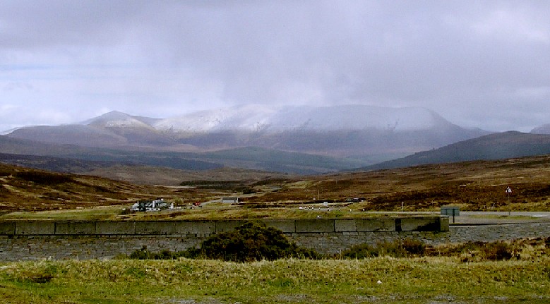
An t-Socach, located in Ross-shire, is a prominent hill/mountain in the Scottish Highlands. Standing at an elevation of 921 meters (3,022 feet), it is part of the Torridon mountain range. An t-Socach is known for its distinctive cone shape, which contributes to its allure for hikers and mountaineers.

The hill is situated in a remote and rugged landscape, surrounded by vast moorlands and rocky terrain. Its location offers breathtaking panoramic views of the surrounding area, including picturesque lochs, deep valleys, and neighboring peaks such as Beinn Liath Mhòr and Sgùrr Dubh.

An t-Socach is a popular destination for outdoor enthusiasts, attracting both experienced climbers and casual hikers. Several well-defined paths lead to the summit, making it accessible for those with varying levels of fitness and experience. The ascent can be challenging, particularly in adverse weather conditions, but the rewarding views at the summit make it worthwhile.

During the summer months, the hill is adorned with a vibrant display of wildflowers, including heather and various alpine plants. The area is also home to a diverse range of wildlife, such as red deer, golden eagles, and mountain hares, adding to the natural beauty and appeal of An t-Socach.

Overall, An t-Socach offers outdoor enthusiasts a chance to immerse themselves in the stunning Scottish Highlands, providing a challenging yet rewarding ascent and stunning views that showcase the raw beauty of the region.

If you have any feedback on the listing, please let us know in the comments section below.
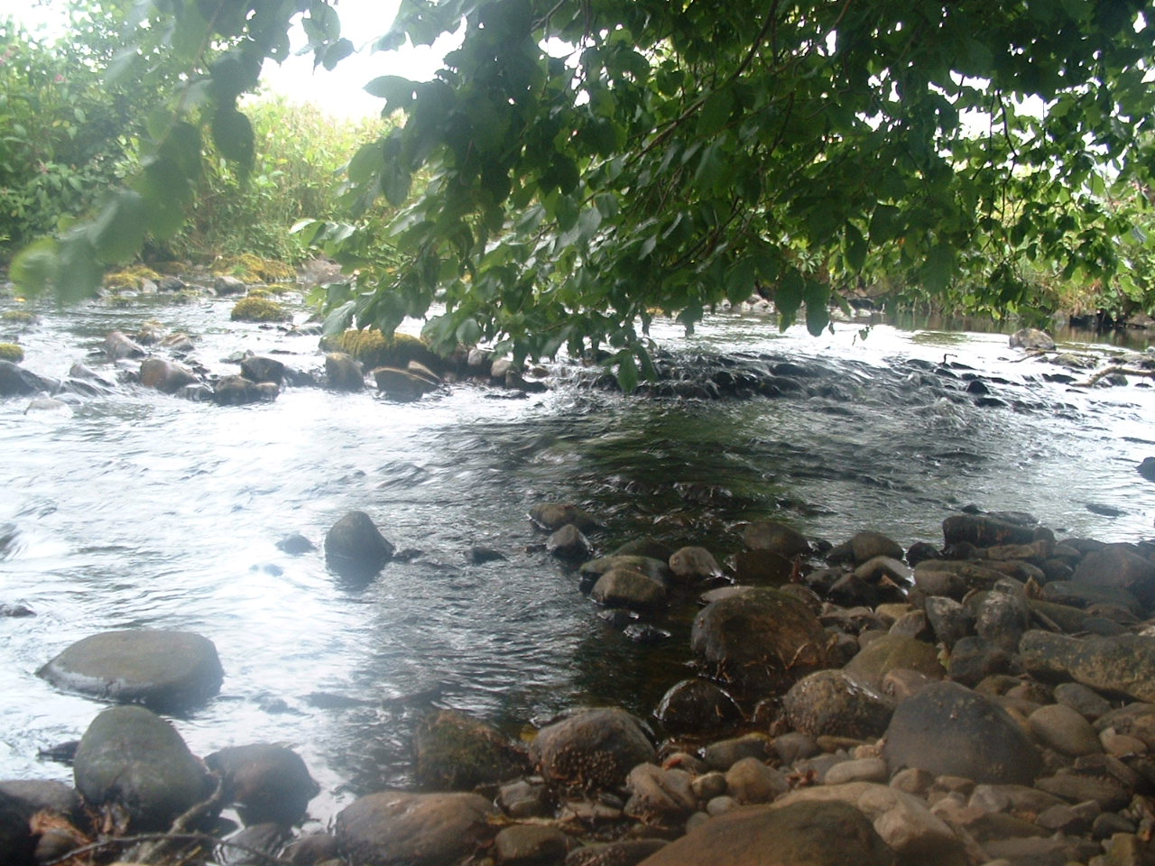
An t-Socach Images

Images are sourced within 2km of 57.677424/-4.5661806 or Grid Reference NH4768. Thanks to Geograph Open Source API. All images are credited.

The summit of Tom a' Choinnich with view W
Trig and cairn, Ben Wyvis
A Precarious Looking Shelter On the Eastern descent from Ben Wyvis (the Munro summit as opposed to the land mass - the whole bulk of this small 'massif' is often referred to by the same name) are a few dodgy looking stone constructions called either cairns, rock huts, or shelters, seemingly on the whim of whoever did the mapmaking legwork up here many years ago. This was actually the sturdiest looking of the lot, though I think all sane people would have to be in pretty dire straits before considering using it!
This is the only (tiny) upward bit on this way down.
A Precarious Looking Shelter
On the Eastern descent from Ben Wyvis (the Munro summit as opposed to the land mass - the whole bulk of this small 'massif' is often referred to by the same name) are a few dodgy looking stone constructions called either cairns, rock huts, or shelters, seemingly on the whim of whoever did the mapmaking legwork up here many years ago. This was actually the sturdiest looking of the lot, though I think all sane people would have to be in pretty dire straits before considering using it! This is the only (tiny) upward bit on this way down.
Is This Scotland's Most Pathetic Cairn?! I make a note of my pictures whilst out and about on my phone. I use a very basic grid reference app and a compass (most of the time!) and type in the details on the phone's notebook, along with a brief description. This one is described as 'crap cairn' and was the only reason I took the picture. I have never seen anything so insubstantial marked on a map before or since.
It marks one of two tiny bumps on the Eastern descent (or ascent if you come up this way of course) from the summit of Ben Wyvis.
Maybe there was a proper cairn here once and it got stolen by some strange practical jokers? Strange things do happen - when walking near Sheffield last year I was perplexed as to why a previously grey trig point was now white and some online research led me to a shadowy fellow who went through a brief phase of painting them with three coats of white before dawn!
Is This Scotland's Most Pathetic Cairn?!
I make a note of my pictures whilst out and about on my phone. I use a very basic grid reference app and a compass (most of the time!) and type in the details on the phone's notebook, along with a brief description. This one is described as 'crap cairn' and was the only reason I took the picture. I have never seen anything so insubstantial marked on a map before or since. It marks one of two tiny bumps on the Eastern descent (or ascent if you come up this way of course) from the summit of Ben Wyvis. Maybe there was a proper cairn here once and it got stolen by some strange practical jokers? Strange things do happen - when walking near Sheffield last year I was perplexed as to why a previously grey trig point was now white and some online research led me to a shadowy fellow who went through a brief phase of painting them with three coats of white before dawn!
View into Coire na Feola Seen from just a few steps east of the Ben Wyvis summit. This view shows the pathless, less explored side of the mountain.
View into Coire na Feola
Seen from just a few steps east of the Ben Wyvis summit. This view shows the pathless, less explored side of the mountain.
Looking towards Ben Wyvis Ben Wyvis is on the distant horizon, beyond the green fields of the Black Isle and the blue water of the Cromarty Firth.
Looking towards Ben Wyvis
Ben Wyvis is on the distant horizon, beyond the green fields of the Black Isle and the blue water of the Cromarty Firth.
Tom a Choinnich. Looking south over the summit cairn of Tom a Choinnich towards Ben Wyvis.
Tom a Choinnich.
Looking south over the summit cairn of Tom a Choinnich towards Ben Wyvis.
Mountain Stream The mountain stream feeds into the Allt a' Choire Mhoir, which flows from right to left, a mere 15 metres away. The east side of Ben Wyvis is in the background, across Coire Mor.
Mountain Stream
The mountain stream feeds into the Allt a' Choire Mhoir, which flows from right to left, a mere 15 metres away. The east side of Ben Wyvis is in the background, across Coire Mor.
On top of Ben Wyvis The broad, mossy whaleback ridge of the hill, heading towards the summit.
On top of Ben Wyvis
The broad, mossy whaleback ridge of the hill, heading towards the summit.
The rim of Coire na Feòla Cloud spilling upwards from the coire and across the 1,000m high ridge of Glas Leathad Mòr, Ben Wyvis.
The rim of Coire na Feòla
Cloud spilling upwards from the coire and across the 1,000m high ridge of Glas Leathad Mòr, Ben Wyvis.
Summit of Glas Leathad Mòr The 1046m high point and Munro summit of Ben Wyvis.
Summit of Glas Leathad Mòr
The 1046m high point and Munro summit of Ben Wyvis.
Ben Wyvis from Loch Glascarnoch About 12 km east of the dam.
Ben Wyvis from Loch Glascarnoch
About 12 km east of the dam.
Snowy summit The summit of Glas Leathad Mòr feels remote in snowy, misty conditions.
Snowy summit
The summit of Glas Leathad Mòr feels remote in snowy, misty conditions.
Striding along the SW Ridge of Ben Wyvis With the weather threatening there was added urgency in getting to the summit.
Striding along the SW Ridge of Ben Wyvis
With the weather threatening there was added urgency in getting to the summit.
Snow  banks above Coire na Feola The remnant of the winter snow whose recent extent is witnessed by the browner hue in the vegetation.
Snow banks above Coire na Feola
The remnant of the winter snow whose recent extent is witnessed by the browner hue in the vegetation.
Imminent hailstorm on the top of Ben Wyvis The heavens opened and hail persisted for 30 minutes as the weather deteriorated.  By the time the walk was over all our clothing was dry again.
Imminent hailstorm on the top of Ben Wyvis
The heavens opened and hail persisted for 30 minutes as the weather deteriorated. By the time the walk was over all our clothing was dry again.
On the Ben Wyvis plateau It may look well rounded when seen from above, but Ben Wyvis has some dramatic cirques well appreciated from the neighbouring countryside.
On the Ben Wyvis plateau
It may look well rounded when seen from above, but Ben Wyvis has some dramatic cirques well appreciated from the neighbouring countryside.
The mossy cover of the Ben Wyvis plateau Ben Wyvis is a National Nature Reserve.  Chosen for its wide ranging ecological conditions.  According to its webpage "The mossy cover on the summit of Ben Wyvis hides many secrets, including summer nesting dotterel and the pure white of a winter-clothed ptarmigan."
The mossy cover of the Ben Wyvis plateau
Ben Wyvis is a National Nature Reserve. Chosen for its wide ranging ecological conditions. According to its webpage "The mossy cover on the summit of Ben Wyvis hides many secrets, including summer nesting dotterel and the pure white of a winter-clothed ptarmigan."
Show me another place!

An t-Socach is located at Grid Ref: NH4768 (Lat: 57.677424, Lng: -4.5661806)

Unitary Authority: Highland

Police Authority: Highlands and Islands

What 3 Words

///paints.camper.shrug. Near Strathpeffer, Highland

Nearby Locations

An t-Socach

Related Wikis

Ben Wyvis

Ben Wyvis (Scottish Gaelic: Beinn Uais) is a mountain in Easter Ross, in the northern Highlands of Scotland. It lies north-west of Dingwall, in the council...

Battle of Bealach nam Broig

The Battle of Bealach nam Broig (Scottish Gaelic: Pass of the Brogue; also known as the Great Battle of Bealach nam Broig, Bealach nam Brog, Beallighne...

River Sgitheach

River Sgitheach also known as Skiach or Skiack, (Scottish Gaelic Abhainn Sgitheach, "Hawthorn River") (grid reference NH5162) is a river in Ross and Cromarty...

Beinn nan Eun

Beinn nan Eun (743 m) is a mountain in the Northwest Highlands of Scotland. It is located in Easter Ross, several miles northwest of Dingwall. A very remote...

Nearby Amenities

Located within 500m of 57.677424,-4.5661806
An t-Socach
Description: Subsidiary peak of Ben Wyvis
Ele: 1006
Natural: peak
Source: NPE
Lat/Long: 57.6774727/-4.5662804
The data included in this document is from www.openstreetmap.org. The data is made available under ODbL.

Have you been to An t-Socach?

Leave your review of An t-Socach below (or comments, questions and feedback).