Blindwalls Hill

Hill, Mountain in Wigtownshire

Scotland

Blindwalls Hill

Dinnans With its own Port Allen.
Let sleeping bulls lie!
Dinnans Credit: Russel Wills

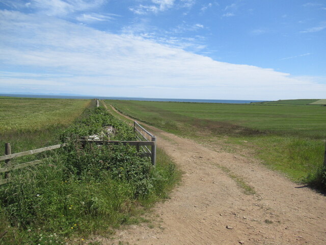
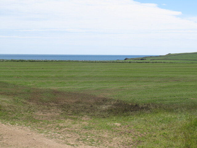
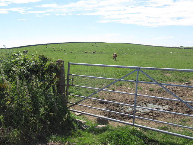
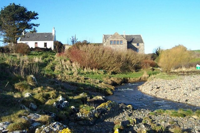
Blindwalls Hill is a prominent hill located in Wigtownshire, Scotland. It is situated near the town of Stranraer and overlooks the surrounding countryside. The hill is known for its steep slopes and rocky terrain, making it a popular destination for hikers and outdoor enthusiasts.

Blindwalls Hill rises to an elevation of approximately 400 meters (1,312 feet) above sea level, offering stunning panoramic views of the surrounding area. The hill is covered in heather and grasses, with scattered patches of woodland along its slopes.

The name "Blindwalls" is said to have originated from the Gaelic word "Blàr nan Allt," which translates to "field of the burns." This name reflects the hill's location near several small streams and rivers that flow through the area.

Visitors to Blindwalls Hill can enjoy a challenging hike to the summit, where they can take in the breathtaking views of the surrounding countryside. The hill is also home to a variety of wildlife, including birds of prey and deer, making it a popular spot for nature enthusiasts.

Overall, Blindwalls Hill is a picturesque and rugged natural landmark in Wigtownshire, offering visitors a chance to experience the beauty of the Scottish countryside.

If you have any feedback on the listing, please let us know in the comments section below.

Blindwalls Hill Images

Images are sourced within 2km of 54.733592/-4.3783828 or Grid Reference NX4640. Thanks to Geograph Open Source API. All images are credited.

Dinnans With its own Port Allen.
Let sleeping bulls lie!
Dinnans
With its own Port Allen. Let sleeping bulls lie!
Near Palmallet A track heading for the sea.
Near Palmallet
A track heading for the sea.
Machars arable Field near Palmallet.
Machars arable
Field near Palmallet.
Blindwalls Hill A drumlin
Blindwalls Hill
A drumlin
Portyerrock Bay See how the bay has remnants of the Mulberry Harbour of WW2.
<span class="nowrap"><a title="https://www.youtube.com/watch?v=d4QswCbNfzU" rel="nofollow ugc noopener" href="https://www.youtube.com/watch?v=d4QswCbNfzU">Link</a><img style="margin-left:2px;" alt="External link" title="External link - shift click to open in new window" src="https://s1.geograph.org.uk/img/external.png" width="10" height="10"/></span>
Portyerrock Bay
See how the bay has remnants of the Mulberry Harbour of WW2. LinkExternal link
Sheddock Overlooking Wigtown Bay.
Sheddock
Overlooking Wigtown Bay.
The road to Whithorn And the turn off to Garlieston.
The road to Whithorn
And the turn off to Garlieston.
Field, Sheddock Sheep grazing, The Machars.
Field, Sheddock
Sheep grazing, The Machars.
Road junction near Sheddock
Towards Balsmith Machars farmland.
Towards Balsmith
Machars farmland.
Rowing up, Sheddock Newly mown grass being raked ready for the forage harvester or round baler.
Rowing up, Sheddock
Newly mown grass being raked ready for the forage harvester or round baler.
Towards Portyerrock B7063
Towards Portyerrock
B7063
Rough grazing, Portyerrock Between road and sea.
Rough grazing, Portyerrock
Between road and sea.
B7063, Portyerrock
B7063, Portyerrock
Muck Spreading Spreading manure with Blindwalls Hill behind.
Muck Spreading
Spreading manure with Blindwalls Hill behind.
Balnab Dairy The farmer has recently diversified and is now selling very fresh milk from a vending machine, there are also "glamping pods" behind.
Balnab Dairy
The farmer has recently diversified and is now selling very fresh milk from a vending machine, there are also "glamping pods" behind.
Portyerrock Mill and Mill Cottage A glorious spot in Wigtownshire
Portyerrock Mill and Mill Cottage
A glorious spot in Wigtownshire
Standing Stone at Stairfield Farm
Show me another place!

Blindwalls Hill is located at Grid Ref: NX4640 (Lat: 54.733592, Lng: -4.3783828)

Unitary Authority: Dumfries and Galloway

Police Authority: Dumfries and Galloway

What 3 Words

///assets.flagging.meatball. Near Whithorn, Dumfries & Galloway

Nearby Locations

Blindwalls Hill

Related Wikis

Whithorn

Whithorn (Scots pronunciation: [ˈʍɪthorn], Taigh Mhàrtainn in modern Gaelic), is a royal burgh in the historic county of Wigtownshire in Dumfries and Galloway...

Whithorn railway station

Whithorn is the closed terminus of the Wigtownshire Railway branch, from Newton Stewart, of the Portpatrick and Wigtownshire Joint Railway. It served...

Candida Casa

Candida Casa was the name given to the church established by St Ninian in Whithorn, Galloway, southern Scotland, in the mid fifth century AD. The name...

Whithorn Priory

Whithorn Priory was a medieval Scottish monastery that also served as a cathedral, located at 6 Bruce Street in Whithorn, Wigtownshire, Dumfries and Galloway...

Nearby Amenities

Located within 500m of 54.733592,-4.3783828
Power: pole
Lat/Long: 54.7374312/-4.3750329
Power: pole
Lat/Long: 54.7365075/-4.3841266
Power: pole
Lat/Long: 54.7369633/-4.3829017
Power: pole
Lat/Long: 54.7373384/-4.3818957
Power: pole
Lat/Long: 54.7376154/-4.3808035
Power: pole
Lat/Long: 54.7378816/-4.3797346
The data included in this document is from www.openstreetmap.org. The data is made available under ODbL.

Have you been to Blindwalls Hill?

Leave your review of Blindwalls Hill below (or comments, questions and feedback).