An Càbagach

Hill, Mountain in Ross-shire

Scotland

An Càbagach

Loch Meall Dheirgidh Loch Meall Dheirgidh lies just south of a shallow moorland col between Meall nan Eun and Meall Dheirgidh. Carn Salachaidh and Carn Chuinneag are the two prominent mountains in the distance, both lying beyond the major valley of Strathconnon.
Loch Meall Dheirgidh Credit: Trevor Littlewood

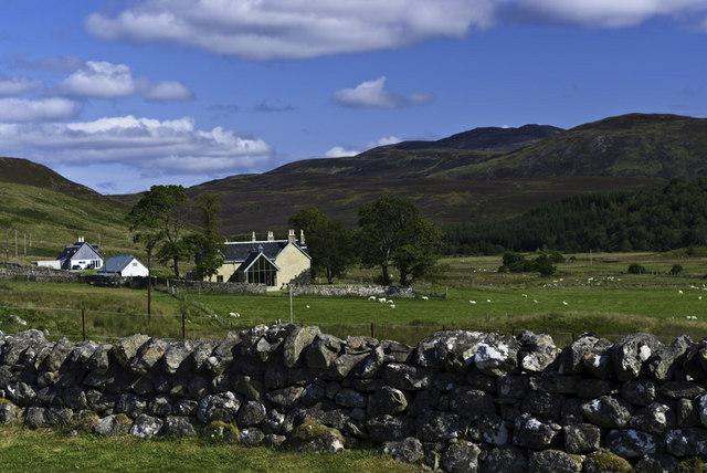
An Càbagach is a prominent hill located in Ross-shire, a county in the Highlands of Scotland. It sits within the rugged and picturesque landscape of the Northwest Highlands, offering breathtaking views and challenging hiking opportunities.

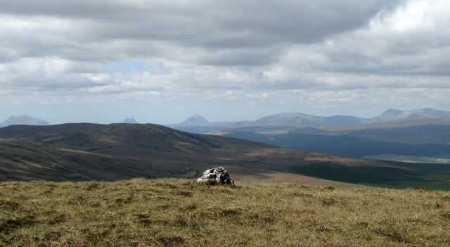
With a summit elevation of 946 meters (3,104 feet), An Càbagach stands as one of the highest peaks in the region. Its distinctive cone-shaped profile can be seen from miles away, making it a noticeable landmark within the surrounding countryside. The hill is composed mainly of quartzite, giving it a unique appearance and enhancing its natural beauty.

Ascending An Càbagach requires a moderate to strenuous climb, with several well-defined paths available for hikers to choose from. The terrain is a mixture of grassy slopes, rocky outcrops, and heather-covered moorland, providing a diverse and challenging hiking experience. As one ascends, the views become increasingly panoramic, revealing the stunning vistas of the surrounding mountains, lochs, and glens.

The hill is home to a variety of wildlife, including red deer, golden eagles, and ptarmigans. It also boasts an abundant display of wildflowers during the summer months, adding vibrant colors to the landscape.

An Càbagach is a popular destination for outdoor enthusiasts, nature lovers, and photographers alike. Its remote location and unspoiled wilderness make it an ideal spot for those seeking solitude and a genuine connection with nature. Whether climbing to the summit or simply admiring its beauty from afar, An Càbagach is a true gem of Ross-shire and an unforgettable experience for all who visit.

If you have any feedback on the listing, please let us know in the comments section below.

An Càbagach Images

Images are sourced within 2km of 57.899595/-4.5886555 or Grid Reference NH4692. Thanks to Geograph Open Source API. All images are credited.

Loch Meall Dheirgidh Loch Meall Dheirgidh lies just south of a shallow moorland col between Meall nan Eun and Meall Dheirgidh. Carn Salachaidh and Carn Chuinneag are the two prominent mountains in the distance, both lying beyond the major valley of Strathconnon.
Loch Meall Dheirgidh
Loch Meall Dheirgidh lies just south of a shallow moorland col between Meall nan Eun and Meall Dheirgidh. Carn Salachaidh and Carn Chuinneag are the two prominent mountains in the distance, both lying beyond the major valley of Strathconnon.
Summit of Meall Dheirgidh Meall Dheirgidh is a 'Marilyn' on the north side of Strathconnon. The Coigach and Assynt mountains are the distant peaks; Beinn Ulbhaidh is nearer on the left side of the image.
Summit of Meall Dheirgidh
Meall Dheirgidh is a 'Marilyn' on the north side of Strathconnon. The Coigach and Assynt mountains are the distant peaks; Beinn Ulbhaidh is nearer on the left side of the image.
Forest Farm near Croick
Gravestones on north side of Croick church The church at Croick in Strathcarron is famed as the place where families evicted from the glen during The Clearances sheltered before their removal and where some scratched their names on to the glass of the windows.
Gravestones on north side of Croick church
The church at Croick in Strathcarron is famed as the place where families evicted from the glen during The Clearances sheltered before their removal and where some scratched their names on to the glass of the windows.
Corrugated metal shed in Strathcarron The building stands on the south side of the valley road between Croick and The Craigs. The river here is known as the Black Water.
Corrugated metal shed in Strathcarron
The building stands on the south side of the valley road between Croick and The Craigs. The river here is known as the Black Water.
Croick Church
Croick Church
Croick Church
Croick Church
Looking east along the road near Forrest Farm
Croick Church
Croick Church
Written in desperation: etched words on Croick Church "Glencalvie people - the wicked generation"

The sad story of the eviction from Glen Calvie and Croick and the parishioners huddled in the lee of the church as they waited their fate is explained on an information board.  The church is part of the parish of Edderton, Croick and Ardgay and four services a year are held here in the summer. The church seemed to be in an excellent state of repair.

See <a href="https://www.geograph.org.uk/photo/19108">NH4591 : Glencalvie: "The wicked generation"</a> for an extended description and Richard Webb's image of the same window.
Written in desperation: etched words on Croick Church
"Glencalvie people - the wicked generation" The sad story of the eviction from Glen Calvie and Croick and the parishioners huddled in the lee of the church as they waited their fate is explained on an information board. The church is part of the parish of Edderton, Croick and Ardgay and four services a year are held here in the summer. The church seemed to be in an excellent state of repair. See NH4591 : Glencalvie: "The wicked generation" for an extended description and Richard Webb's image of the same window.
Croick in Strathcarron Looking towards Croick House and Croick Church in the distance.
Croick in Strathcarron
Looking towards Croick House and Croick Church in the distance.
Wicked Generation: Croick Church window The scratching reads: "Glencalvie people the wicked generation Glencalvie." For more about Croick Church, and its role in the clearances, see the website: <span class="nowrap"><a title="http://www.croickchurch.com/" rel="nofollow ugc noopener" href="http://www.croickchurch.com/">Link</a><img style="margin-left:2px;" alt="External link" title="External link - shift click to open in new window" src="https://s1.geograph.org.uk/img/external.png" width="10" height="10"/></span>.
Wicked Generation: Croick Church window
The scratching reads: "Glencalvie people the wicked generation Glencalvie." For more about Croick Church, and its role in the clearances, see the website: LinkExternal link.
Damaged Plantation at Croick, Scottish Highlands These bare trees at a plantation near Croick have been stripped by deer, which roam the Scottish Highlands.  Presumably there are some holes in the deer fence which is supposed to enclose the plantation.  The hill in the background is Meall Dheirgidh (506 m).
Damaged Plantation at Croick, Scottish Highlands
These bare trees at a plantation near Croick have been stripped by deer, which roam the Scottish Highlands. Presumably there are some holes in the deer fence which is supposed to enclose the plantation. The hill in the background is Meall Dheirgidh (506 m).
Ford on the Allt a' Chairn Watercourse, near Croick, Scottish Highlands
Croick Church and Black Water Valley, Scottish Highlands Croick Church building stands among the trees in the foreground.
Croick Church and Black Water Valley, Scottish Highlands
Croick Church building stands among the trees in the foreground.
Across the Black Water Another view down to the Black Water river and across the hill
Across the Black Water
Another view down to the Black Water river and across the hill
Croik Church and Yard The old Croik Church (which is currently closed)
Croik Church and Yard
The old Croik Church (which is currently closed)
Glencalvie: "The wicked generation" In 1845 the population of Glen Calvie were evicted from their homes in one of the better documented acts of clearance. The land was reassigned to sheep farming and the local tenants were in the way and removed. 
The people sheltered in foul weather in the kirkyard at Croick.They would not enter the church out of respect. Some wrote their names and dates on the window where they remain to this day. The description of themselves as the "wicked generation" suggests that they saw their plight in some way as God's retribution.
Glencalvie: "The wicked generation"
In 1845 the population of Glen Calvie were evicted from their homes in one of the better documented acts of clearance. The land was reassigned to sheep farming and the local tenants were in the way and removed. The people sheltered in foul weather in the kirkyard at Croick.They would not enter the church out of respect. Some wrote their names and dates on the window where they remain to this day. The description of themselves as the "wicked generation" suggests that they saw their plight in some way as God's retribution.
Show me another place!

An Càbagach is located at Grid Ref: NH4692 (Lat: 57.899595, Lng: -4.5886555)

Unitary Authority: Highland

Police Authority: Highlands and Islands

What 3 Words

///richer.unfocused.sagging. Near Lairg, Highland

Related Wikis

Amatnatua

Amatnatua (Scottish Gaelic: Àmait na Tuath) is a hamlet in Highland, Scotland.

Alladale Wilderness Reserve

Alladale Wilderness Reserve is a 23,000-acre (93 km2) highland estate in the Caledonian Forest in Sutherland, in the Scottish Highlands. The estate was...

Battle of Aldy Charrish

The Battle of Aldy Charrish (also known as the Battle of Auldicharish, Aldicharrish, Aldecharwis, Alt a'Charrais, Alt Charrais, Alt na Charrais) was a...

Achnahanat

Achnahanat (Scottish Gaelic: Achadh na h-Annaid) is a crofting settlement on the south side of the Kyle of Sutherland in Scotland. It is about 4 miles...

Have you been to An Càbagach?

Leave your review of An Càbagach below (or comments, questions and feedback).