Bennan Hill

Hill, Mountain in Kirkcudbrightshire

Scotland

Bennan Hill

View from near Curleywee
View from near Curleywee Credit: M Pollard

Bennan Hill is a prominent hill located in Kirkcudbrightshire, Scotland. It stands at an elevation of 471 meters (1,545 feet) above sea level and is a popular destination for hikers and outdoor enthusiasts. The hill offers stunning panoramic views of the surrounding countryside, including the rolling hills and valleys of Kirkcudbrightshire.

Bennan Hill is known for its rugged terrain, with steep slopes and rocky outcrops that provide a challenging climb for visitors. The hill is covered in a mix of grasses, heather, and other vegetation, creating a picturesque landscape that changes with the seasons.

At the summit of Bennan Hill, there is a trig point that marks the highest point on the hill and offers a perfect vantage point to take in the breathtaking views of the surrounding area. On clear days, it is possible to see as far as the Solway Firth and the Irish Sea from the summit.

Overall, Bennan Hill is a must-visit destination for those looking to experience the natural beauty and rugged landscapes of Kirkcudbrightshire.

If you have any feedback on the listing, please let us know in the comments section below.
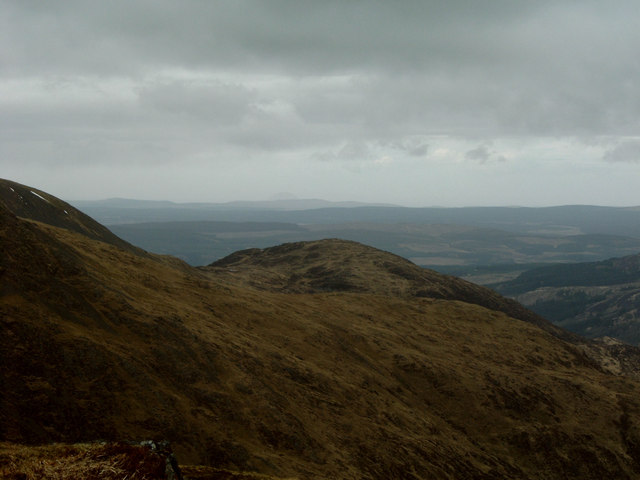
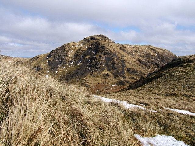
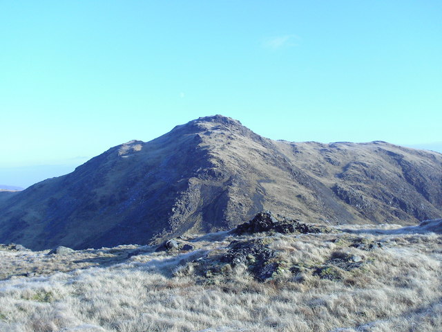
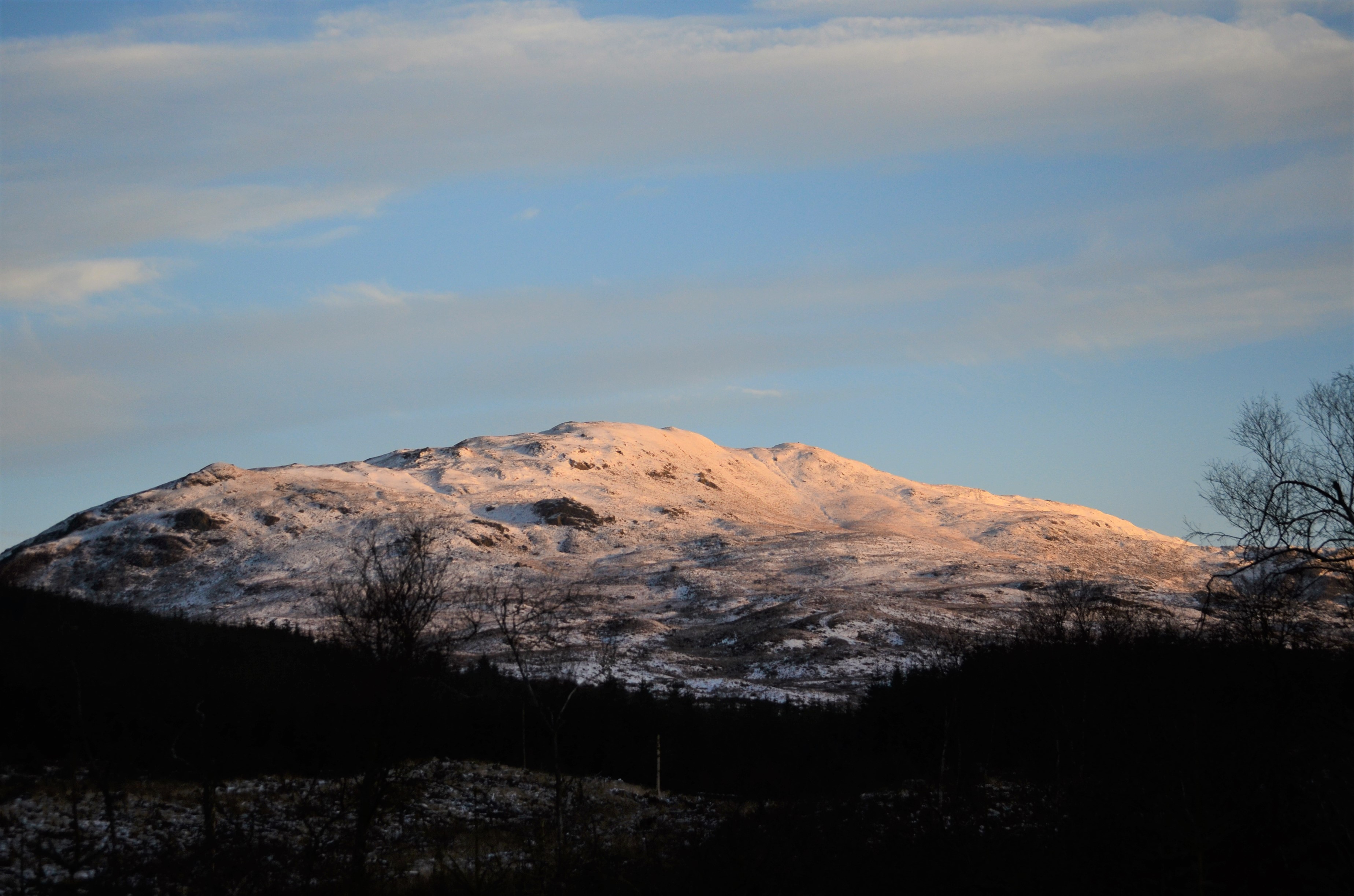
Bennan Hill Images

Images are sourced within 2km of 55.05258/-4.4235845 or Grid Reference NX4575. Thanks to Geograph Open Source API. All images are credited.

View from near Curleywee
White Lochan of Drigmorn Taken from the 581m knoll to the south west of the lochan with the Rhinns of Kells  range of hills in the distance.
White Lochan of Drigmorn
Taken from the 581m knoll to the south west of the lochan with the Rhinns of Kells range of hills in the distance.
From Near the Nick of Curleywee Looking towards Bennan Hill.
From Near the Nick of Curleywee
Looking towards Bennan Hill.
Ruined Fence, Near the Nick of Curleywee
Pulnee Burn Taken from the top of a crag at 467m south west of the col mapped as the Loup of Laggan.
Pulnee Burn
Taken from the top of a crag at 467m south west of the col mapped as the Loup of Laggan.
Nick of Curleywee Altitude 555m.
Nick of Curleywee
Altitude 555m.
White Laggan Burn Loch Dee in the distance.
White Laggan Burn
Loch Dee in the distance.
View From Near the Summit of White Hill ... ... looking towards the Merrick with the Round Loch of Glenhead reflecting the late afternoon light.
View From Near the Summit of White Hill ...
... looking towards the Merrick with the Round Loch of Glenhead reflecting the late afternoon light.
Scars of Bennanbrack The north eastern broken slopes of the 685m high hill Bennanbrack are known as the Scars of Bennanbrack.
Scars of Bennanbrack
The north eastern broken slopes of the 685m high hill Bennanbrack are known as the Scars of Bennanbrack.
Wall, Punlee Burn Snaking its way up to the Loup of Laggan.
Wall, Punlee Burn
Snaking its way up to the Loup of Laggan.
Five Pound Well
Five Pound Well
Bennanbrack from White Hill
Ruin, near White Lochan of Drigmorn I am informed that this was built by soldiers stationed in the lowland below during the Crimean War when the loch was used for curling. The building was used to store curling stones.

Loch Dee in the distance.
Ruin, near White Lochan of Drigmorn
I am informed that this was built by soldiers stationed in the lowland below during the Crimean War when the loch was used for curling. The building was used to store curling stones. Loch Dee in the distance.
Cairn, Gairy of Pulnee 581m spot height.
Cairn, Gairy of Pulnee
581m spot height.
Footpath, White Laggan to Loup of Laggan The footpath can be seen climbing diagonally behind the boulder up to the col Loup of Laggan.
Footpath, White Laggan to Loup of Laggan
The footpath can be seen climbing diagonally behind the boulder up to the col Loup of Laggan.
The summit of Curlywee 674 metres. Here is the summit of Curlywee 674 metres. It is one of the hills in the Minnigaff Range in the Galloway Hills and is quite a challenging climb. The photo was taken on a beautiful day in March.
The summit of Curlywee 674 metres.
Here is the summit of Curlywee 674 metres. It is one of the hills in the Minnigaff Range in the Galloway Hills and is quite a challenging climb. The photo was taken on a beautiful day in March.
Curlywee
Curlywee
Waterfall  from White hill
Waterfall from White hill
Show me another place!

Bennan Hill is located at Grid Ref: NX4575 (Lat: 55.05258, Lng: -4.4235845)

Unitary Authority: Dumfries and Galloway

Police Authority: Dumfries and Galloway

What 3 Words

///data.described.lamp. Near Newton Stewart, Dumfries & Galloway

Nearby Locations

Bennan Hill

Related Wikis

Lamachan Hill

Lamachan Hill is a hill in the Minnigaff Hills, a sub-range of the Galloway Hills range, part of the Southern Uplands of Scotland. It is the highest hill...

Millfore

Millfore is a hill in the Minnigaff Hills, a sub-range of the Galloway Hills range, part of the Southern Uplands of Scotland. It lies northeast of Newton...

Hespies Linn

Hespies Linn is a waterfall of Scotland. == See also == Waterfalls of Scotland == References ==

Round Loch of Glenhead

The Round Loch of Glenhead is a small upland single basin loch in Dumfries and Galloway. It is situated within Galloway Forest Park to the west of the...

Have you been to Bennan Hill?

Leave your review of Bennan Hill below (or comments, questions and feedback).