Hillpool

Settlement in Worcestershire Wyre Forest

England

Hillpool

Robin Hood, Drayton, Belbroughton Freehouse -log fires - good range of beers
Robin Hood, Drayton, Belbroughton Credit: al partington

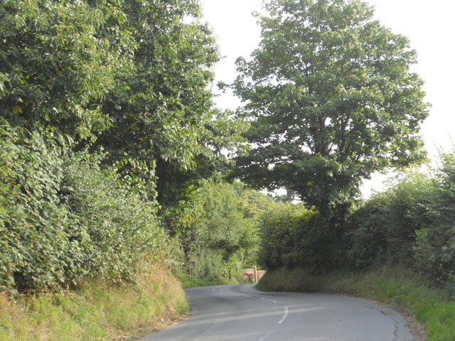
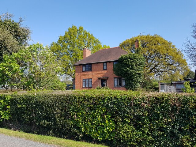
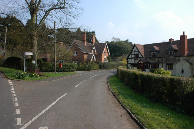
Hillpool is a charming village located in Worcestershire, England. Nestled in the picturesque countryside, it is known for its tranquil atmosphere and natural beauty. The village is situated on a hilltop, providing breathtaking views of the surrounding landscape.

Hillpool is a small community with a population of around 500 residents. It has a close-knit feel, and the locals are known for their friendliness and welcoming nature. The village is well-maintained, with neatly kept gardens and charming cottages that exude traditional English charm.

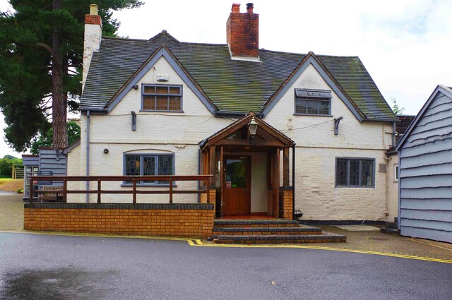
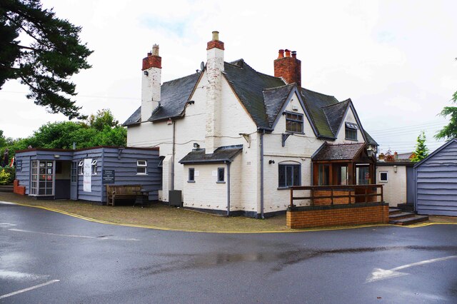
The heart of Hillpool is its village square, which is lined with quaint shops, cafes, and a few local businesses. Here, residents and visitors can enjoy a leisurely stroll while taking in the village's peaceful ambiance. The square often hosts community events and fairs, which bring the villagers together and add vibrancy to the area.

For those who appreciate the outdoors, Hillpool offers an array of walking and cycling routes that wind through the surrounding countryside. The village is also in close proximity to several nature reserves and parks, providing ample opportunities for nature enthusiasts to explore and enjoy the local flora and fauna.

Hillpool is well-connected to the wider region by a network of roads, making it easily accessible for both residents and visitors. With its idyllic setting and friendly community, Hillpool offers a peaceful and pleasant place to live or visit, away from the hustle and bustle of city life.

If you have any feedback on the listing, please let us know in the comments section below.
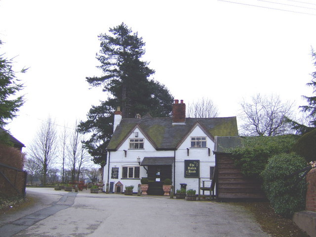
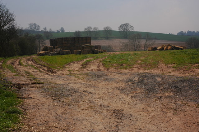
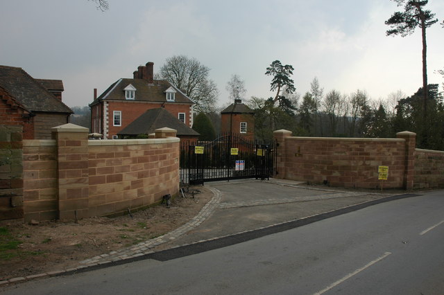
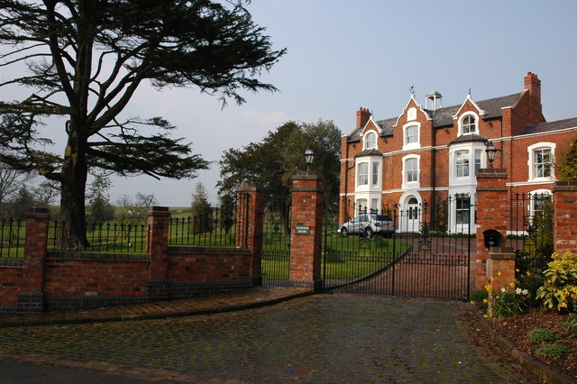
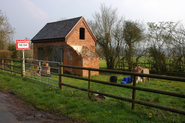
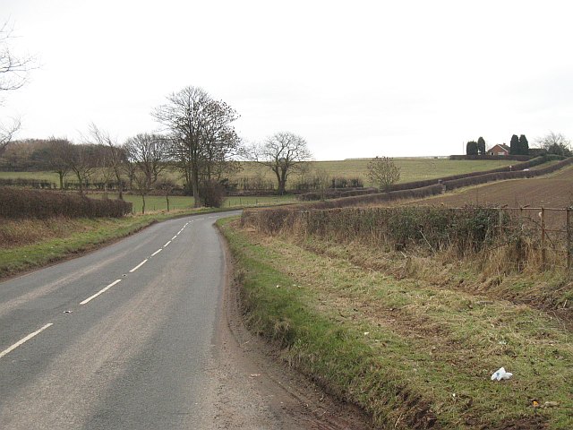
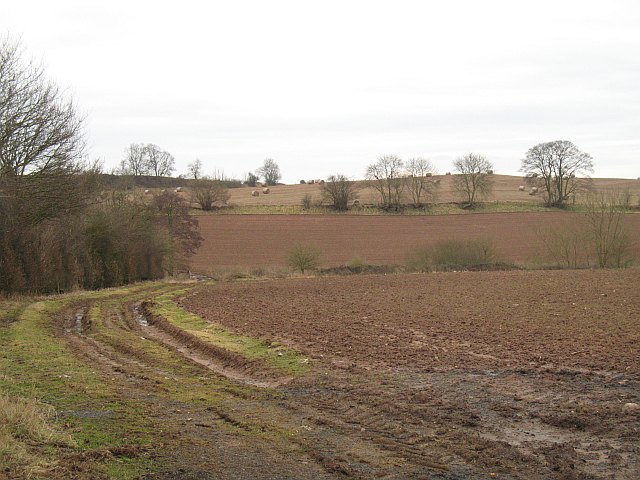
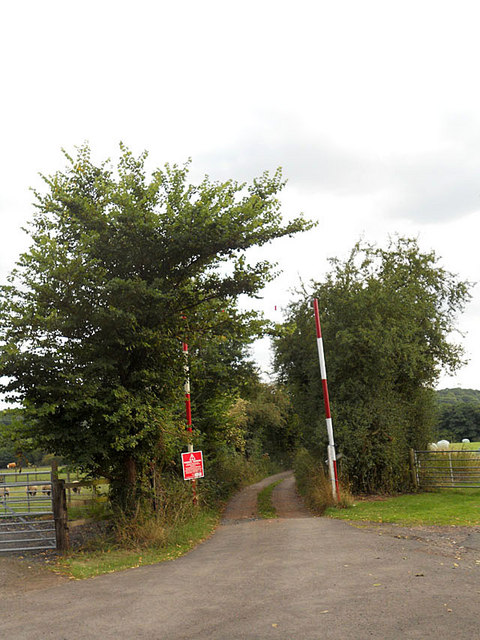
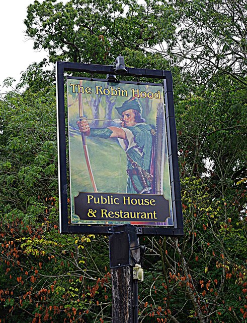
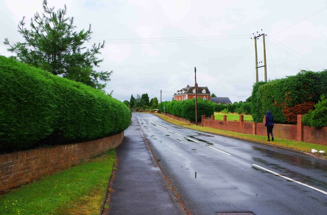
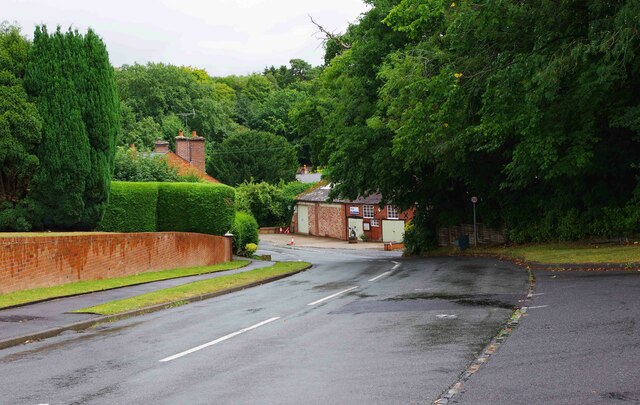
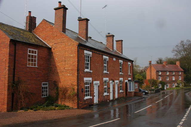
Hillpool Images

Images are sourced within 2km of 52.382445/-2.151295 or Grid Reference SO8976. Thanks to Geograph Open Source API. All images are credited.

Robin Hood, Drayton, Belbroughton Freehouse -log fires - good range of beers
Robin Hood, Drayton, Belbroughton
Freehouse -log fires - good range of beers
A rick of straw bales near Belbroughton This rick of old straw bales is in a field to the west of the village of Belbroughton.
A rick of straw bales near Belbroughton
This rick of old straw bales is in a field to the west of the village of Belbroughton.
Entrance to Drayton House
Drayton Terrace, Drayton
Tanwood House near Chaddesley Corbett
'Property with potential....' at Tanwood
Hackmans Gate Lane Running through Worcestershire's commuter belt. Mixed farmland area.
Hackmans Gate Lane
Running through Worcestershire's commuter belt. Mixed farmland area.
Fields off Hackmans Gate Lane Ploughed and cultivated - compare with a view from a few years earlier <a href="https://www.geograph.org.uk/photo/385179">SO9077 : A rick of straw bales near Belbroughton</a>.
Fields off Hackmans Gate Lane
Ploughed and cultivated - compare with a view from a few years earlier SO9077 : A rick of straw bales near Belbroughton.
Access is limited
Access is limited
Down the hill to Drayton
Entering Drayton from the north
The Robin Hood Public House, Drayton, Worcestershire
House at Tanwood Cross
The Robin Hood (1) Drayton Road, Drayton, Worcs Local public house and restaurant in the small hamlet of Drayton. It first opened for business in 1825.

<a href="https://www.geograph.org.uk/photo/7242382">SO9075 : The Robin Hood (2) Drayton Road, Drayton, Worcs</a>.
<a href="https://www.geograph.org.uk/photo/7242391">SO9075 : The Robin Hood (3) - sign, Drayton Road, Drayton, Worcs</a>.
The Robin Hood (1) Drayton Road, Drayton, Worcs
Local public house and restaurant in the small hamlet of Drayton. It first opened for business in 1825. SO9075 : The Robin Hood (2) Drayton Road, Drayton, Worcs. SO9075 : The Robin Hood (3) - sign, Drayton Road, Drayton, Worcs.
The Robin Hood (2) Drayton Road, Drayton, Worcs Local public house and restaurant. See also:- <a href="https://www.geograph.org.uk/photo/7242370">SO9075 : The Robin Hood (1) Drayton Road, Drayton, Worcs</a> and <a href="https://www.geograph.org.uk/photo/7242391">SO9075 : The Robin Hood (3) - sign, Drayton Road, Drayton, Worcs</a>.
The Robin Hood (2) Drayton Road, Drayton, Worcs
The Robin Hood (3) - sign, Drayton Road, Drayton, Worcs Quite why this public house and restaurant has been named after Robin Hood isn't clear. There is still uncertainty about whether Robin Hood actually existed and, if he did, exactly where he operated. So far Worcestershire doesn't seem to be one of those. There is at least one other Robin Hood pub in the north of the county. Unfortunately the sign is rather faded. It is located on a post by the edge of the pavement in Drayton Road, near the vehicular access to The Robin Hood public house and restaurant.

<a href="https://www.geograph.org.uk/photo/7242370">SO9075 : The Robin Hood (1) Drayton Road, Drayton, Worcs</a>.
<a href="https://www.geograph.org.uk/photo/7242382">SO9075 : The Robin Hood (2) Drayton Road, Drayton, Worcs</a>.
The Robin Hood (3) - sign, Drayton Road, Drayton, Worcs
Quite why this public house and restaurant has been named after Robin Hood isn't clear. There is still uncertainty about whether Robin Hood actually existed and, if he did, exactly where he operated. So far Worcestershire doesn't seem to be one of those. There is at least one other Robin Hood pub in the north of the county. Unfortunately the sign is rather faded. It is located on a post by the edge of the pavement in Drayton Road, near the vehicular access to The Robin Hood public house and restaurant. SO9075 : The Robin Hood (1) Drayton Road, Drayton, Worcs. SO9075 : The Robin Hood (2) Drayton Road, Drayton, Worcs.
Drayton Road, Drayton, Worcs Drayton Road is the main road running through the hamlet of Drayton.
Drayton Road, Drayton, Worcs
Drayton Road is the main road running through the hamlet of Drayton.
Drayton Road, Drayton, Worcs Drayton Road is the main road in the hamlet of Drayton. On the immediate right is the vehicular access to The Robin Hood public house and restaurant.
Drayton Road, Drayton, Worcs
Drayton Road is the main road in the hamlet of Drayton. On the immediate right is the vehicular access to The Robin Hood public house and restaurant.
Show me another place!

Hillpool is located at Grid Ref: SO8976 (Lat: 52.382445, Lng: -2.151295)

Administrative County: Worcestershire

District: Wyre Forest

Police Authority: West Mercia

What 3 Words

///midfield.skidding.alleyway. Near Belbroughton, Worcestershire

Nearby Locations

Hillpool

Related Wikis

Drayton, Worcestershire

Drayton is a hamlet in Worcestershire, England which remains part of the ecclesiastical parish of Chaddesley Corbett, which from its select vestry formed...

Tanwood

Tanwood is a hamlet in the English county of Worcestershire. It lies about one mile northeast of the village of Chaddesley Corbett and forms part of the...

Hackmans Gate

Hackmans Gate is a hamlet in the parish of Broome, and the district of Wyre Forest District of Worcestershire, England.

Belbroughton

Belbroughton ( bel-BRAW-tən) is a village and civil parish in the Bromsgrove District of Worcestershire, England. According to the 2021 census it had...

Broome, Worcestershire

Broome is a village and civil parish in the Wyre Forest District of Worcestershire, England. According to the 2001 census it had a population of 338. The...

Chaddesley Corbett

Chaddesley Corbett is a village and civil parish in the Wyre Forest District of Worcestershire, England. The Anglican and secular versions of the parish...

Harvington Hall

Harvington Hall is a moated medieval and Elizabethan manor house in the hamlet of Harvington in the civil parish of Chaddesley Corbett, southeast of Kidderminster...

Chaddesley Woods National Nature Reserve

Chaddesley Woods National Nature Reserve is situated near the village of Chaddesley Corbett, in Worcestershire, England. It is a reserve of the Worcestershire...

Nearby Amenities

Located within 500m of 52.382445,-2.151295
Waterway: weir
Lat/Long: 52.3830912/-2.1546094
Waterway: weir
Lat/Long: 52.3831356/-2.154595
The data included in this document is from www.openstreetmap.org. The data is made available under ODbL.

Have you been to Hillpool?

Leave your review of Hillpool below (or comments, questions and feedback).