An Stuchd

Hill, Mountain in Perthshire

Scotland

An Stuchd

Partly snowed ground south-east of Stob a' Choin. The gently rolling ground is north of Creag Chaorannach and south-east of Stob a' Choin which was the destination on the day the image was recorded; it rises steeply to the left.
The distant snowy peak is Stob Binnein; it lies beyond the upper Balquhidder glen.
Partly snowed ground south-east of Stob a' Choin. Credit: Trevor Littlewood

The requested URL returned error: 429 Too Many Requests

If you have any feedback on the listing, please let us know in the comments section below.
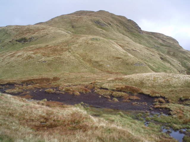
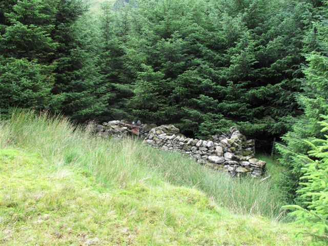
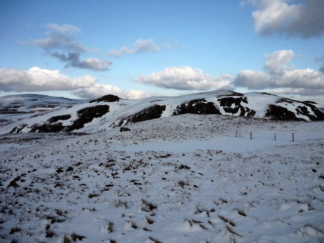
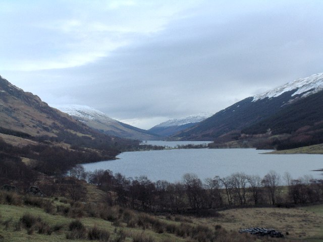
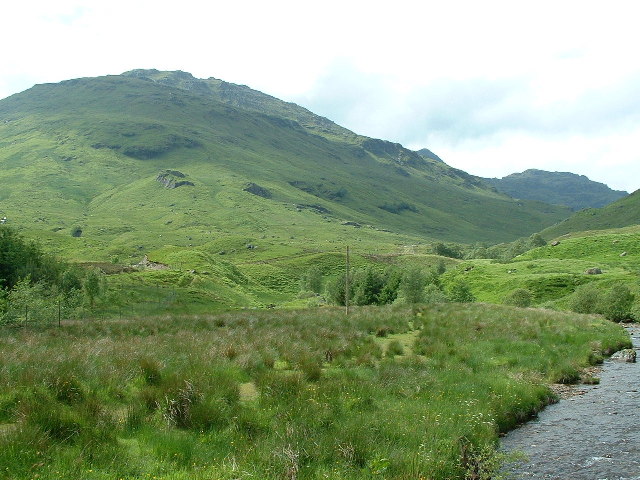
An Stuchd Images

Images are sourced within 2km of 56.299729/-4.5111082 or Grid Reference NN4414. Thanks to Geograph Open Source API. All images are credited.

Partly snowed ground south-east of Stob a' Choin. The gently rolling ground is north of Creag Chaorannach and south-east of Stob a' Choin which was the destination on the day the image was recorded; it rises steeply to the left.
The distant snowy peak is Stob Binnein; it lies beyond the upper Balquhidder glen.
Partly snowed ground south-east of Stob a' Choin.
The gently rolling ground is north of Creag Chaorannach and south-east of Stob a' Choin which was the destination on the day the image was recorded; it rises steeply to the left. The distant snowy peak is Stob Binnein; it lies beyond the upper Balquhidder glen.
South from An Stuchd View towards Ben Lomond over the hill country to the north of Loch Katrine.
South from An Stuchd
View towards Ben Lomond over the hill country to the north of Loch Katrine.
Bogs below Stob a' Choin. A boggy area below the south side of Stob a' Choin.
Bogs below Stob a' Choin.
A boggy area below the south side of Stob a' Choin.
Arkle on a Graham Summit of Stob Breac a very steep Graham south of Inverlochlarig, Balquhidder.
Arkle - a wee dog named after one of the big bold Sutherland Corbetts - Arkle is neither big or bold!
Arkle on a Graham
Summit of Stob Breac a very steep Graham south of Inverlochlarig, Balquhidder. Arkle - a wee dog named after one of the big bold Sutherland Corbetts - Arkle is neither big or bold!
Boggy Col One of the many cols on the switchback ridge from Stob Breac to Beinn Mheadhonach between Balquhidder and Loch Katrine - I've been here twice and never seen a soul as the attractions of Ben More, Stob Binnein and others are nearby.
Boggy Col
One of the many cols on the switchback ridge from Stob Breac to Beinn Mheadhonach between Balquhidder and Loch Katrine - I've been here twice and never seen a soul as the attractions of Ben More, Stob Binnein and others are nearby.
Old Deer Fence Rickety old deer fence just south of the summit of An Stuchd looking down into the top of the Invernenty Glen. Just beyond where I was standing I could step right over this fence so it certainly isn't stopping any deer from passing through.
Old Deer Fence
Rickety old deer fence just south of the summit of An Stuchd looking down into the top of the Invernenty Glen. Just beyond where I was standing I could step right over this fence so it certainly isn't stopping any deer from passing through.
Bheinn Mheadhonach Hill on north side of Loch Katrine.
Bheinn Mheadhonach
Hill on north side of Loch Katrine.
Loch Katrine View Loch Katrine from the west fork of Strone Burn - Ben Venue is the prominent peak in the distance.
Loch Katrine View
Loch Katrine from the west fork of Strone Burn - Ben Venue is the prominent peak in the distance.
Derelict buildings Taken from the forestry track that runs south through this square we found this derelict building just to the west.
Derelict buildings
Taken from the forestry track that runs south through this square we found this derelict building just to the west.
Track in forest Track through forest with Stob Binnein in the background
Track in forest
Track through forest with Stob Binnein in the background
Frozen burn below Taobh na Coille This unnamed burn drops down the steep hillside into the trees at the south end of the forest.
Frozen burn below Taobh na Coille
This unnamed burn drops down the steep hillside into the trees at the south end of the forest.
Upper Glen Invernenty Although the OS map shows forest covering the whole glen in the south of this square, the flat glen floor is too wet for trees.
Upper Glen Invernenty
Although the OS map shows forest covering the whole glen in the south of this square, the flat glen floor is too wet for trees.
Stag at the road end The forest road up the west side of Invernenty Glen ends in a clearing with a wide bulldozed turning space and, on this occasion, a grazing stag.
Stag at the road end
The forest road up the west side of Invernenty Glen ends in a clearing with a wide bulldozed turning space and, on this occasion, a grazing stag.
Hillside above Taobh na Coille Hillside slopes south from a small top at 692m, with Ben Venue visible in the distance.
The snow bank reveals the passage of one or more mountain hares.
Hillside above Taobh na Coille
Hillside slopes south from a small top at 692m, with Ben Venue visible in the distance. The snow bank reveals the passage of one or more mountain hares.
Hilltop view near Inverlochlarig Looking across a small hilltop above Invernenty Glen towards striking snowcapped Crianlarich Munros.
Hilltop view near Inverlochlarig
Looking across a small hilltop above Invernenty Glen towards striking snowcapped Crianlarich Munros.
Top near Stob Fear-Tomhais This top, with a spot height of 715m, lies to the southwest of the Corbett Stob Fear-Tomhais (aka Ceann na Baintighearna) whose rounded summit at 771m is visible behind on the left hand side.
Top near Stob Fear-Tomhais
This top, with a spot height of 715m, lies to the southwest of the Corbett Stob Fear-Tomhais (aka Ceann na Baintighearna) whose rounded summit at 771m is visible behind on the left hand side.
Forest in Invernenty Glen Much of this square on the east side of the glen is covered in forest running down to the Invernenty Burn.
Forest in Invernenty Glen
Much of this square on the east side of the glen is covered in forest running down to the Invernenty Burn.
Meall Gaotach north of Loch Katrine Contouring along the south-east of the hill.
Meall Gaotach north of Loch Katrine
Contouring along the south-east of the hill.
Show me another place!

An Stuchd is located at Grid Ref: NN4414 (Lat: 56.299729, Lng: -4.5111082)

Unitary Authority: Stirling

Police Authority: Forth Valley

What 3 Words

///juggles.tapes.eyebrows. Near Callander, Stirling

Nearby Locations

An Stuchd

Related Wikis

Stob a' Choin

Stob a'Choin (869 m) is a mountain in the Grampian Mountains, Scotland, north of Loch Katrine in the Loch Lomond and The Trossachs National Park. The nearest...

Loch Doine

Loch Doine is a small freshwater loch that lies to the west of Balquhidder in the Trossachs and Teith ward within Stirling council area of Scotland. It...

Loch Katrine

Loch Katrine (; Scottish Gaelic: Loch Ceiteirein [l̪ˠɔx ˈkʲʰeʰtʲɪɾʲɛɲ] or Loch Ceathairne) is a freshwater loch in the Trossachs area of the Scottish Highlands...

Beinn Tulaichean

Beinn Tulaichean is a Scottish mountain. It is not much more than the southern top of Cruach Ardrain, with a descent of only 120m before the ascent to...

Nearby Amenities

Located within 500m of 56.299729,-4.5111082
An Stuichd
Ele: 665
Munro: no
Natural: peak
Source: OS7
Lat/Long: 56.3002298/-4.5117002
The data included in this document is from www.openstreetmap.org. The data is made available under ODbL.

Have you been to An Stuchd?

Leave your review of An Stuchd below (or comments, questions and feedback).