Beinn Pharlagain

Hill, Mountain in Perthshire

Scotland

Beinn Pharlagain

View towards Allt Eigheach This picture was taken from the new-ish gravelled hydro track up the western side of the valley. The cloud helpfully obscures the photogenic southern end of Beinn Pharlagain, to not detract unnecessarily from the not too photogenic moorland around the Allt Eigheach.
View towards Allt Eigheach Credit: Aleks Scholz

The requested URL returned error: 429 Too Many Requests

If you have any feedback on the listing, please let us know in the comments section below.

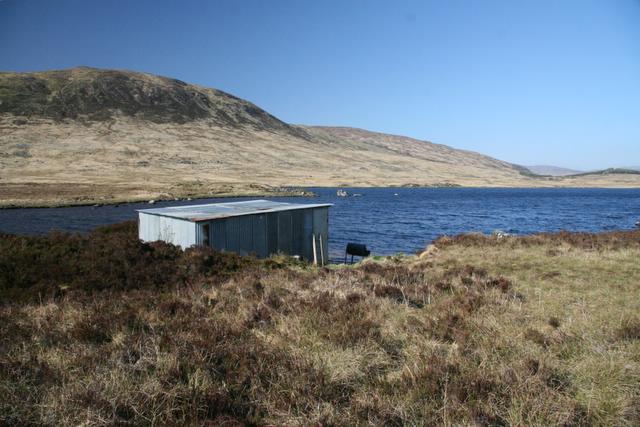
Beinn Pharlagain Images

Images are sourced within 2km of 56.731179/-4.5422724 or Grid Reference NN4462. Thanks to Geograph Open Source API. All images are credited.

View towards Allt Eigheach This picture was taken from the new-ish gravelled hydro track up the western side of the valley. The cloud helpfully obscures the photogenic southern end of Beinn Pharlagain, to not detract unnecessarily from the not too photogenic moorland around the Allt Eigheach.
View towards Allt Eigheach
This picture was taken from the new-ish gravelled hydro track up the western side of the valley. The cloud helpfully obscures the photogenic southern end of Beinn Pharlagain, to not detract unnecessarily from the not too photogenic moorland around the Allt Eigheach.
Coire a' Ghiubhais near Ben Alder with a frayed mantle of snow
Coire Dubh Garbh near Ben Alder from across Loch Ericht
The Allt Eaghaich near the top of the step There is a clear 'step' or steepish drop on this river out of Coire Eaghaich, where the altitude falls from about 1500' to 1100' over the course of rather less than a mile. This is the drop that's been exploited by the Dunan Hydro scheme.
The Allt Eaghaich near the top of the step
There is a clear 'step' or steepish drop on this river out of Coire Eaghaich, where the altitude falls from about 1500' to 1100' over the course of rather less than a mile. This is the drop that's been exploited by the Dunan Hydro scheme.
The Allt Eaghaich Lying in the valley between Beinn Pharlagain to the east and Sròn Leachd a’ Chaorainn to the west, this burn drains Corrie Eaghaich.
The Allt Eaghaich
Lying in the valley between Beinn Pharlagain to the east and Sròn Leachd a’ Chaorainn to the west, this burn drains Corrie Eaghaich.
A shy hydro building It's not entirely clear from a distance what this little brown 'shed' is. The newly constructed hydro road goes right past it, and it's hiding behind a large moraine. It may simply be a temporary workers' shelter-cum-bothy, or it may be a more permanent piece of the hydro scheme's infrastructure.
A shy hydro building
It's not entirely clear from a distance what this little brown 'shed' is. The newly constructed hydro road goes right past it, and it's hiding behind a large moraine. It may simply be a temporary workers' shelter-cum-bothy, or it may be a more permanent piece of the hydro scheme's infrastructure.
Western slopes of Beinn Pharlagain You'll have to take my word for it that this is the lower part of the western flank of Pharlagain; it could be pretty much anywhere in this area (probably anywhere in the hills of Scotland, to be honest)
Western slopes of Beinn Pharlagain
You'll have to take my word for it that this is the lower part of the western flank of Pharlagain; it could be pretty much anywhere in this area (probably anywhere in the hills of Scotland, to be honest)
Looking up into Corrie Eaghaich Taken from the lower part of Beinn Pharlagain, shortly before heading up into the mist for much of the rest of the day.
Looking up into Corrie Eaghaich
Taken from the lower part of Beinn Pharlagain, shortly before heading up into the mist for much of the rest of the day.
The lower end of Corrie Eaghaich A new hydro access road has been driven up onto the corrie floor, currently forming a rather ugly scar. It will blend in, given time to weather and with fairly low levels of use. Hopefully it's not intended to extend it over the bealach of the Mam Ban between Carn Dearg and Sgòr Gaibhre.
The lower end of Corrie Eaghaich
A new hydro access road has been driven up onto the corrie floor, currently forming a rather ugly scar. It will blend in, given time to weather and with fairly low levels of use. Hopefully it's not intended to extend it over the bealach of the Mam Ban between Carn Dearg and Sgòr Gaibhre.
Lower Corrie Eaghaich The open end of Corrie Eaghaich, seen from above on the slopes of Beinn Pharlagain.
Lower Corrie Eaghaich
The open end of Corrie Eaghaich, seen from above on the slopes of Beinn Pharlagain.
Summit boulder on the south top of Beinn Pharlagain Lying at 807m (2648ft) this is the south 'top' of Beinn Pharlagain, the hill which, together with Meall na Meoig, forms much of the ridge running south from Sgòr Gaibhre.
Summit boulder on the south top of Beinn Pharlagain
Lying at 807m (2648ft) this is the south 'top' of Beinn Pharlagain, the hill which, together with Meall na Meoig, forms much of the ridge running south from Sgòr Gaibhre.
Boggy pool on Beinn Pharlagain On the ridge between the south 'top' and the summit of Garbh Mheall Mòr.
Boggy pool on Beinn Pharlagain
On the ridge between the south 'top' and the summit of Garbh Mheall Mòr.
Summit cairn - Garbh Meall Mòr Given a spot height of 838m, 2749ft, Garbh Meall Mòr is a subsidiary northern summit of Beinn Pharlagain, which lies on the ridge of Meall na Meoig.
Summit cairn - Garbh Meall Mòr
Given a spot height of 838m, 2749ft, Garbh Meall Mòr is a subsidiary northern summit of Beinn Pharlagain, which lies on the ridge of Meall na Meoig.
Alternative summit cairn on Garbh Meall Mòr This pile of rocks may (possibly) be the summit, but the cairn seen in <a href="https://www.geograph.org.uk/photo/3284965">NN4563 : Garbh Mheall Mòr</a> is a much more likely contender. Hard to be sure on a day such as this one.
Alternative summit cairn on Garbh Meall Mòr
This pile of rocks may (possibly) be the summit, but the cairn seen in NN4563 : Garbh Mheall Mòr is a much more likely contender. Hard to be sure on a day such as this one.
Misty western shoreline of Lochan Meoigeach Not a great day for photography, to be fair, but we were there so it needed to be recorded. This is the western side of the wee lochan that sits right under the summit area of Meall na Meoig, at about 830m
Misty western shoreline of Lochan Meoigeach
Not a great day for photography, to be fair, but we were there so it needed to be recorded. This is the western side of the wee lochan that sits right under the summit area of Meall na Meoig, at about 830m
Summit area on Meall na Meoig Somewhere in the nearby mist lies the summit of the Corbett - it's either this small cairn, or another one just to the east. We visited each of the two contenders, so were happy to claim the hill.
Summit area on Meall na Meoig
Somewhere in the nearby mist lies the summit of the Corbett - it's either this small cairn, or another one just to the east. We visited each of the two contenders, so were happy to claim the hill.
Shelf below summit of Meall na Meoig Rocks on a shelf, partly concealed by snow, just below the mountain's summit beyond which the ground steepens.
Carn Dearg is the mountain in the middle distance, Ben Nevis is on the horizon at the far left, Beinn na Lap is to the right.
(Copied from a Fujichrome transparency.)
Shelf below summit of Meall na Meoig
Rocks on a shelf, partly concealed by snow, just below the mountain's summit beyond which the ground steepens. Carn Dearg is the mountain in the middle distance, Ben Nevis is on the horizon at the far left, Beinn na Lap is to the right. (Copied from a Fujichrome transparency.)
Snow patch below summit of Meall na Meoig The large snow patch lies just north of the mountain's summit. Carn Dearg lies in the middle distance with Ben na Lap further away and right of centre.
Snow patch below summit of Meall na Meoig
The large snow patch lies just north of the mountain's summit. Carn Dearg lies in the middle distance with Ben na Lap further away and right of centre.
Show me another place!

Beinn Pharlagain is located at Grid Ref: NN4462 (Lat: 56.731179, Lng: -4.5422724)

Unitary Authority: Perth and Kinross

Police Authority: Tayside

What 3 Words

///staked.morphing.cycled. Near Pubil, Perth & Kinross

Related Wikis

Lochan Sròn Smeur

Lochan Sròn Smeur is an upland loch in Tayside, Scotland. == References ==

Càrn Dearg (Corrour)

Càrn Dearg (941 m) is a remote mountain in Corrour Forest in the Grampian Mountains of Scotland. It lies northeast of Rannoch Moor, overlooking Loch Ossian...

Sgor Gaibhre

Sgor Gaibhre (955 m) is a mountain in the Grampian Mountains of Scotland. It lies on the border of Highland and Perth and Kinross, near Loch Ossian. A...

The Heart Stone

The Heart Stone or Clach Cridhe in Perth and Kinross, Scotland is an ancient landmark on Rannoch Moor situated on the old 'Road to the Isles'. During the...

Have you been to Beinn Pharlagain?

Leave your review of Beinn Pharlagain below (or comments, questions and feedback).