Bennanbrack

Hill, Mountain in Kirkcudbrightshire

Scotland

Bennanbrack

Stone by the Southern Upland Way near Corse Knowe
Stone by the Southern Upland Way near Corse Knowe Credit: Dave Kelly

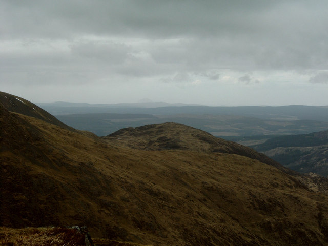
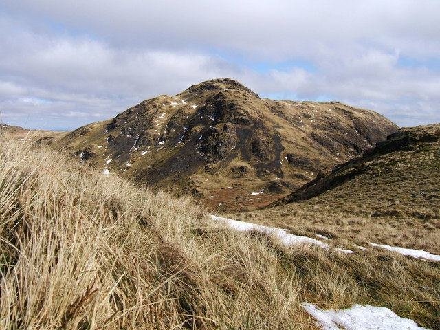
Bennanbrack is a hill located in the region of Kirkcudbrightshire in southwest Scotland. It is part of the Galloway Hills range and is known for its stunning views and rugged terrain. The hill reaches a height of 692 meters (2,270 feet) above sea level, making it a popular destination for hikers and outdoor enthusiasts.

Bennanbrack is characterized by its steep slopes and rocky outcrops, which provide a challenging but rewarding climb for those seeking adventure. The hill is also home to a variety of wildlife, including red deer, mountain hares, and various bird species.

The surrounding area of Kirkcudbrightshire is known for its natural beauty, with rolling hills, lush forests, and picturesque villages. Bennanbrack offers visitors the opportunity to experience the stunning landscapes of the Scottish countryside, with panoramic views stretching out across the region.

Overall, Bennanbrack is a popular destination for those looking to explore the great outdoors and immerse themselves in the beauty of Scotland's countryside. Whether you are an experienced hiker or simply looking for a peaceful retreat, Bennanbrack has something to offer for everyone.

If you have any feedback on the listing, please let us know in the comments section below.

Bennanbrack Images

Images are sourced within 2km of 55.064968/-4.4424235 or Grid Reference NX4477. Thanks to Geograph Open Source API. All images are credited.

Stone by the Southern Upland Way near Corse Knowe
The Southern Upland Way near Corse Knowe
The Southern Upland Way near Glenhead Burn
The Southern Upland Way near Little Trostan
Glenhead Burn and Forest track
Track, cycle route 7
View from near Curleywee
From Near the Nick of Curleywee Looking towards Bennan Hill.
From Near the Nick of Curleywee
Looking towards Bennan Hill.
Ruined Fence, Near the Nick of Curleywee
Nick of Curleywee Altitude 555m.
Nick of Curleywee
Altitude 555m.
Track, Linking Loch Dee with Glentrool The track has been surfaced using scallop shells; quite a common material in south west Scotland for road mending. The track forms part of the Southern Upland Way and  National Cycleway No. 7. In the distance lie the Rhinns of Kells hills.
Track, Linking Loch Dee with Glentrool
The track has been surfaced using scallop shells; quite a common material in south west Scotland for road mending. The track forms part of the Southern Upland Way and National Cycleway No. 7. In the distance lie the Rhinns of Kells hills.
View From Near the Summit of White Hill ... ... looking towards the Merrick with the Round Loch of Glenhead reflecting the late afternoon light.
View From Near the Summit of White Hill ...
... looking towards the Merrick with the Round Loch of Glenhead reflecting the late afternoon light.
Scars of Bennanbrack The north eastern broken slopes of the 685m high hill Bennanbrack are known as the Scars of Bennanbrack.
Scars of Bennanbrack
The north eastern broken slopes of the 685m high hill Bennanbrack are known as the Scars of Bennanbrack.
Wall, Punlee Burn Snaking its way up to the Loup of Laggan.
Wall, Punlee Burn
Snaking its way up to the Loup of Laggan.
Five Pound Well
Five Pound Well
Bennanbrack from White Hill
Boulder, South Side An orienteering control used in the 2007 OMM (original Mountain Marathon). Near to Corse Knowe of White Laggan which I think is the small knoll middle distance, centre.
Boulder, South Side
An orienteering control used in the 2007 OMM (original Mountain Marathon). Near to Corse Knowe of White Laggan which I think is the small knoll middle distance, centre.
The summit of Curlywee 674 metres. Here is the summit of Curlywee 674 metres. It is one of the hills in the Minnigaff Range in the Galloway Hills and is quite a challenging climb. The photo was taken on a beautiful day in March.
The summit of Curlywee 674 metres.
Here is the summit of Curlywee 674 metres. It is one of the hills in the Minnigaff Range in the Galloway Hills and is quite a challenging climb. The photo was taken on a beautiful day in March.
Show me another place!

Bennanbrack is located at Grid Ref: NX4477 (Lat: 55.064968, Lng: -4.4424235)

Unitary Authority: Dumfries and Galloway

Police Authority: Dumfries and Galloway

What 3 Words

///according.counters.across. Near Newton Stewart, Dumfries & Galloway

Nearby Locations

Bennanbrack

Related Wikis

Lamachan Hill

Lamachan Hill is a hill in the Minnigaff Hills, a sub-range of the Galloway Hills range, part of the Southern Uplands of Scotland. It is the highest hill...

Round Loch of Glenhead

The Round Loch of Glenhead is a small upland single basin loch in Dumfries and Galloway. It is situated within Galloway Forest Park to the west of the...

Battle of Glen Trool

The Battle of Glen Trool was a minor engagement in the First War of Scottish Independence, fought in April 1307. Glen Trool is a narrow glen in the Southern...

Loch Trool

Loch Trool is a narrow, freshwater loch in Galloway, in the Southern Uplands in south-west Scotland. It lies in an elevated position in Glen Trool in the...

Have you been to Bennanbrack?

Leave your review of Bennanbrack below (or comments, questions and feedback).