Conic Hill
Hill, Mountain in Stirlingshire
Scotland
Conic Hill

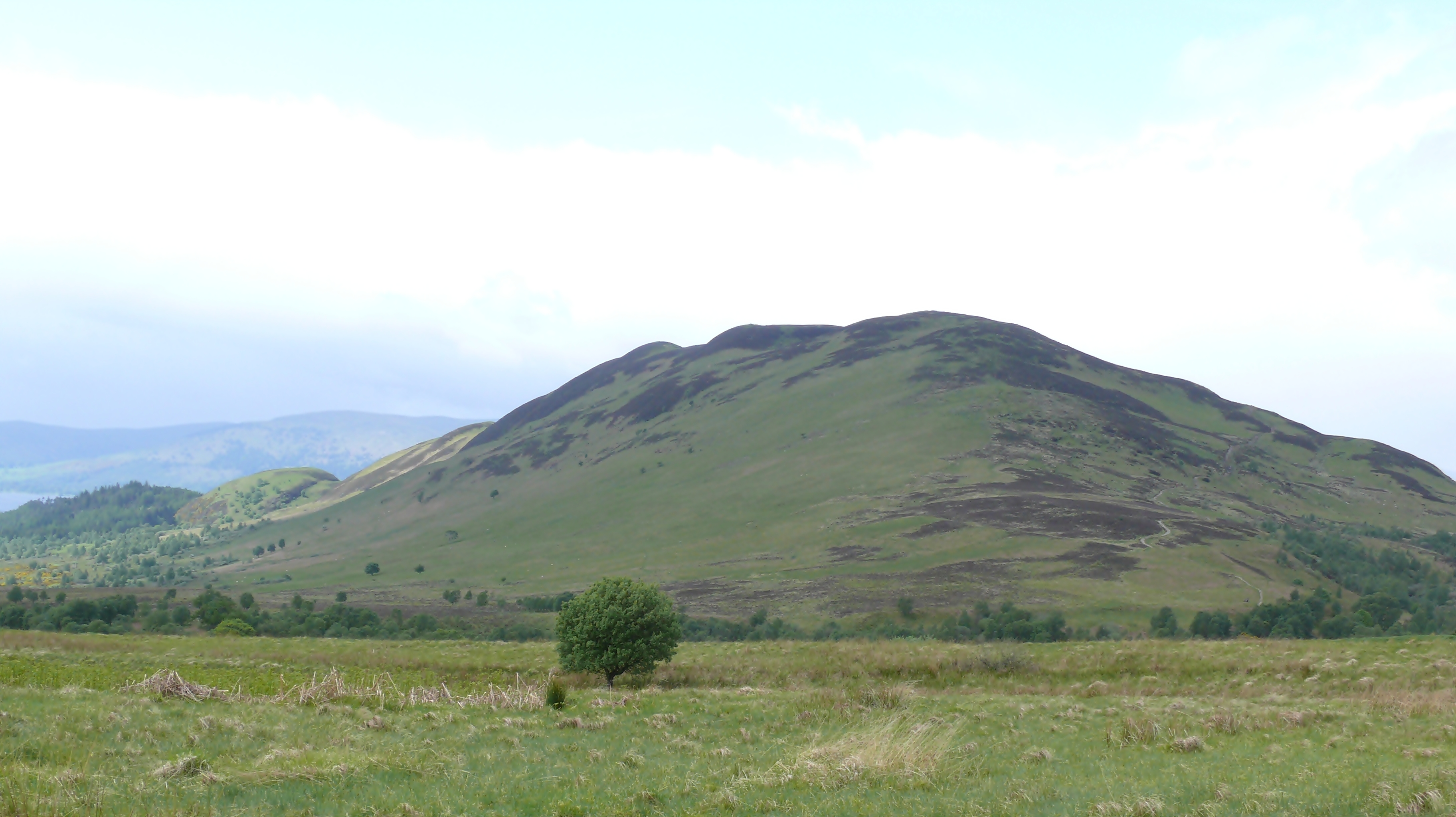
Conic Hill is a prominent hill located in Stirlingshire, Scotland. It is part of the wider Loch Lomond and The Trossachs National Park, which is renowned for its stunning natural beauty and diverse landscape. Standing at an elevation of 361 meters (1,185 feet), Conic Hill offers breathtaking panoramic views of the surrounding area, including the iconic Loch Lomond.
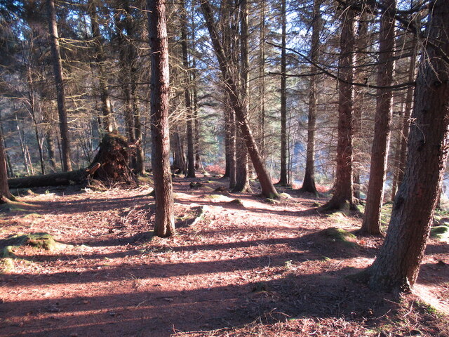
The hill itself is formed from volcanic rock, with its distinct conical shape being a result of ancient volcanic activity. Its slopes are covered in a mixture of grass, heather, and rocky outcrops, providing a habitat for a variety of plant and animal species. The area is particularly rich in birdlife, with sightings of buzzards, kestrels, and peregrine falcons being common.
A well-maintained path leads visitors to the summit of Conic Hill, making it accessible to both experienced hikers and casual walkers. The ascent is relatively moderate, with a few steeper sections that require some effort. Along the way, hikers can enjoy the picturesque scenery, including the serene waters of Loch Lomond and the surrounding mountains.
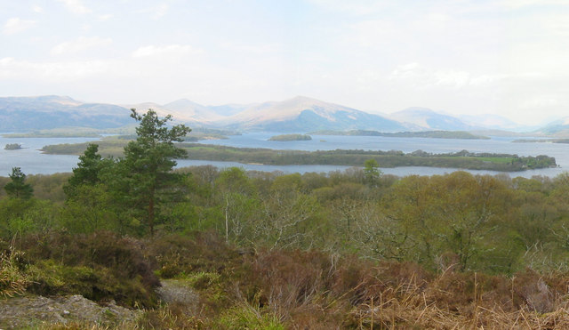
Once at the top, the reward is a breathtaking view that stretches across the vast expanse of Loch Lomond and its many islands. On a clear day, it is possible to see as far as the Arrochar Alps and even the distant mountains of the Scottish Highlands.
Conic Hill is a popular destination for outdoor enthusiasts and nature lovers, providing a serene and picturesque setting for a leisurely walk or a more challenging hike.
If you have any feedback on the listing, please let us know in the comments section below.
Conic Hill Images
Images are sourced within 2km of 56.098574/-4.5213559 or Grid Reference NS4392. Thanks to Geograph Open Source API. All images are credited.


Conic Hill is located at Grid Ref: NS4392 (Lat: 56.098574, Lng: -4.5213559)
Unitary Authority: Stirling
Police Authority: Forth Valley
What 3 Words
///euphoric.shredder.shifters. Near Killearn, Stirling
Nearby Locations
Related Wikis
Conic Hill
Conic Hill (from Gaelic "còinneach" meaning moss) is a prominent hill in Stirling, Scotland. == Location and description == It is on the east bank of Loch...

Buchanan, Stirling
Buchanan is a historic parish in Stirlingshire in Scotland. It includes a large part of the eastern shore of Loch Lomond. The most populated village in...

Balmaha
Balmaha (Gaelic: Baile Mo Thatha) is a village on the eastern shore of Loch Lomond in the council area of Stirling, Scotland. The village is a popular...

Milton of Buchanan
Milton of Buchanan is a small village in Stirling, Scotland, within the parish of Buchanan. Historically, the village was in the Registration County of...

Milarrochy Bay
Milarrochy Bay is a bay on Loch Lomond, in southern Scotland. It is near the village of Balmaha. Known locally as Bakey Bay, due to the rounded mounds...
Loch Lomond National Nature Reserve
Loch Lomond National Nature Reserve (NNR) (Scottish Gaelic: Tèarmann Nàdair Nàiseanta Loch Laomainn) encompasses 430 hectares of land at the southeastern...
Inchcailloch
Inchcailloch (Scottish Gaelic: Innis na Cailleach) is an islet on Loch Lomond in Scotland. It is 85 metres (279 ft) at its highest point. It is also known...

Endrick Water
The Endrick Water or River Endrick (Scottish Gaelic: Eunarag) is a river which flows into the eastern end of Loch Lomond, Scotland. Its drainage basin...
Nearby Amenities
Located within 500m of 56.098574,-4.5213559Have you been to Conic Hill?
Leave your review of Conic Hill below (or comments, questions and feedback).