Bwlch Mawr

Hill, Mountain in Caernarfonshire

Wales

Bwlch Mawr

Gyrn Goch Distant Summit Gyrn Goch as seen from Gyrn Ddu.
Name: Gyrn Goch
Hill number: 7496
Height: 492m / 1614ft
Area: 30A: Anglesey and the Lleyn Peninsula
Class: 4
Grid ref: SH407475 (est)
Drop: 63m
Col: 429m  SH407471
Gyrn Goch Distant Summit Credit: Rude Health

Bwlch Mawr is a prominent hill or mountain located in the county of Caernarfonshire in Wales, United Kingdom. It is part of the Snowdonia National Park and lies in close proximity to the popular tourist destination of Snowdon, the highest mountain in Wales.

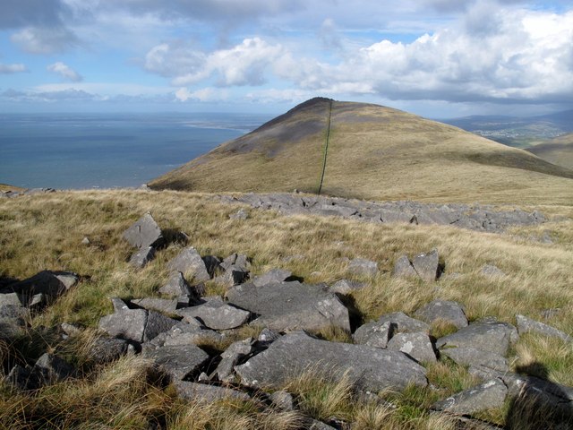
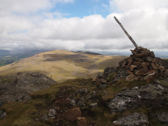
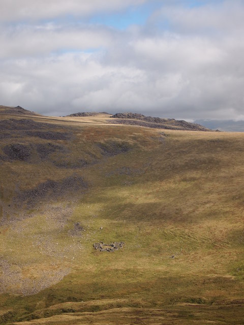
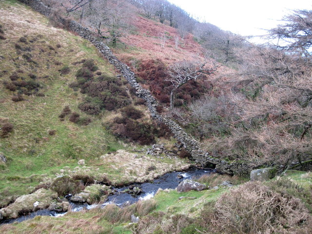
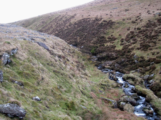
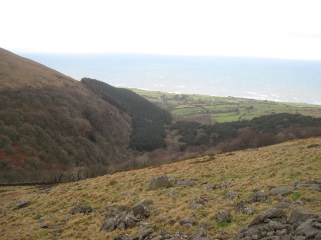
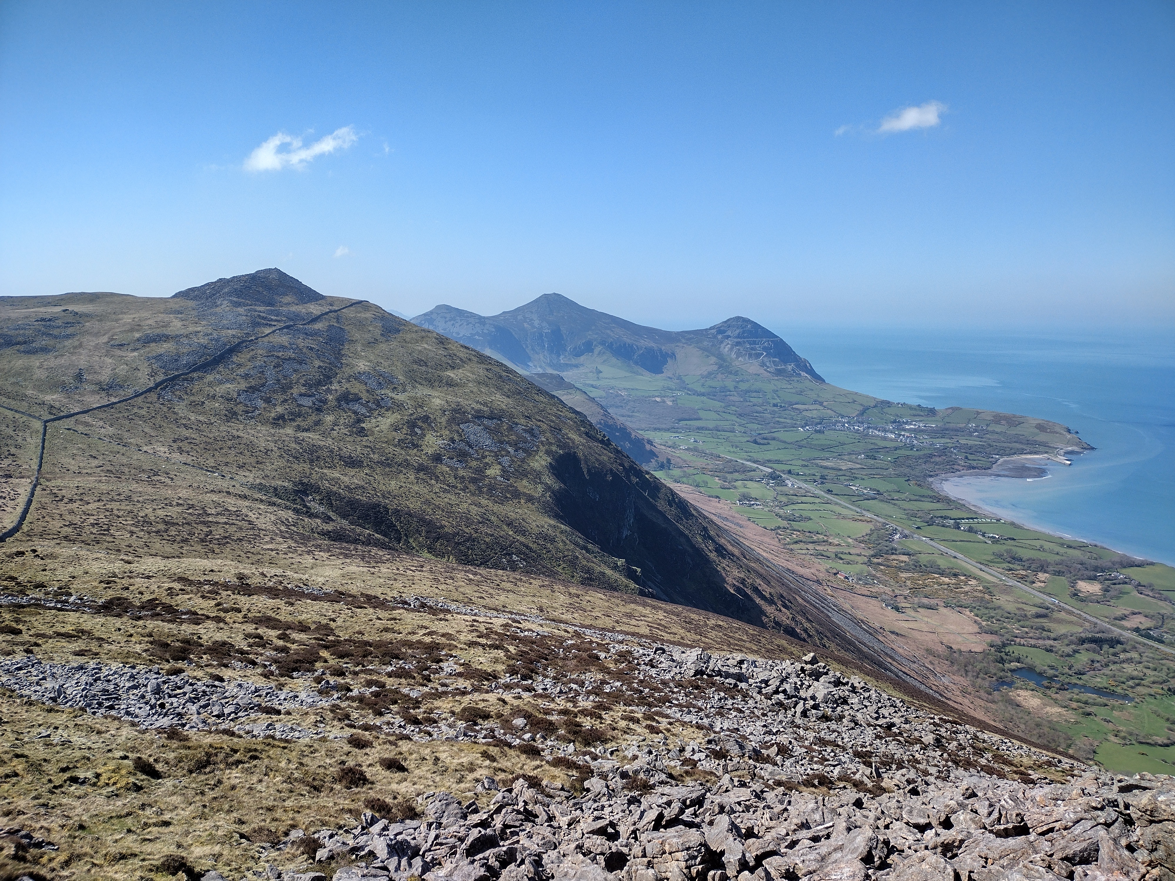
Standing at an elevation of 672 meters (2,205 feet), Bwlch Mawr offers breathtaking panoramic views of the surrounding landscape. Its distinctive shape and rocky terrain make it a notable landmark in the area. The hill is predominantly composed of volcanic rocks, including rhyolite and volcanic ash, providing a glimpse into the region's geological history.

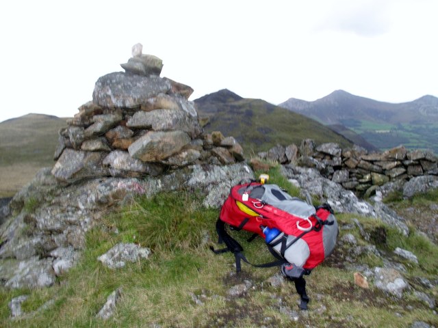
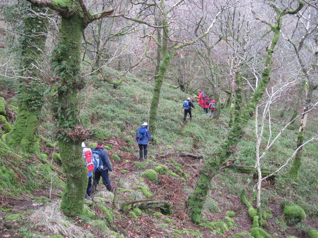
The ascent to the summit of Bwlch Mawr can be challenging, requiring hikers to navigate steep slopes and rocky paths. However, the effort is rewarded with stunning vistas of the surrounding mountains and valleys, including the majestic Snowdon.

The hill is also home to a variety of flora and fauna, with heather, grasses, and mosses covering its slopes. Wildlife enthusiasts may spot birds such as ravens, buzzards, and peregrine falcons soaring above or catch a glimpse of mammals like mountain goats and wild ponies that graze in the area.

Bwlch Mawr is a popular destination for outdoor enthusiasts, attracting hikers, mountaineers, and nature lovers throughout the year. Its proximity to Snowdon and the surrounding peaks offers opportunities for more challenging hikes and mountaineering expeditions, making it a favorite spot for adventure seekers.

Overall, Bwlch Mawr's natural beauty, geological significance, and accessibility make it an enticing destination for those seeking a memorable outdoor experience in Caernarfonshire.

If you have any feedback on the listing, please let us know in the comments section below.

Bwlch Mawr Images

Images are sourced within 2km of 53.003522/-4.3464259 or Grid Reference SH4247. Thanks to Geograph Open Source API. All images are credited.

Gyrn Goch Distant Summit Gyrn Goch as seen from Gyrn Ddu.
Name: Gyrn Goch
Hill number: 7496
Height: 492m / 1614ft
Area: 30A: Anglesey and the Lleyn Peninsula
Class: 4
Grid ref: SH407475 (est)
Drop: 63m
Col: 429m  SH407471
Gyrn Goch Distant Summit
Gyrn Goch as seen from Gyrn Ddu. Name: Gyrn Goch Hill number: 7496 Height: 492m / 1614ft Area: 30A: Anglesey and the Lleyn Peninsula Class: 4 Grid ref: SH407475 (est) Drop: 63m Col: 429m SH407471
Gyrn Goch Gyrn Goch looking across from summit cairn to Gyrn Ddu and hills beyond.
Name: Gyrn Goch
Hill number: 7496
Height: 492m / 1614ft
Area: 30A: Anglesey and the Lleyn Peninsula
Class: 4
Grid ref: SH407475 (est)
Drop: 63m
Col: 429m  SH407471
Gyrn Goch
Gyrn Goch looking across from summit cairn to Gyrn Ddu and hills beyond. Name: Gyrn Goch Hill number: 7496 Height: 492m / 1614ft Area: 30A: Anglesey and the Lleyn Peninsula Class: 4 Grid ref: SH407475 (est) Drop: 63m Col: 429m SH407471
Cae-hir Uchaf The ruins of the cottage are now a holding pen for the sheep dip built onto the side.
Cae-hir Uchaf
The ruins of the cottage are now a holding pen for the sheep dip built onto the side.
Trig Point, Bwlch Mawr
Stile and Wall, South of Bwlch Mawr
Sheepfolds and Walls Yr Eifl in the far distance.
Sheepfolds and Walls
Yr Eifl in the far distance.
Summit Cairn, Gyrn Goch Bwlch Mawr in the Distance.
Summit Cairn, Gyrn Goch
Bwlch Mawr in the Distance.
Sheepfolds, Corsyddalfa
Cwmgwared farm
Cwmgwared farm
House in the plantation Not named on the map.
House in the plantation
Not named on the map.
The path through the plantation
Afon Hen above the plantation
Looking upstream towards Corsyddalfa
Looking towards Cwm-gwared plantation The Irish Sea is in the background.
Looking towards Cwm-gwared plantation
The Irish Sea is in the background.
Looking towards Gyrn Goch The track to the old manganese mine is clearly visible on the far side of Afon Hen.
Looking towards Gyrn Goch
The track to the old manganese mine is clearly visible on the far side of Afon Hen.
Steep slopes on Bwlch Mawr
Looking towards Clipiau and Gyrn Goch With Gyrn Ddu just visible beyond.
Looking towards Clipiau and Gyrn Goch
With Gyrn Ddu just visible beyond.
Rough ground on Bwlch Mawr Looking towards Clipiau, Gyrn Ddu and Gyrn Goch.
Rough ground on Bwlch Mawr
Looking towards Clipiau, Gyrn Ddu and Gyrn Goch.
Show me another place!

Bwlch Mawr is located at Grid Ref: SH4247 (Lat: 53.003522, Lng: -4.3464259)

Unitary Authority: Gwynedd

Police Authority: North Wales

What 3 Words

///digestion.react.acrobats. Near Penygroes, Gwynedd

Nearby Locations

Bwlch Mawr

Related Wikis

Bwlch Mawr

Bwlch Mawr is a hill near the northeastern corner of the Llŷn Peninsula in the community of Clynnog in the county of Gwynedd in North Wales. Its name is...

Clynnog Fawr

Clynnog Fawr, often simply called "Clynnog", is a village and community on the north coast of Llŷn Peninsula in Gwynedd, north-west Wales. It is in the...

Gyrn Ddu

Gyrn Ddu is a hill near the northeastern corner of the Llŷn Peninsula in the community of Llanaelhaearn in the county of Gwynedd in North Wales. It forms...

Aberdesach

Aberdesach is a small village in a primarily Welsh speaking area of Gwynedd. It is in the historic county of Caernarfonshire. The village is situated approximately...

Nearby Amenities

Located within 500m of 53.003522,-4.3464259
Bwlch Mawr
Description: OS trig pillar
Ele: 509.625
Man Made: survey_point
Natural: peak
Note: Accurate location import for imagery offset calibration. Please do not move.
Ref: S7437
Source: Ordnance Survey (OGL)
Survey Point: pillar
Wikidata: Q15206216
Wikipedia: en:Bwlch Mawr
Lat/Long: 53.0048076/-4.3463357
The data included in this document is from www.openstreetmap.org. The data is made available under ODbL.

Have you been to Bwlch Mawr?

Leave your review of Bwlch Mawr below (or comments, questions and feedback).