Beinn nan Imirean

Hill, Mountain in Perthshire

Scotland

Beinn nan Imirean

Meall Glas The approach to the summit of the Munro from the east.
Meall Glas Credit: Iain Russell

Beinn nan Imirean is a prominent hill located in Perthshire, Scotland. It is part of the Grampian Mountains and sits at an elevation of 845 meters (2,772 feet). The hill is situated about 13 kilometers (8 miles) north-northeast of the town of Aberfeldy.

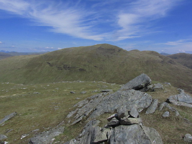
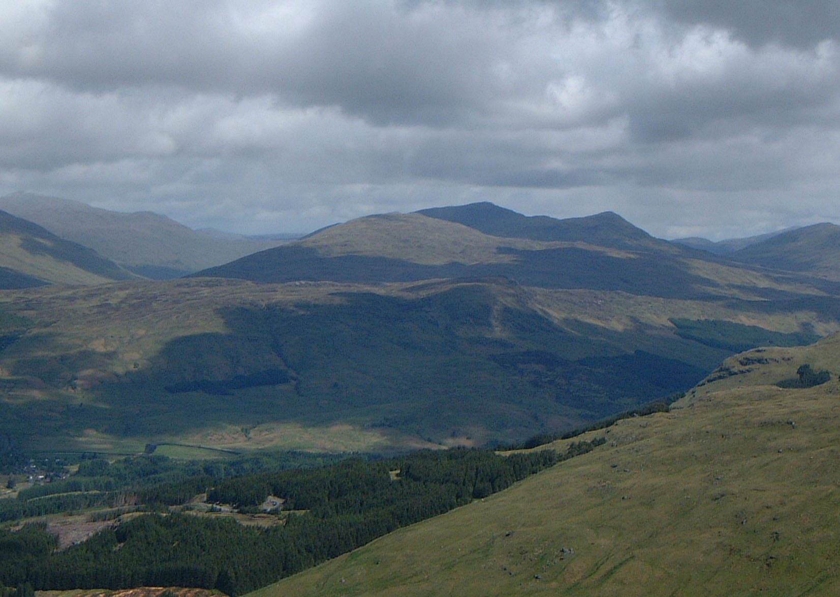
Beinn nan Imirean boasts a distinctive appearance with its rounded shape and grassy slopes. It is a popular destination for hikers and outdoor enthusiasts, offering stunning panoramic views of the surrounding countryside. On a clear day, visitors can see the nearby mountains, lochs, and glens, providing a picturesque backdrop.

The hill is accessible via several routes, with the most commonly used path starting near the village of Amulree. The ascent is moderate in difficulty, and the walk takes approximately 4-5 hours to complete, depending on the individual's fitness level. Along the way, hikers may encounter diverse flora and fauna, including heather, wildflowers, and bird species.

Beinn nan Imirean also holds historical significance, as it was once part of the Atholl Estate and used for deer stalking. Today, it remains a popular spot for wildlife enthusiasts, who may spot red deer, hares, and various bird species in the area.

Overall, Beinn nan Imirean offers a rewarding experience for nature lovers and outdoor adventurers, combining stunning scenery, a moderate challenge, and a chance to immerse oneself in the natural beauty of Perthshire.

If you have any feedback on the listing, please let us know in the comments section below.

Beinn nan Imirean Images

Images are sourced within 2km of 56.444196/-4.565872 or Grid Reference NN4130. Thanks to Geograph Open Source API. All images are credited.

Meall Glas The approach to the summit of the Munro from the east.
Meall Glas
The approach to the summit of the Munro from the east.
South eastern approach towards Beinn nan Imirean Two miles of rough country has to be crossed from the end of the track to reach Beinn nan Imirean but the going underfoot is relatively easy.
South eastern approach towards Beinn nan Imirean
Two miles of rough country has to be crossed from the end of the track to reach Beinn nan Imirean but the going underfoot is relatively easy.
Beinn nan Imirean summit cairn with view towards Meall Glas
On Beinn nan Imirean summit with view towards Meall Glas
Large quartz boulder above Lairig Riarein, lower eastern slopes of Beinn nan Imirean By far the largest of several quartz boulders on the lower slopes of Beinn nan Imirean and a landmark from quite a distance.
Large quartz boulder above Lairig Riarein, lower eastern slopes of Beinn nan Imirean
By far the largest of several quartz boulders on the lower slopes of Beinn nan Imirean and a landmark from quite a distance.
Deer fawn resting at Lairig Riarein, east of Beinn nan Imirean This deer fawn was very camouflaged against the surrounding terrain insomuch I was almost on top of it before I spotted it.
Deer fawn resting at Lairig Riarein, east of Beinn nan Imirean
This deer fawn was very camouflaged against the surrounding terrain insomuch I was almost on top of it before I spotted it.
Approaching the summit of Meall Glas from the south, above Glen Dochart
On Meall Glas summit with view towards Ben Challum
Deer fence in upper Glen Lochay
Track in upper Glen Lochay
Looking down upper Glen Lochay track Fencing all ready but no trees yet.
Looking down upper Glen Lochay track
Fencing all ready but no trees yet.
Planting below Beinn Challuim in Mamlorn Forest The black 'molehills' are planting mounds ready for an occupant.
Planting below Beinn Challuim in Mamlorn Forest
The black 'molehills' are planting mounds ready for an occupant.
Burn coming off Beinn Challuim in Mamlorn Forest
Green mound by River Lochay
Slopes of Beinn Challuim in Mamlorn Forest
Track in upper Glen Lochay
Fence crossing track in upper Glen Lochay Sometimes called a gate!
Fence crossing track in upper Glen Lochay
Sometimes called a gate!
Unmapped fencing in upper Glen Lochay
Show me another place!

Beinn nan Imirean is located at Grid Ref: NN4130 (Lat: 56.444196, Lng: -4.565872)

Unitary Authority: Stirling

Police Authority: Forth Valley

What 3 Words

///surprises.stack.chilling. Near Tyndrum, Stirling

Nearby Locations

Beinn nan Imirean

Related Wikis

Meall Glas

Meall Glas is a mountain situated in the southern highlands of Scotland. It stands on the northern border of the Loch Lomond and the Trossachs National...

Loch Essan

Loch Essan is a freshwater trout loch, located 2 miles north of Loch Dochart, within the Stirling Council Area, Scotland. == Settlements == On the mid...

Beinn Challuim

Beinn Challuim (English: Ben Challum) is a mountain in the Breadalbane region of the Scottish Highlands. It is east of the village of Tyndrum, in the Forest...

Loch Iubhair

Loch Iubhair pronounced yoo-ar meaning yew loch, is a freshwater loch, located in Glen Dochart, and six kilometres (four miles) east of the village of...

Nearby Amenities

Located within 500m of 56.444196,-4.565872
Beinn nan Imirean
Corbett: yes
Description: Hill of the ridges
Ele: 849
Graham: no
Marilyn: yes
Munro: no
Natural: peak
Prominence: 185
Lat/Long: 56.44609/-4.5676889
The data included in this document is from www.openstreetmap.org. The data is made available under ODbL.

Have you been to Beinn nan Imirean?

Leave your review of Beinn nan Imirean below (or comments, questions and feedback).